Waterwatch Data Portal
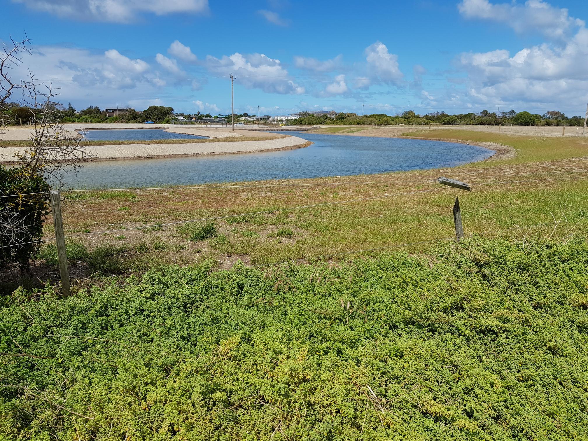
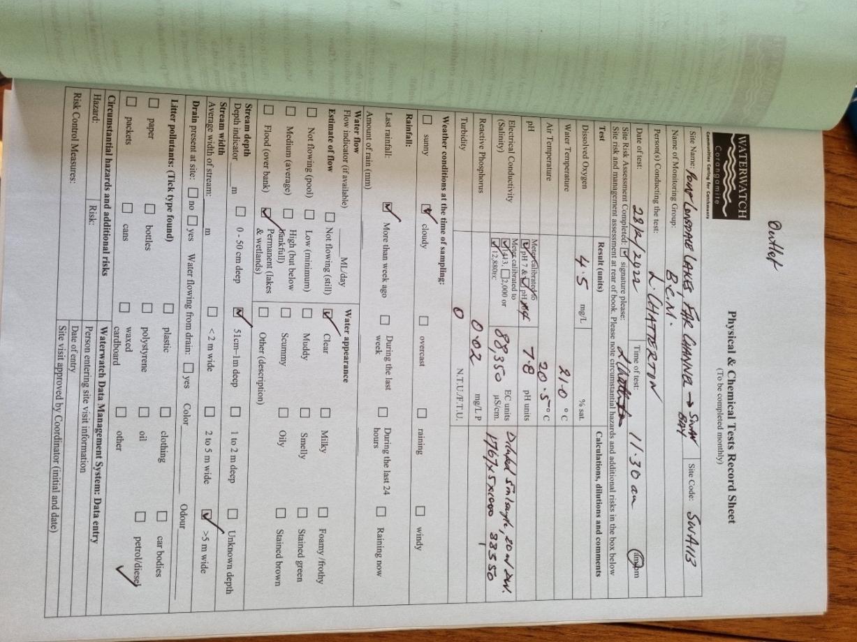
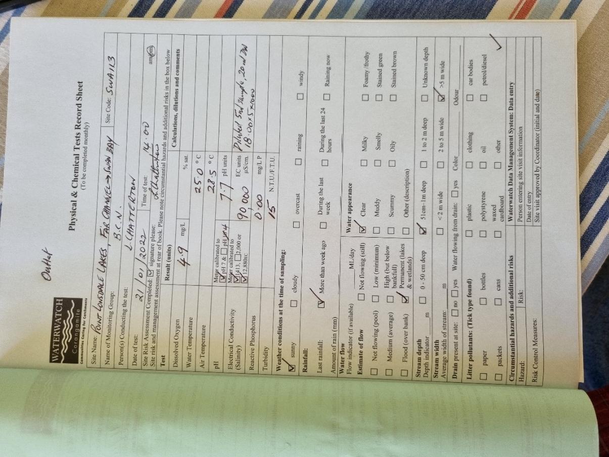
CO_SWA113 Point Lonsdale Lakes, far channel connecting with Swan Bay
Site details
Overview
| Site code | CO_SWA113 |
|---|---|
| Site name | Point Lonsdale Lakes, far channel connecting with Swan Bay |
| Status | Active |
| Water Authority | Corangamite |
| Basin | Barwon River |
| Catchment | Barwon River |
| Sub catchment | Swan Bay |
| Reach | |
| Water type | Channel |
| Council | Greater Geelong City Council |
| History | View all 19 site visits 21-01-2022 - 04-04-2024 |
| Monitoring organisations |
Site visits
 Loading chart
| Date | D.O. % | D.O mg/L | EC µS/cm | pH pH Units | rP mg/L P | Air ° C | Water ° C | Turb FTU | Turb NTU |
|---|---|---|---|---|---|---|---|---|---|
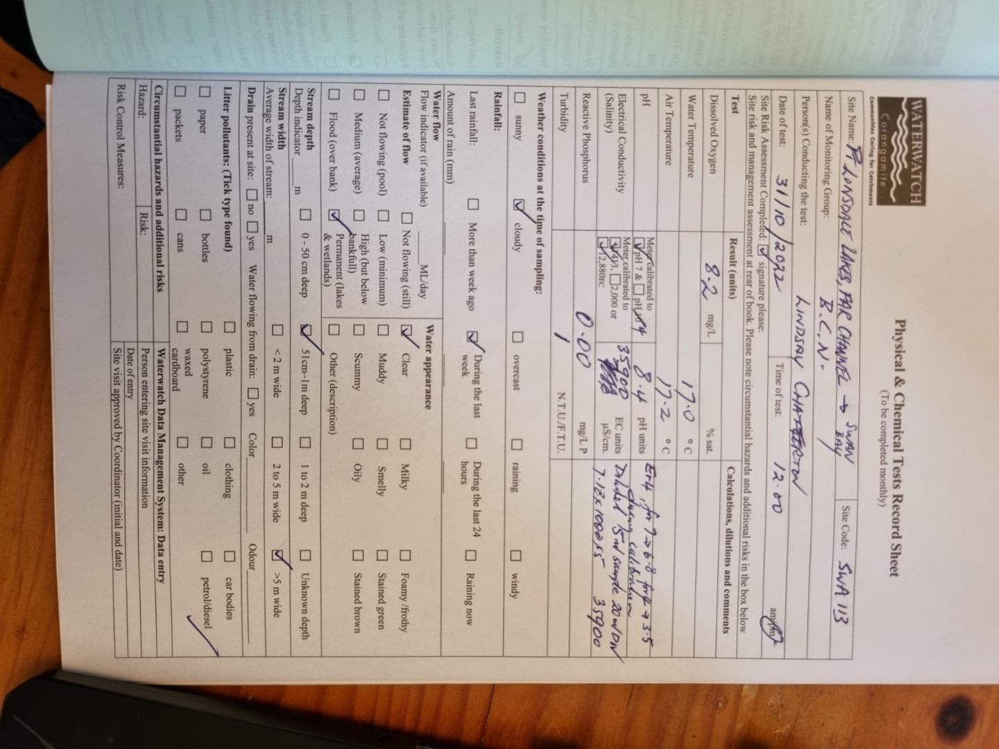
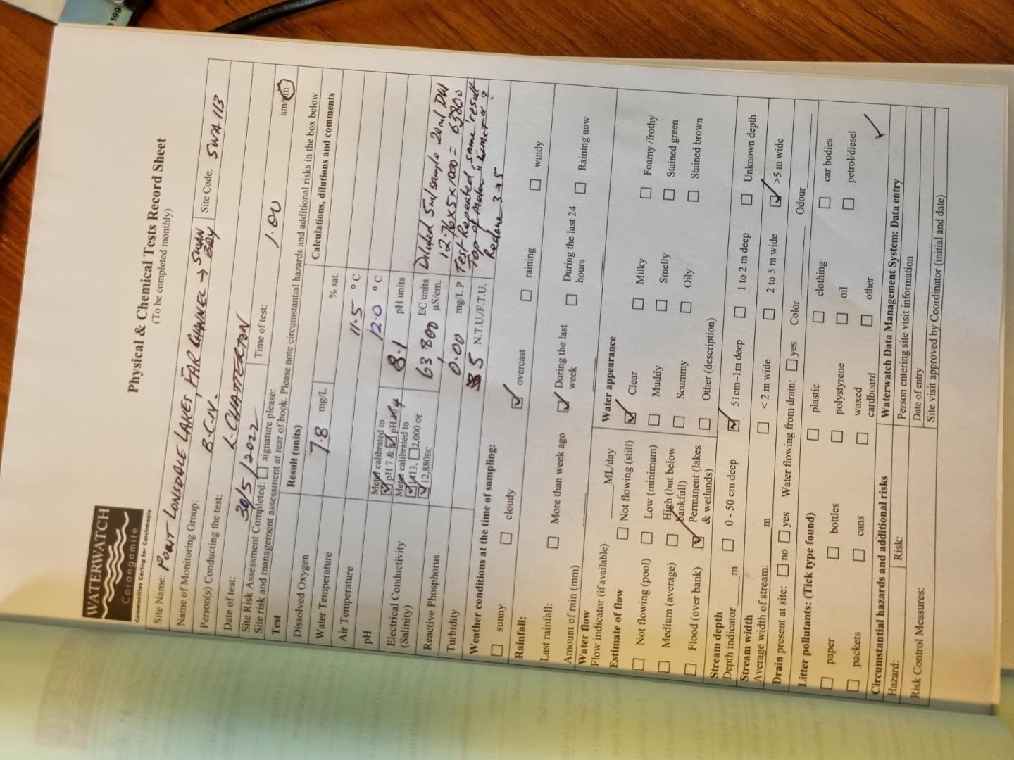
| 30-05-2022 | 94.27 | 7.8 | 63800 | 8.1 | 0 | 12 | 11.5 | 5 | |
| 05-07-2022 | 84.44 | 7.4 | 59000 | 7.9 | 0 | 14 | 10 | 1 | |
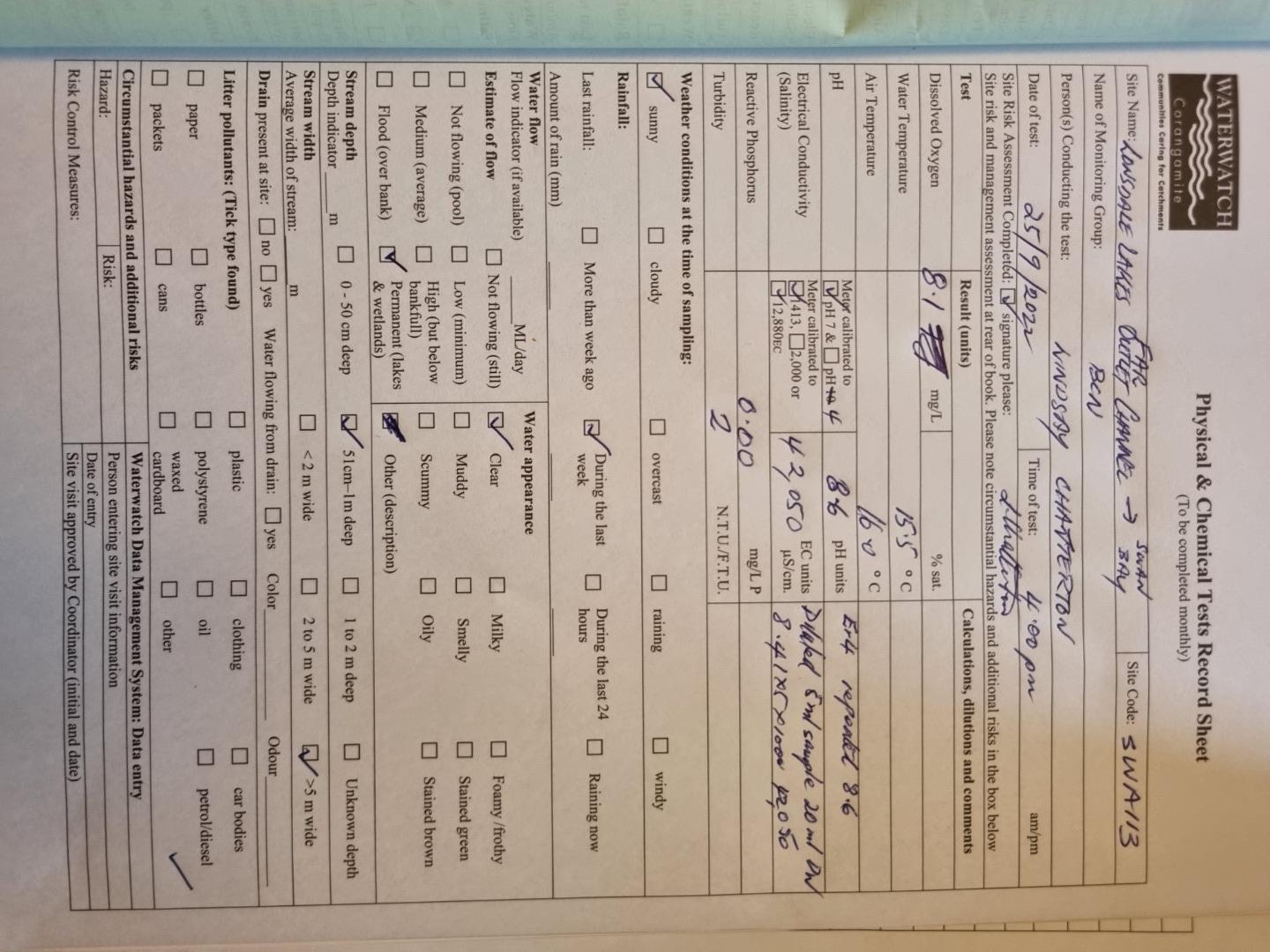
| 25-09-2022 | 95.77 | 8.1 | 42050 | 8.6 | 0 | 16 | 15.5 | 2 | |
| 31-10-2022 | 97.29 | 8.2 | 35900 | 8.4 | 0 | 17.2 | 17 | 1 | |
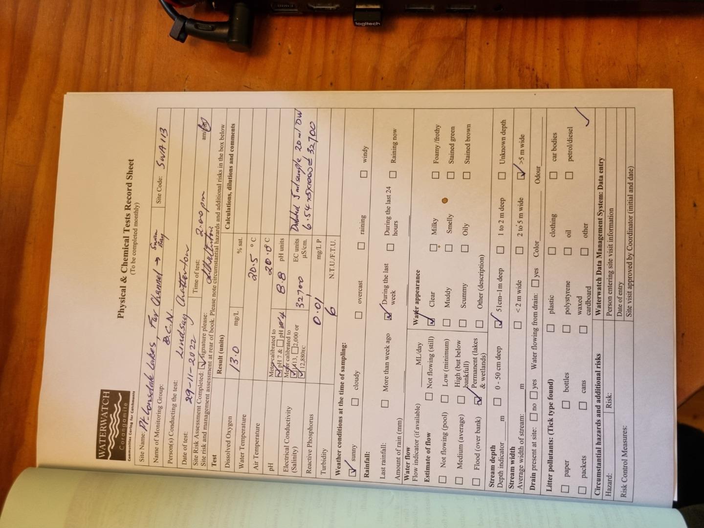
| 29-11-2022 | 162.83 | 13 | 32700 | 8.8 | 0.01 | 20 | 20.5 | 6 | |
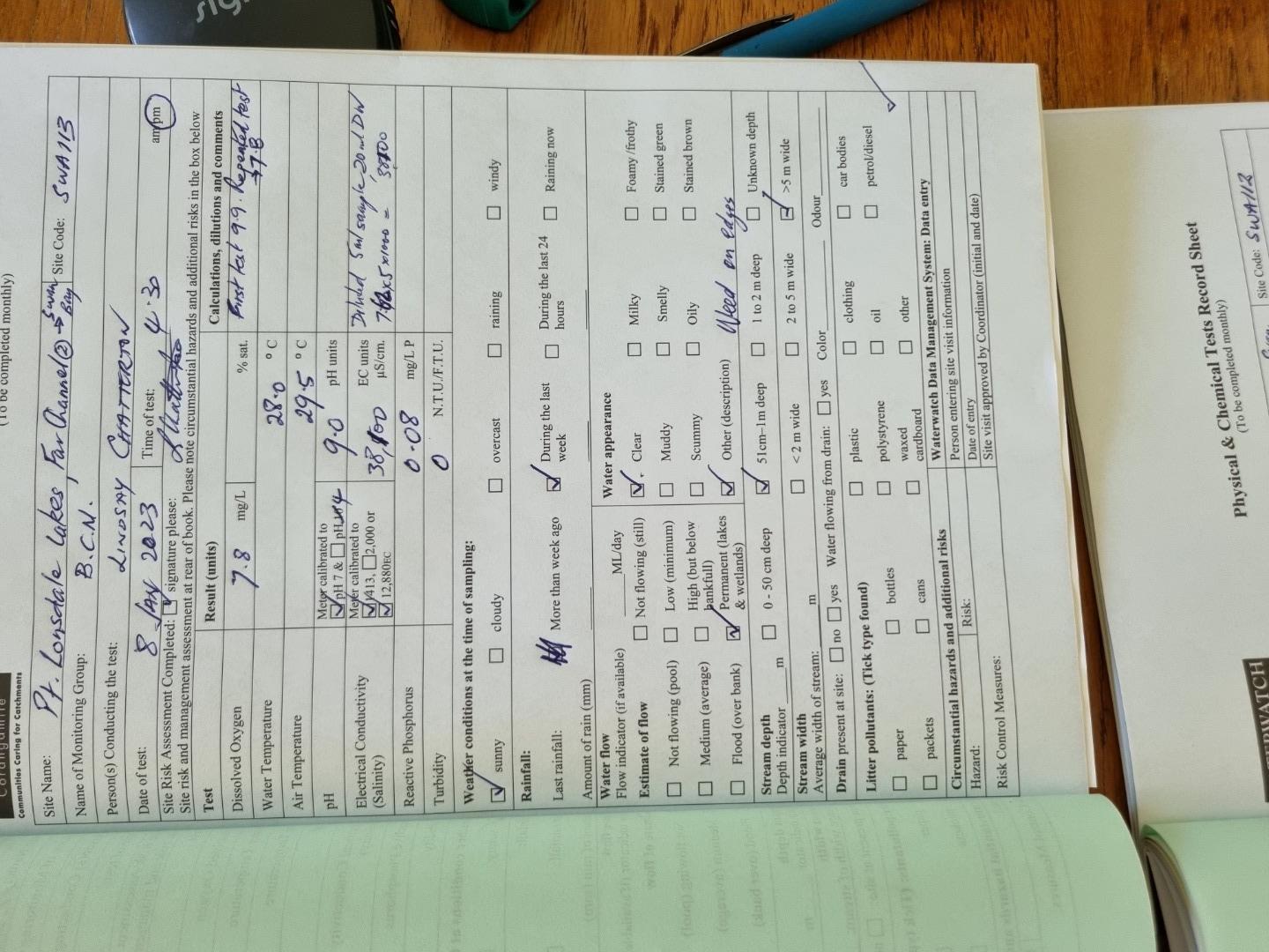
| 08-01-2023 | 114.03 | 7.8 | 38100 | 9 | 0.08 | 29.5 | 28 | 0 | |
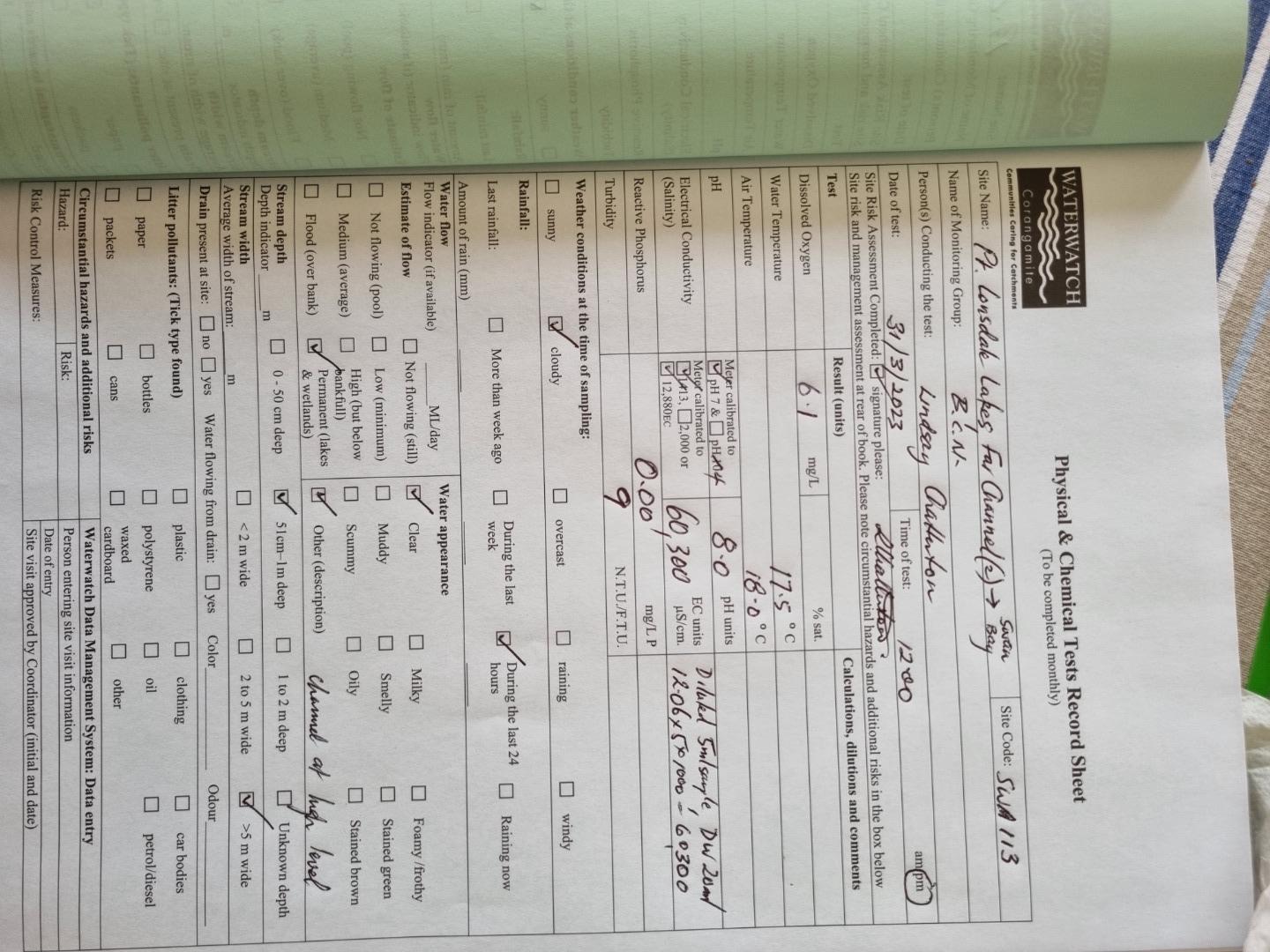
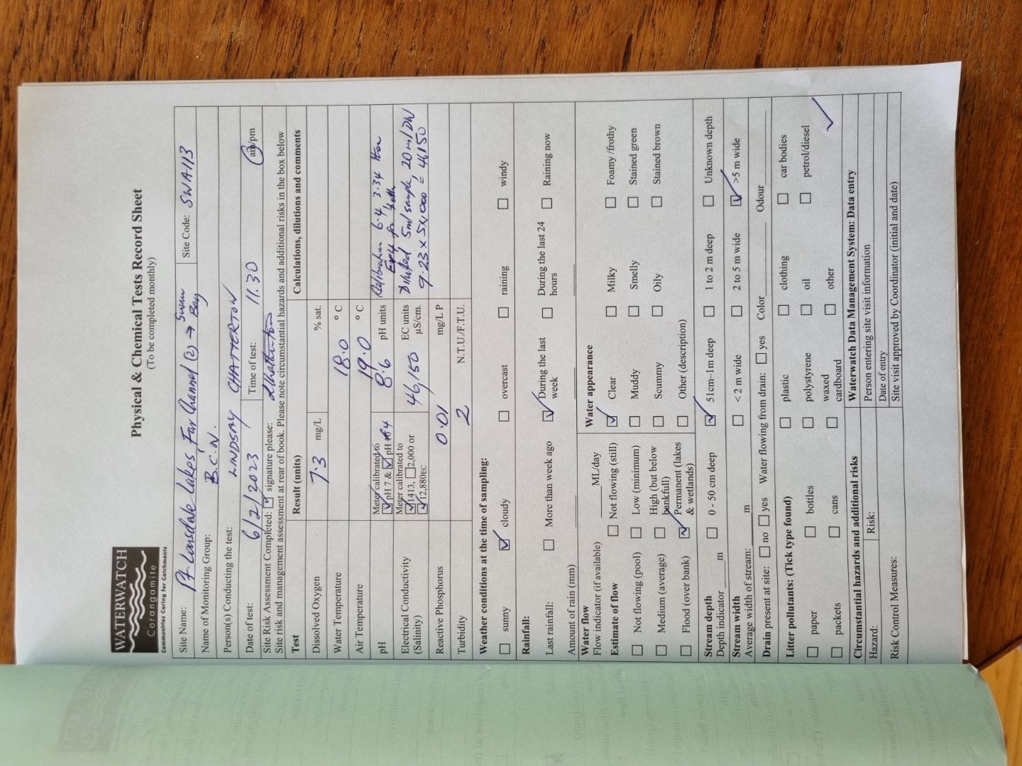
| 06-02-2023 | 92.27 | 7.3 | 46150 | 8.6 | 0.01 | 19 | 18 | 2 | |
| 31-03-2023 | 81.44 | 6.1 | 60300 | 8 | 0 | 18 | 17.5 | 9 | |
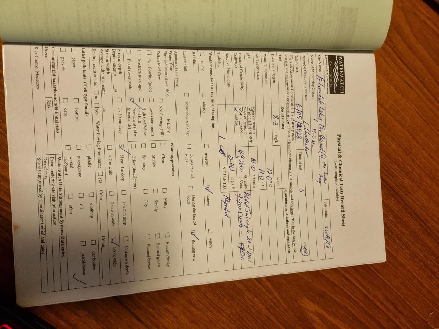
| 06-05-2023 | 94.41 | 8.3 | 49500 | 8 | 0 | 11 | 12 | 1 | |
| 17-07-2023 | 99.14 | 9.2 | 47100 | 8.5 | 0.03 | 14 | 10 | 0 | |
| 22-08-2023 | 94.42 | 9.8 | 4535 | 8.5 | 0 | 12 | 13 | 2 | |
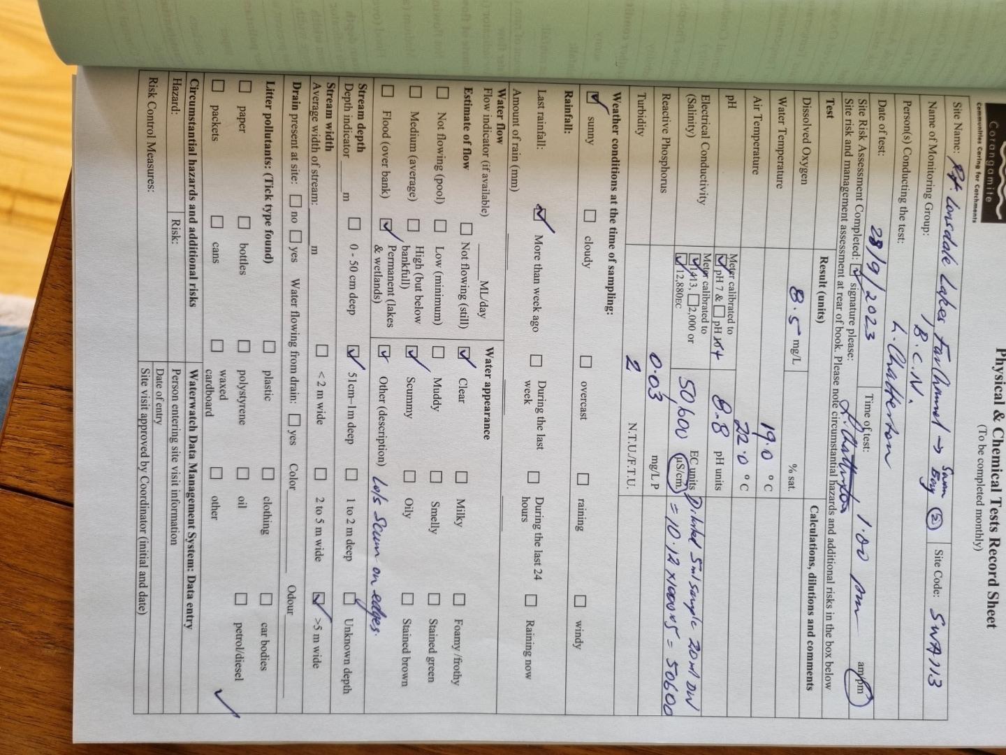
| 28-09-2023 | 111.62 | 8.5 | 50600 | 8.8 | 0.03 | 22 | 19 | 2 | |
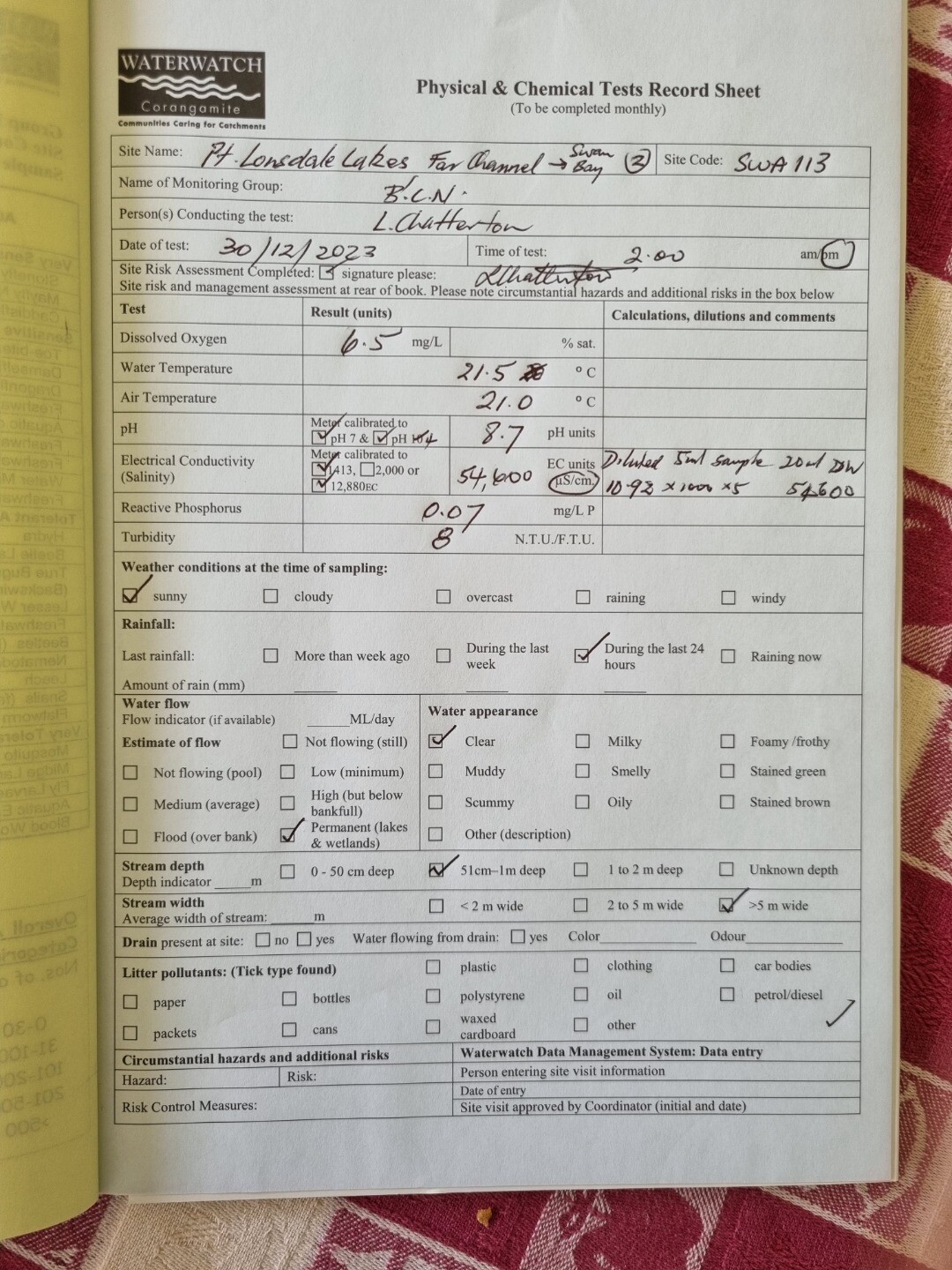
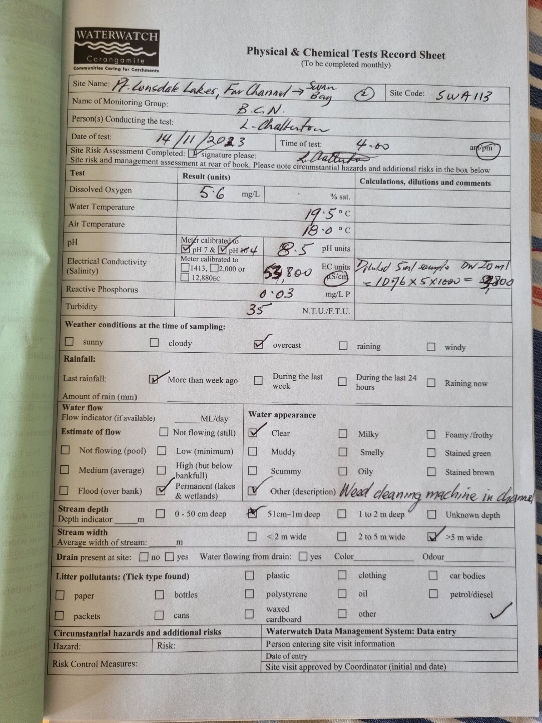
| 14-11-2023 | 75.28 | 5.6 | 53800 | 8.5 | 0.03 | 18 | 19.5 | 35 | |
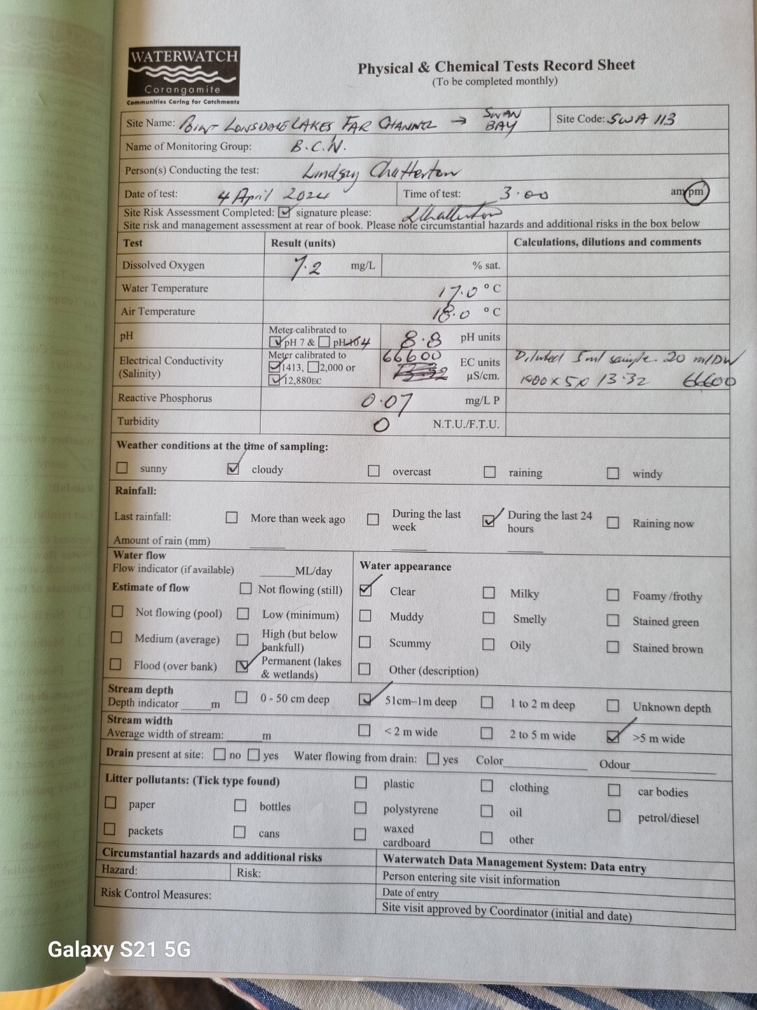
| 30-12-2023 | 90.92 | 6.5 | 54600 | 8.7 | 0.07 | 21 | 21.5 | 8 | |
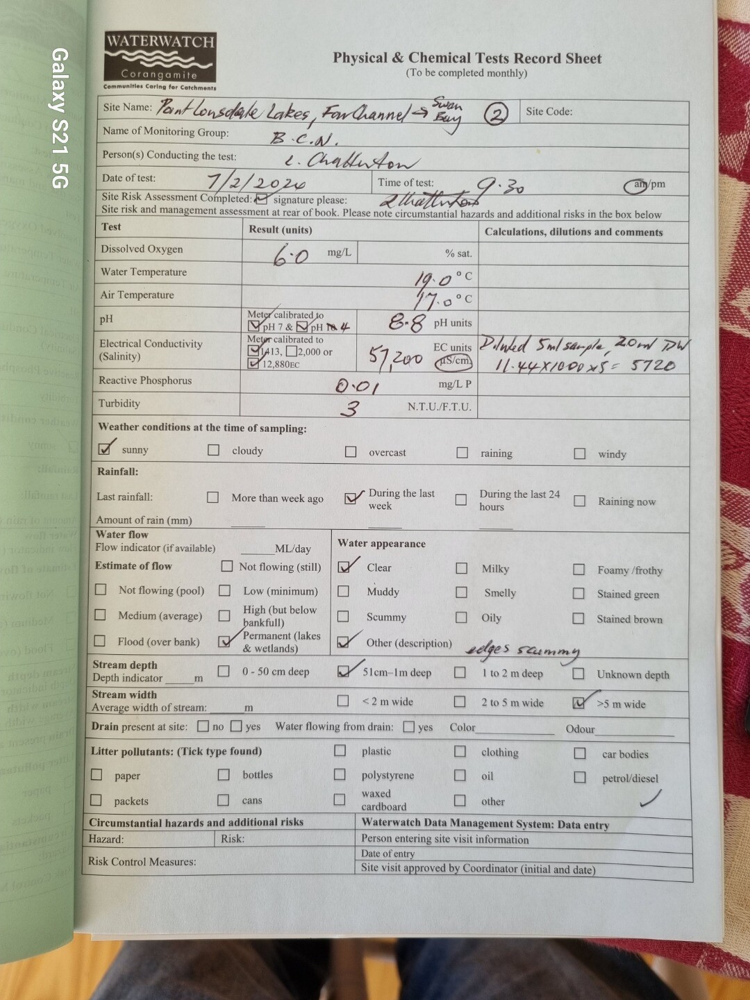
| 07-02-2024 | 81.15 | 6 | 57200 | 8.8 | 0.01 | 17 | 19 | 3 | |
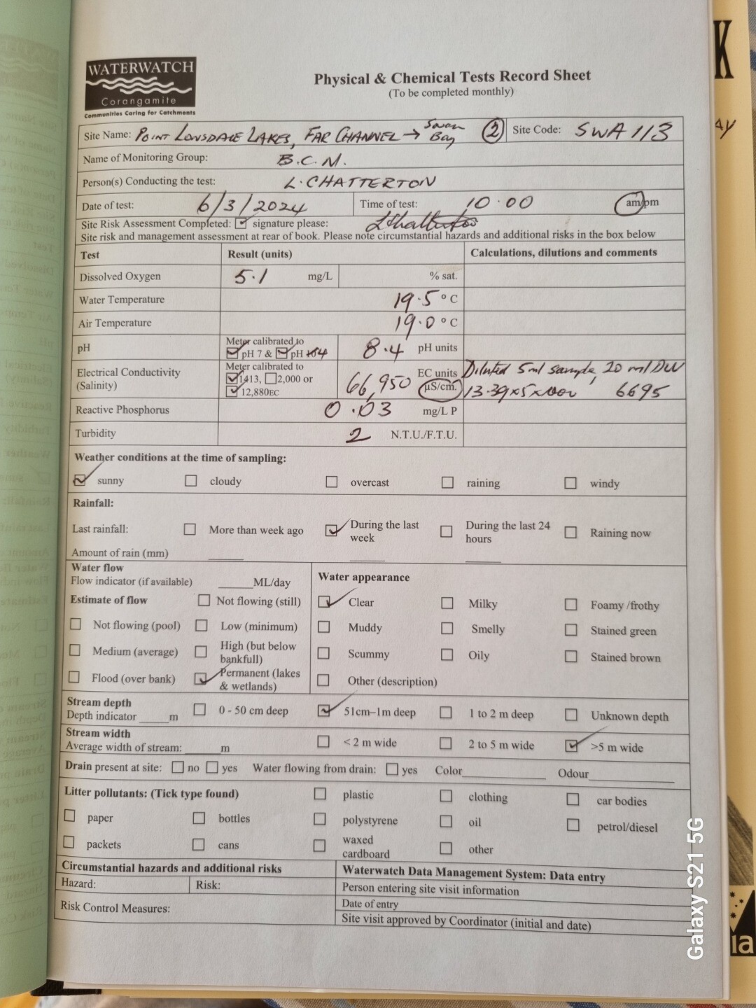
| 06-03-2024 | 73.22 | 5.1 | 66950 | 8.4 | 0.03 | 19 | 19.5 | 2 |


All content, files, data and images provided by the Waterwatch Data Portal and Gallery are subject to a Creative Commons Attribution License
Content is made available to be used in any way, and should always attribute Waterwatch and www.vic.waterwatch.org.au
.png)