Waterwatch Data Portal
Welcome to the Waterwatch data portal.
Here you can view, query and download Waterwatch data and images for regions of Victoria you are interested in.
Click on site markers in the map for specific rivers, lakes or wetlands. There are two search boxes you may also find helpful. Use the first box to type in a particular waterway name eg Avoca River. Or, if you want to browse a catchment region, use the drop down box labelled Region to select a region of interest to you eg Mallee. Don’t forget to click the Go button.
Below the map are the 46 basins that make up the 10 catchment regions in Victoria. To help you find your local waterway, view the lists for the catchments within each basin.
| Catchment | Waterways | Basin | |
|---|---|---|---|
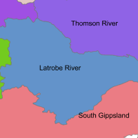
Lake Wellington CatchmentWest Gippsland Water Authority Latrobe River Basin 4 active sitesIn the West Gippsland region, there are three basins. These are the Latrobe River, South Gippsland and Thomson River basins. The Latrobe River basin contains the Latrobe River and Lake Wellington catchment |
|
||
Latrobe River CatchmentWest Gippsland Water Authority Latrobe River Basin 13 active sitesIn the West Gippsland region, there are three basins. These are the Latrobe River, South Gippsland and Thomson River basins. The Latrobe River basin contains the Latrobe River and Lake Wellington catchment |

|
||
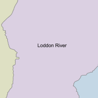
Loddon River CatchmentNorth Central Water Authority Loddon River Basin 81 active sitesIn the North Central region, there are three basins. These are the Avoca River, Campaspe River and Loddon River basins. The Loddon River basin contains the Loddon River catchment |
|
||
Mallee CatchmentMallee Water Authority Mallee Basin 8 active sitesThe Mallee region includes the Mallee, Avoca and Wimmera basins |
|

|
|
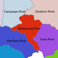
Maribyrnong River CatchmentMelbourne Water Authority Maribyrnong River Basin 12 active sitesIn the Melbourne region, there are four basins. These are the Bunyip River, Maribyrnong River, Werribee River and Yarra River basins. The Maribyrnong River basin contains the Maribyrnong River catchment. |
Barringo Creek
Bolinda Creek Boyd Creek Deep Creek Deep Creek Deep Creek Upper Emu Creek Emu Creek Gully Creek Jacksons Creek Jacksons Creek Lower Jacksons Creek Middle Jacksons Creek Upper Kongaderra Creek Maribyrnong River Maribyrnong River Lower Riddells Creek Riddells Lower/Sandy Creek Saltwater Creek Steele Creek Stony Creek Taylors Creek |
|
|
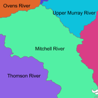
Mitchell River CatchmentEast Gippsland Water Authority Mitchell River Basin 0 active sitesIn the East Gippsland region, there are four basins. These are the East Gippsland, Mitchell River, Snowy River and Tambo River basins. The Mitchell basin has Lake King, Lake Victoria and Mitchell River catchments |
|
||
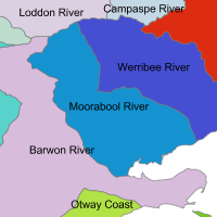
Moorabool River CatchmentCorangamite Water Authority Moorabool River Basin 8 active sitesIn the Corangamite region, there are four basins. These are the Barwon River, Lake Corangamite, Moorabool River and Otway Coast basins. The Moorabool basin contains the Moorabool River catchment. |
|
||
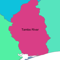
Nicholson River CatchmentEast Gippsland Water Authority Tambo River Basin 0 active sitesIn the East Gippsland region, there are four basins. These are the East Gippsland, Mitchell River, Snowy River and Tambo River basins. The Tambo River basin has Nicholson River and Tambo River catchments |
|
||
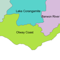
Otway Coast CatchmentCorangamite Water Authority Otway Coast Basin 11 active sitesIn the Corangamite region, there are four basins. These are the Barwon River, Lake Corangamite, Moorabool River and Otway Coast basins. The Otway Coast basin has two catchments: Gellibrand River and Otway Coast. |
Aire River
Anglesea River Barham River Black Glen Creek Campbell Creek Carlisle River Cumberland River Curdies River Deep Creek Erskine River Gellibrand River Grey River Johanna River Kennedys Creek Lardner Creek Lowe Creek Painkalac Creek Parker River Salt Creek Spring Creek Thompson Creek Wild Dog Creek Wonky Gully Creek |
|
|

All content, files, data and images provided by the Waterwatch Data Portal and Gallery are subject to a Creative Commons Attribution License
Content is made available to be used in any way, and should always attribute Waterwatch and www.vic.waterwatch.org.au
.png)