Waterwatch Data Portal
Waterwatch Site Search
79 results found (Displaying 51 - 79)
| Site code | Name | ||
|---|---|---|---|
EG_MIT280 |
Mitchell River " private jetty between cliffs & Morass"Inactive River 24_4 Mitchell River 27-02-2009 - 18-08-2014 19 Site visits
|
||
EG_MIT530 |
Mitchell River - Hillside, on Nick Bartons propertyInactive River 24_5 Mitchell River 01-07-2003 - 09-06-2015 145 Site visits
|
||
EG_MIT540 |
Lind BridgeInactive River 24_4 Mitchell River 29-11-2013 - 12-10-2014 11 Site visits |
||
EG_MIT540 |
Mitchell River - Lind BridgeActive Other 24_4 Mitchell River 25-10-1999 - 17-08-2019 15 Site visits |
||
EG_MIT543 |
Mitchell River - Lind Bridge at 3mInactive Other 24_4 Mitchell River 25-10-1999 - 25-10-1999 1 Site visits |
||
EG_MIT630 |
Mitchell River - Hillside farm floodplain wetlandInactive Pond/Wetland 24_5 Mitchell River 27-07-2003 - 11-11-2003 2 Site visits |
||
EG_MIT830 |
Mitchell River - HillsideInactive Other 24_5 Mitchell River 01-01-1995 - 15-11-1997 41 Site visits |
||
EG_MMS010 |
McMillan Strait - Raymond IslandInactive Estuary 24_4 Mitchell River 04-01-1997 - 08-03-2011 623 Site visits |
||
EG_MMS021 |
McMillan Straits - Boat Sewerage Pump-Out Jetty @ 1mInactive Other 26-02-1999 - 02-08-1999 5 Site visits |
||
EG_MMS022 |
McMillan Straits - Boat Sewerage Pump-Out Jetty @ 2mInactive Other 26-02-1999 - 02-08-1999 5 Site visits |
||
EG_MMS023 |
McMillan Straits - Boat Sewerage Pump-Out Jetty @ 3mInactive Other 26-02-1999 - 14-12-1999 6 Site visits |
||
EG_MMS024 |
McMillan Straits - Boat Sewerage Pump-Out Jetty @ 4mInactive Other 26-02-1999 - 02-08-1999 5 Site visits |
||
EG_MOR020 |
Macleod Morass - upper artificial pond, below tipInactive Other 23-01-2001 - 03-07-2001 3 Site visits |
||
EG_MOR030 |
Macleod Morass - upperInactive Other 01-06-1998 - 10-07-2002 54 Site visits |
||
EG_MOR050 |
Macleod Morass - long water holeInactive Other 24_4 Mitchell River 01-06-1998 - 04-06-1999 10 Site visits |
||
EG_MOR060 |
Macleod Morass - Hunters Lane endInactive Other 24_4 Mitchell River 04-10-2000 - 22-04-2001 4 Site visits |
||
EG_MOR070 |
Macleod Morass - Quadrat 1 Carp Research StationInactive Other 24_4 Mitchell River 29-06-1998 - 10-07-2002 63 Site visits |
||
EG_MOR080 |
Macleod Morass - Bore waterInactive Other 24_4 Mitchell River 26-02-2001 - 02-07-2001 17 Site visits |
||
EG_MOR090 |
Macleod Morass - OutletInactive Pond/Wetland 24_4 Mitchell River 21-03-1996 - 18-08-2014 339 Site visits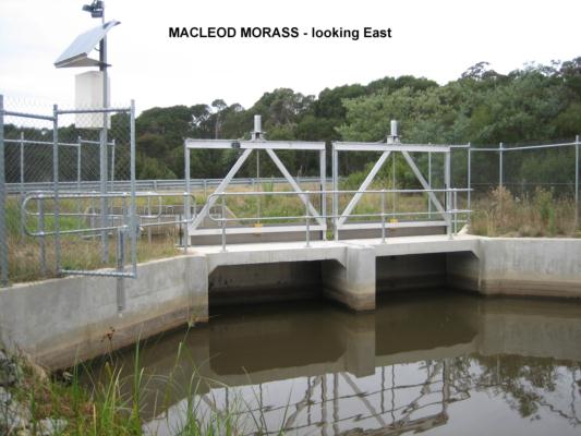

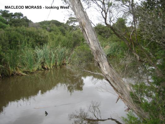
|
||
EG_MOR091 |
Macleods Morass below bridge/salt gateInactive Creek 24_4 Mitchell River 23-06-2014 - 18-08-2014 3 Site visits |
||
EG_PAY010 |
Paynesville Canal, Burrabogie Bridge - Site 2Inactive Other 24_4 Mitchell River 26-02-1999 - 25-09-2012 14 Site visits
|
||
EG_PAY011 |
Paynesville Canal - King Street, Paynesville @ 1mInactive Other 26-02-1999 - 28-06-2001 3 Site visits |
||
EG_PRO070 |
Prospect Creek - Counihans BridgeInactive Other 24_19 Prospect Creek 08-05-2000 - 07-05-2002 4 Site visits |
||
EG_STO050 |
Stoney Creek - Mitchell River CatchmentInactive Other 24-08-1999 - 20-05-2001 3 Site visits |
||
EG_TRC010 |
Tom Roberts Creek - Canoe DamInactive Other 16-02-2000 - 23-04-2002 28 Site visits |
||
EG_TRC040 |
Tom Roberts Creek - TributaryInactive Other 13-09-2000 - 06-06-2001 10 Site visits |
||
EG_WGN010 |
Wongungarra River - Kee's propertyInactive Other 24_30 Wongungarra River 0 Site visits |
||
EG_WON010 |
Wonnangatta River - NeatesInactive Other 24_8 Wonnangatta River 12-06-1995 - 12-04-2009 48 Site visits |
||
EG_WON020 |
Wonnangatta River - Wilkinsons at DargoInactive Other 24_8 Wonnangatta River 11-07-1996 - 21-05-2003 24 Site visits |
||

All content, files, data and images provided by the Waterwatch Data Portal and Gallery are subject to a Creative Commons Attribution License
Content is made available to be used in any way, and should always attribute Waterwatch and www.vic.waterwatch.org.au
.png)