Waterwatch Data Portal
GB_SUG020 Sugarloaf Creek at ford in Ashes Bridge Road
26 August 2013
Site visit details
Overview
| Catchment | Goulburn River |
|---|---|
| Site | Sugarloaf Creek at ford in Ashes Bridge Road GB_SUG020 |
| Date and Time | Monday 26th August 2013 09:15am |
| Approved | Approved |
Physical Chemical Tests
| D.O. % | D.O mg/L | E coli orgs/100mL | EC µS/cm | pH pH Units | Rain mm | rP mg/L P | Air ° C | Water ° C | Coli orgs/100mL | P mg/L | Turb NTU | |
|---|---|---|---|---|---|---|---|---|---|---|---|---|
| Sample | 188 | 580 | 7.5 | 0.2 | 11 | 11.3 | 2420 | 21 |
| Weather | cloudy |
|---|---|
| Last rainfall | During the last week 5.2 |
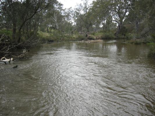
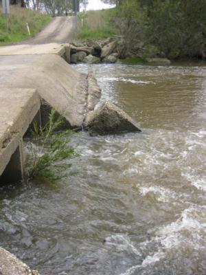
| Flow estimate | HIGH: Less than bankfull and in-stream habitats connected |
| Water Appearance | |
| Stream depth | 1m - 2m |
| Stream width | >5m |
| Hazards | |
| Litter/Pollutants |
Water level has fallen since last month. Level is still high and gushing through both sides of the culvert. Ecoli sample taken.

All content, files, data and images provided by the Waterwatch Data Portal and Gallery are subject to a Creative Commons Attribution License
Content is made available to be used in any way, and should always attribute Waterwatch and www.vic.waterwatch.org.au
.png)