Waterwatch Data Portal
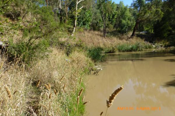
ME_YPL280 Plenty River at Gorge Rd, South Morang, downstream of bridge
6 March 2013
Site visit details
Overview
| Catchment | Yarra River |
|---|---|
| Site | Plenty River at Gorge Rd, South Morang, downstream of bridge ME_YPL280 |
| Date and Time | Wednesday 6th March 2013 10:05am |
| Approved | Approved |
Physical Chemical Tests
| Ammon-Nit mg/L NH3-N | D.O mg/L | EC µS/cm | FrP mg/L P | Nitrate-Nit mg/L N | pH pH Units | rP mg/L P | Air ° C | Water ° C | Turb FTU | Turb NTU | |
|---|---|---|---|---|---|---|---|---|---|---|---|
| Sample | 5.7 | 410 | 7.4 | 25 | 21 | 160 | 90 |
| Weather | sunny |
|---|---|
| Last rainfall | More than a week ago 40 |
| Flow estimate | MEDIUM: flow is normal/typical average flow |
| Water Appearance | Muddy |
| Stream depth | 1m - 2m |
| Stream width | >5m |
| Hazards | |
| Litter/Pollutants |
The water level was 32cm below my reference point, which was 3cm higher than when last measured. At Mill Park I recorded 40mm of rain over a 3 day period, just over a week ago.

All content, files, data and images provided by the Waterwatch Data Portal and Gallery are subject to a Creative Commons Attribution License
Content is made available to be used in any way, and should always attribute Waterwatch and www.vic.waterwatch.org.au
.png)