Waterwatch Data Portal
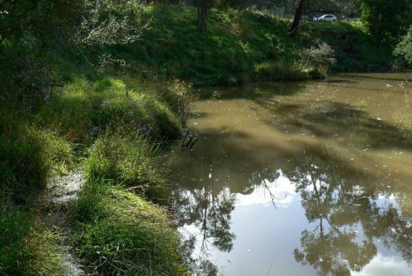
ME_YPL280 Plenty River at Gorge Rd, South Morang, downstream of bridge
19 June 2012
Site visit details
Overview
| Catchment | Yarra River |
|---|---|
| Site | Plenty River at Gorge Rd, South Morang, downstream of bridge ME_YPL280 |
| Date and Time | Tuesday 19th June 2012 13:30pm |
| Approved | Approved |
Physical Chemical Tests
| Ammon-Nit mg/L NH3-N | D.O mg/L | EC µS/cm | FrP mg/L P | Nitrate-Nit mg/L N | pH pH Units | rP mg/L P | Air ° C | Water ° C | Turb FTU | Turb NTU | |
|---|---|---|---|---|---|---|---|---|---|---|---|
| Sample | 9.8 | 580 | 7.8 | 12 | 10 | 76 | 35 |
| Weather | cloudy |
|---|---|
| Last rainfall | During the last 24 hours 2 |
| Flow estimate | MEDIUM: flow is normal/typical average flow |
| Water Appearance | Muddy |
| Stream depth | >2m |
| Stream width | >5m |
| Hazards | |
| Litter/Pollutants |
Water level was 23cm below my reference point, which is 2cm lower than when last measured. At Mill park I have had just under 2mm of rain in the last 24 hours, 5mm in the last 3 days, and 9mm in the last week.

All content, files, data and images provided by the Waterwatch Data Portal and Gallery are subject to a Creative Commons Attribution License
Content is made available to be used in any way, and should always attribute Waterwatch and www.vic.waterwatch.org.au
.png)