Slow Load Detected
catchment snapshot charts are taking longer than expected to load.
This may be the result many snapshots for this catchment, a slow internet connection or a device with limited
recources.
Please wait for the charts to finish loading, or Reload
this page without snapshot charts
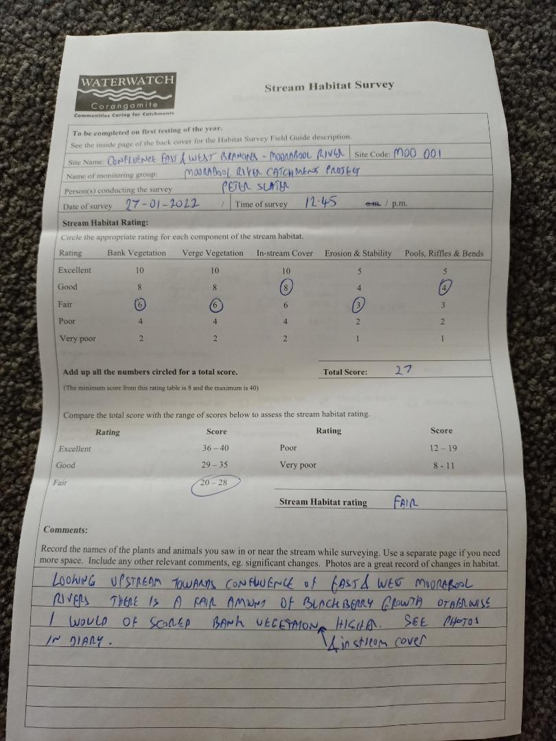
<p>Looking upstream towards confluence of east/west moorabool river there is a fair amound of blackberry growth, otherwise i would have scored bank vegetation higher. See photos for instream cover in diary.</p>
Bank Erosion Stability
Bank Vegetation
In Stream Cover
Riffles Pools Bends
Verge Vegetation
Overall
Fair 3
Fair 6
Good 8
Good 4
Fair 6
27
Diary photos
Chart image
Right click or touch and hold the image below to download

.png)