Waterwatch Data Portal
WG_TYR090 TYERS RIVER at Wirilda Reserve off Tyers- Yallourn Nth Rd.
21 June 2021
Site visit details
Overview
| Catchment | Latrobe River |
|---|---|
| Site | TYERS RIVER at Wirilda Reserve off Tyers- Yallourn Nth Rd. WG_TYR090 |
| Date and Time | Monday 21st June 2021 09:30am |
| Approved | Approved |
Physical Chemical Tests
| D.O mg/L | EC µS/cm | Nitrate-Nit mg/L N | pH pH Units | rP mg/L P | Air ° C | Water ° C | Turb NTU | |
|---|---|---|---|---|---|---|---|---|
| Sample | 80 | 4.9 | 0.015 | 6.2 | 10.7 | 50 |
| Weather | sunny |
|---|---|
| Last rainfall | During the last week 8.00 |
| Flow estimate | HIGH: Less than bankfull and in-stream habitats connected |
| Water Appearance | Other |
| Stream depth | 1m - 2m |
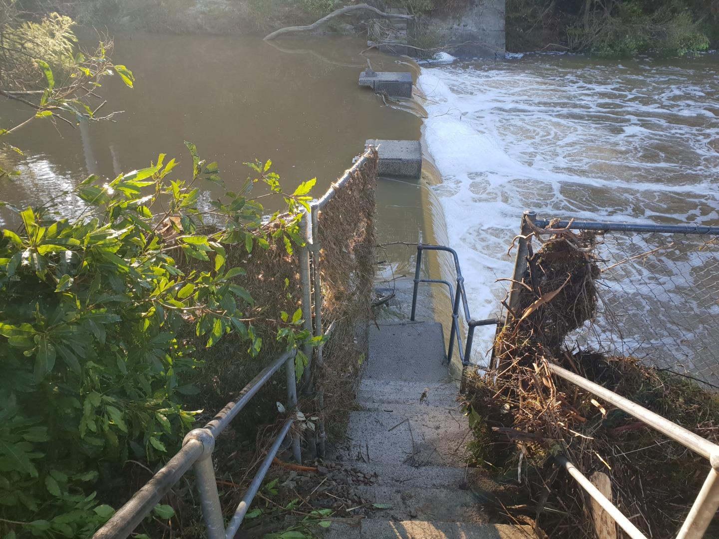
| Stream width | 2m - 5m |
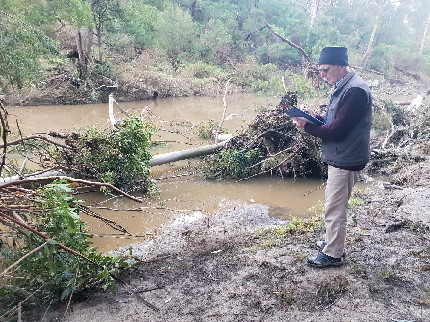
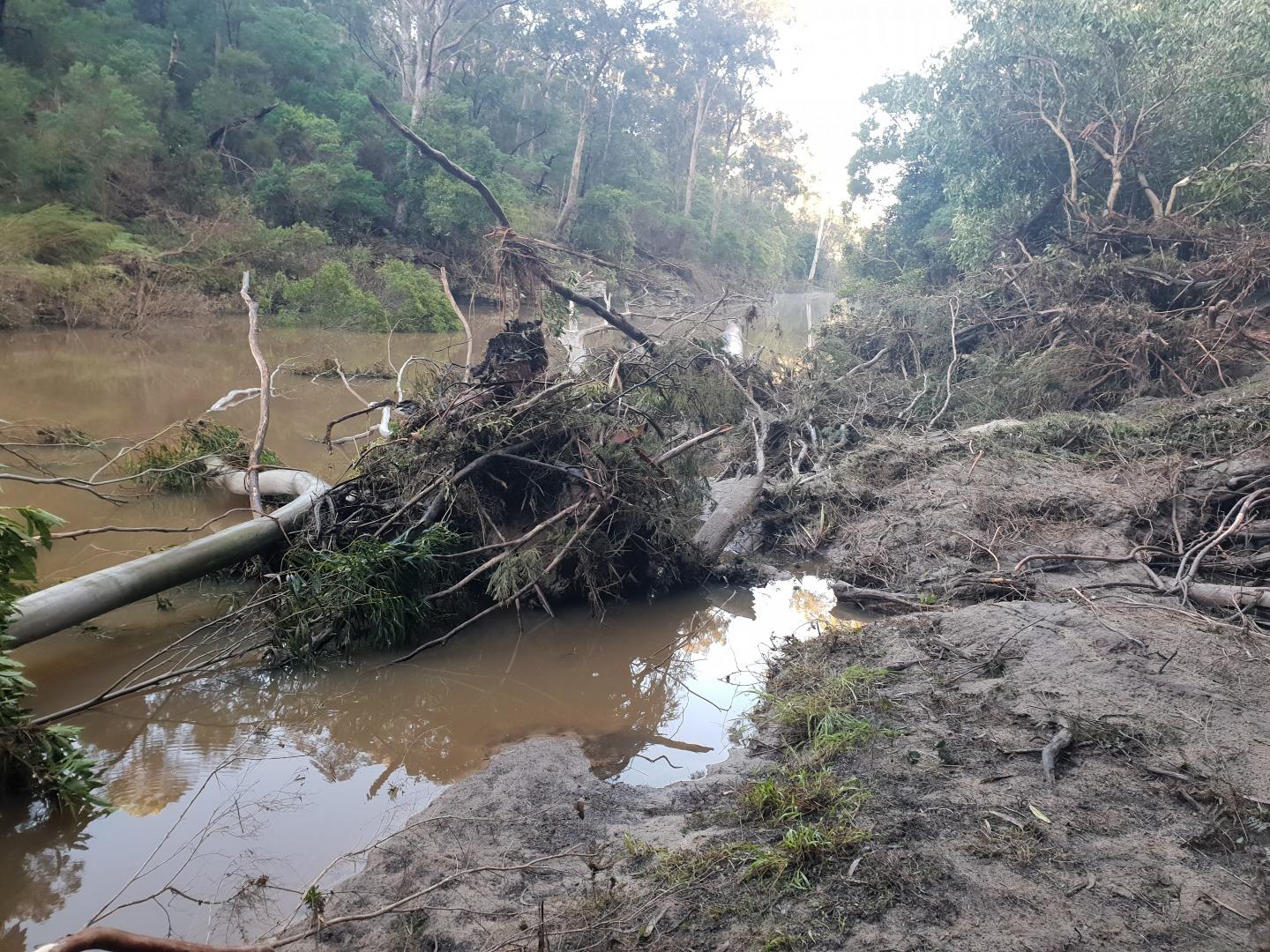
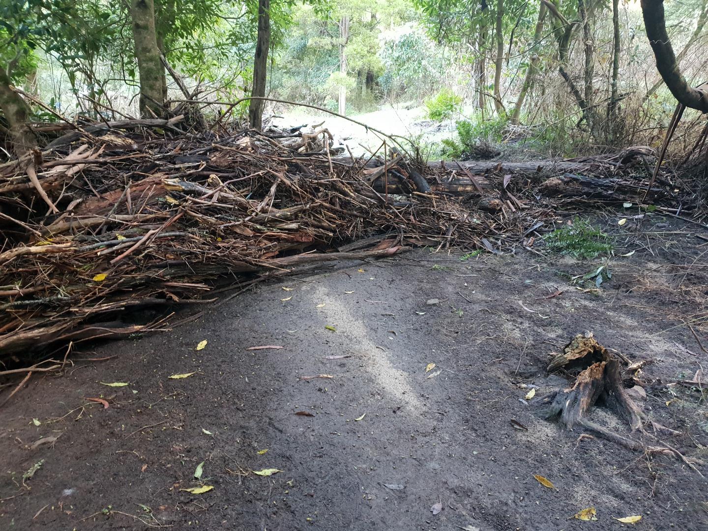
| Hazards | Access to the site had been considerably modified due to storms on 9 and 10 June. |
| Litter/Pollutants | plastic |
The river had suffered considerable erosion and modification due to the recent storms. Trees had fallen across and into the river and snags inthe river had been relocated. The monitoring site has been modified considerably. The peak flood level at the sampling point was some 4metres above normal level.

All content, files, data and images provided by the Waterwatch Data Portal and Gallery are subject to a Creative Commons Attribution License
Content is made available to be used in any way, and should always attribute Waterwatch and www.vic.waterwatch.org.au
.png)