Waterwatch Data Portal
CO_MOE070 Moorabool River East branch @ Egerton-Ballark Rd
4 October 2016
Site visit details
Overview
| Catchment | Moorabool River |
|---|---|
| Site | Moorabool River East branch @ Egerton-Ballark Rd CO_MOE070 |
| Date and Time | Tuesday 4th October 2016 13:10pm |
| Approved | Approved |
Physical Chemical Tests
| D.O. % | D.O mg/L | EC µS/cm | pH pH Units | rP mg/L P | Air ° C | Water ° C | P mg/L | Turb NTU | |
|---|---|---|---|---|---|---|---|---|---|
| Sample | 66.29 | 7.3 | 430 | 6.7 | 0 | 12 | 11 | 80 |
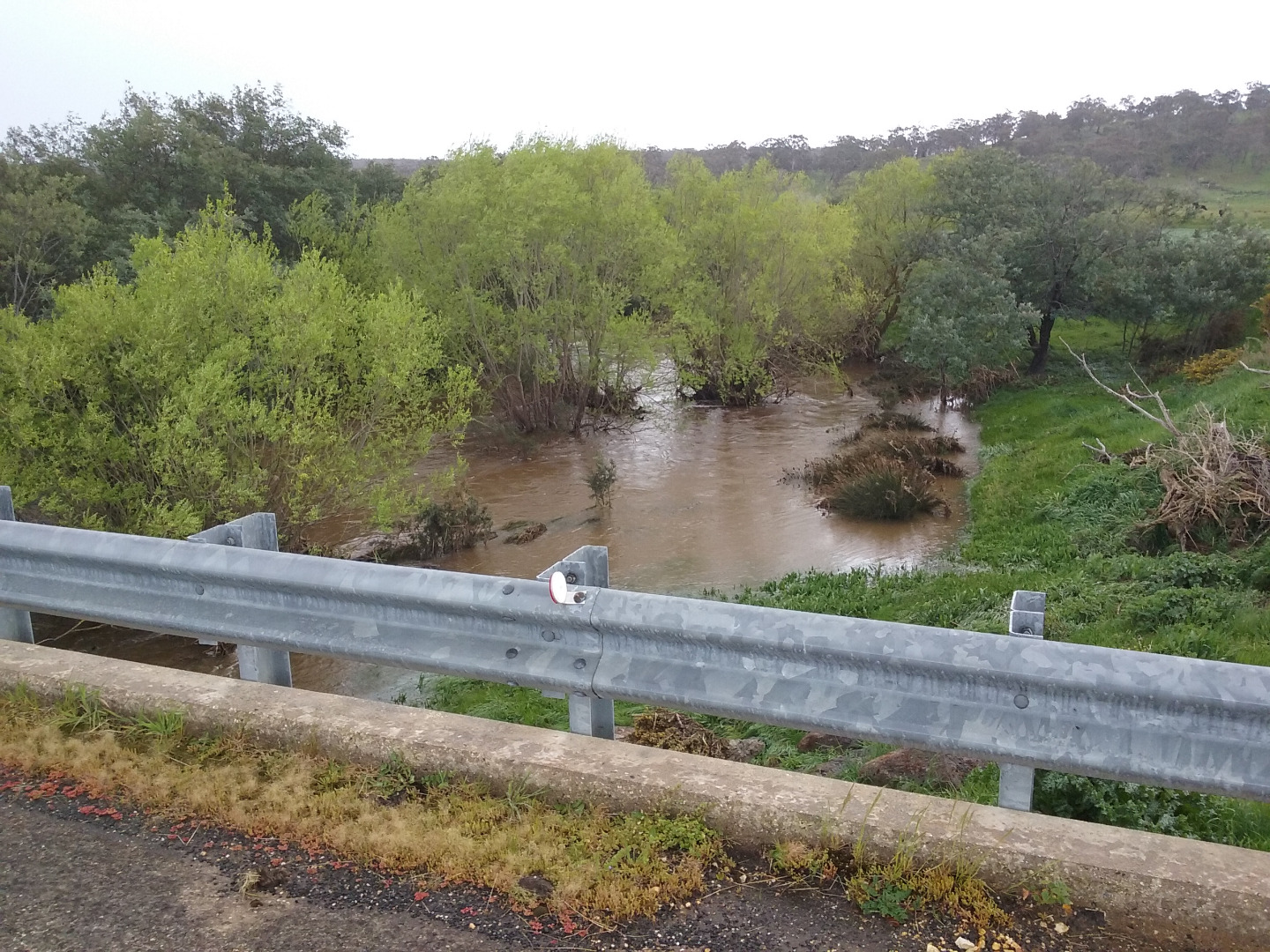
| Weather | cloudy |
|---|---|
| Last rainfall | Raining now |
| Flow estimate | FLOOD / OVERBANK: flow is high and water level has exceeded bank capacity and is connecting with floodplain |
| Water Appearance | Muddy |
| Stream depth | 1m - 2m |
| Stream width | > 5m |
| Hazards | |
| Litter/Pollutants | paper |

All content, files, data and images provided by the Waterwatch Data Portal and Gallery are subject to a Creative Commons Attribution License
Content is made available to be used in any way, and should always attribute Waterwatch and www.vic.waterwatch.org.au
.png)