Waterwatch Data Portal
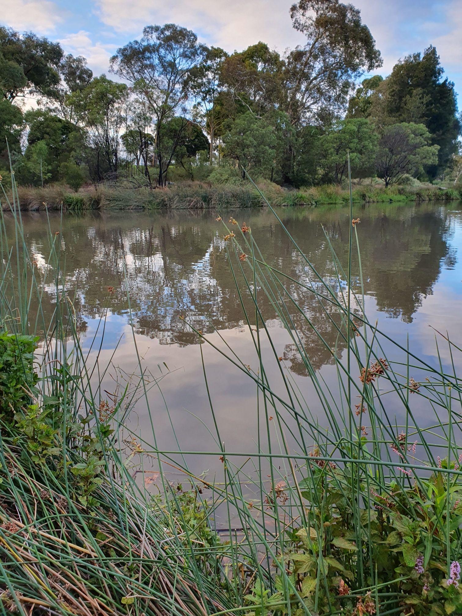
ME_YED066 P4, Edwardes Lake, near outlet for Low-flow wetland, downstream of ME_YED068
Site details
Overview
| Site code | ME_YED066 |
|---|---|
| Site name | P4, Edwardes Lake, near outlet for Low-flow wetland, downstream of ME_YED068 |
| Status | Active |
| Water Authority | Melbourne |
| Basin | Yarra River |
| Catchment | Yarra River |
| Sub catchment | Edgars Creek |
| Reach | |
| Water type | Other |
| Council | Darebin City Council |
| History | View all 9 site visits 14-05-2023 - 10-03-2024 |
| Monitoring organisations |
|
Site visits
 Loading chart
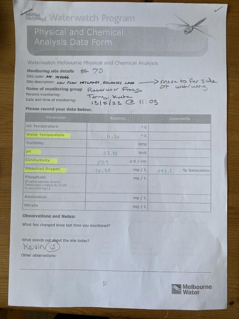
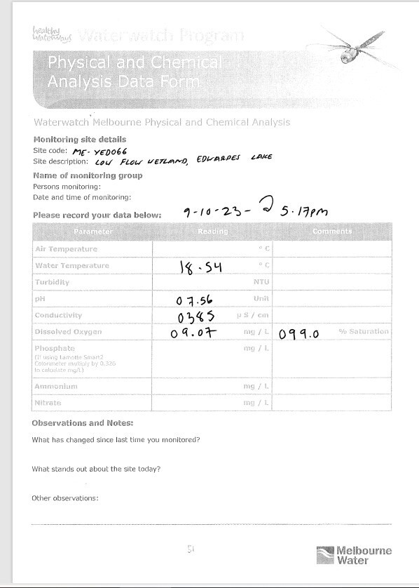
| Date | D.O. % | D.O mg/L | EC µS/cm | pH pH Units | Air ° C | Water ° C |
|---|---|---|---|---|---|---|
| 14-05-2023 | 93.8323 | 9.85 | 478 | 8.16 | 17.2 | 13.1 |
| 11-06-2023 | 72.6969 | 7.53 | 496 | 8.14 | 13.7 | |
| 09-07-2023 | 74.7647 | 8.19 | 628 | 8 | 11.2 | |
| 13-08-2023 | 94.66 | 10.38 | 319 | 7.8 | 11.2 | |
| 10-09-2023 | 99.42 | 10.58 | 413 | 8 | 12.5 | |
| 09-10-2023 | 9.07 | 385 | 7.56 | 18.5 | ||
| 12-11-2023 | 7.56 | 704 | 7.64 | 16.5 | 19.7 | |
| 10-12-2023 | 6.12 | 181 | 7.37 | 16.2 | 17.5 | |
| 14-01-2024 | 4.85 | 1637 | 7.62 | 18.9 | 22 |


All content, files, data and images provided by the Waterwatch Data Portal and Gallery are subject to a Creative Commons Attribution License
Content is made available to be used in any way, and should always attribute Waterwatch and www.vic.waterwatch.org.au
.png)