Waterwatch Data Portal
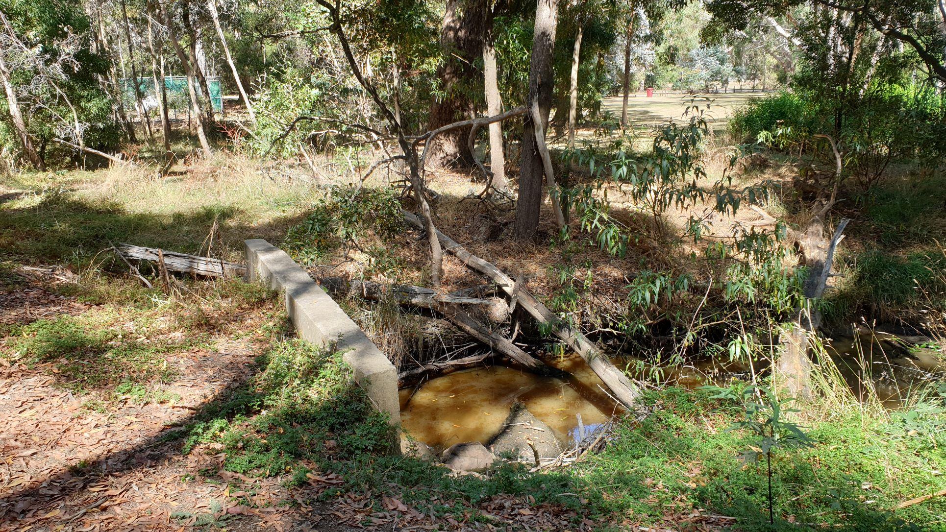
NC_SMO200 Smokers Creek, Hanging Rock Reserve near south east picnic shelter
Site details
Overview
| Site code | NC_SMO200 |
|---|---|
| Site name | Smokers Creek, Hanging Rock Reserve near south east picnic shelter |
| Status | Active |
| Water Authority | North Central |
| Basin | Campaspe River |
| Catchment | Campaspe River |
| Sub catchment | Campaspe River |
| Reach | 6_24 Five Mile Creek |
| Water type | |
| Council | |
| History | View all 11 site visits 03-03-2022 - 28-04-2024 |
| Monitoring organisations |
|
Site visits
 Loading chart
| Date | EC µS/cm | pH pH Units | rP mg/L P | Air ° C | Water ° C | Turb NTU |
|---|---|---|---|---|---|---|
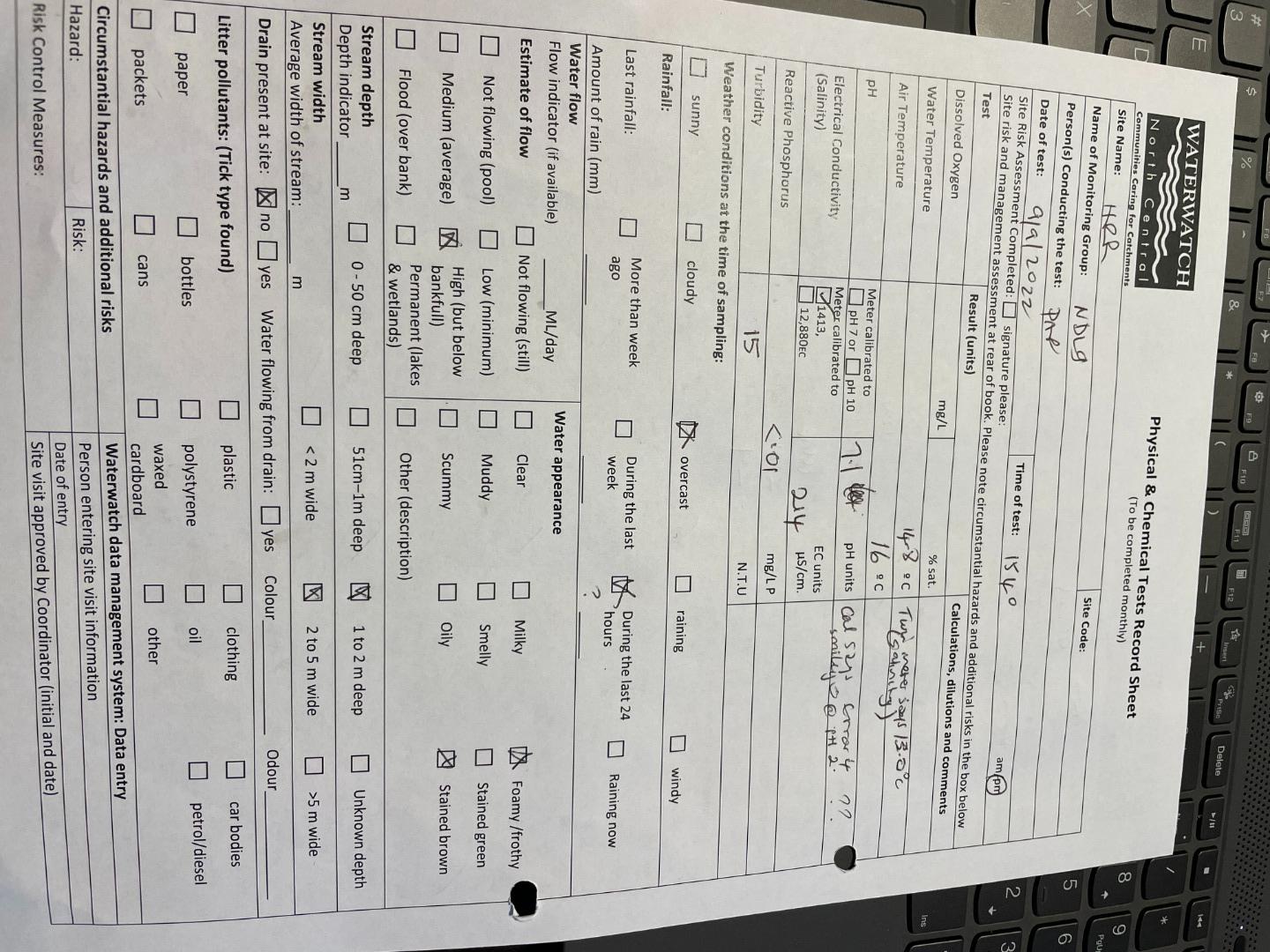
| 09-08-2022 | 7.3 | 0.01 | 12 | 9.5 | 9 | |
| 09-09-2022 | 214 | 7.1 | 0.01 | 16 | 14.8 | 15 |
| 16-11-2022 | 145 | 7.5 | 0.02 | 12 | 0 | |
| 24-11-2022 | 147 | 7.1 | 0.04 | 14 | 17 | 18 |
| 19-02-2023 | 274 | 7 | 0 | 18 | 21.7 | 22 |
| 16-03-2023 | 214 | 7.4 | 0 | 18 | 16.5 | 21 |
| 23-05-2023 | 134 | 7.7 | 0 | 9 | 8 | 9 |
| 26-09-2023 | 167 | 7.4 | 0.01 | 17.7 | 15.2 | 13 |
| 07-11-2023 | 157 | 0.01 | 26.4 | 22.4 | 11 |
Habitat
| Date | Comment | Bank Erosion Stability | Bank Vegetation | In Stream Cover | Riffles Pools Bends | Verge Vegetation | Overall |
|---|---|---|---|---|---|---|---|
| 28-04-2024 | <p>At the testing site vegetation has been protected from wallabies and kangaroos by cyclone mesh fencing for > 18 months now and banks look vastly better than before this was implemented.</p> <p>The fenced area is narrow in this section - fencing being an estimated 5m from the centre of the stream. Northern side has revegetation 10- 15m width</p> <p>Previously riparian plantings were protected by 450mm high guards and animals had access to creek.</p> | Fair 3 | Good 8 | Good 8 | Fair 3 | Fair 6 | 28 |
| 23-05-2023 | Good 4 | Fair 6 | Fair 6 | Fair 3 | Fair 6 | 25 | |
| 19-02-2023 | <p>management practices over past 6 years have resulted in improvement in condition of banks and widening of native vegetation on verges.</p> | Fair 3 | Fair 6 | Fair 6 | Poor 2 | Fair 6 | 23 |

All content, files, data and images provided by the Waterwatch Data Portal and Gallery are subject to a Creative Commons Attribution License
Content is made available to be used in any way, and should always attribute Waterwatch and www.vic.waterwatch.org.au
.png)