Waterwatch Data Portal
Site details
Overview
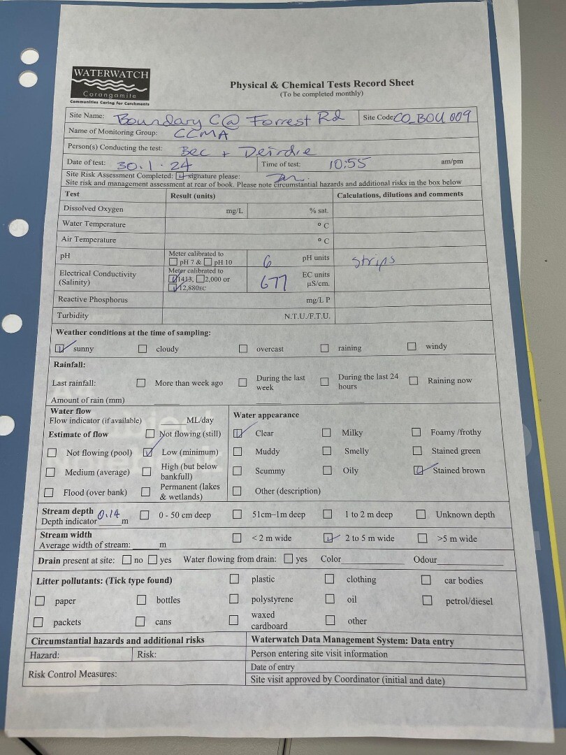
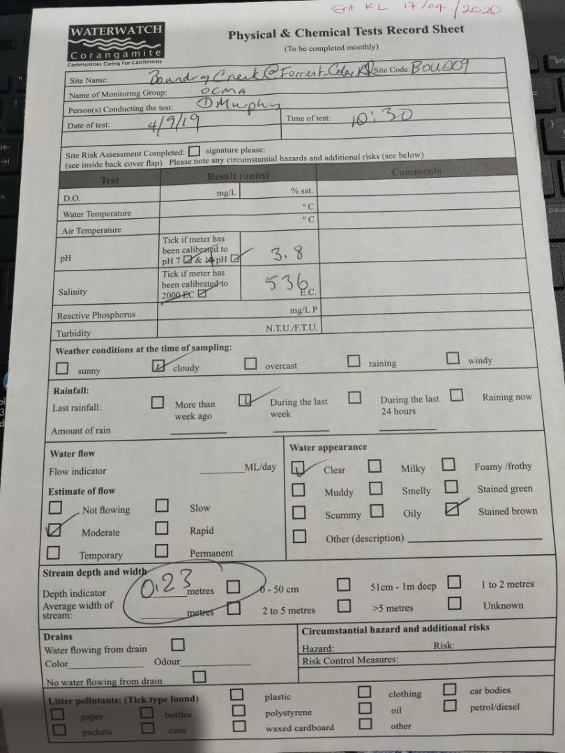
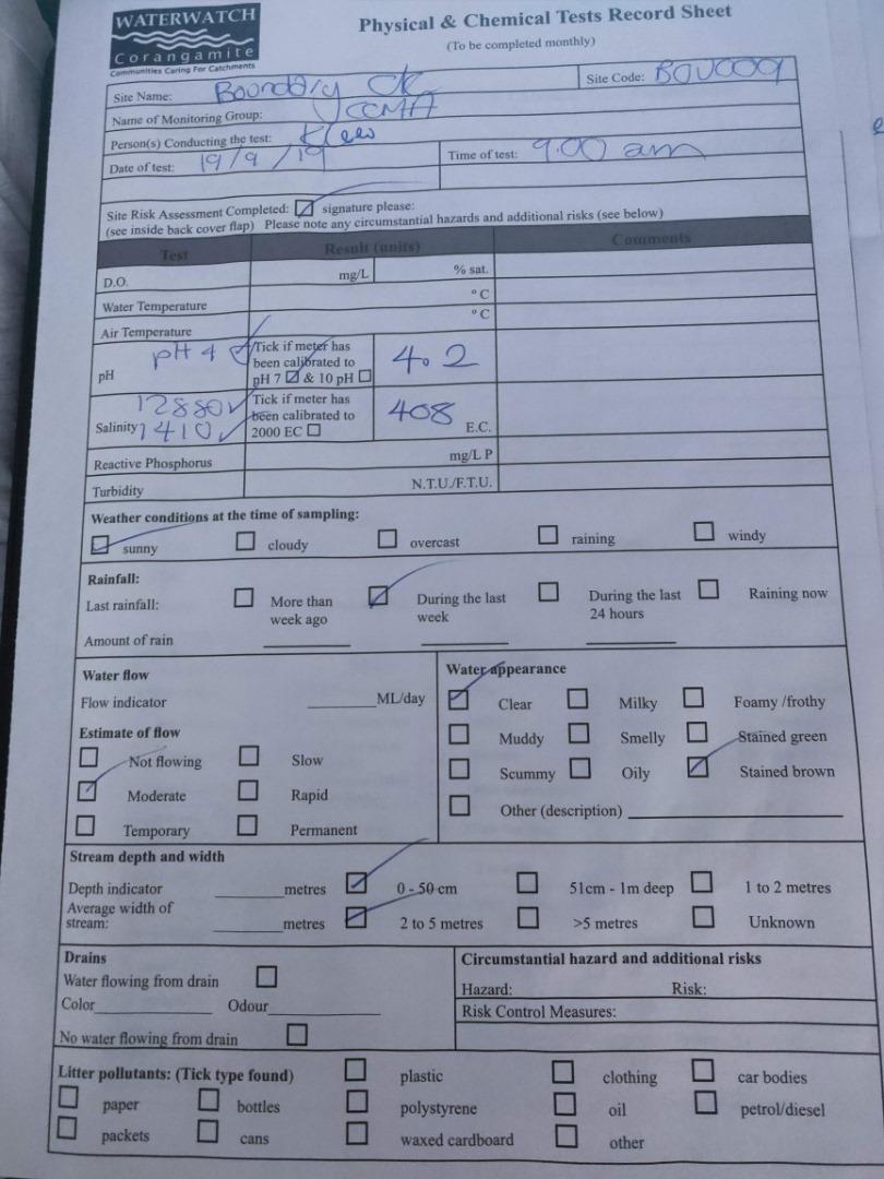
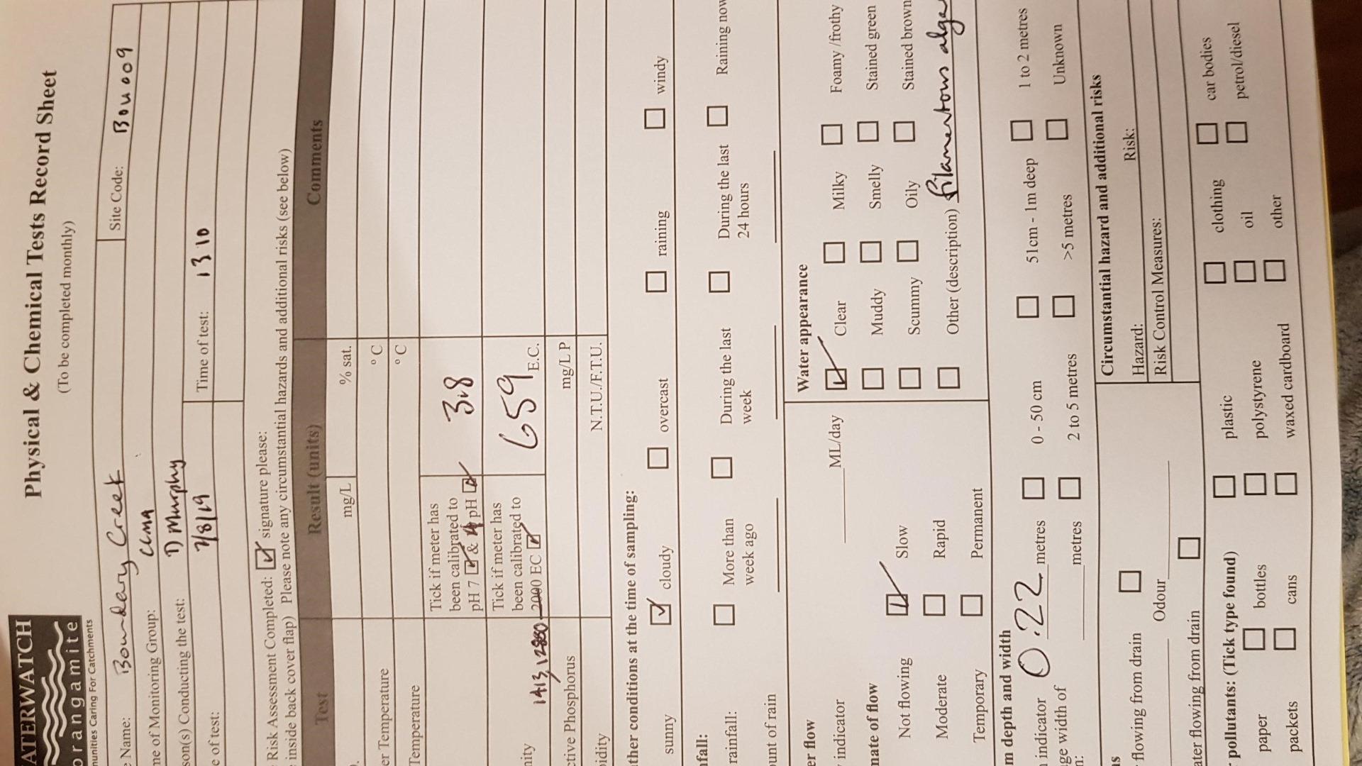
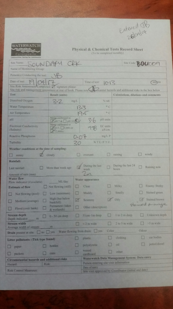
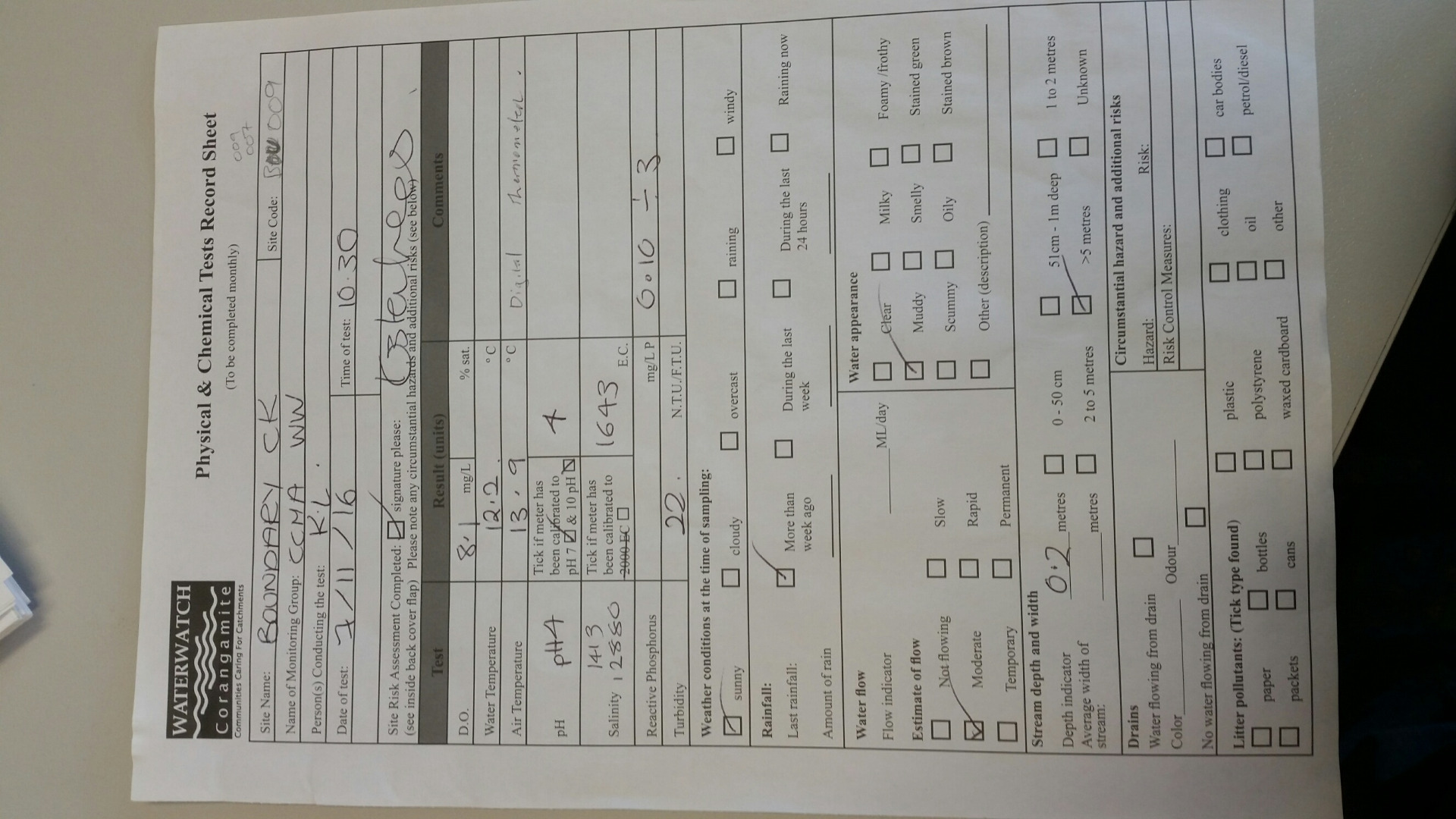
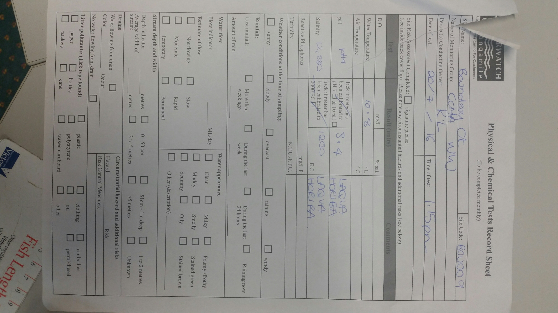
| Site code | CO_BOU009 |
|---|---|
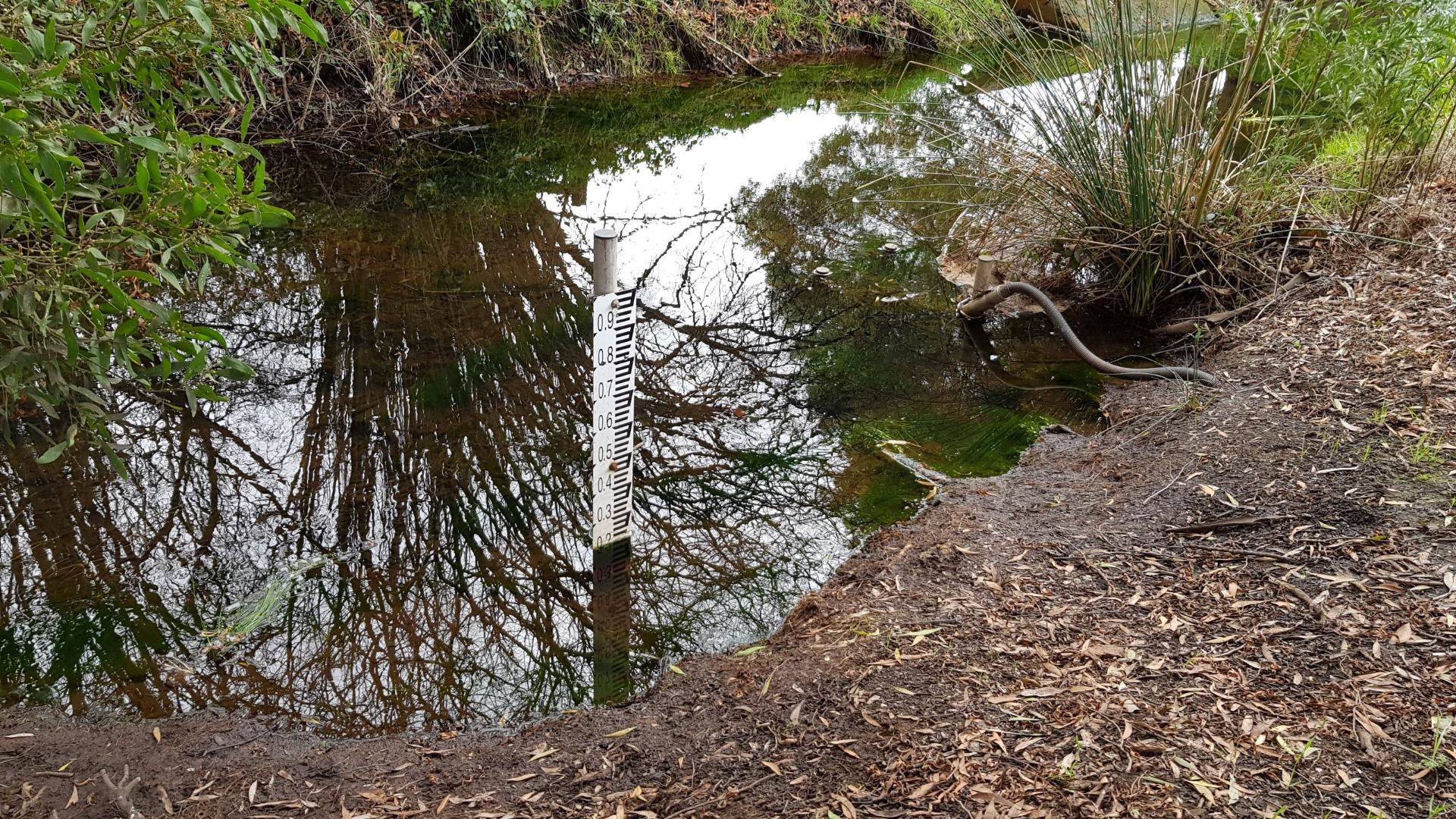
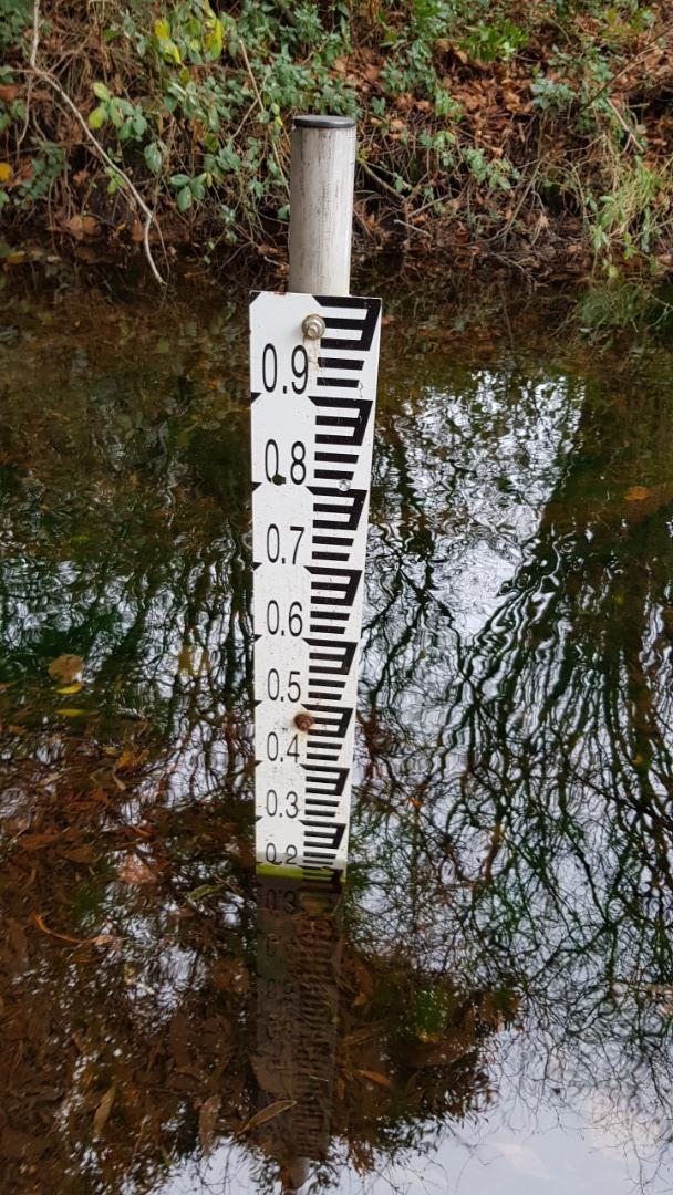
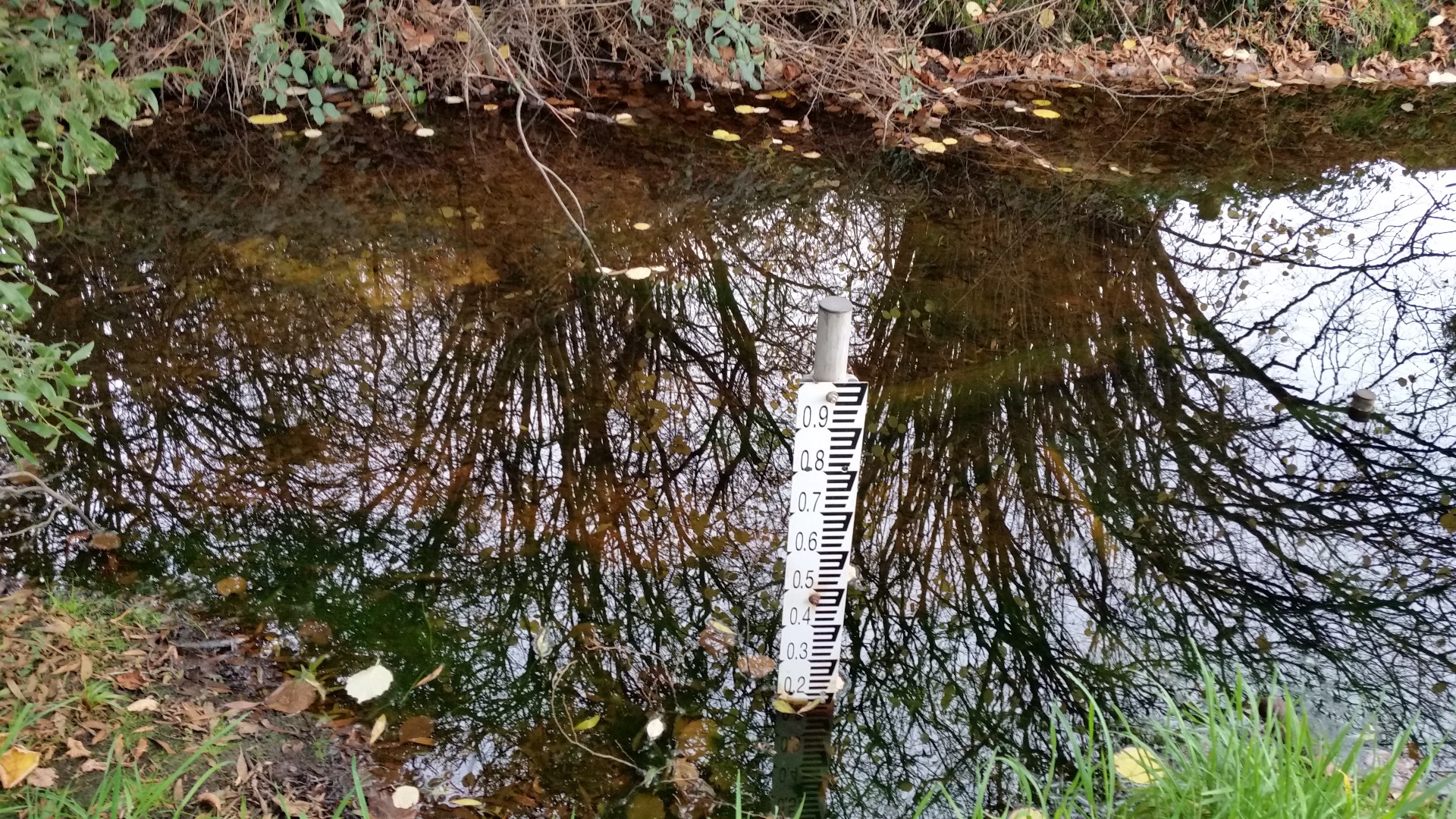
| Site name | Boundary Creek |
| Status | Active |
| Water Authority | Corangamite |
| Basin | Barwon River |
| Catchment | Barwon River |
| Sub catchment | Boundary Creek |
| Reach | 33_33 Boundary Creek |
| Water type | Other |
| Council | |
| History | View all 191 site visits 13-04-2004 - 30-01-2024 |
| Monitoring organisations |
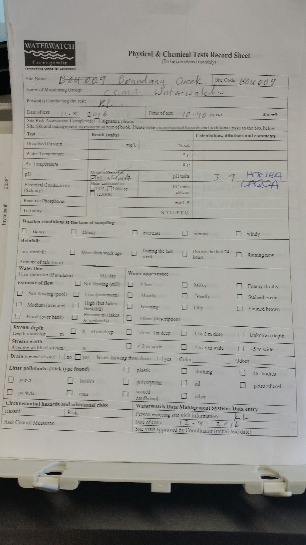
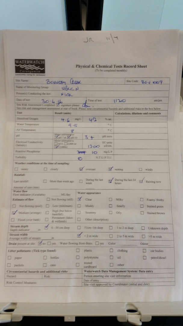
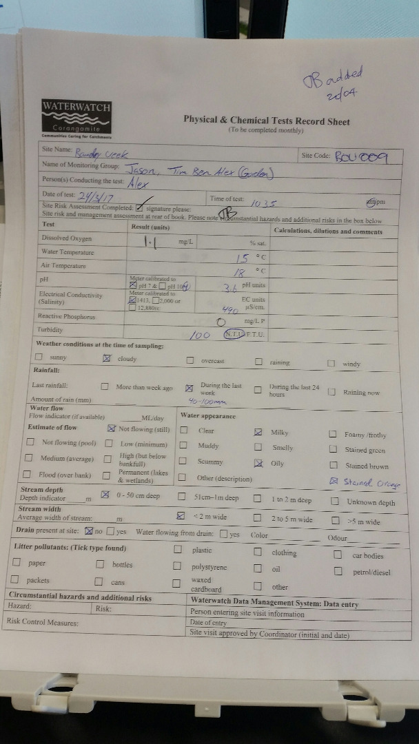
Site visits
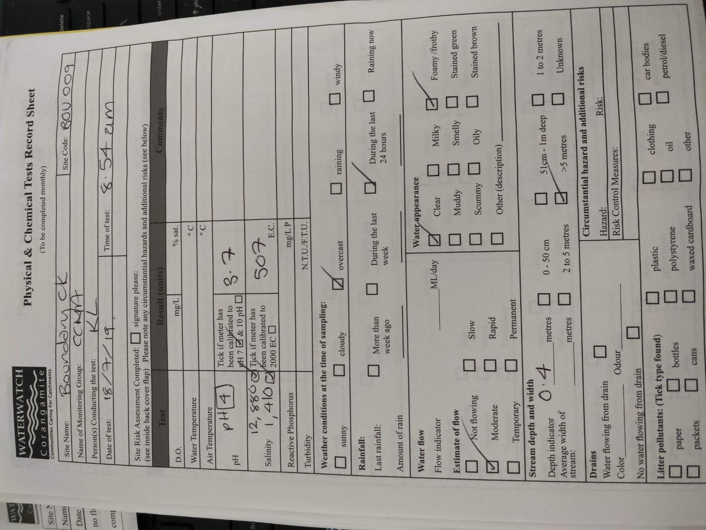
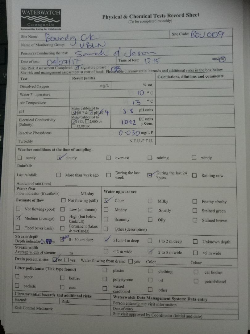
 Loading chart
| Date | D.O. % | D.O mg/L | eDNA presence=1 | EC µS/cm | pH pH Units | rP mg/L P | Air ° C | Water ° C | Turb FTU | Turb NTU |
|---|---|---|---|---|---|---|---|---|---|---|
| 21-12-2022 | 400 | 6 | 32.3 | |||||||
| 30-01-2024 | 677 | 6 |
Habitat
| Date | Comment | Bank Erosion Stability | Bank Vegetation | In Stream Cover | Riffles Pools Bends | Verge Vegetation | Overall |
|---|---|---|---|---|---|---|---|
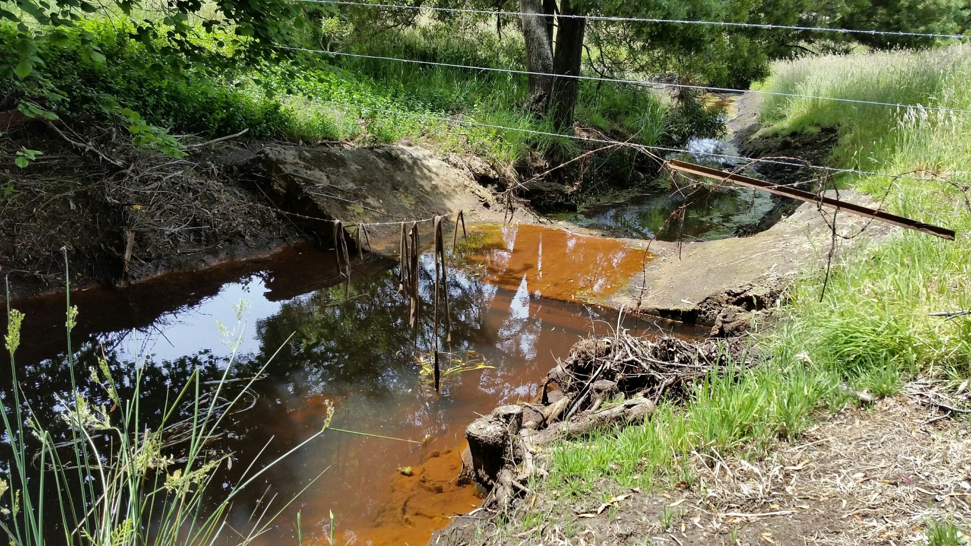
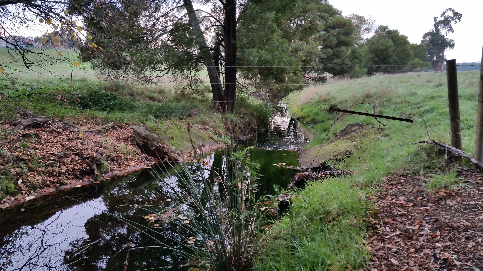
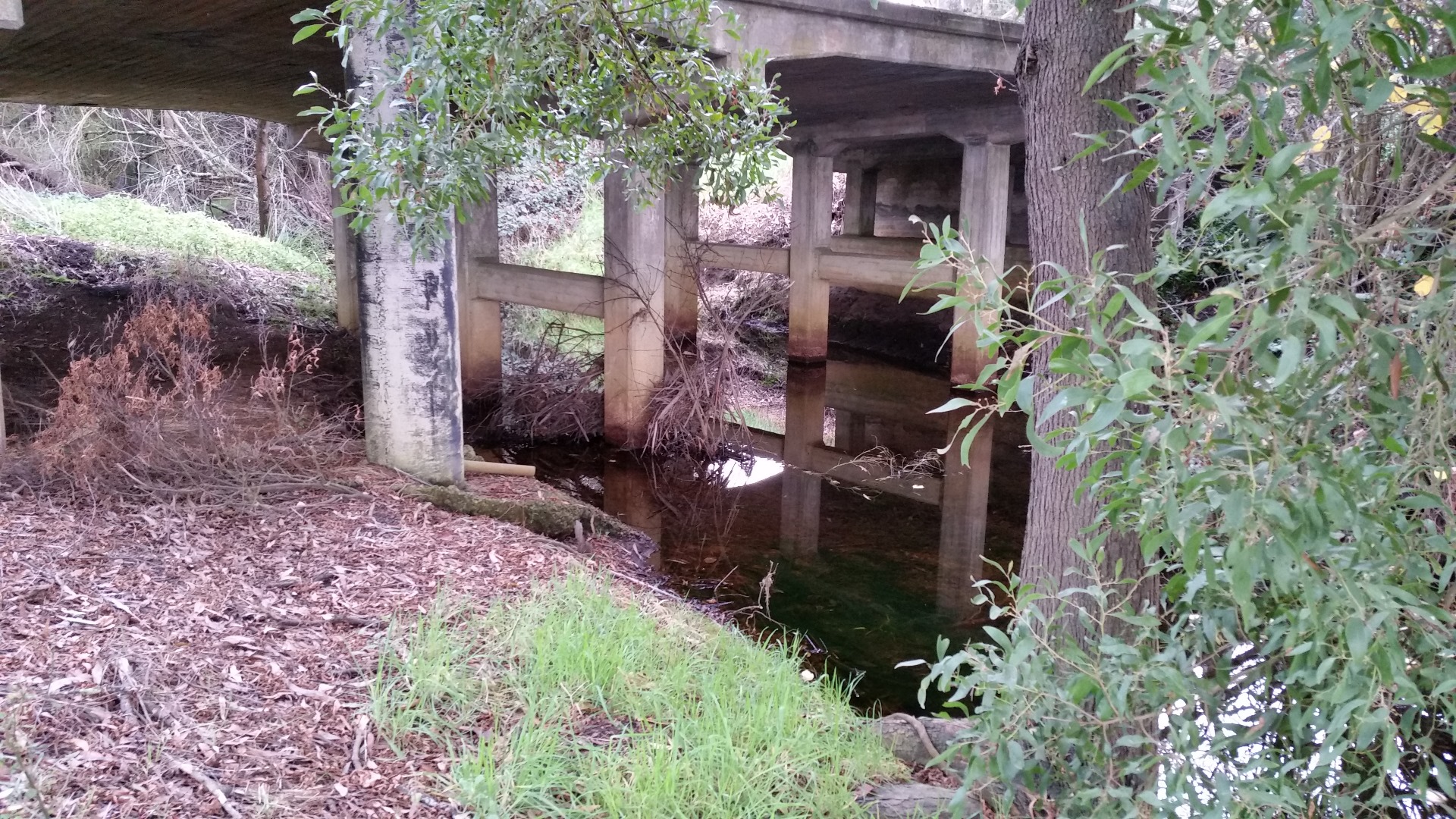
| 12-02-2021 | <p>Still water, Foamy slick, Brown stained colour, Ground cover & Trees mainly weeds, Some native trees - Blackwoods, Eucalypts. Crows have access to the stream.</p> | Good 4 | Fair 6 | Fair 6 | Poor 2 | Poor 4 | 22 |
| 14-02-2020 | <p>Site sampled with Pesticide Detectives - No pesticides detected</p> | Fair 3 | Fair 6 | Fair 6 | Poor 2 | Good 8 | 25 |
| 04-07-2011 | Survey conducted by Gene | Fair 3 | Fair 6 | Poor 4 | Poor 2 | Fair 6 | Fair 21 |
| 08-06-2010 | blackberries, blackwood, pasture grasses | Fair 3 | Fair 6 | Good 8 | Good 4 | Fair 6 | Fair 27 |
| 02-07-2009 | blackberry, wattle, blackwood | Fair 3 | Good 8 | Fair 6 | Fair 3 | Good 8 | Fair 28 |
| 05-06-2008 | blackberry, blackwood, bracken, exotic grasses, gums, wattles | Fair 3 | Fair 6 | Fair 6 | Fair 3 | Good 8 | Fair 26 |
| 01-02-2007 | reveg project approx 8 years, blue gum, blackwood, black wattle, phalaris understorey on verge, blackberry on bank | Poor 2 | Fair 6 | Poor 4 | Fair 3 | Fair 6 | Fair 21 |
| 11-01-2006 | re-veg approx 8 - 10 years ago - indigenous species stock excluded | Poor 2 | Poor 4 | Fair 6 | Good 4 | Poor 4 | Fair 20 |
| 21-04-2005 | blackberries and exotic grasses present | VeryPoor 1 | Good 8 | Fair 6 | Good 4 | Fair 6 | Fair 25 |


All content, files, data and images provided by the Waterwatch Data Portal and Gallery are subject to a Creative Commons Attribution License
Content is made available to be used in any way, and should always attribute Waterwatch and www.vic.waterwatch.org.au
.png)