Waterwatch Data Portal
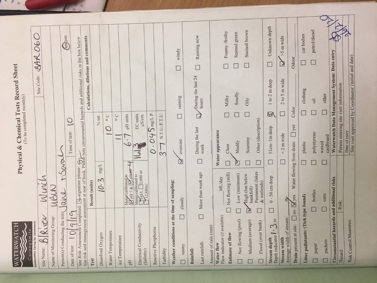
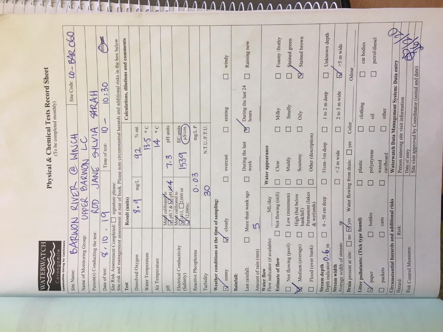
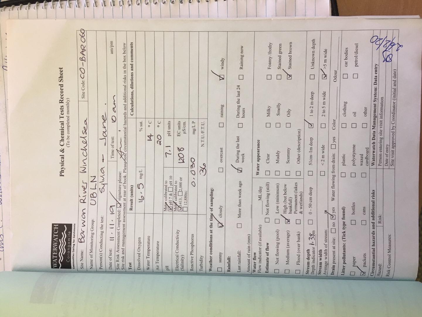
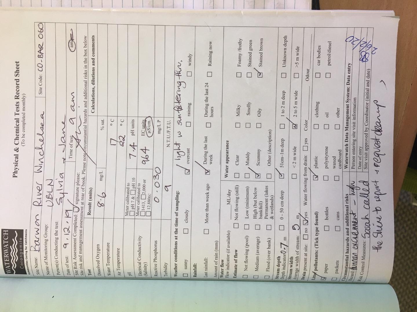
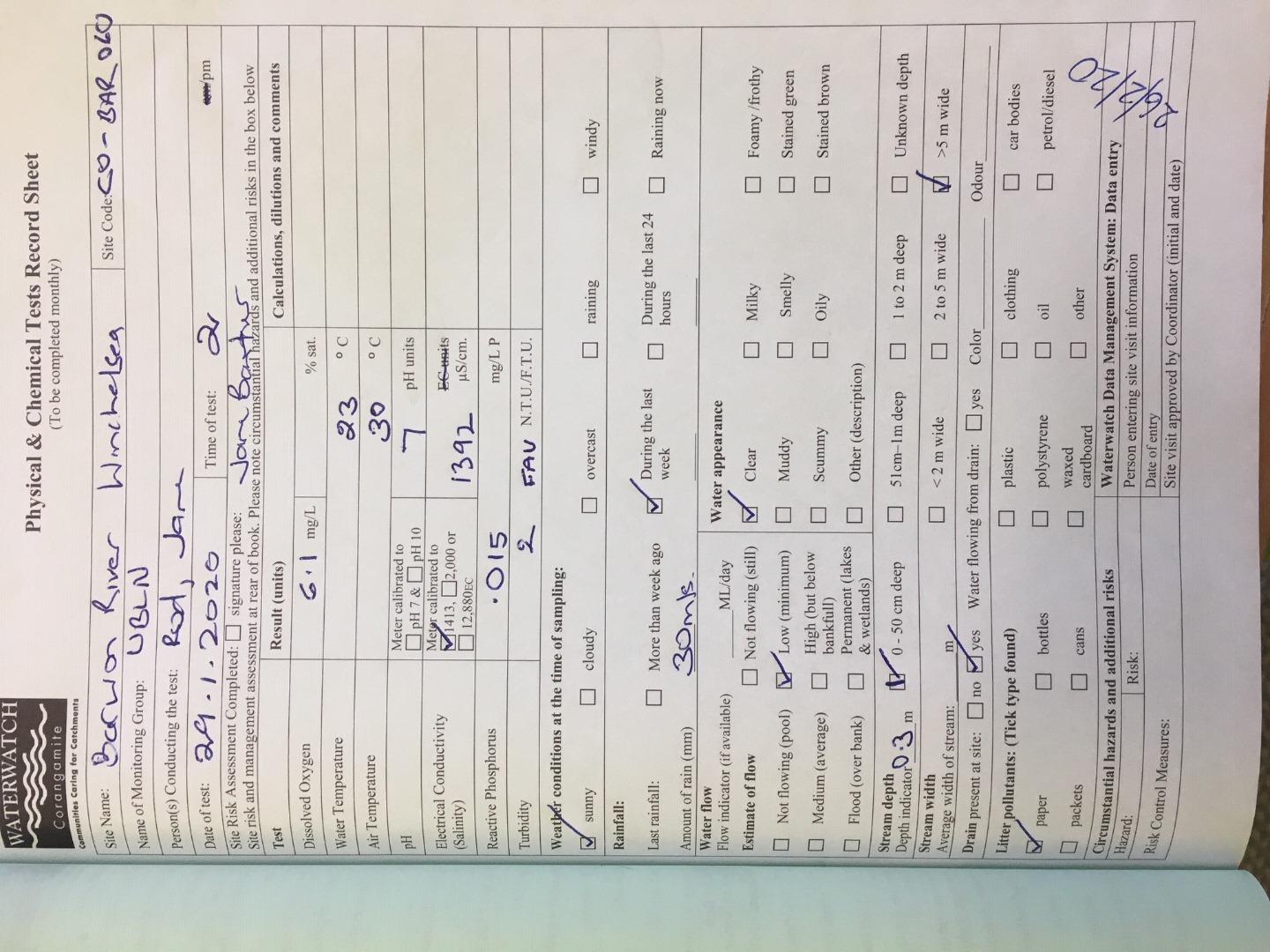
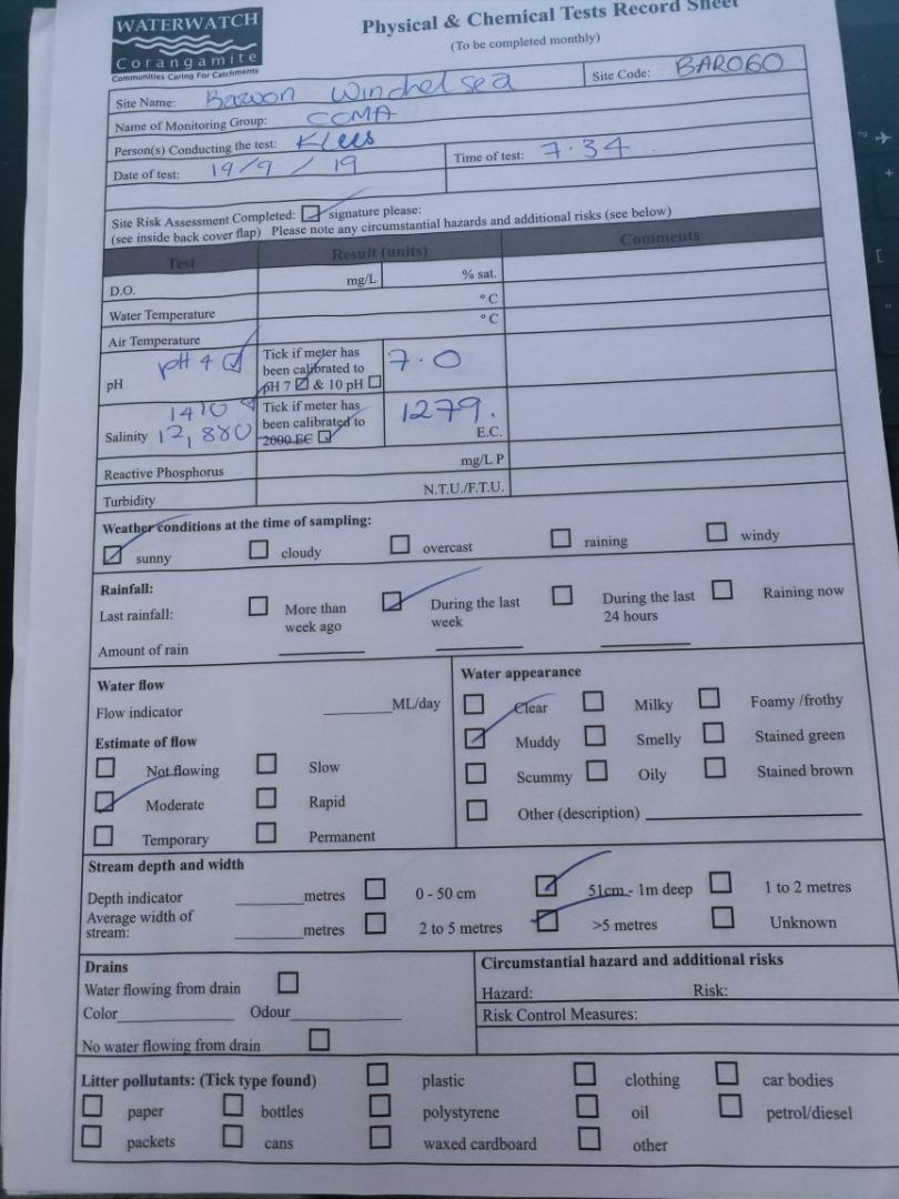
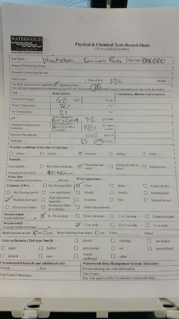
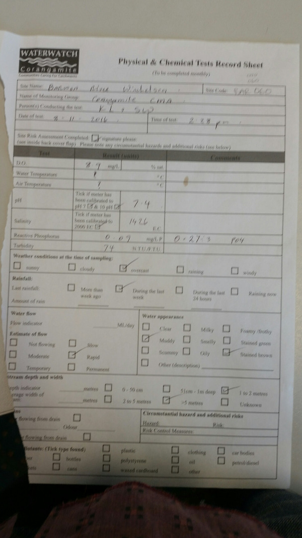
CO_BAR060 Barwon River @ Winchelsea, Princess Hwy Bridge
Site details
Overview
| Site code | CO_BAR060 |
|---|---|
| Site name | Barwon River @ Winchelsea, Princess Hwy Bridge |
| Status | Active |
| Water Authority | Corangamite |
| Basin | Barwon River |
| Catchment | Barwon River |
| Sub catchment | Barwon River |
| Reach | 33_4 Barwon River |
| Water type | Other |
| Council | |
| History | View all 215 site visits 22-06-1995 - 25-07-2023 |
| Monitoring organisations |
Site visits
 Loading chart
| Date | D.O. % | D.O mg/L | eDNA presence=1 | EC µS/cm | Nitrate-Nit mg/L N | pH pH Units | rP mg/L P | Air ° C | Water ° C | P mg/L | Turb NTU |
|---|---|---|---|---|---|---|---|---|---|---|---|
| 25-07-2023 | 1068 | 9 |
Habitat
| Date | Comment | Bank Erosion Stability | Bank Vegetation | In Stream Cover | Riffles Pools Bends | Verge Vegetation | Overall |
|---|---|---|---|---|---|---|---|
| 14-09-2019 | <p>Platypus eDNA Site</p> <p>Burrowing Habitat Score 3</p> <p>Site Positive</p> | Good 4 | Fair 6 | Poor 4 | Fair 3 | Fair 6 | 23 |
| 22-09-2018 | Fair 3 | Poor 4 | Fair 6 | Fair 3 | Poor 4 | 20 | |
| 18-01-2011 | recent high water levels - evidence of cutting into the bank on the left side - upstream of the monitoring site - reeds instream vegetation - mosquitos present | Fair 3 | Fair 6 | Poor 4 | Good 4 | Excellent 10 | Fair 27 |
| 20-01-2010 | Good 4 | Fair 6 | Fair 6 | Good 4 | Excellent 10 | Poor 30 | |
| 21-08-2008 | pasture grasses, red gum, grass parrots, | Fair 3 | Good 8 | Fair 6 | Good 4 | Good 8 | Poor 29 |


All content, files, data and images provided by the Waterwatch Data Portal and Gallery are subject to a Creative Commons Attribution License
Content is made available to be used in any way, and should always attribute Waterwatch and www.vic.waterwatch.org.au
.png)