Waterwatch Data Portal
Welcome to the Waterwatch data portal.
Here you can view, query and download Waterwatch data and images for regions of Victoria you are interested in.
Click on site markers in the map for specific rivers, lakes or wetlands. There are two search boxes you may also find helpful. Use the first box to type in a particular waterway name eg Avoca River. Or, if you want to browse a catchment region, use the drop down box labelled Region to select a region of interest to you eg Mallee. Don’t forget to click the Go button.
Below the map are the 46 basins that make up the 10 catchment regions in Victoria. To help you find your local waterway, view the lists for the catchments within each basin.
View Basin and Catchment explanation
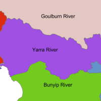
Each region in Victoria is comprised of one to four basins. Each of the basins are further divided into catchments. For waterway managers to identify each part of a river, a unique code is given to the reach (a particular stretch of waterway) within these catchments. For major rivers, reach numbers progressively increase as it extends upstream. For example the Barwon River reach code is 33-2 nearest the coast, and goes up to 33-7 in the upper catchment
The catchment condition snapshot provides you with a median value, the midpoint in a set of numbers, for Waterwatch water quality tests measured in each reach.
Water quality data is useful in establishing the condition of a river reach. For instance, the Index of Stream Condition report uses water quality, along with other river characteristics, to measure the health of Victorian rivers and streams.
Active Waterwatch sites have been grouped into basins and catchments. Select the catchment of interest to you.

All content, files, data and images provided by the Waterwatch Data Portal and Gallery are subject to a Creative Commons Attribution License
Content is made available to be used in any way, and should always attribute Waterwatch and www.vic.waterwatch.org.au
.png)