Slow Load Detected
catchment snapshot charts are taking longer than expected to load.
This may be the result many snapshots for this catchment, a slow internet connection or a device with limited
recources.
Please wait for the charts to finish loading, or Reload
this page without snapshot charts
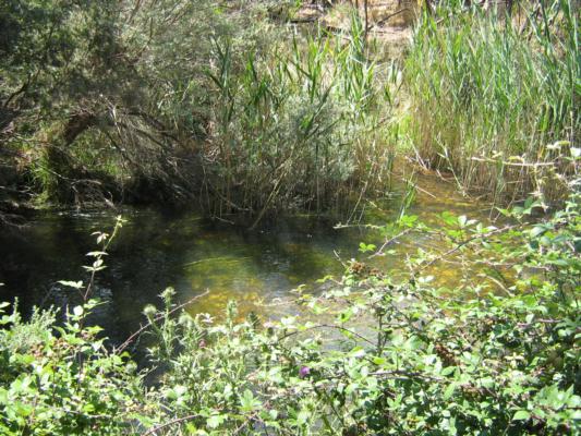
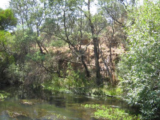
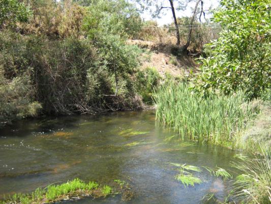
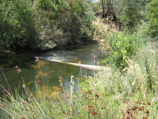
Overall there is a fairly good cover of native vegetation with a few weed/thistle type plants here & there and also some blackberries further up & down stream from the test site.
Physical Chemical Tests
D.O.
%
D.O
mg/L
EC
µS/cm
pH
pH Units
rP
mg/L P
Air
° C
Water
° C
Turb
NTU
Sample
68
6.1
550
7
0.0132
24
20
9
Weather
sunny
Last rainfall
More than a week ago
Flow estimate
MEDIUM: flow is normal/typical average flow
Water Appearance
Clear
Stream depth
0.16
Stream width
2m - 5m
Hazards
Litter/Pollutants
paper,plastic
Stream Habitat Survey done today.
Habitat
Overall there is a fairly good cover of native vegetation with a few weed/thistle type plants here & there and also some blackberries further up & down stream from the test site. I could hear a bit of bird life but only could see a White-Faced Heron close by. If you look behind the vegetation on the steep banks on the opposite side of the river you can see bare patches with some erosion which appears to be much the same as in previous years, no major changes. I have attached some photos in the Diary.
Bank Erosion Stability
Bank Vegetation
In Stream Cover
Riffles Pools Bends
Verge Vegetation
Overall
Fair 3
Fair 6
Excellent 10
Good 4
Fair 6
Good 29
Diary photos
Chart image
Right click or touch and hold the image below to download

.png)