Waterwatch Data Portal
NE_NAR060 Nariel Creek, Benambra-Corryong Road, Stacey's Bridge
22 January 2020
Site visit details
Overview
| Catchment | Upper Murray River |
|---|---|
| Site | Nariel Creek, Benambra-Corryong Road, Stacey's Bridge NE_NAR060 |
| Date and Time | Wednesday 22nd January 2020 11:00am |
| Approved | Approved |
Physical Chemical Tests
| D.O. % | D.O mg/L | EC µS/cm | pH pH Units | rP mg/L P | Water ° C | P mg/L | Turb FTU | Turb NTU | |
|---|---|---|---|---|---|---|---|---|---|
| Sample | 75.1782 | 7.1 | 120 | 8.45 | 18.1 | 0.25 | 90 |
| Weather | sunny |
|---|---|
| Last rainfall | During the last week |
| Flow estimate | LOW: Minimum flow in channel/continuous flow in some part of channel (in-stream habitats connected) |
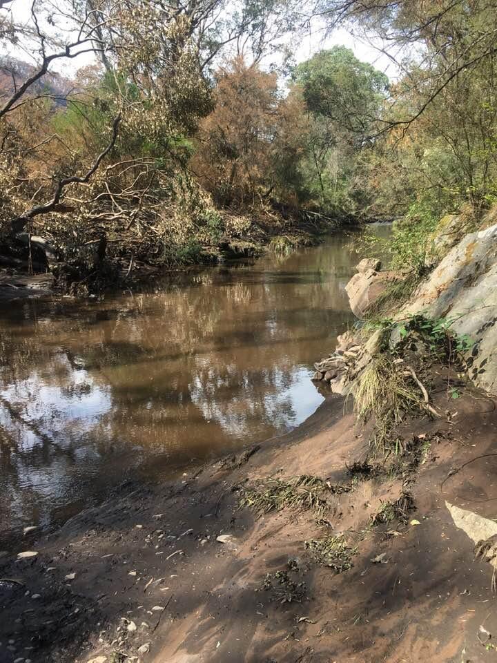
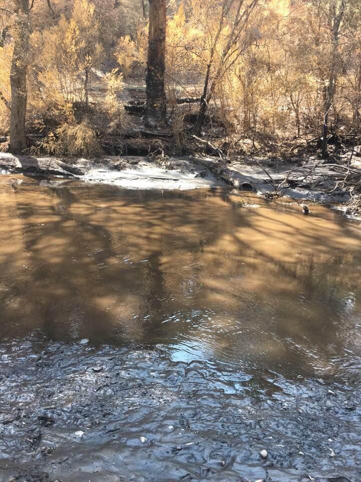
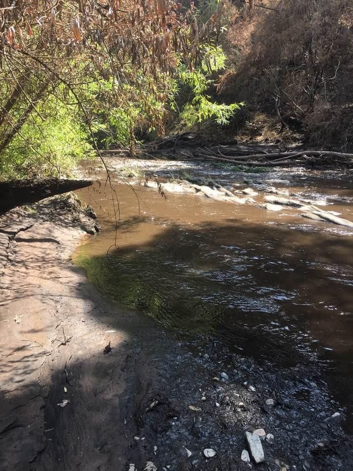
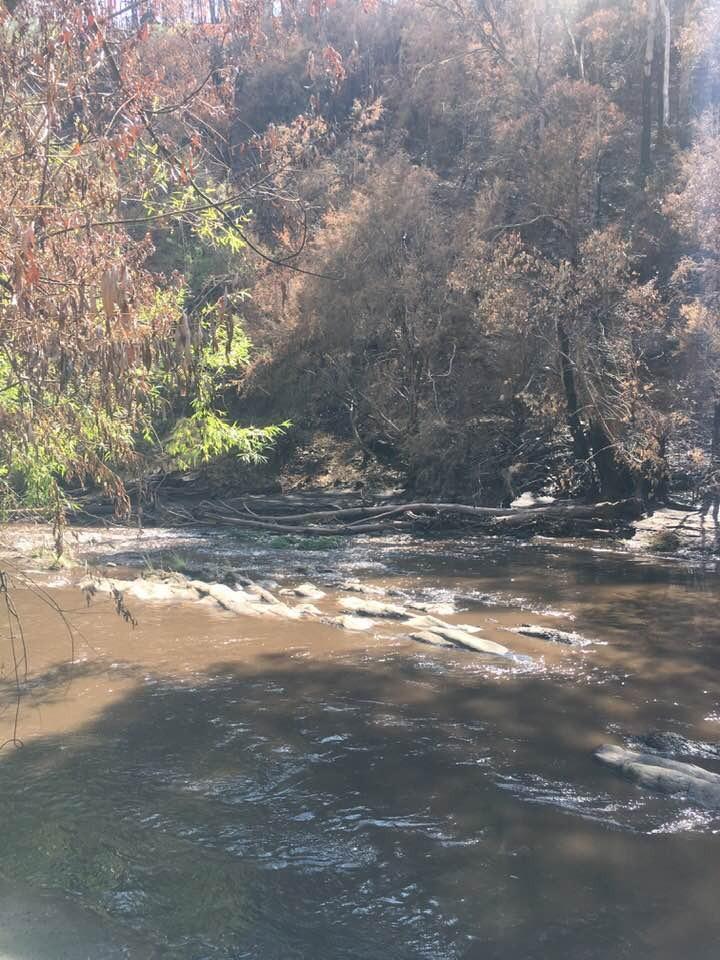
| Water Appearance | Stained brown,Muddy |
| Stream depth | 51cm - 99cm |
| Stream width | > 5m |
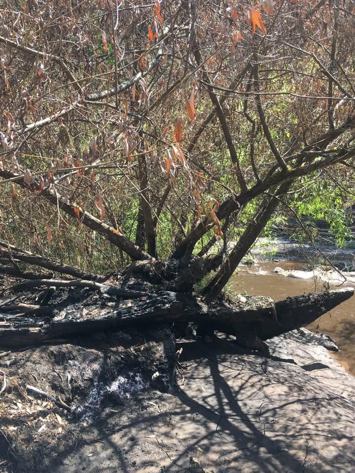
| Hazards | Fire went through in first week on January. erosion around banks |
| Litter/Pollutants |
Water appears brown with some foam. Water is runny, going over rocks etc. A loy of silt of banks covering vegetation. Many snags from debris from fire. Fire has burnt to river edge on far side to collection point (north). and has burnt patchy on the collection point side.
Workers by road cutting down trees and in camp area

All content, files, data and images provided by the Waterwatch Data Portal and Gallery are subject to a Creative Commons Attribution License
Content is made available to be used in any way, and should always attribute Waterwatch and www.vic.waterwatch.org.au
.png)