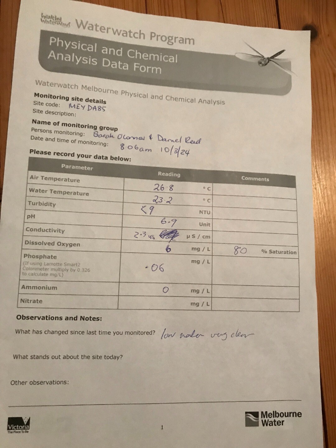
Waterwatch Data Portal
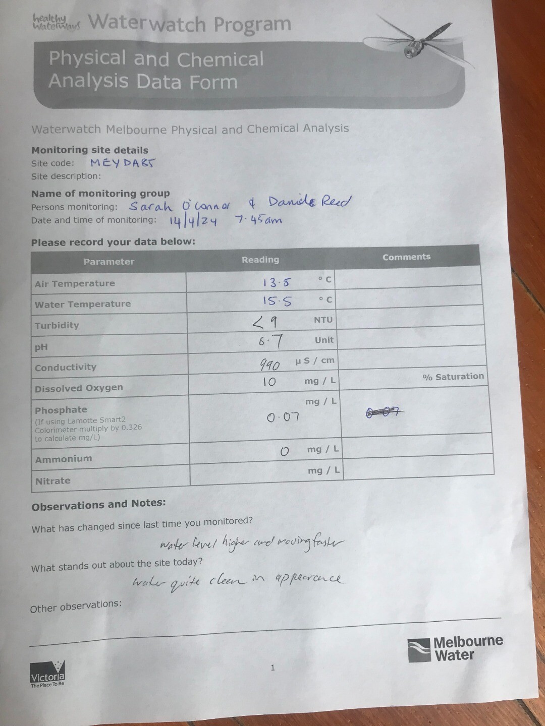
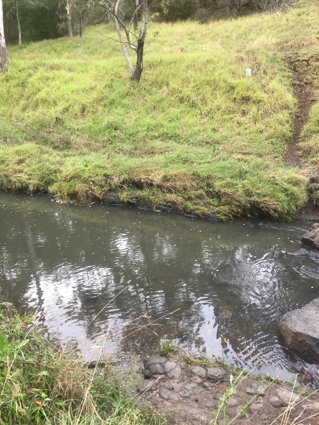
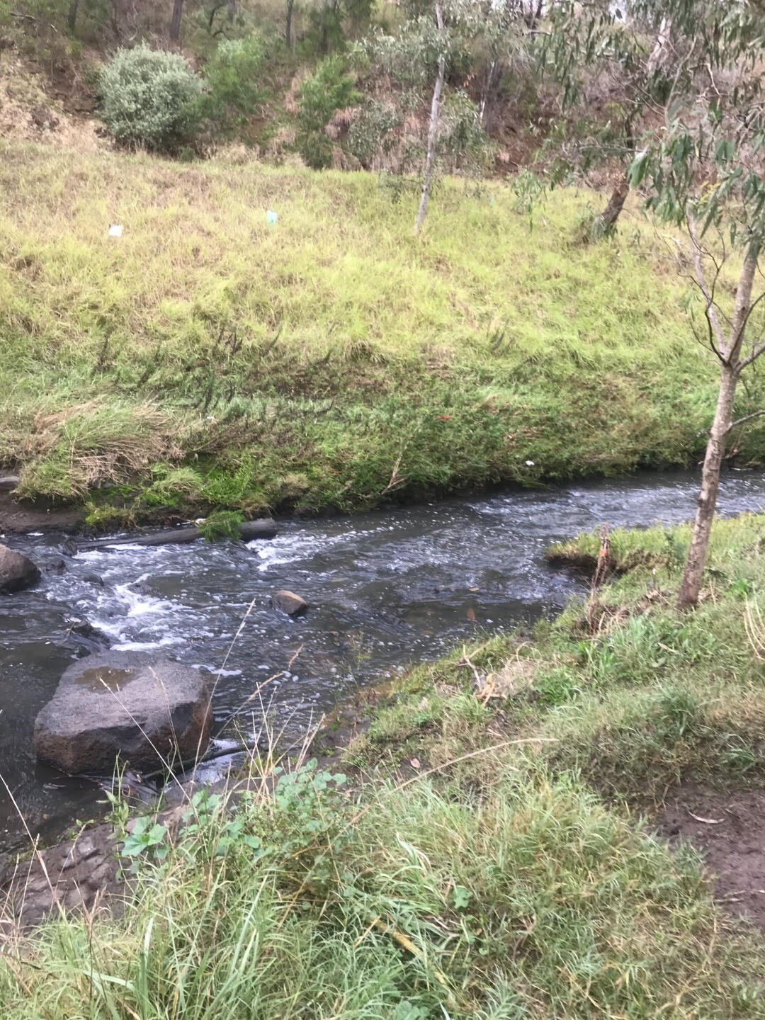
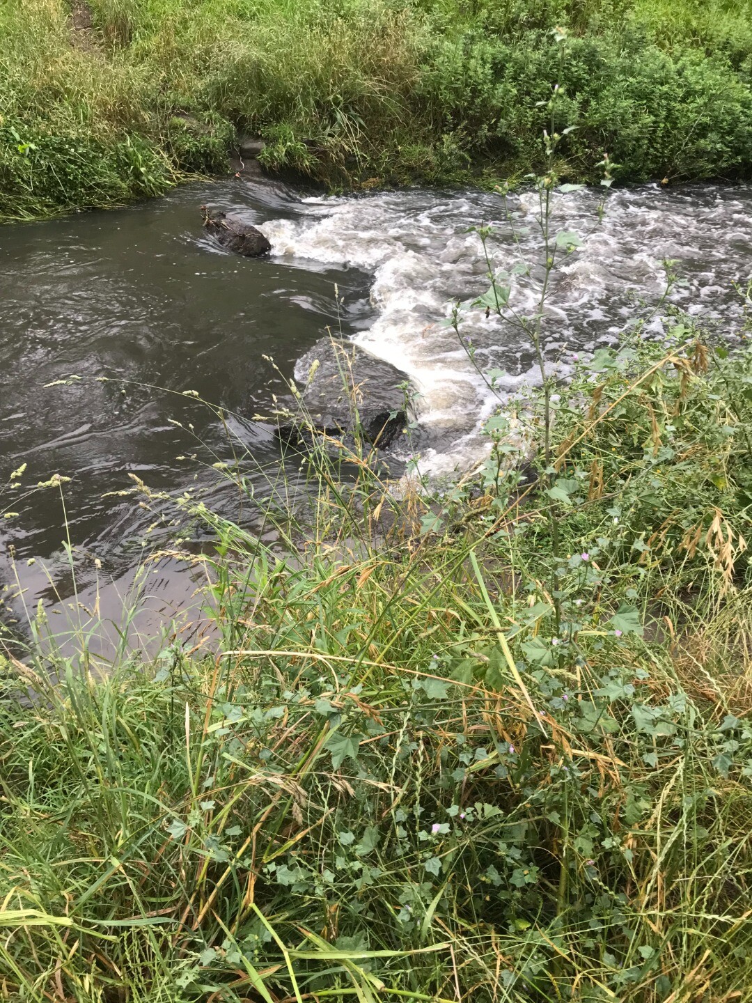
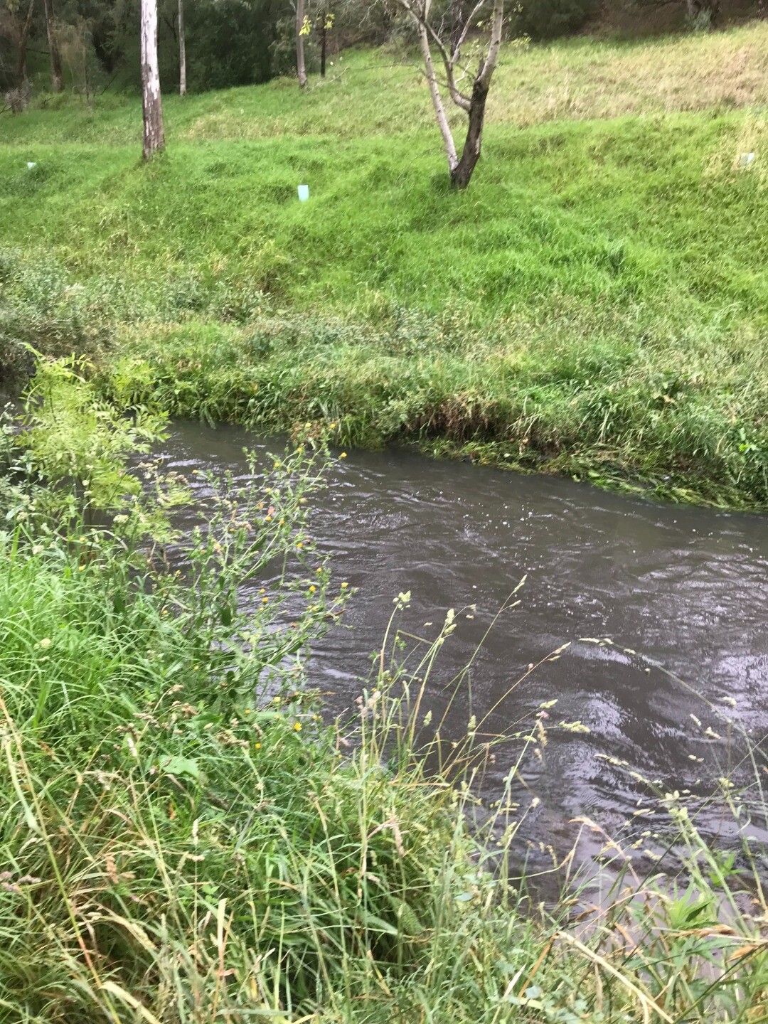
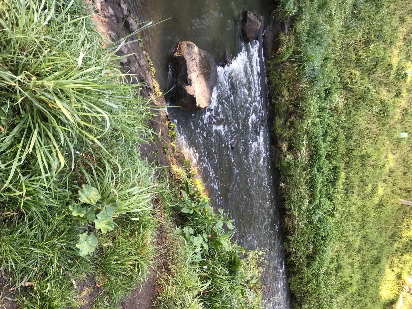
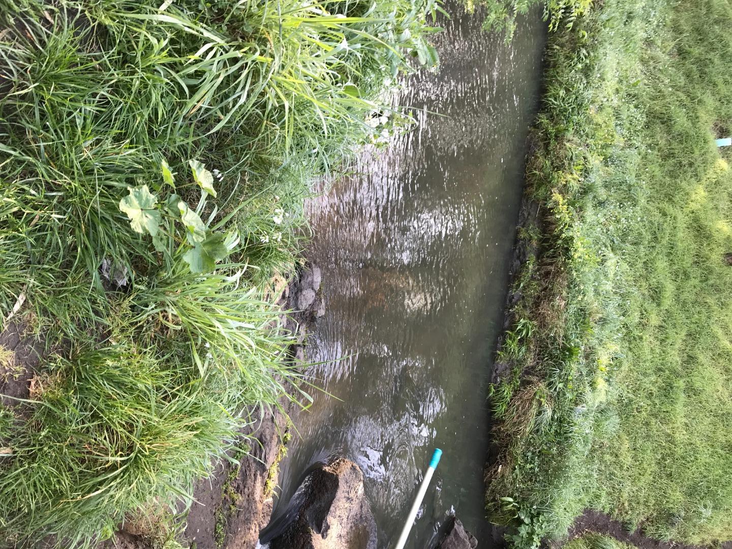
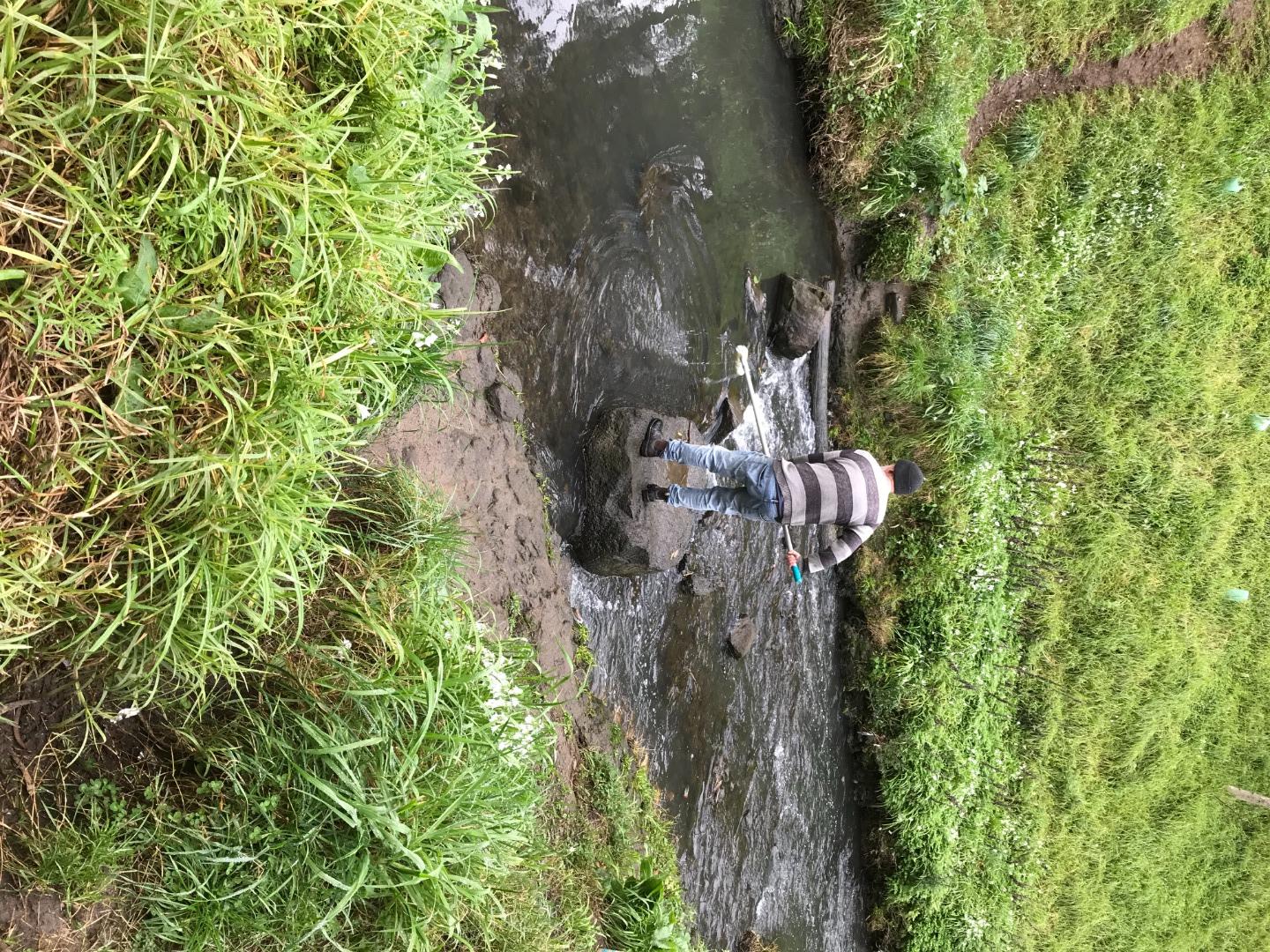
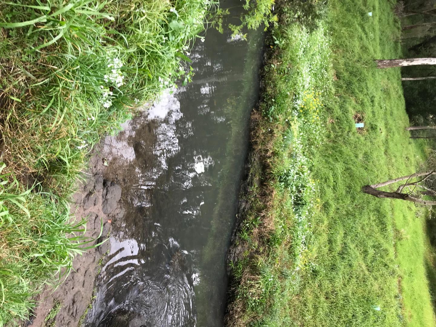
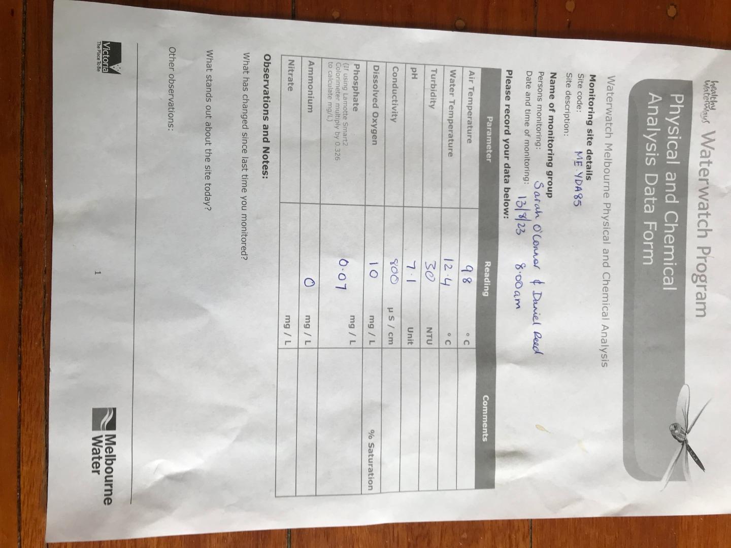
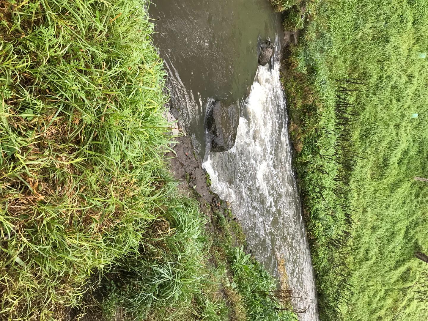
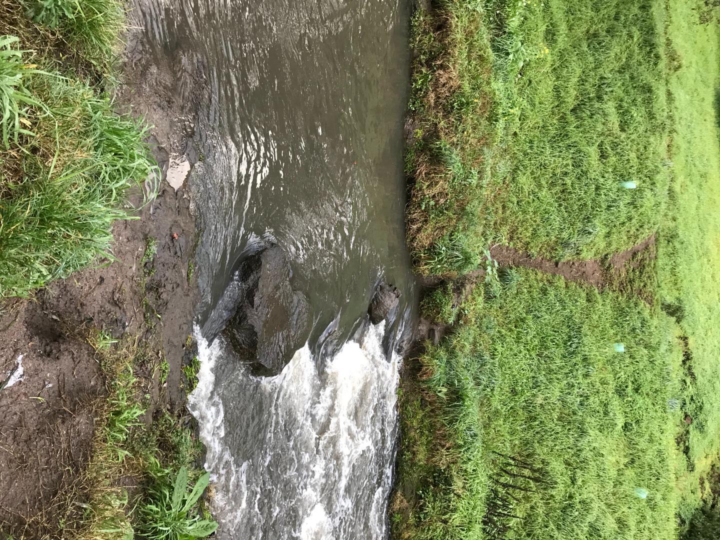
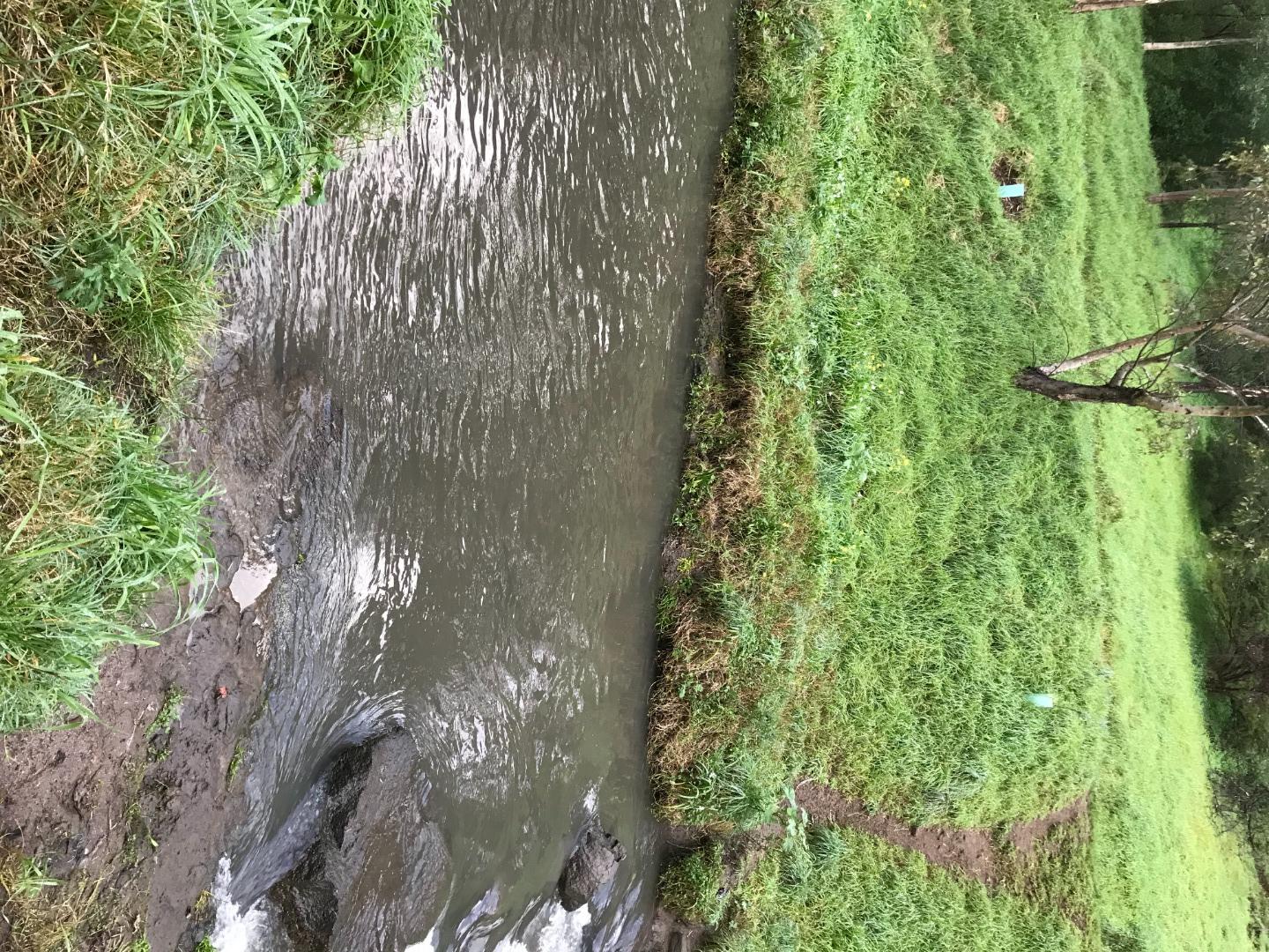
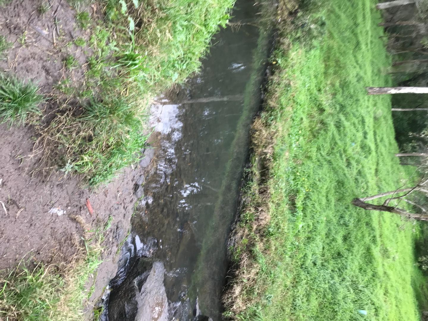
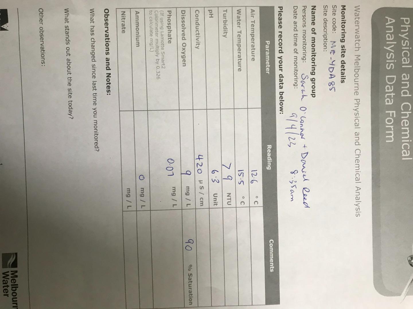
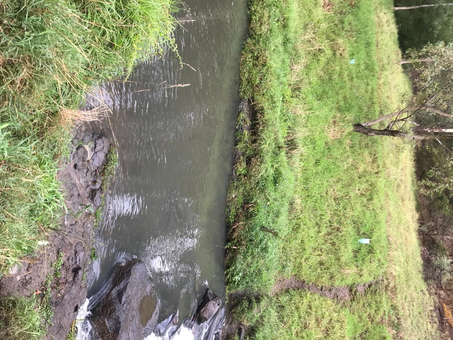
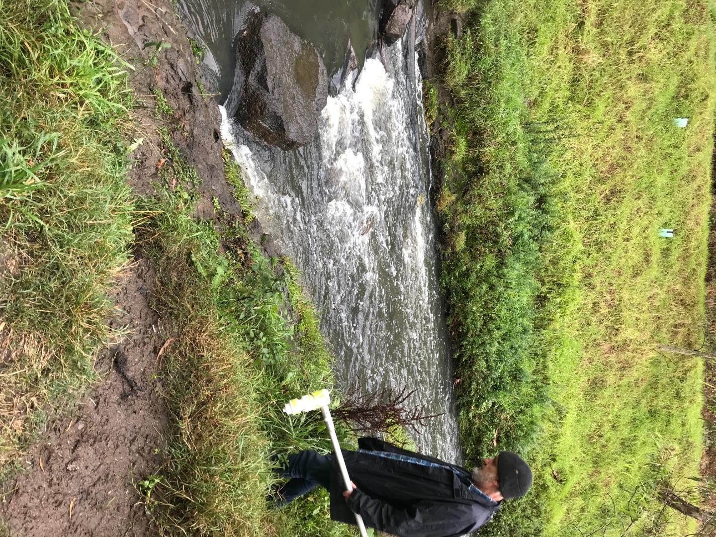
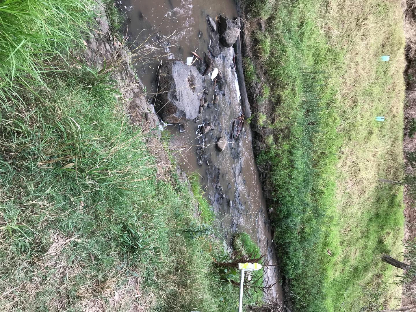
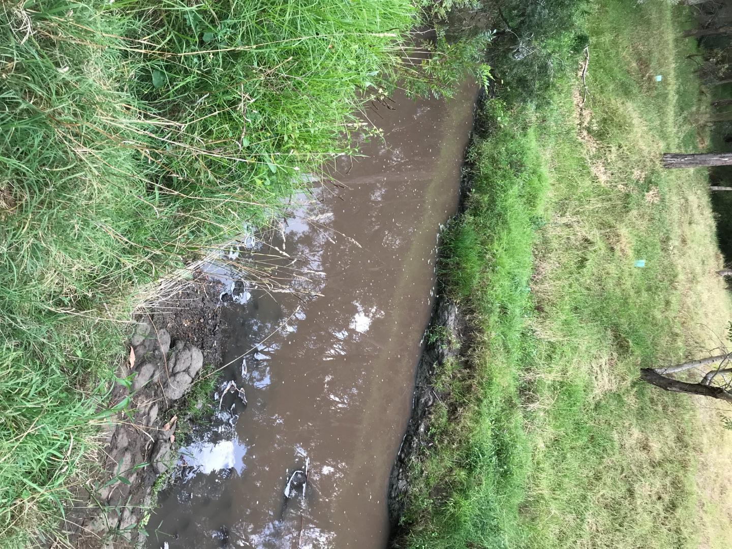
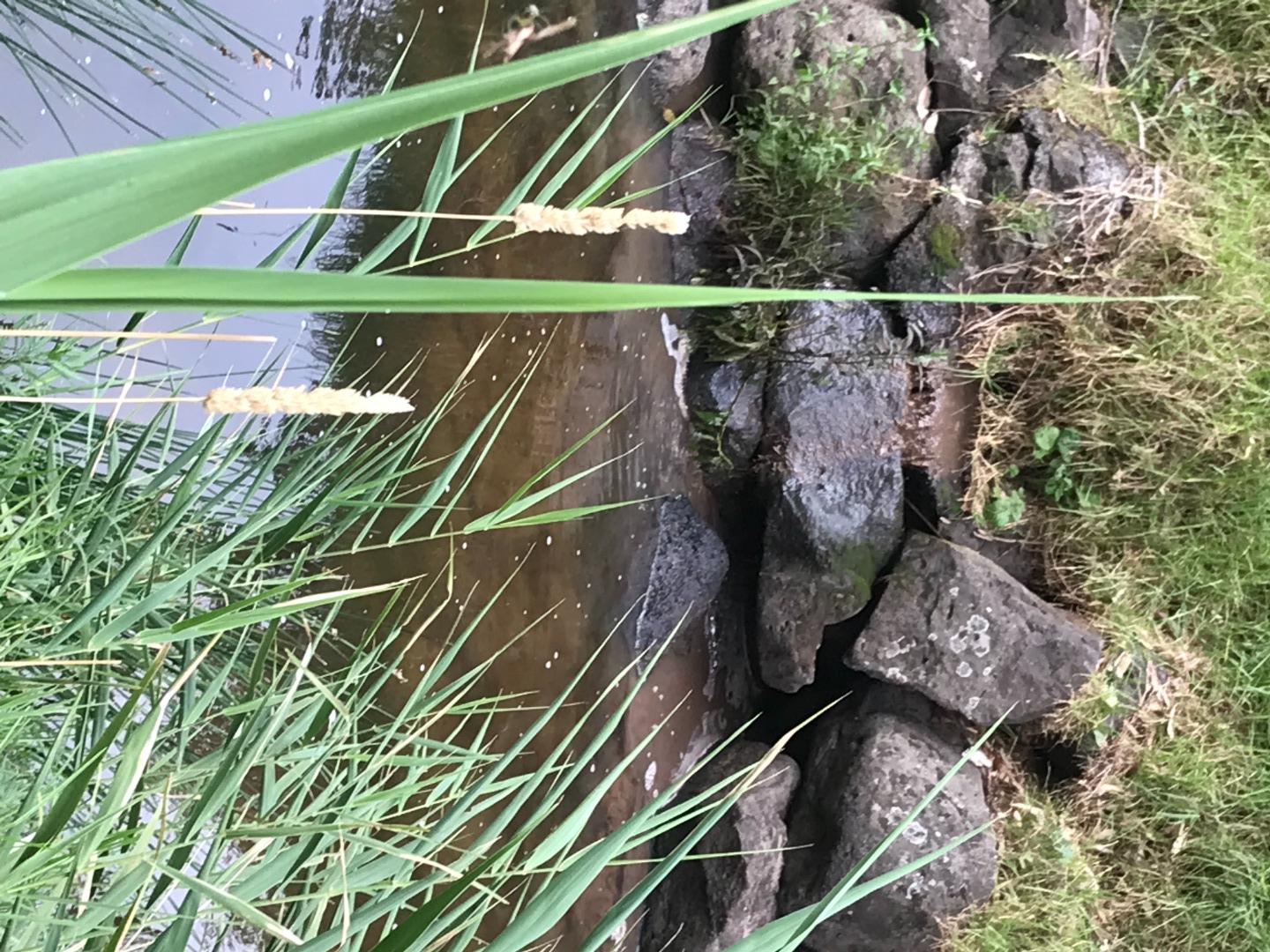
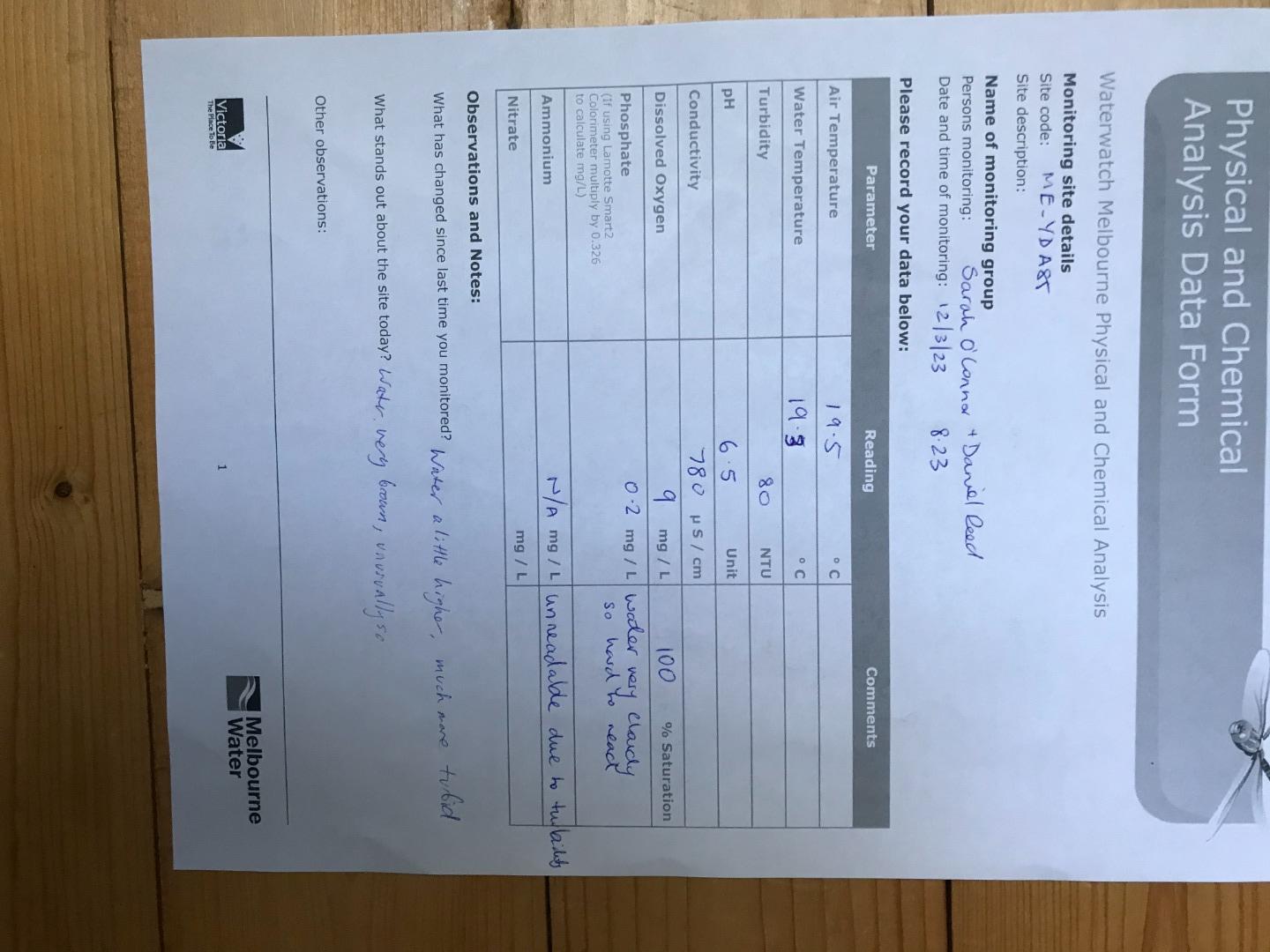
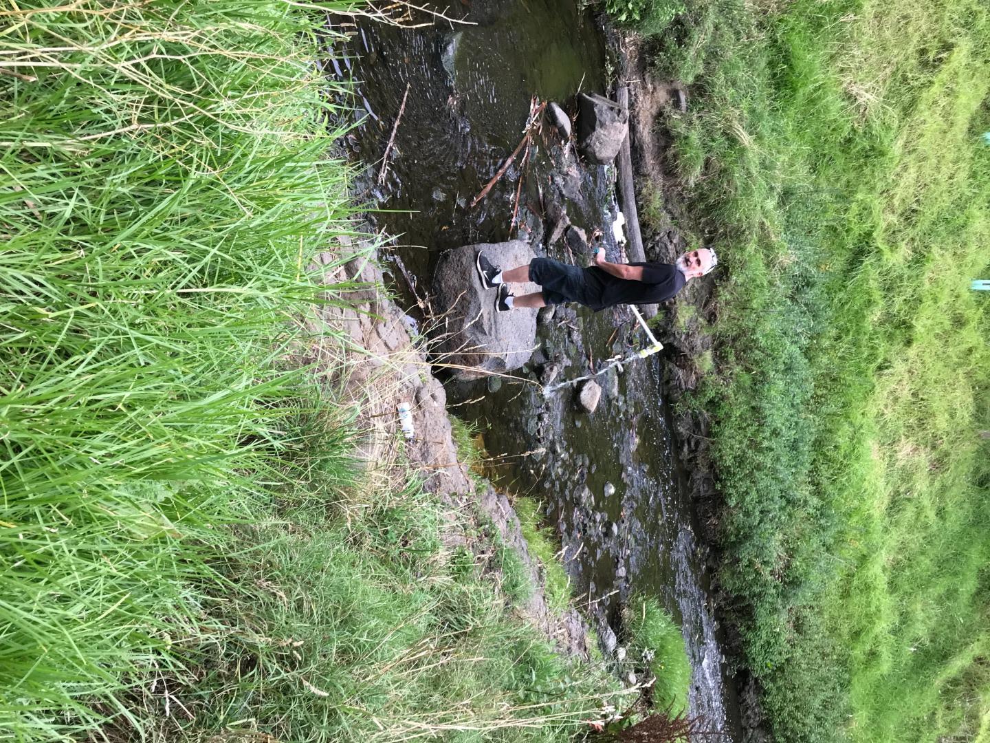
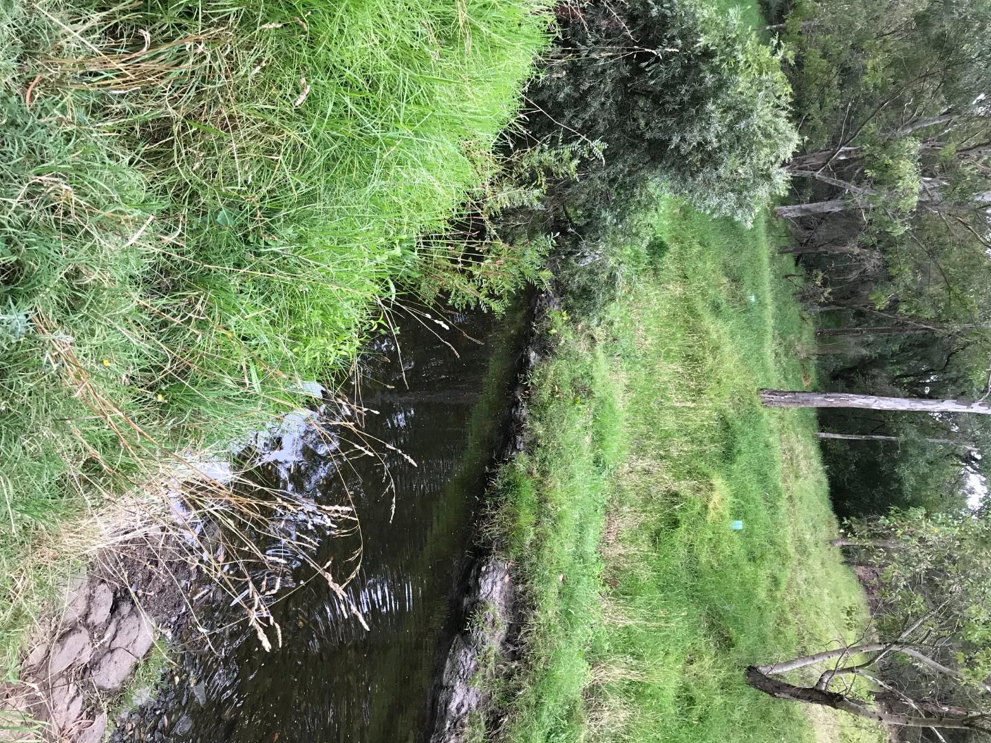
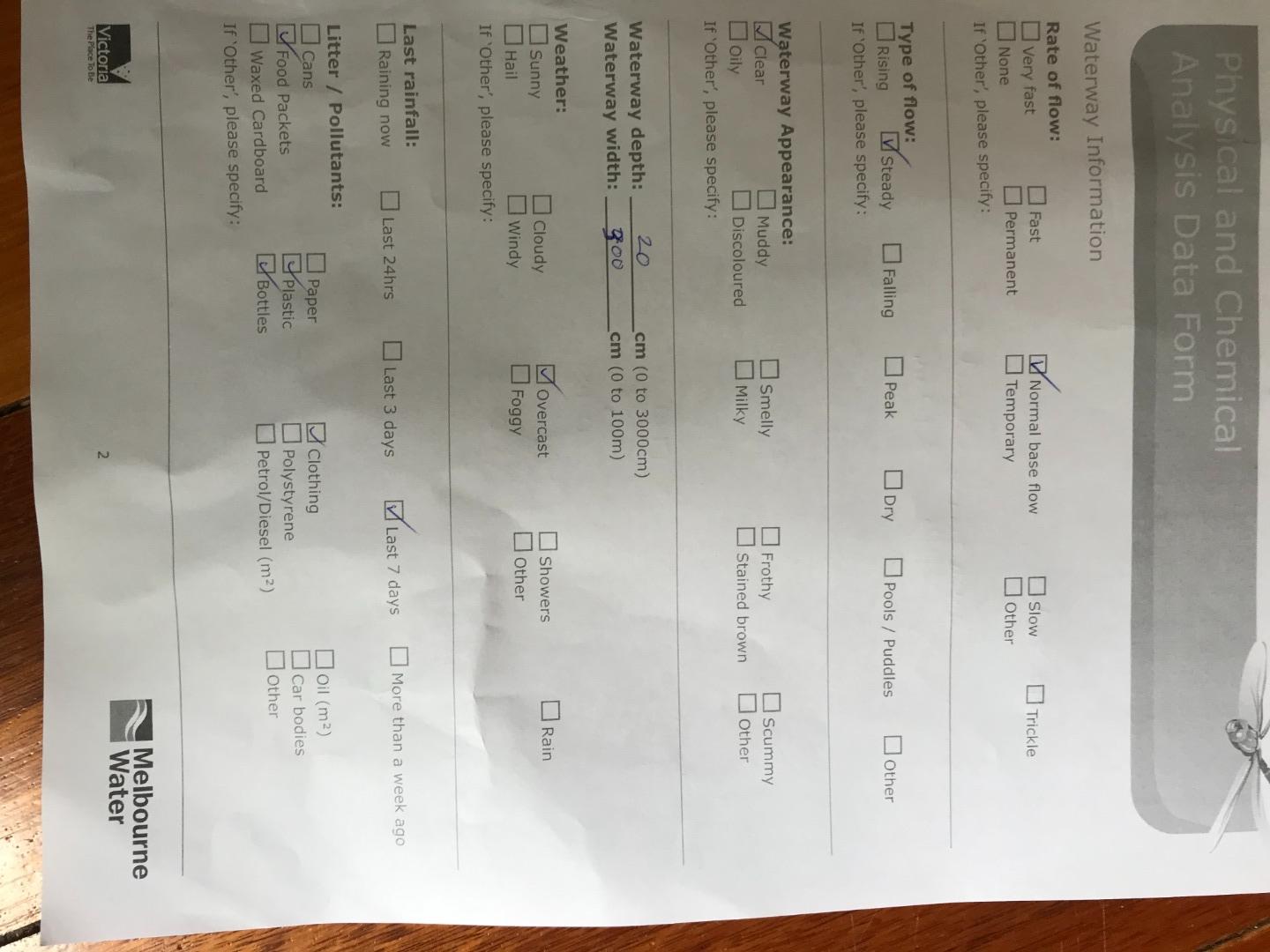
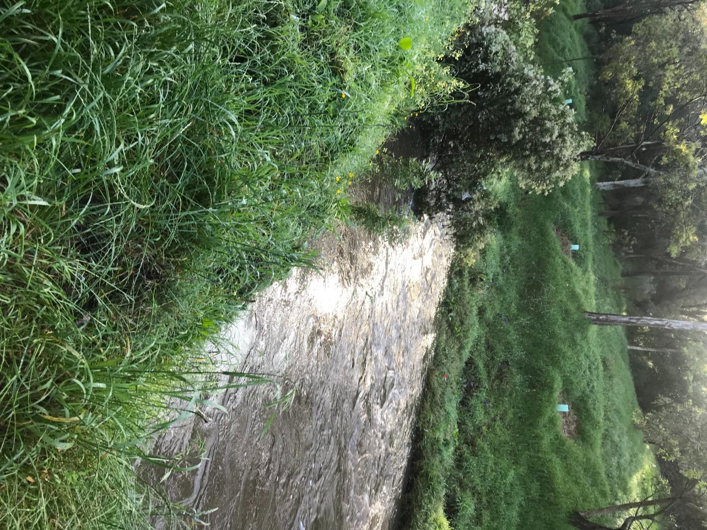
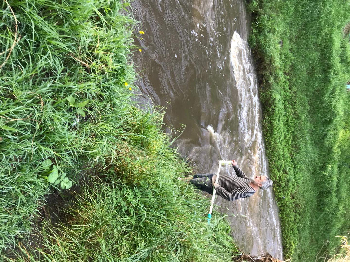
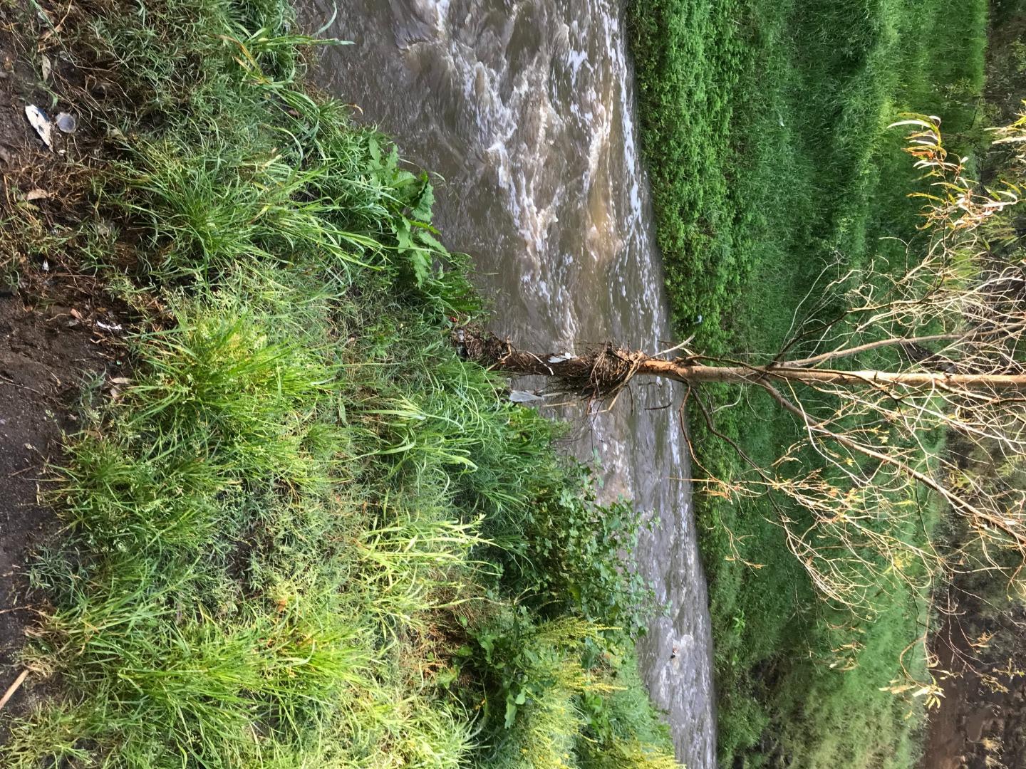
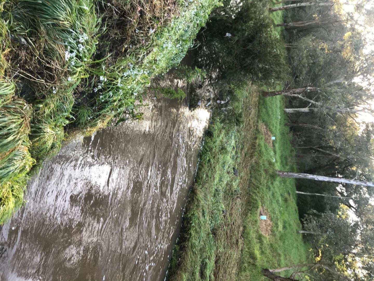
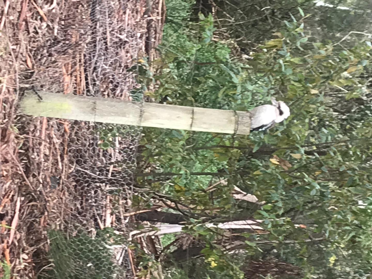
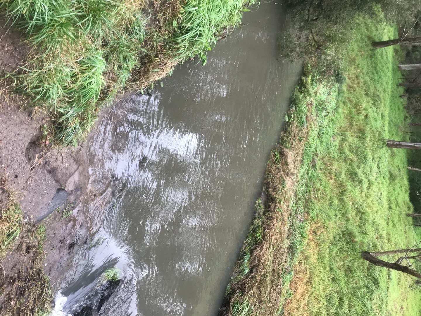
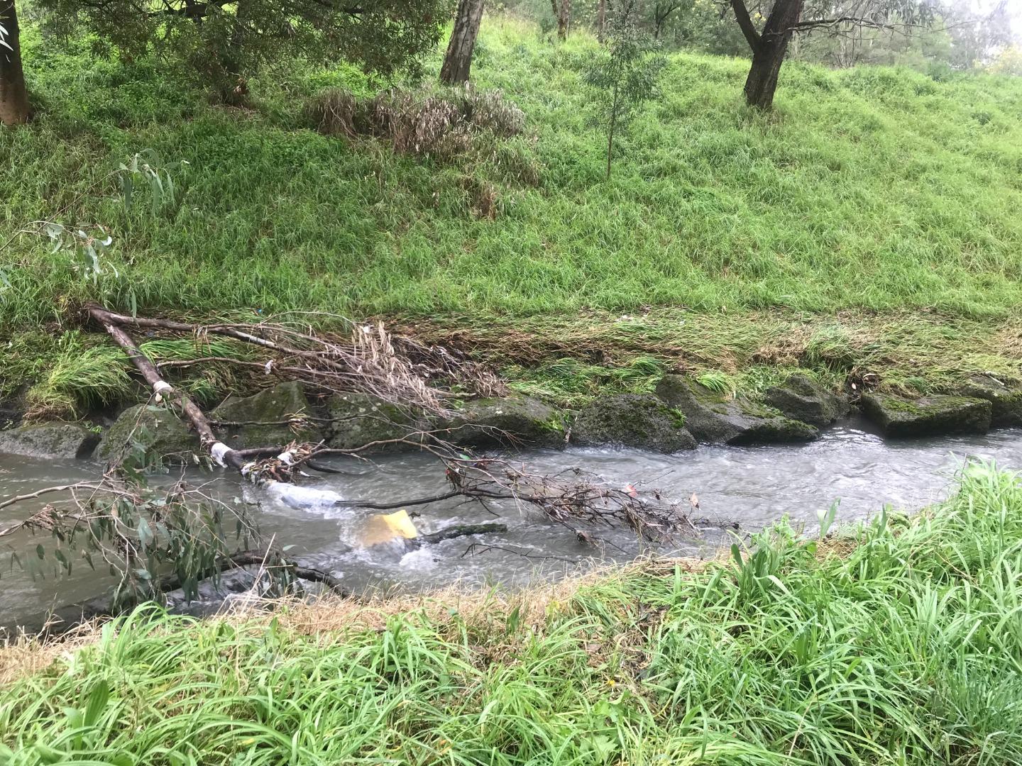
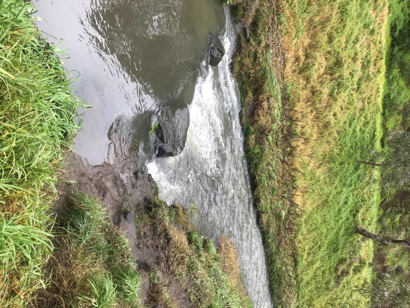
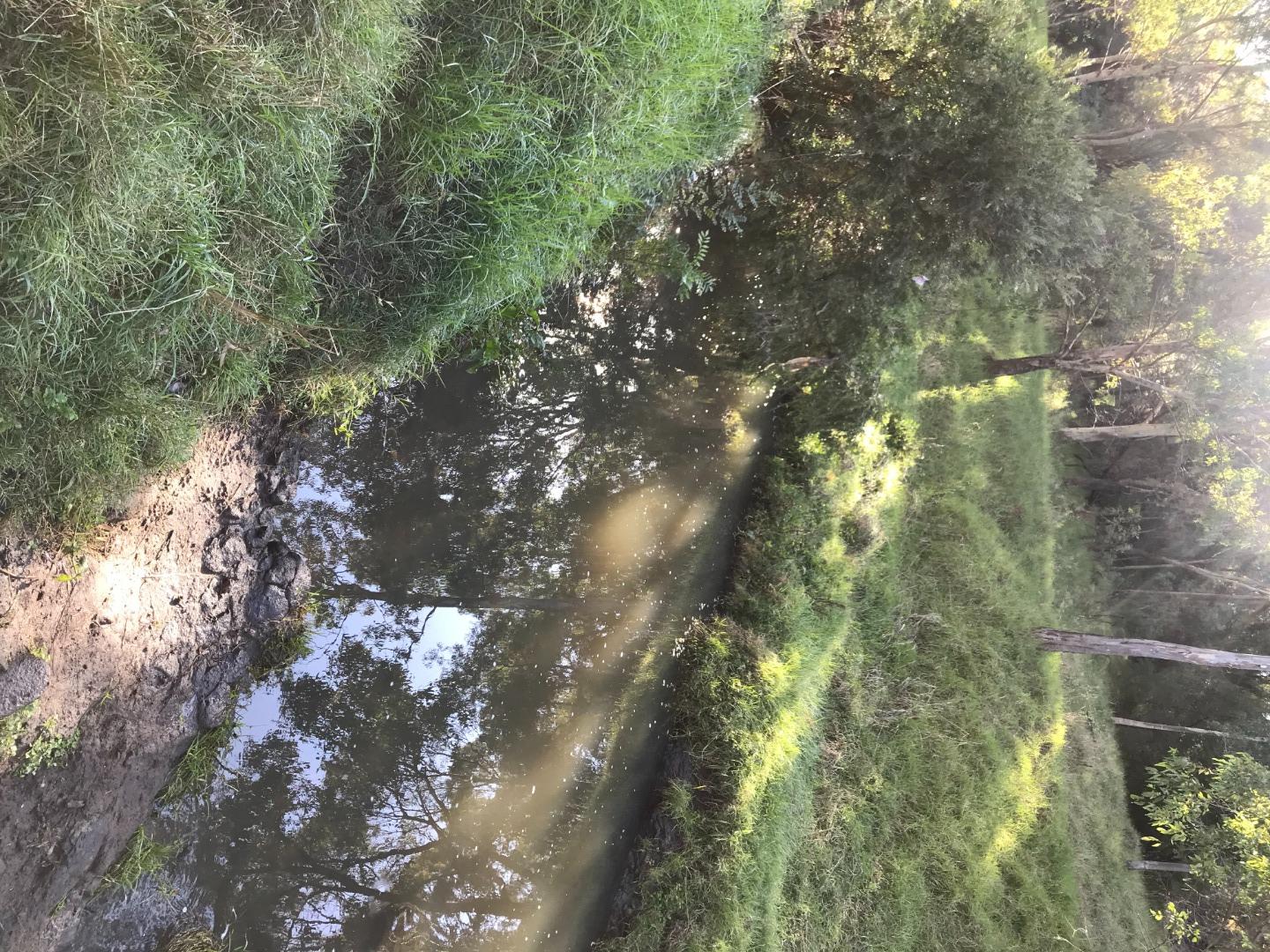
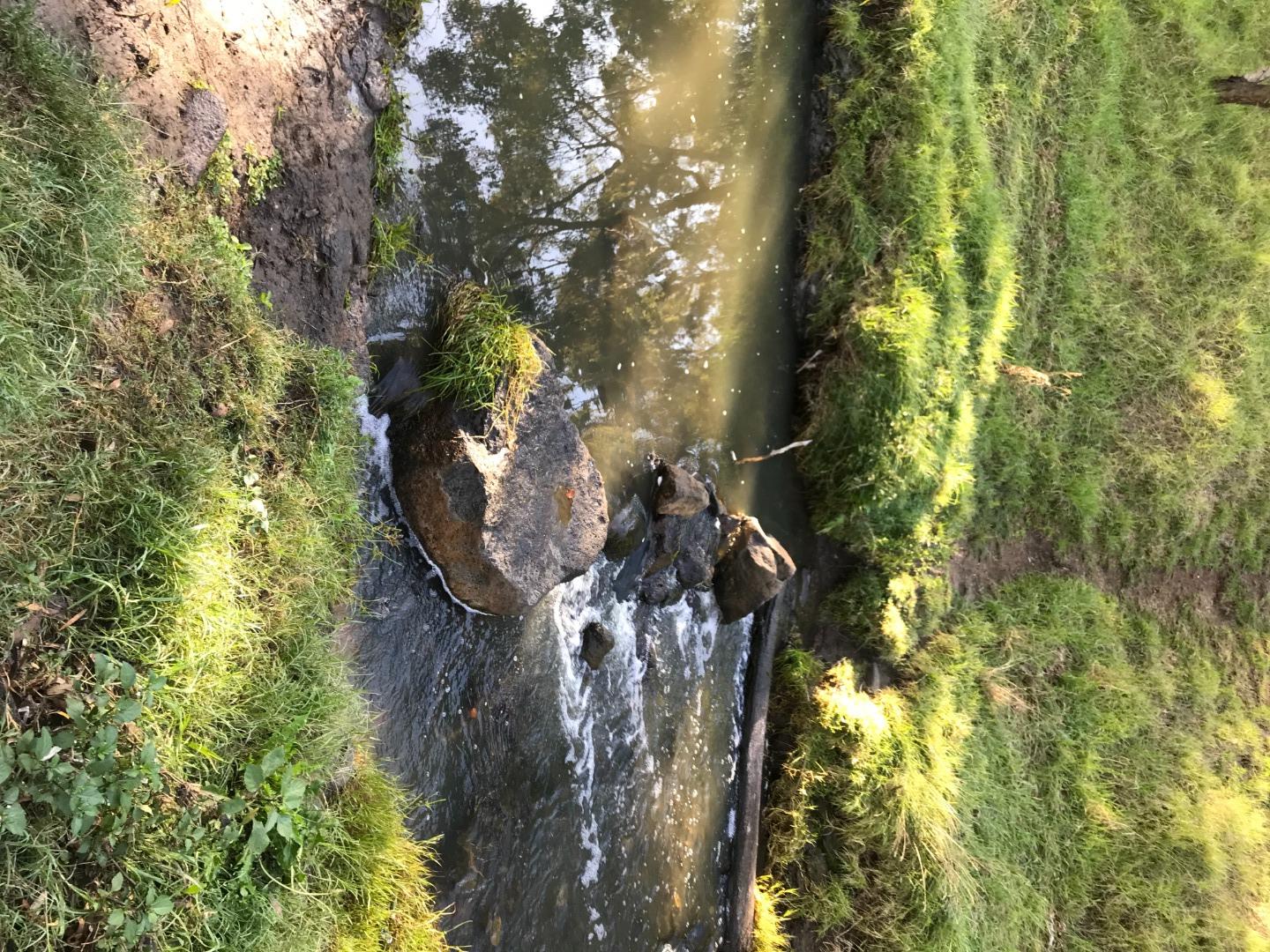
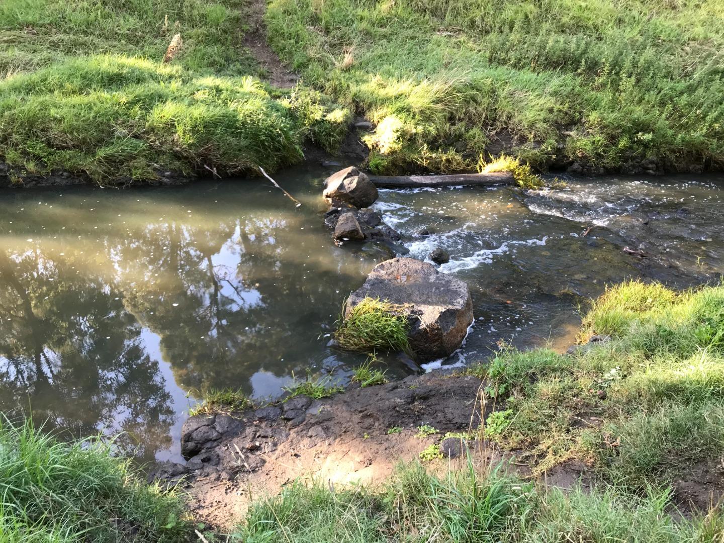
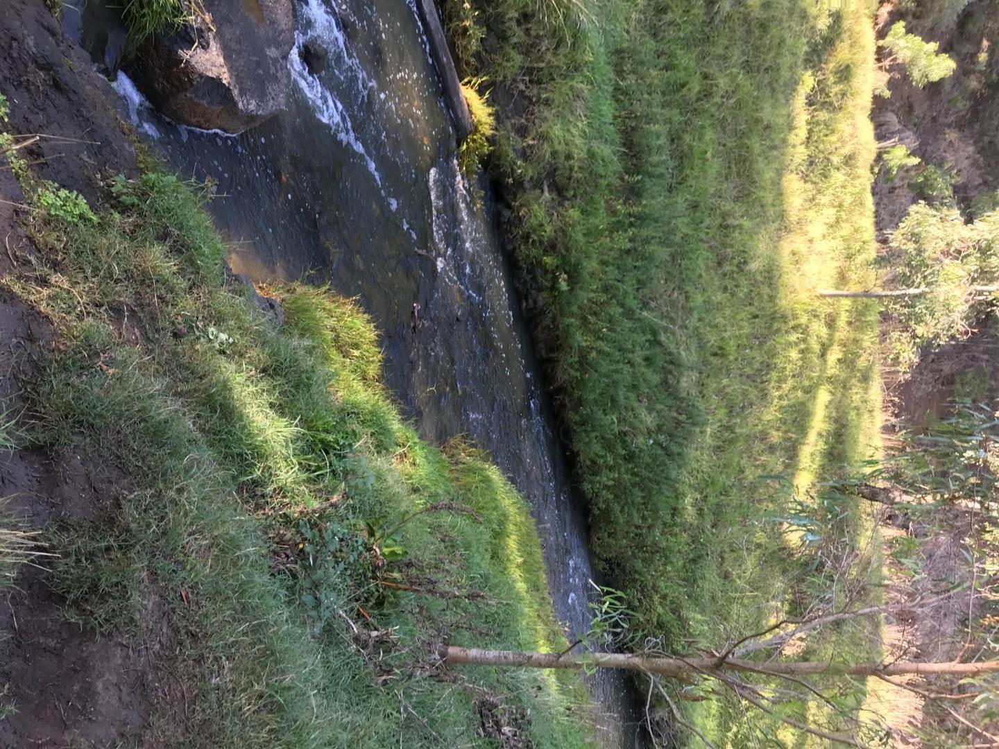
ME_YDA485 Darebin Creek, downstream of Thornbury High School , off Theobald Street, Thornbury
Site details
Overview
| Site code | ME_YDA485 |
|---|---|
| Site name | Darebin Creek, downstream of Thornbury High School , off Theobald Street, Thornbury |
| Status | Active |
| Water Authority | Melbourne |
| Basin | Yarra River |
| Catchment | Yarra River |
| Sub catchment | Darebin Creek (Urban) |
| Reach | 29_9 Darebin Creek |
| Water type | Creek |
| Council | Darebin City Council |
| History | View all 24 site visits 07-08-2018 - 14-04-2024 |
| Monitoring organisations |
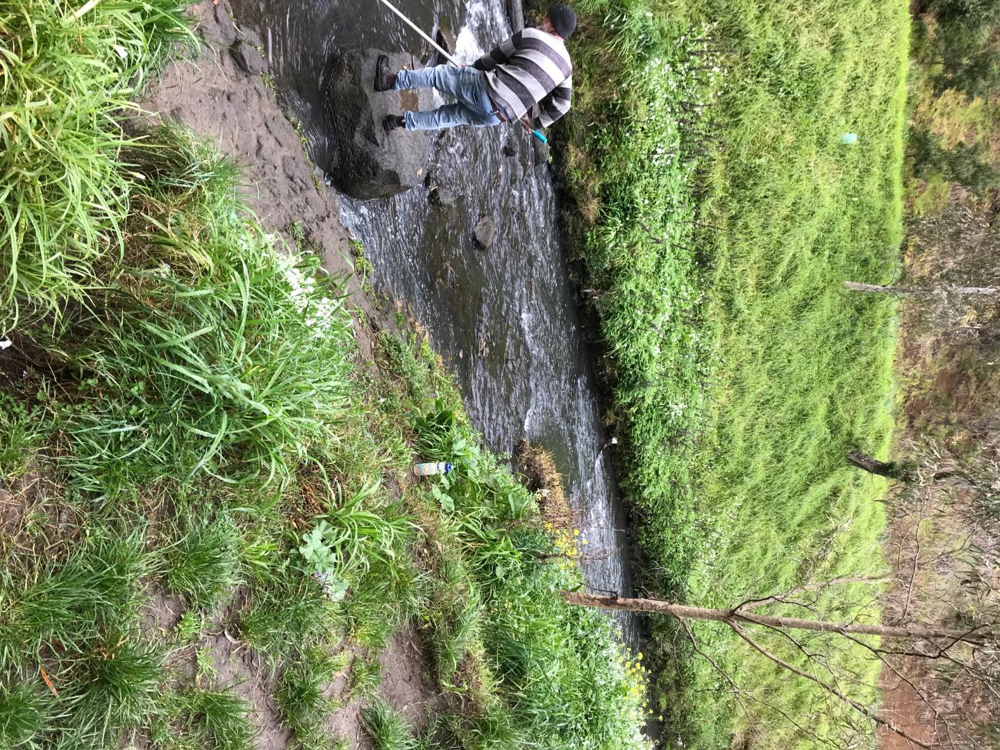
Site visits
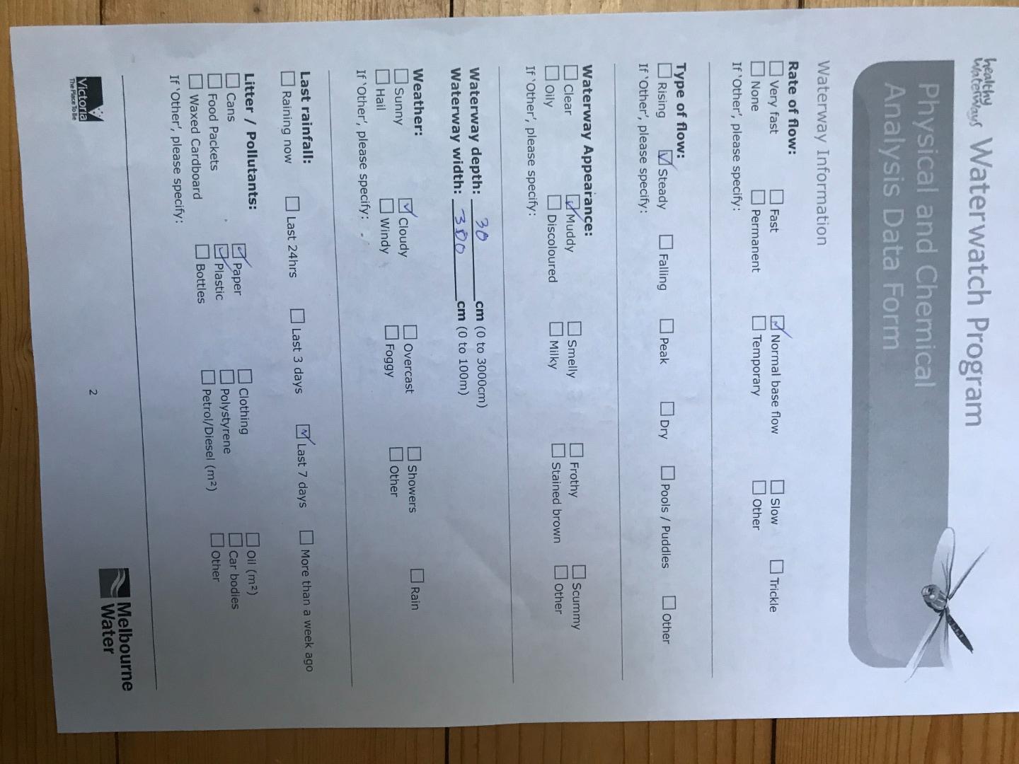
 Loading chart
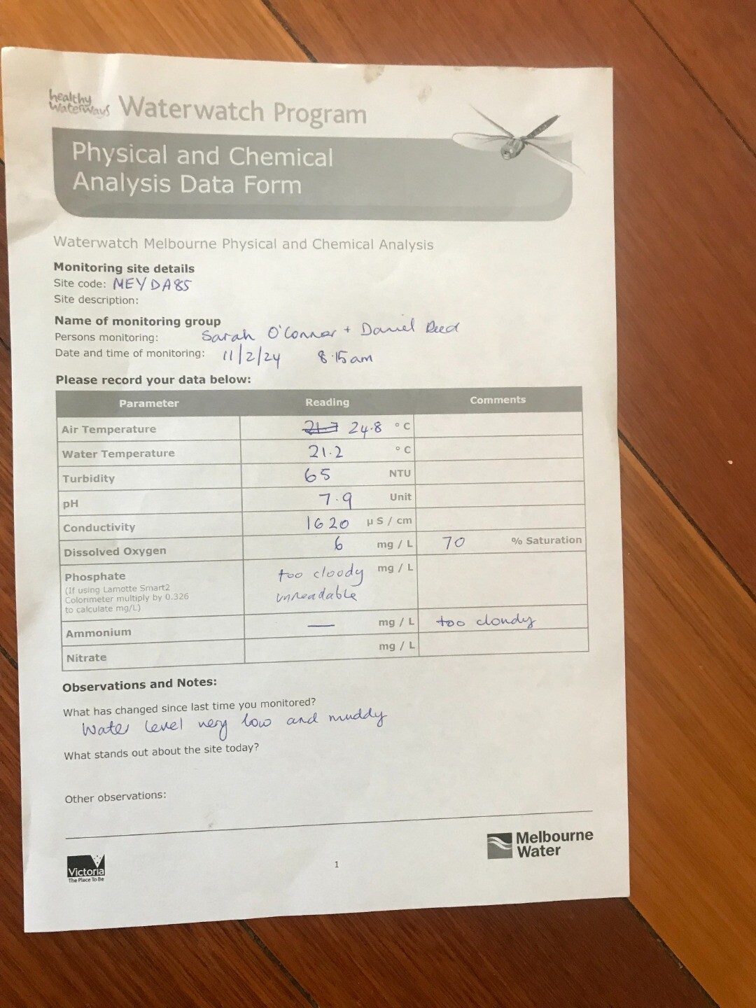
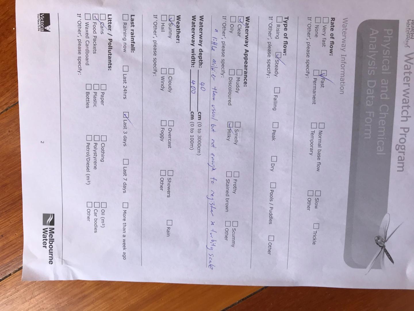
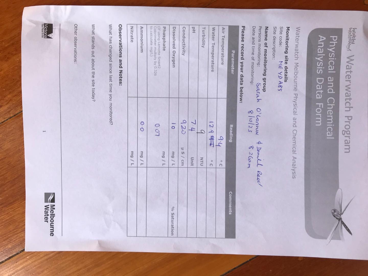
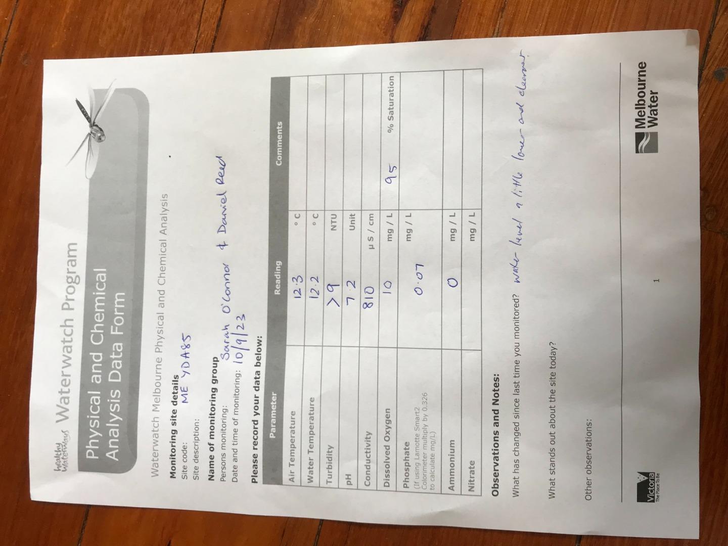
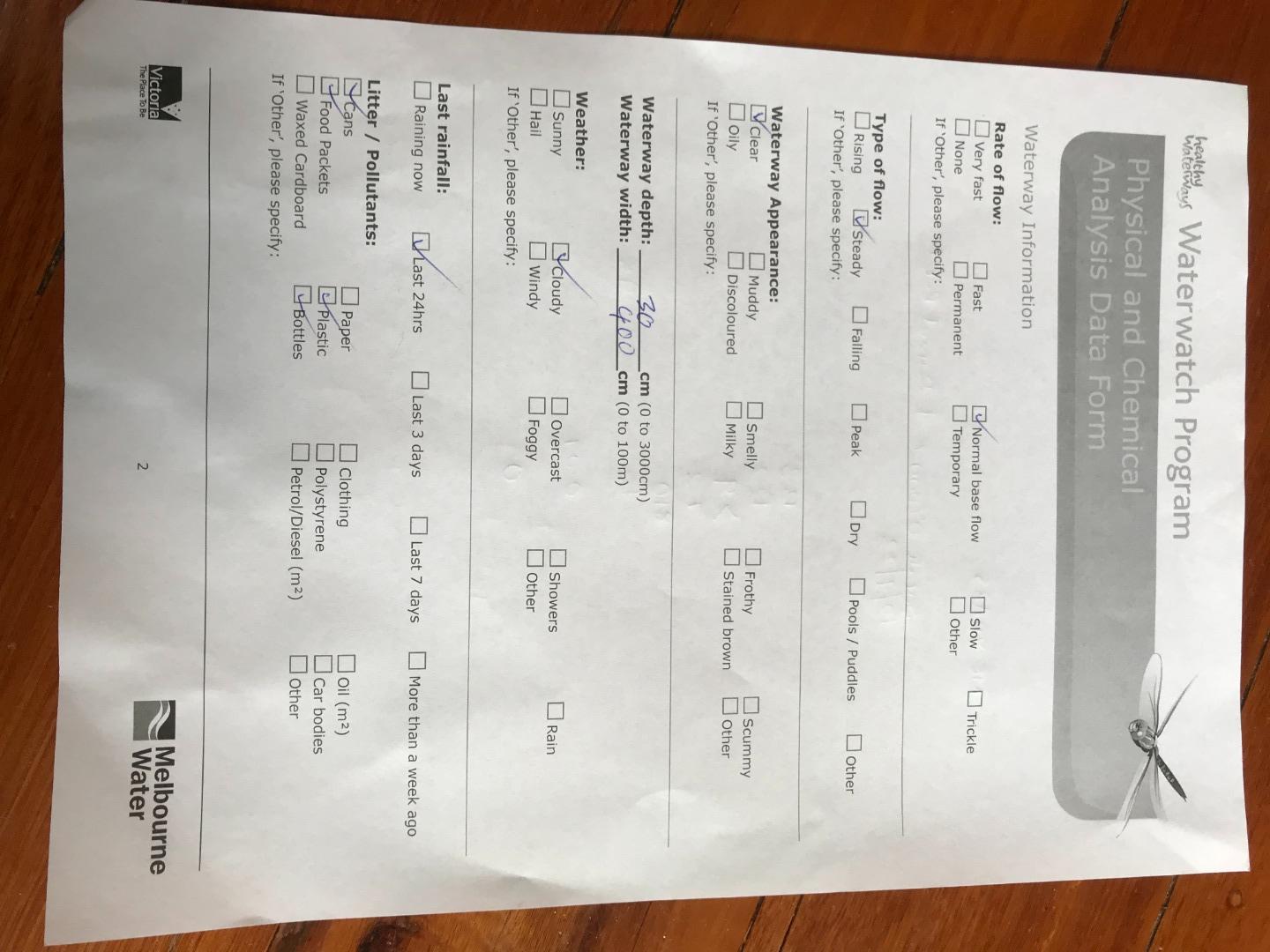
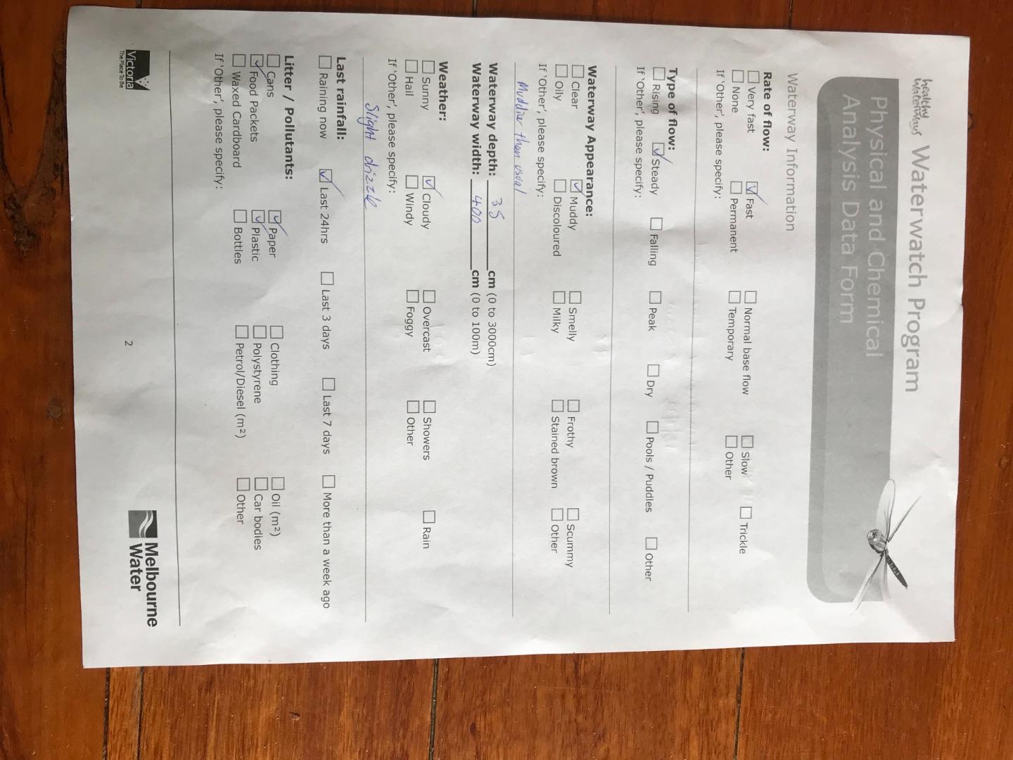
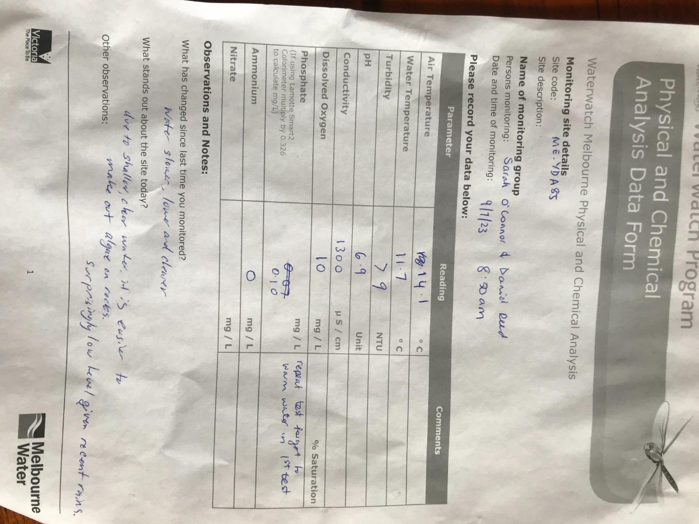
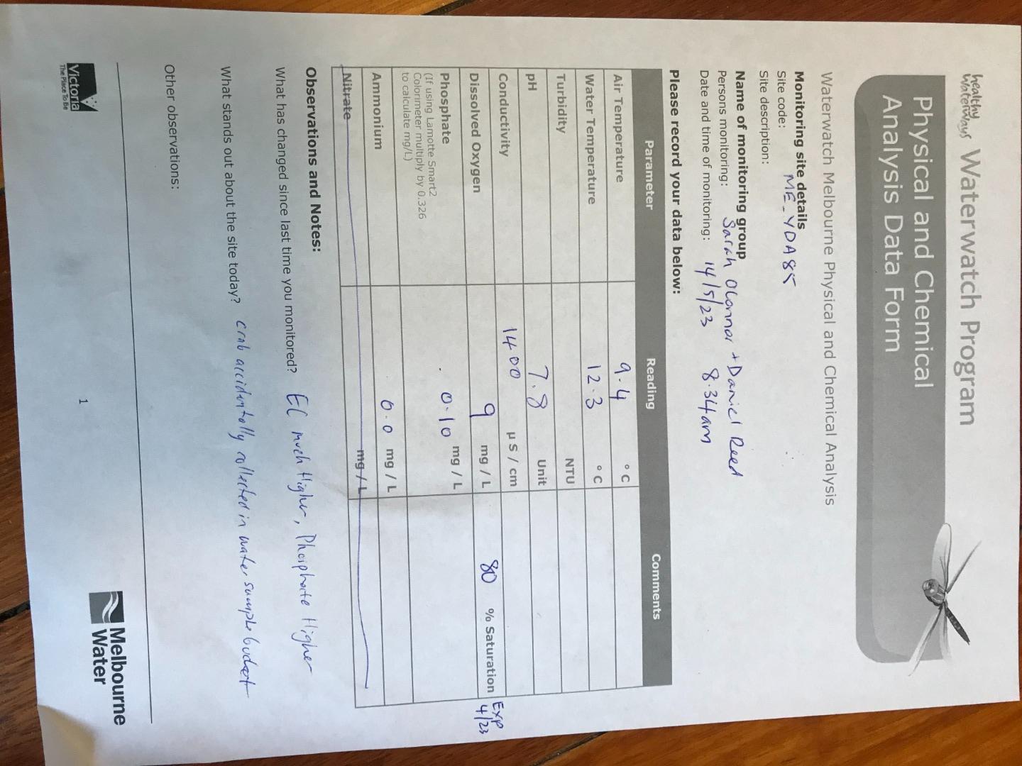
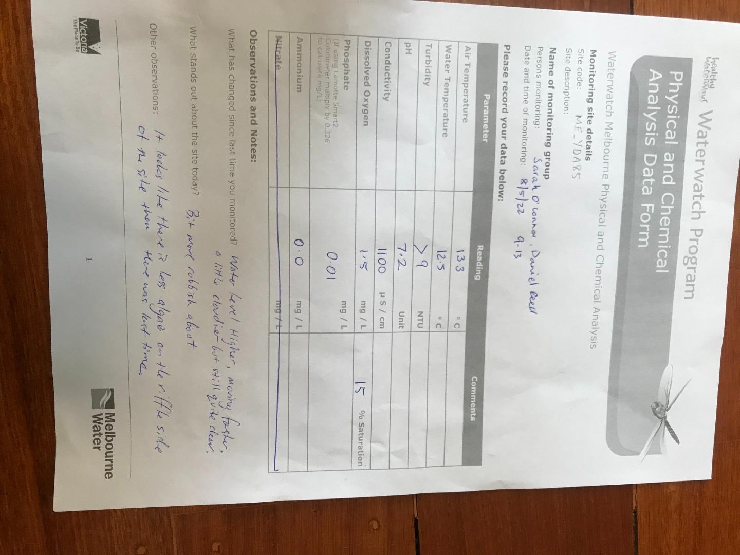
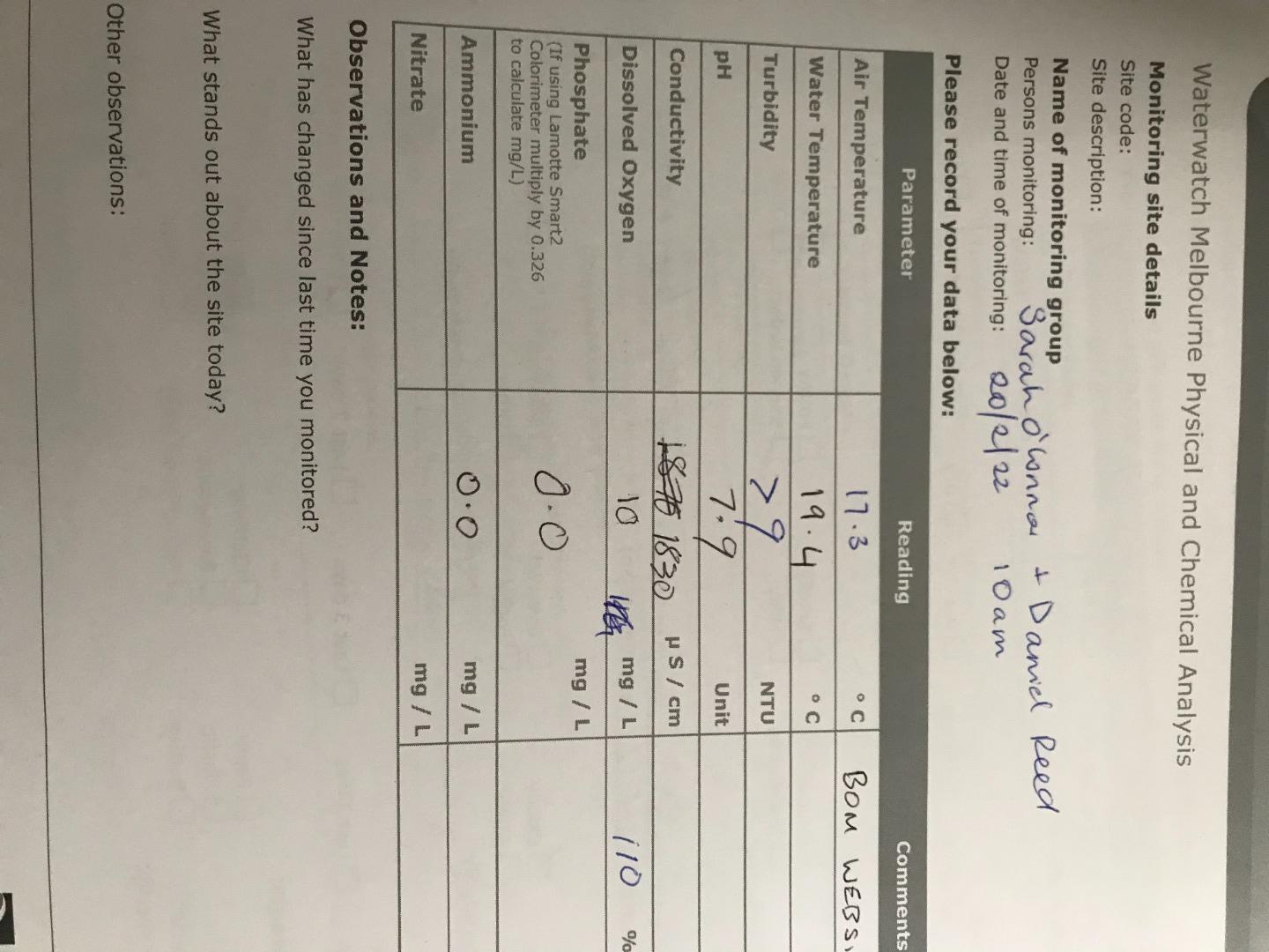
| Date | N mg/L NH4+ | D.O. % | D.O mg/L | EC µS/cm | pH pH Units | rP mg/L P | Air ° C | Water ° C | Turb NTU |
|---|---|---|---|---|---|---|---|---|---|
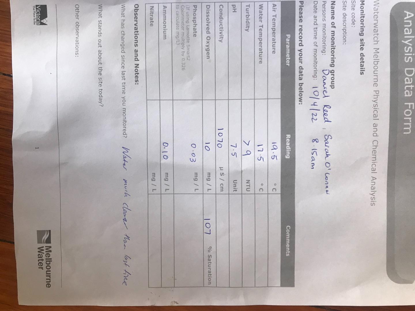
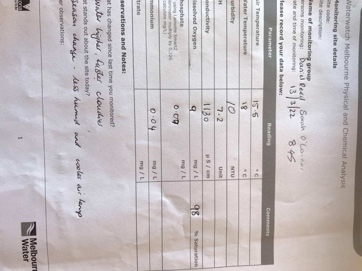
| 08-05-2022 | 0 | 14.13 | 1.5 | 1100 | 7.2 | 0.01 | 13.3 | 12.5 | 9 |
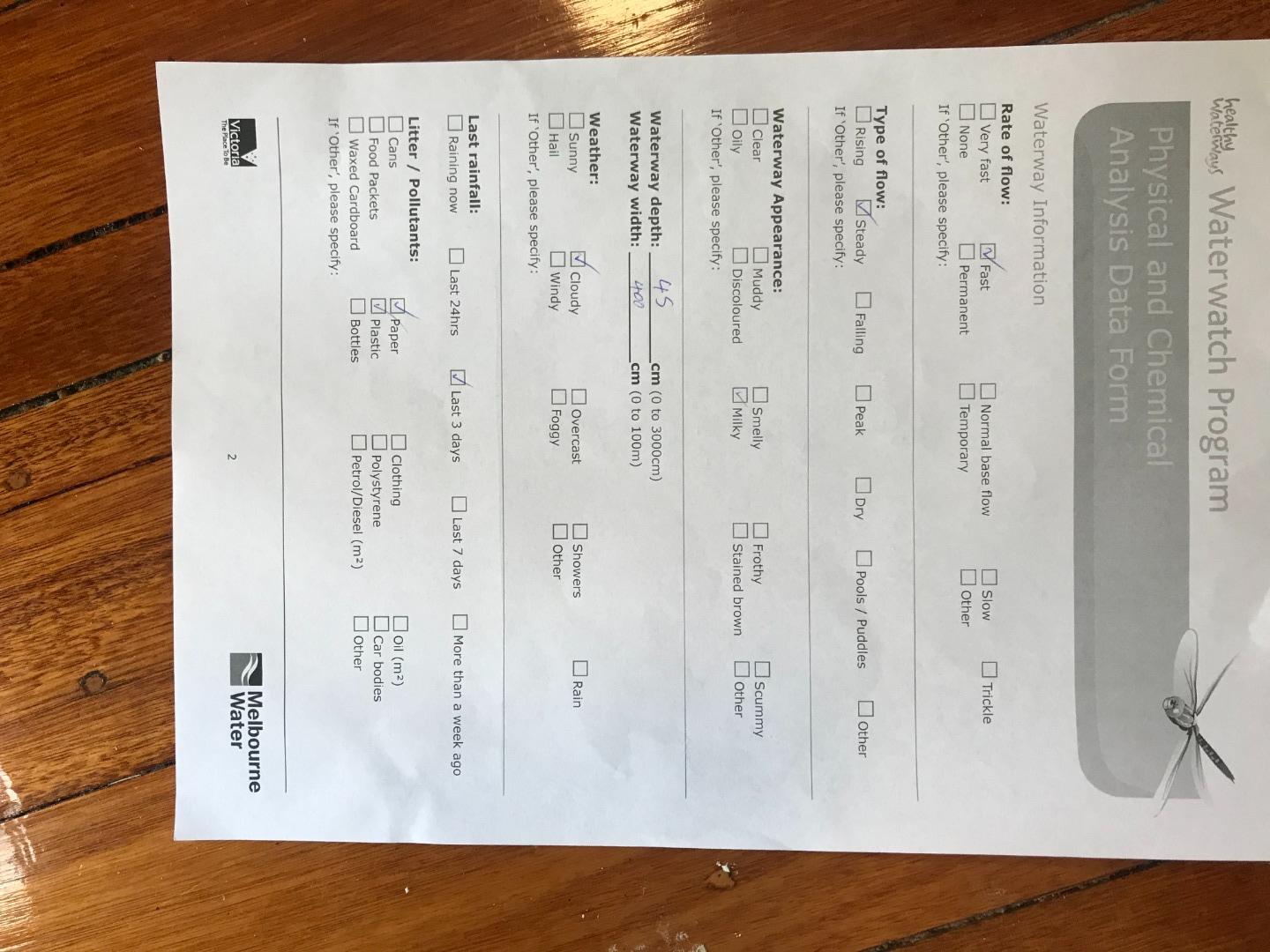
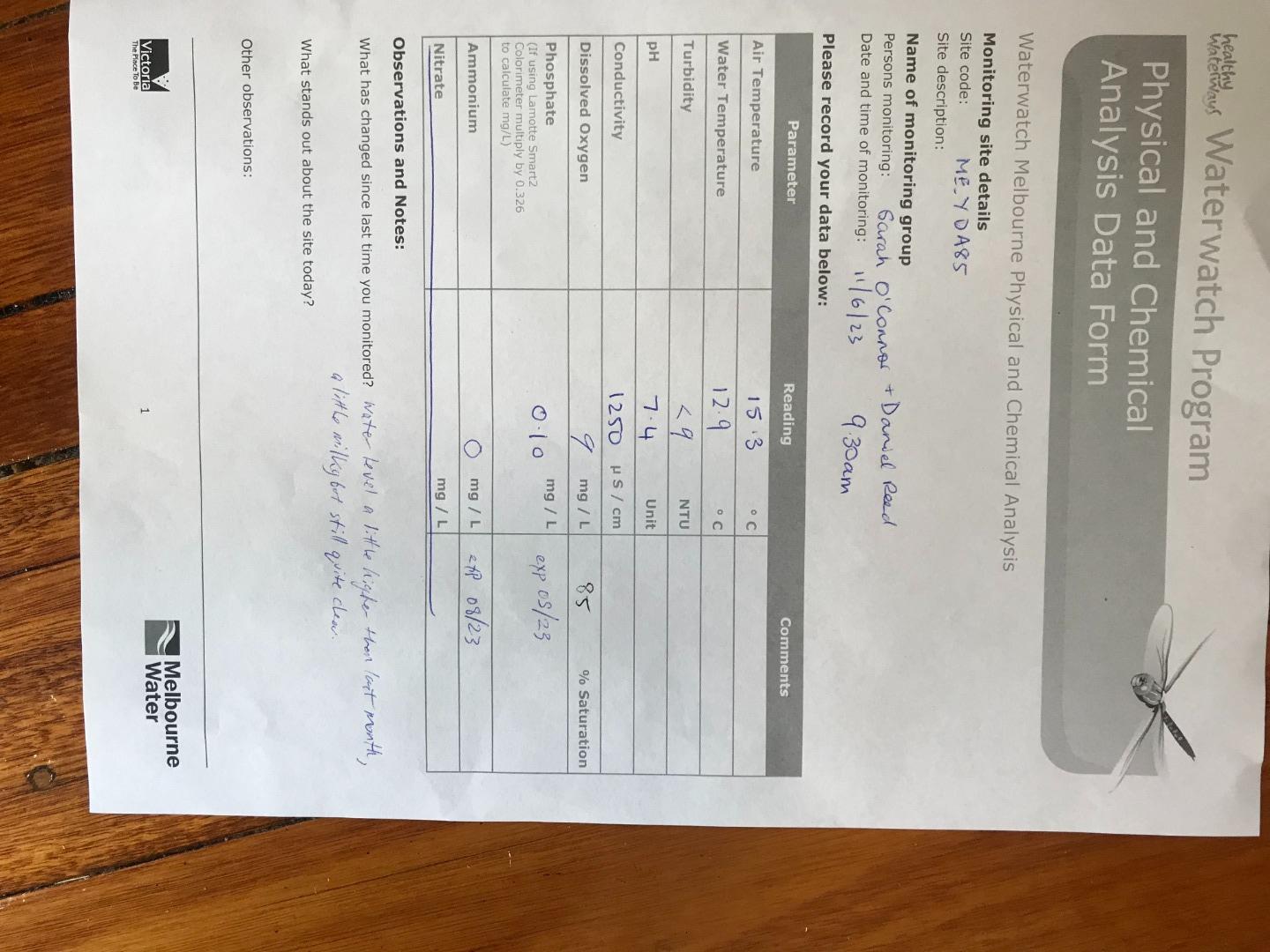
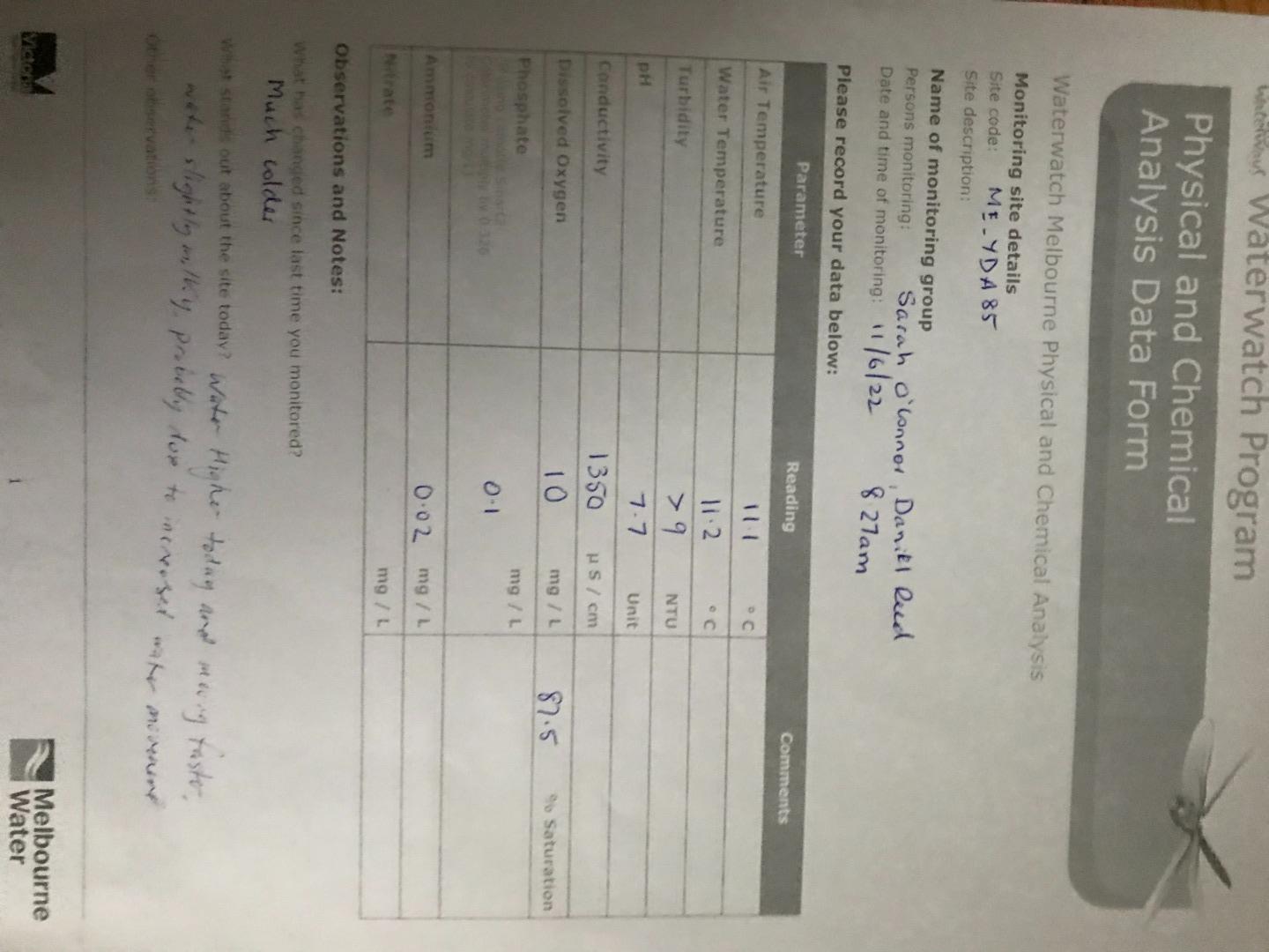
| 11-06-2022 | 0.02 | 91.5 | 10 | 1350 | 7.7 | 0 | 11.1 | 11.2 | 9 |
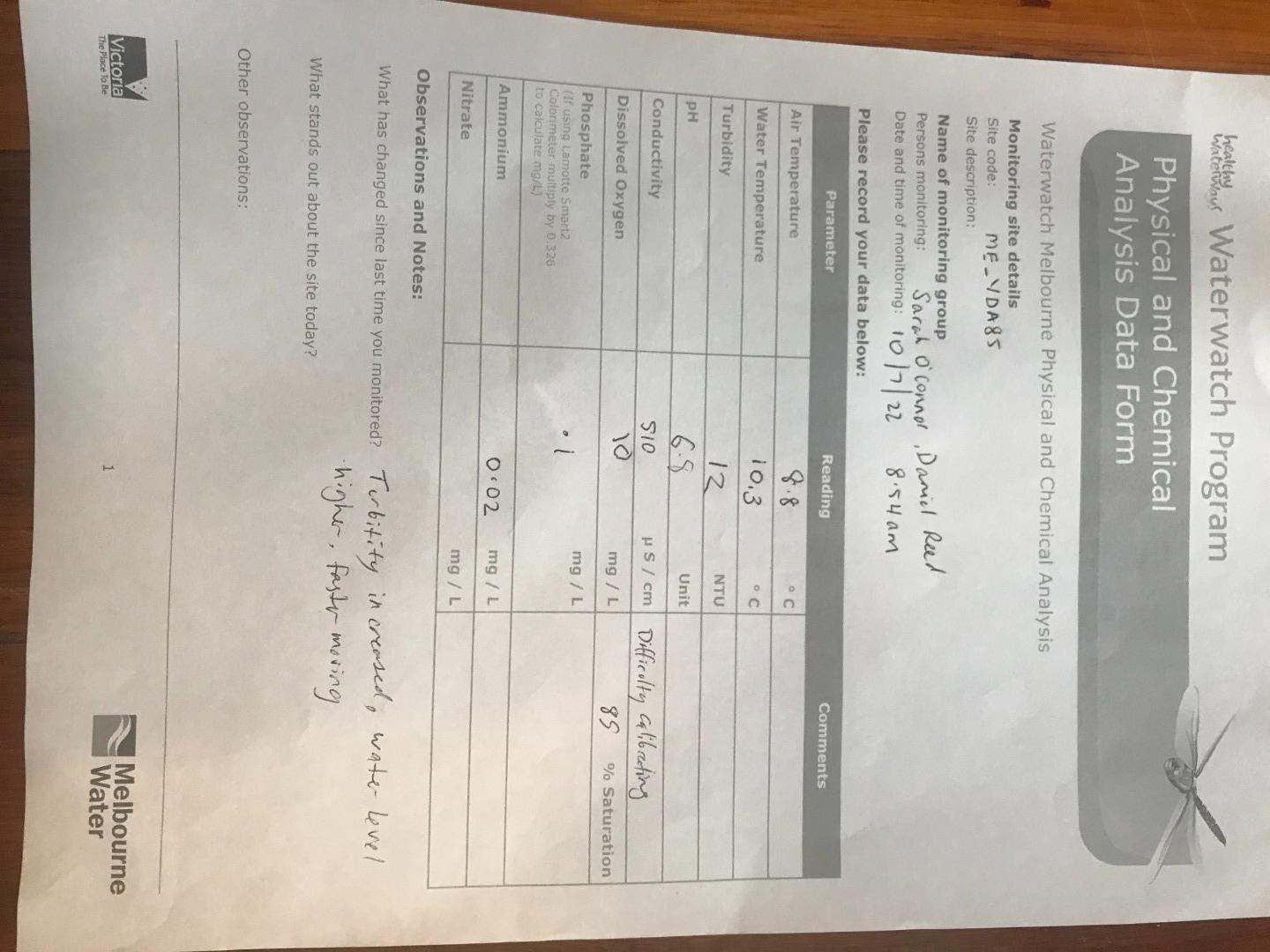
| 10-07-2022 | 0.02 | 89.36 | 10 | 510 | 6.8 | 0.1 | 8.8 | 10.3 | 12 |
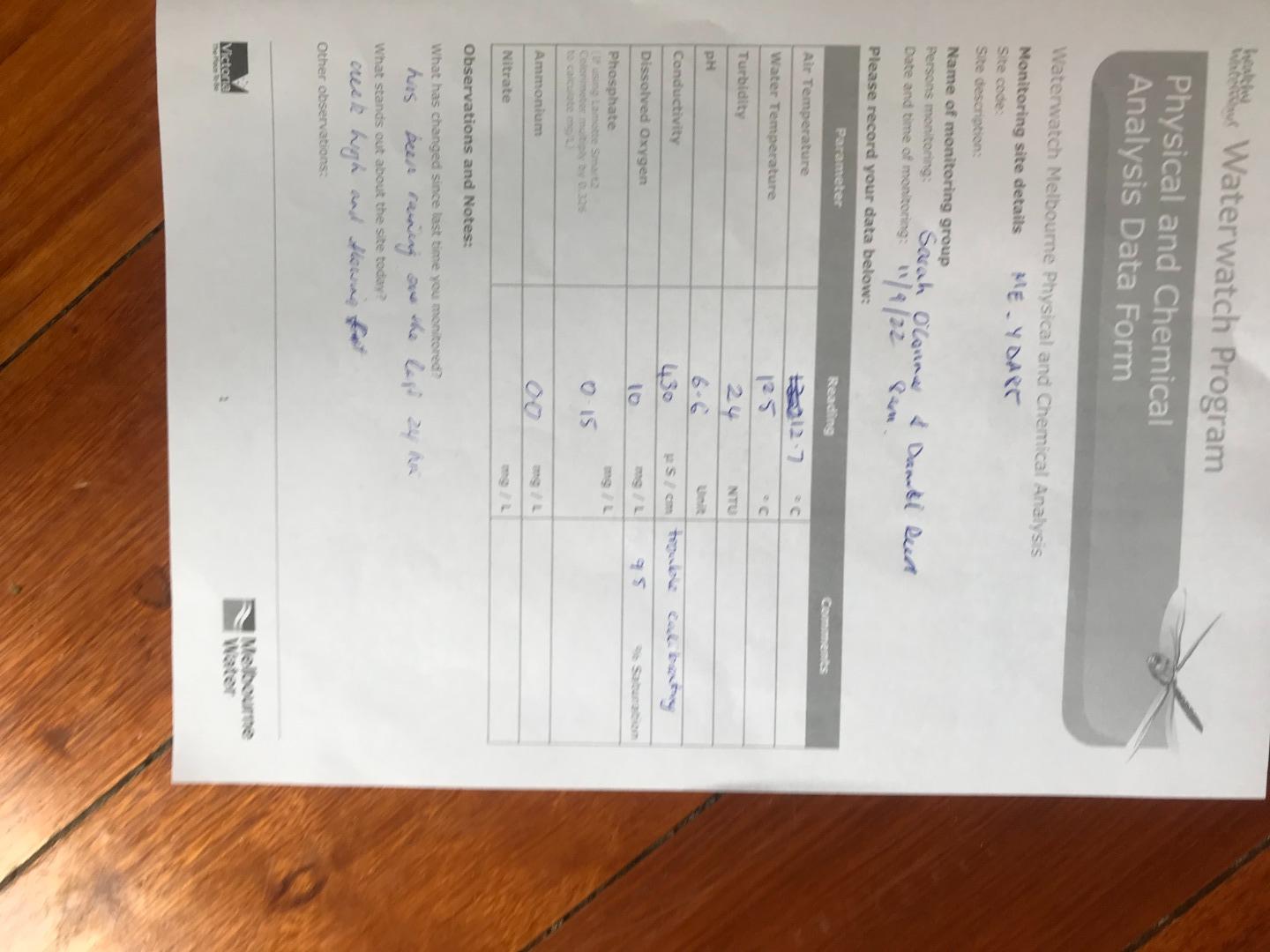
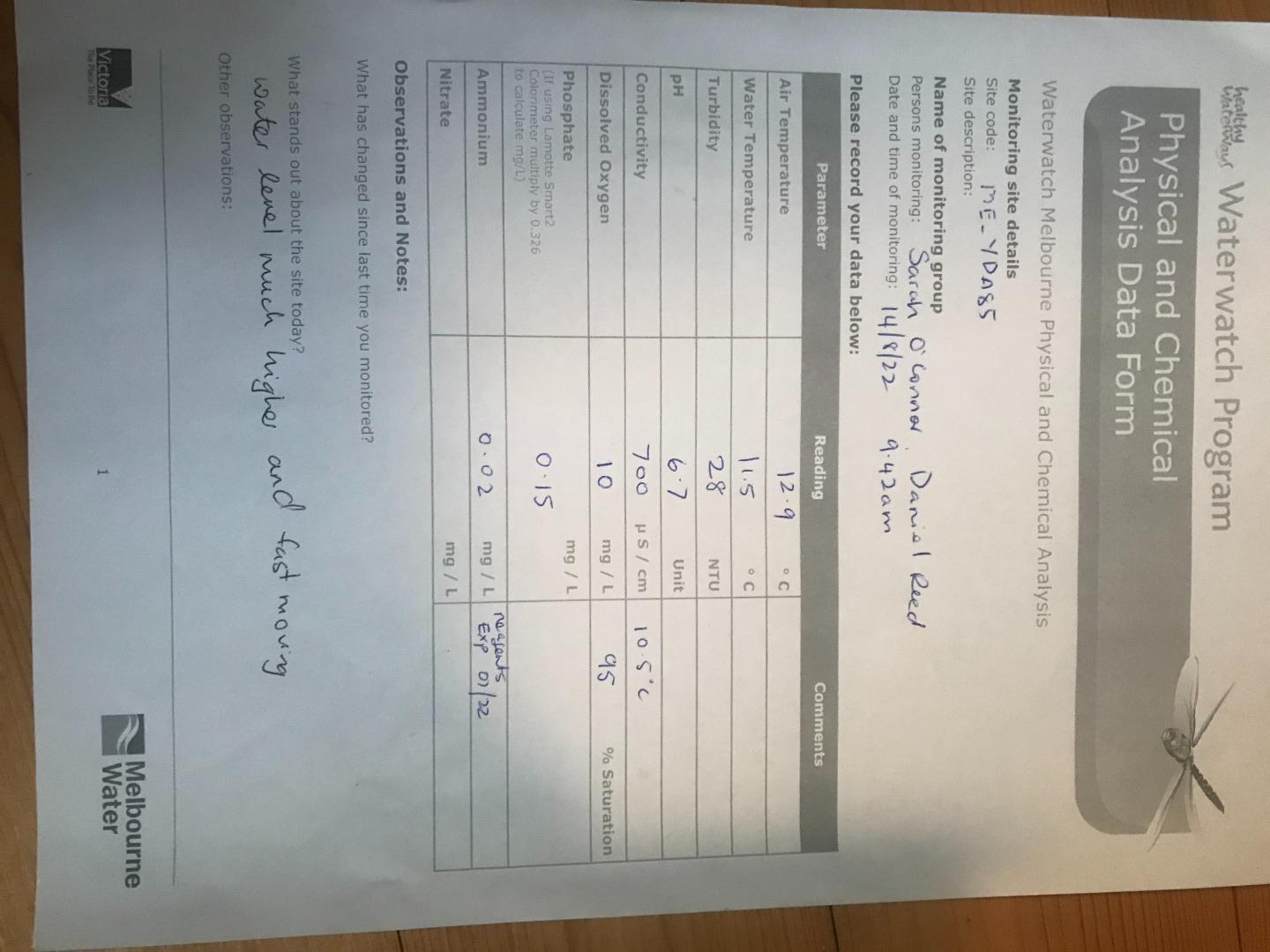
| 14-08-2022 | 0.02 | 91.94 | 10 | 700 | 6.7 | 0.15 | 12.9 | 11.5 | 28 |
| 11-09-2022 | 0 | 93.97 | 10 | 430 | 6.6 | 0.15 | 12.7 | 12.5 | 24 |
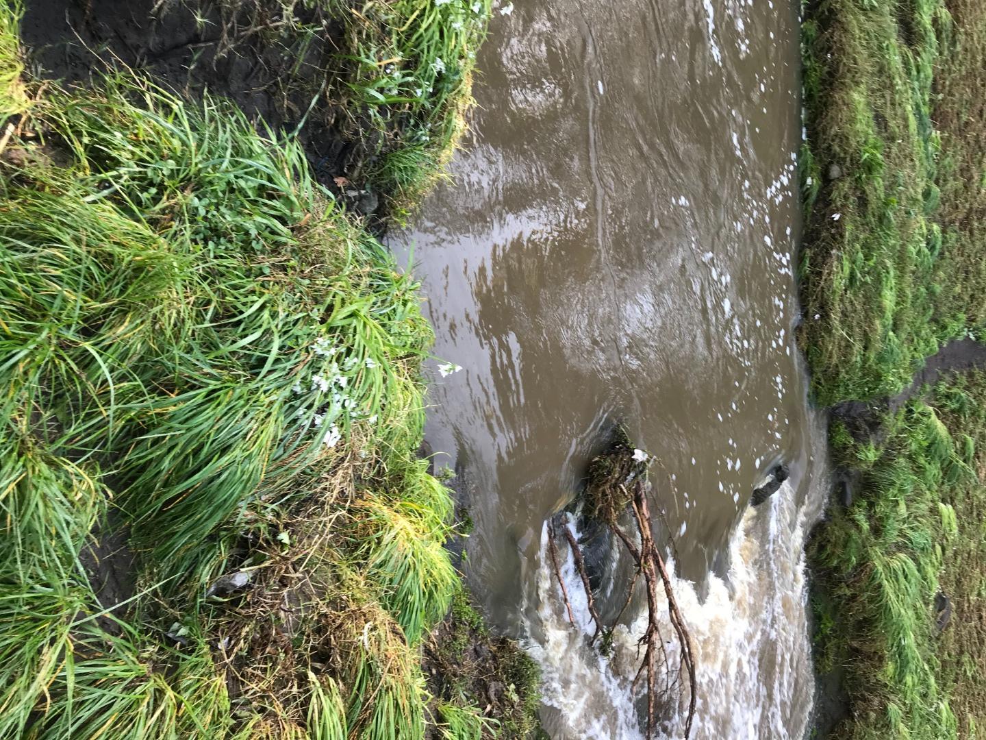
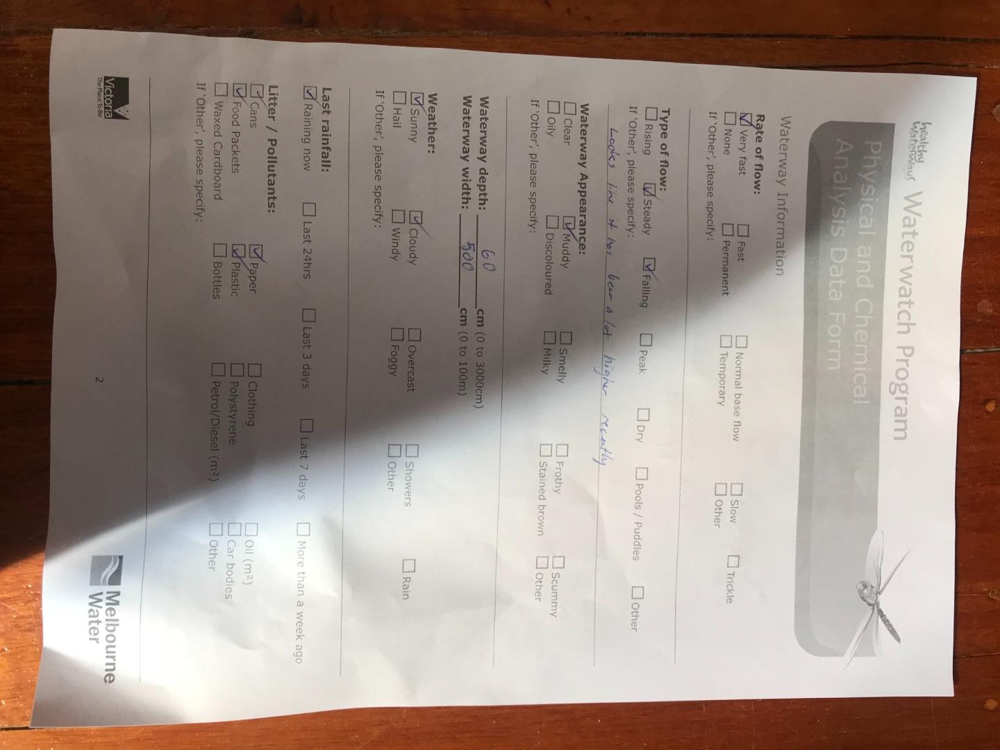
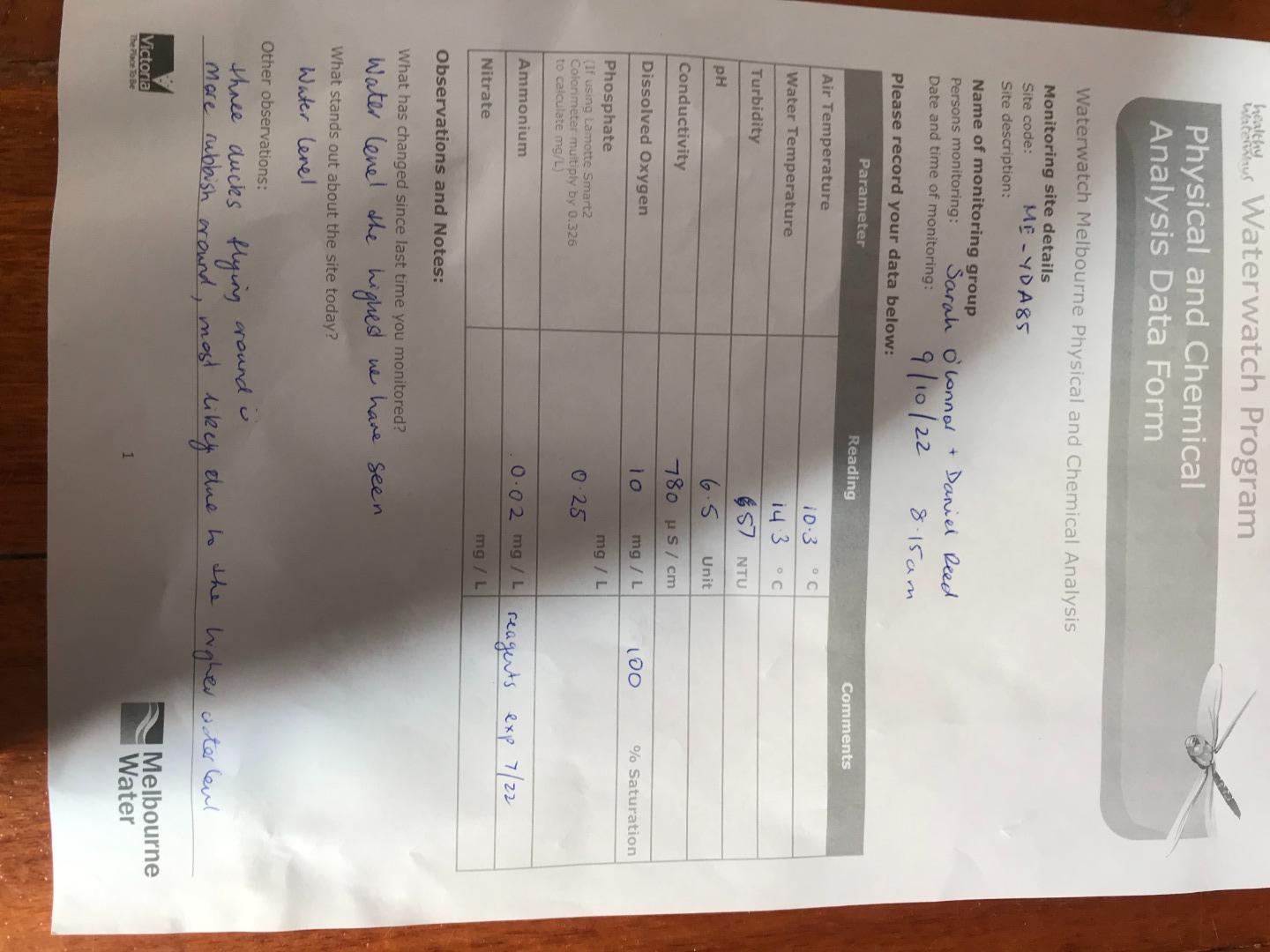
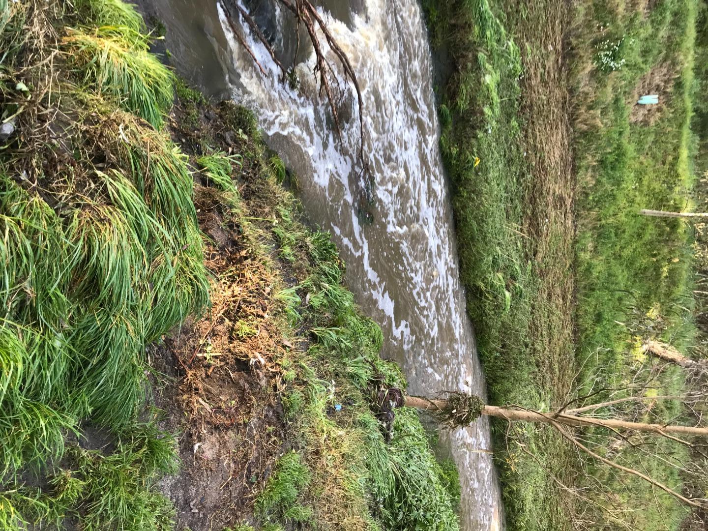
| 09-10-2022 | 0.02 | 97.91 | 10 | 780 | 6.5 | 0.25 | 10.3 | 14.3 | 57 |
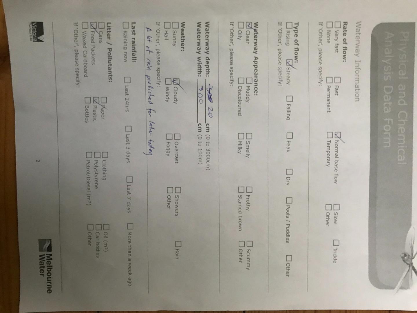
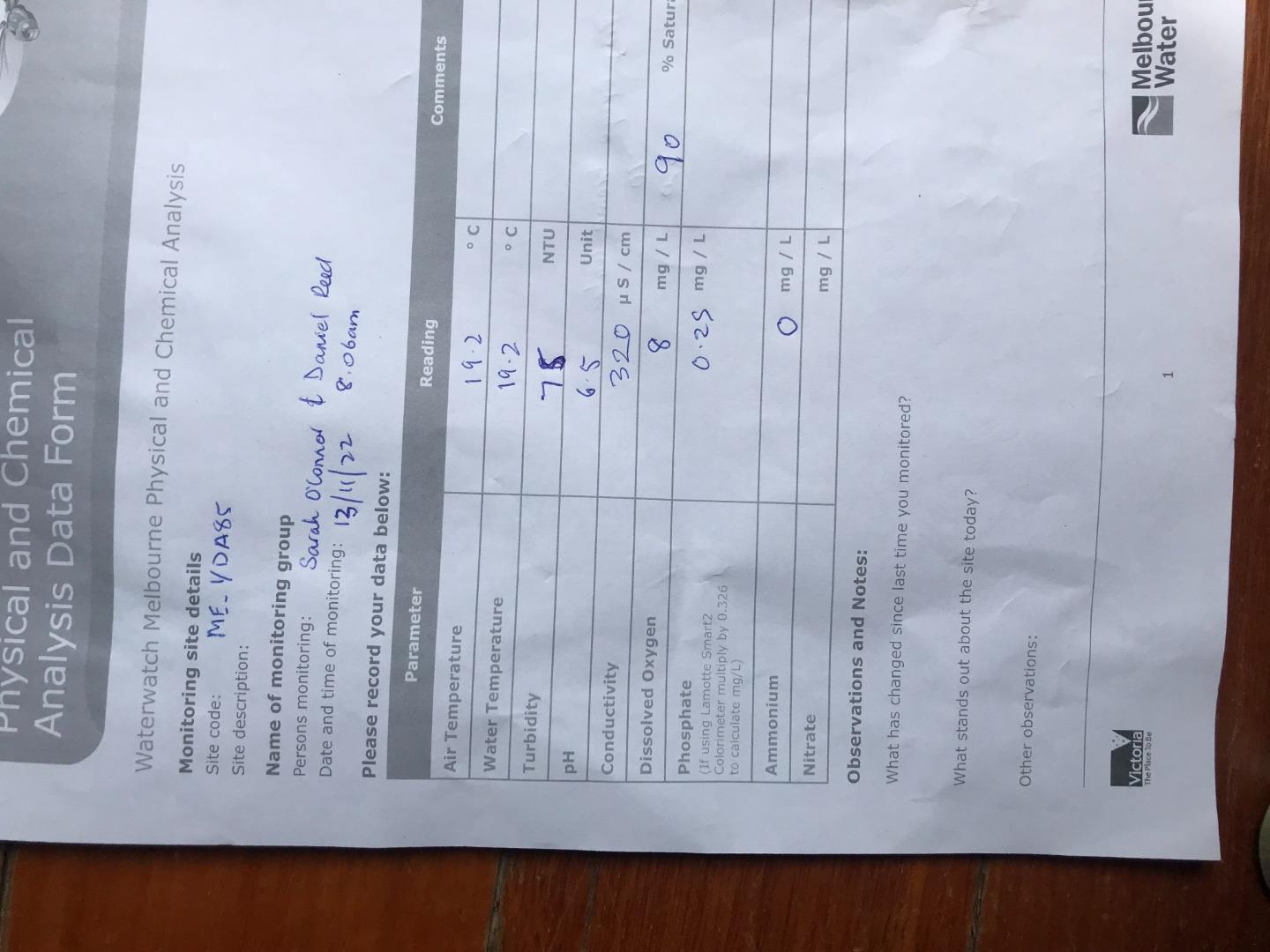
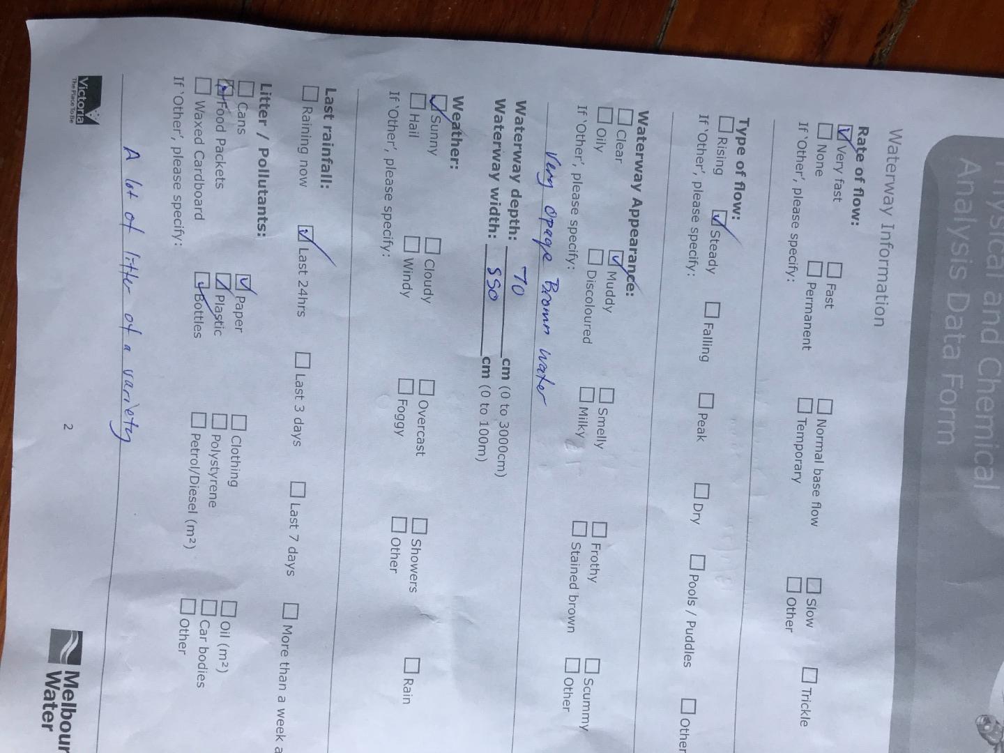
| 13-11-2022 | 86.67 | 8 | 320 | 6.5 | 0.25 | 19.2 | 19.2 | 75 | |
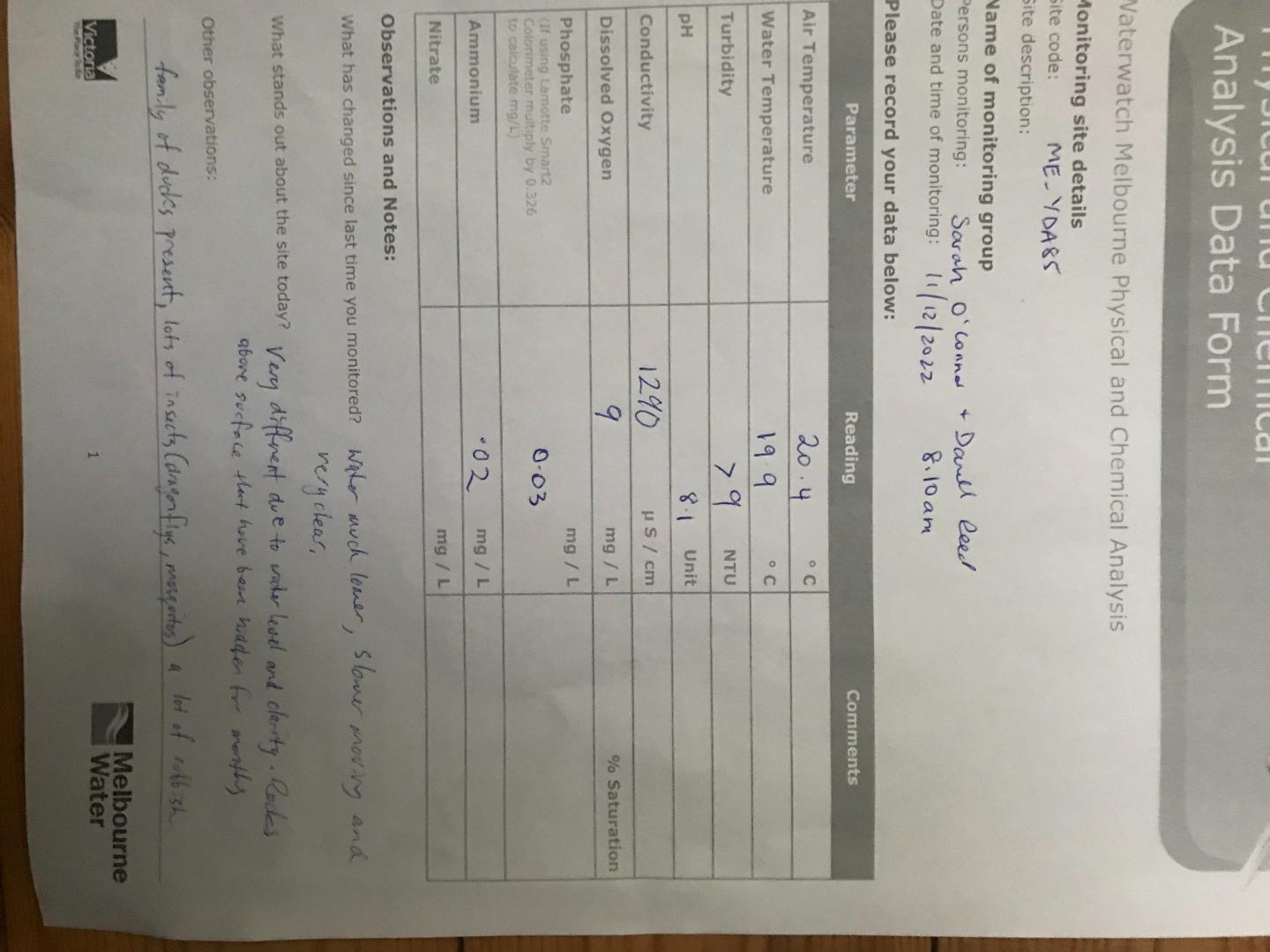
| 11-12-2022 | 0.02 | 99.17 | 9 | 1290 | 8.1 | 0.03 | 20.4 | 19.9 | 9 |
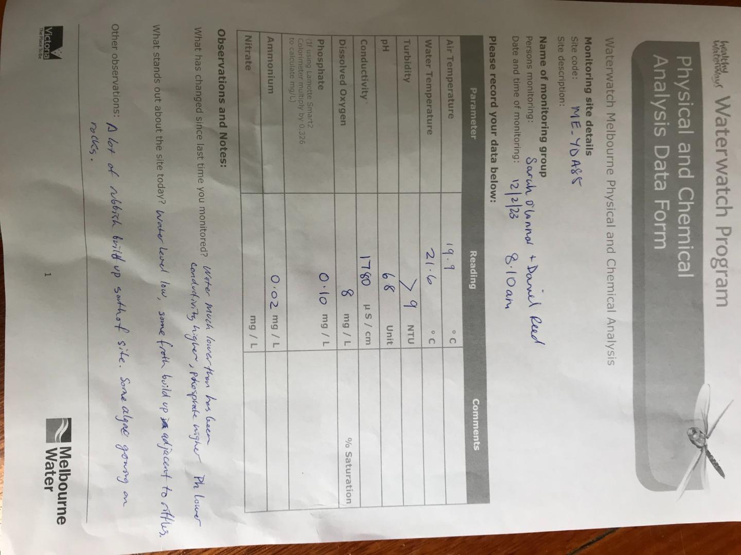
| 12-02-2023 | 0.02 | 91.28 | 8 | 1780 | 6.8 | 0.1 | 19.9 | 21.6 | 9 |
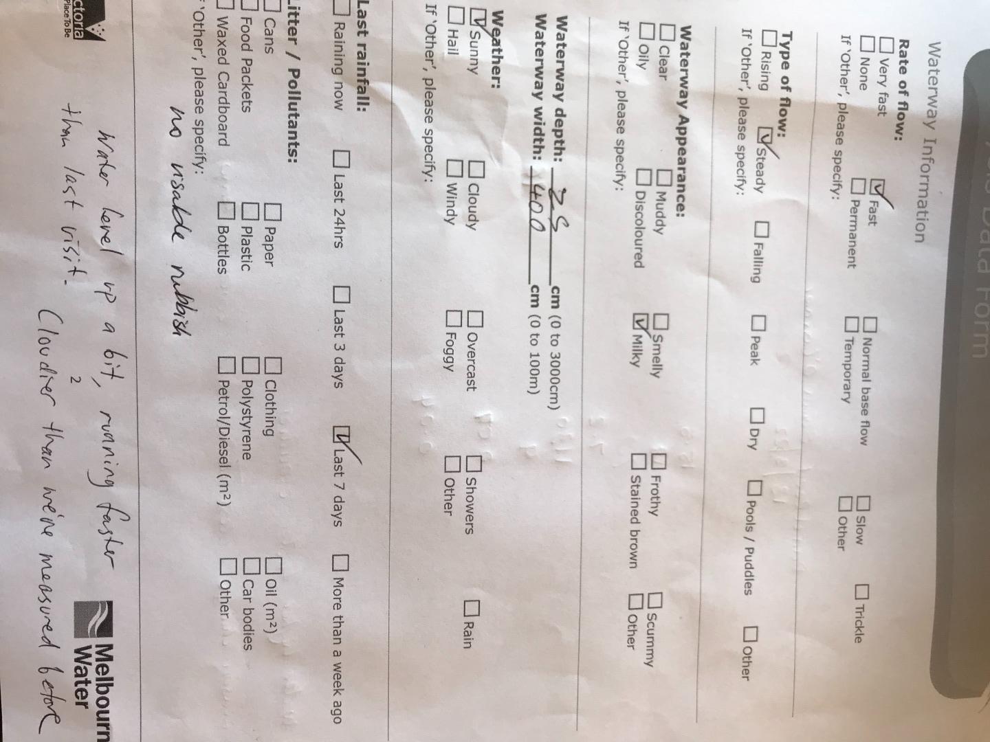
| 12-03-2023 | 97.84 | 9 | 780 | 6.5 | 0.2 | 19.5 | 19.3 | 80 | |
| 09-04-2023 | 0 | 90.33 | 9 | 420 | 6.3 | 0.07 | 12.6 | 15.5 | 9 |
| 14-05-2023 | 0 | 84.46 | 9 | 1400 | 7.8 | 0.1 | 9.4 | 12.3 | 9 |
| 09-07-2023 | 0 | 92.54 | 10 | 1300 | 6.9 | 0.1 | 14.1 | 11.7 | 9 |
| 10-09-2023 | 0 | 93.66 | 10 | 810 | 7.2 | 0.07 | 12.2 | 12.3 | 9 |
| 08-10-2023 | 0 | 94.97 | 10 | 920 | 7.4 | 0.07 | 9.4 | 12.9 | 9 |
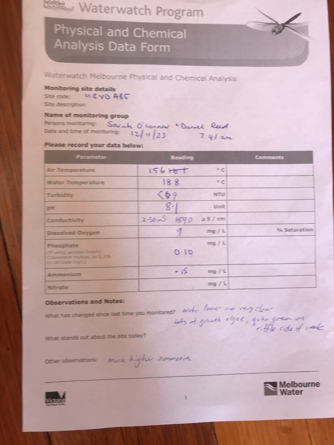
| 12-11-2023 | 0.15 | 97.19 | 9 | 1890 | 8.1 | 0.1 | 15.6 | 18.8 | 9 |
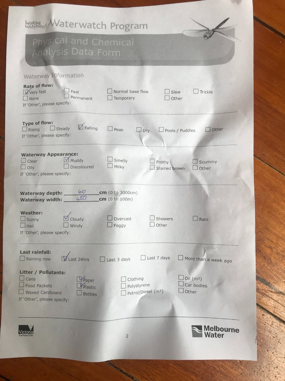
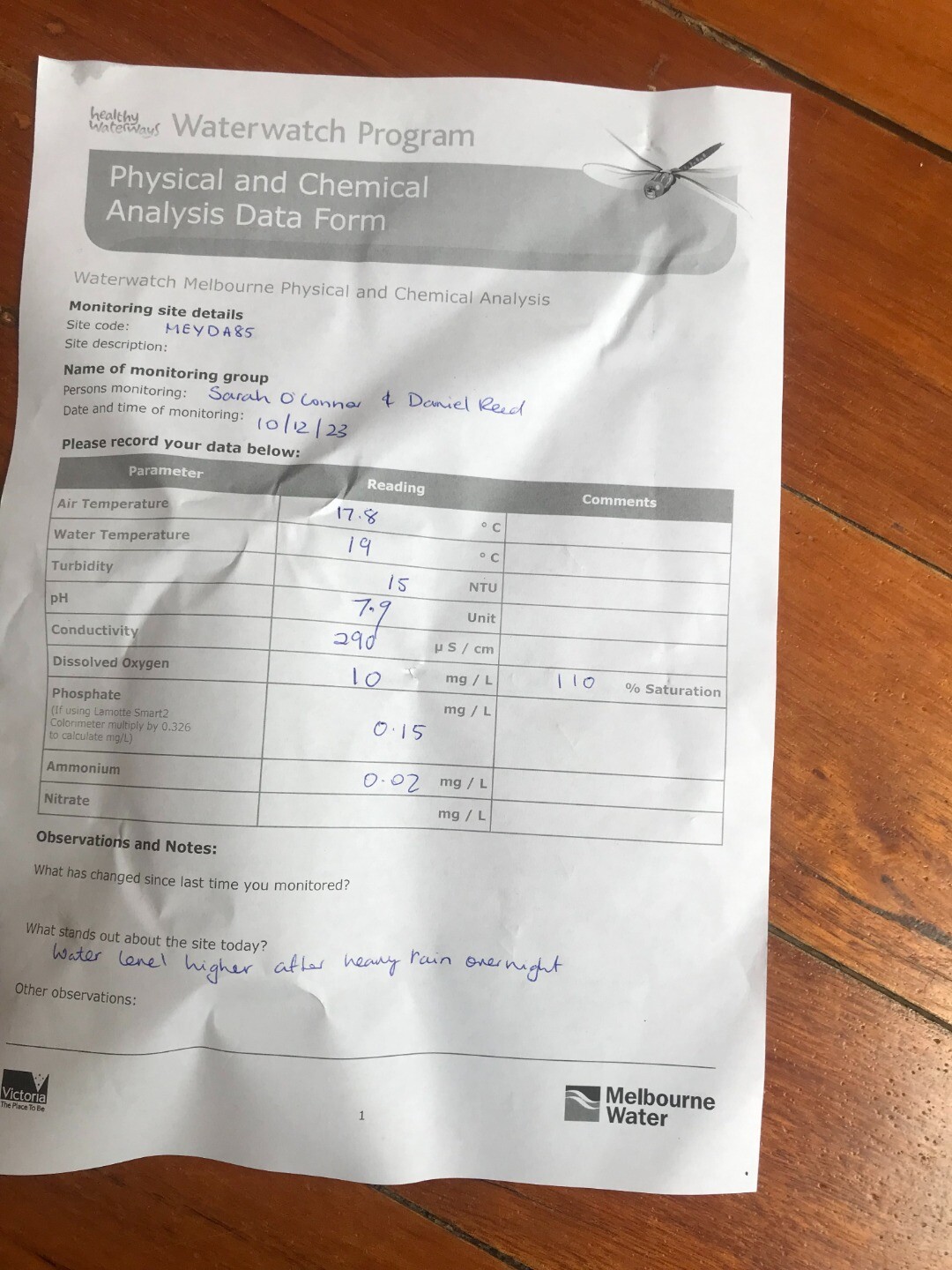
| 10-12-2023 | 0.02 | 107.89 | 10 | 290 | 7.9 | 0.15 | 17.8 | 19 | 15 |
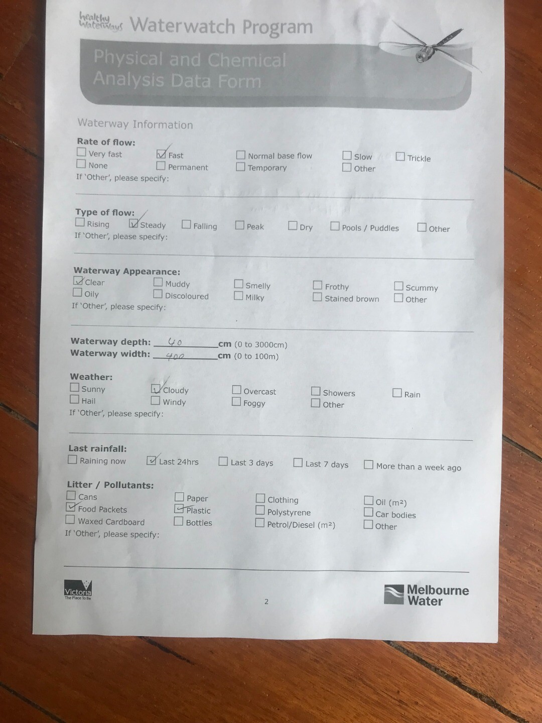
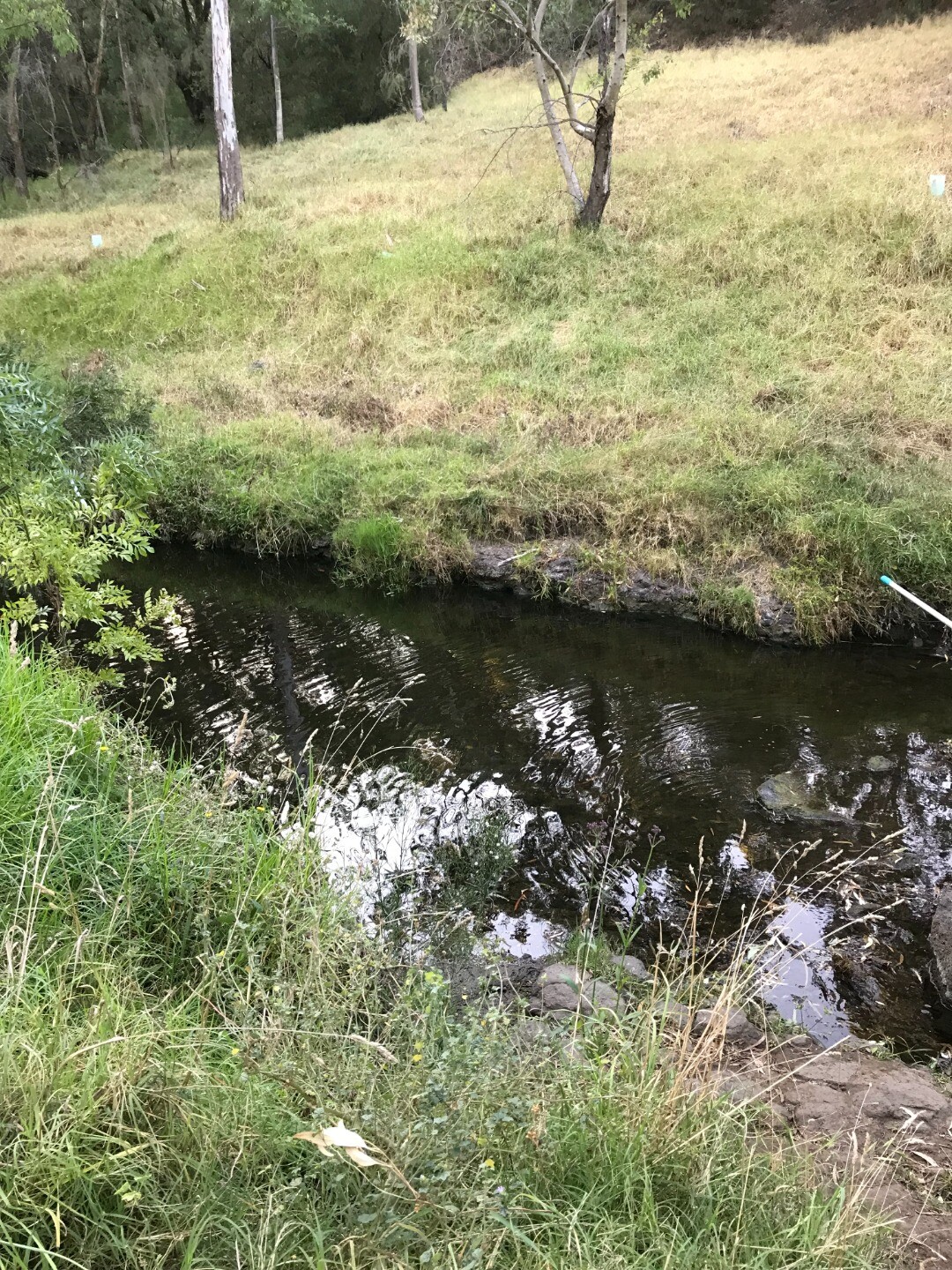
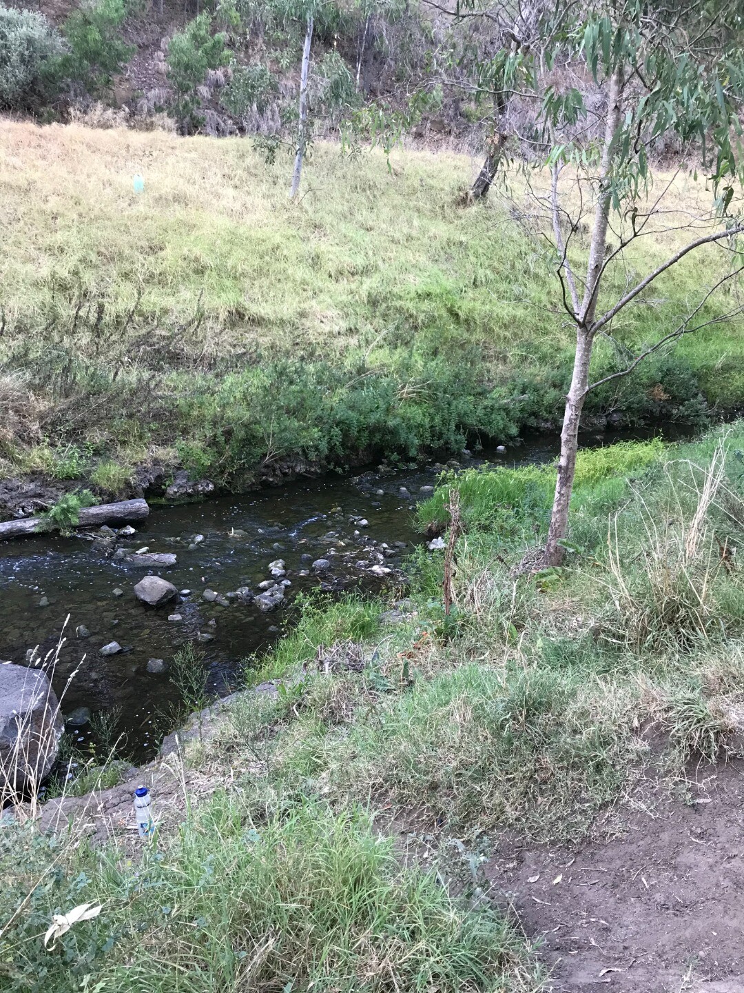
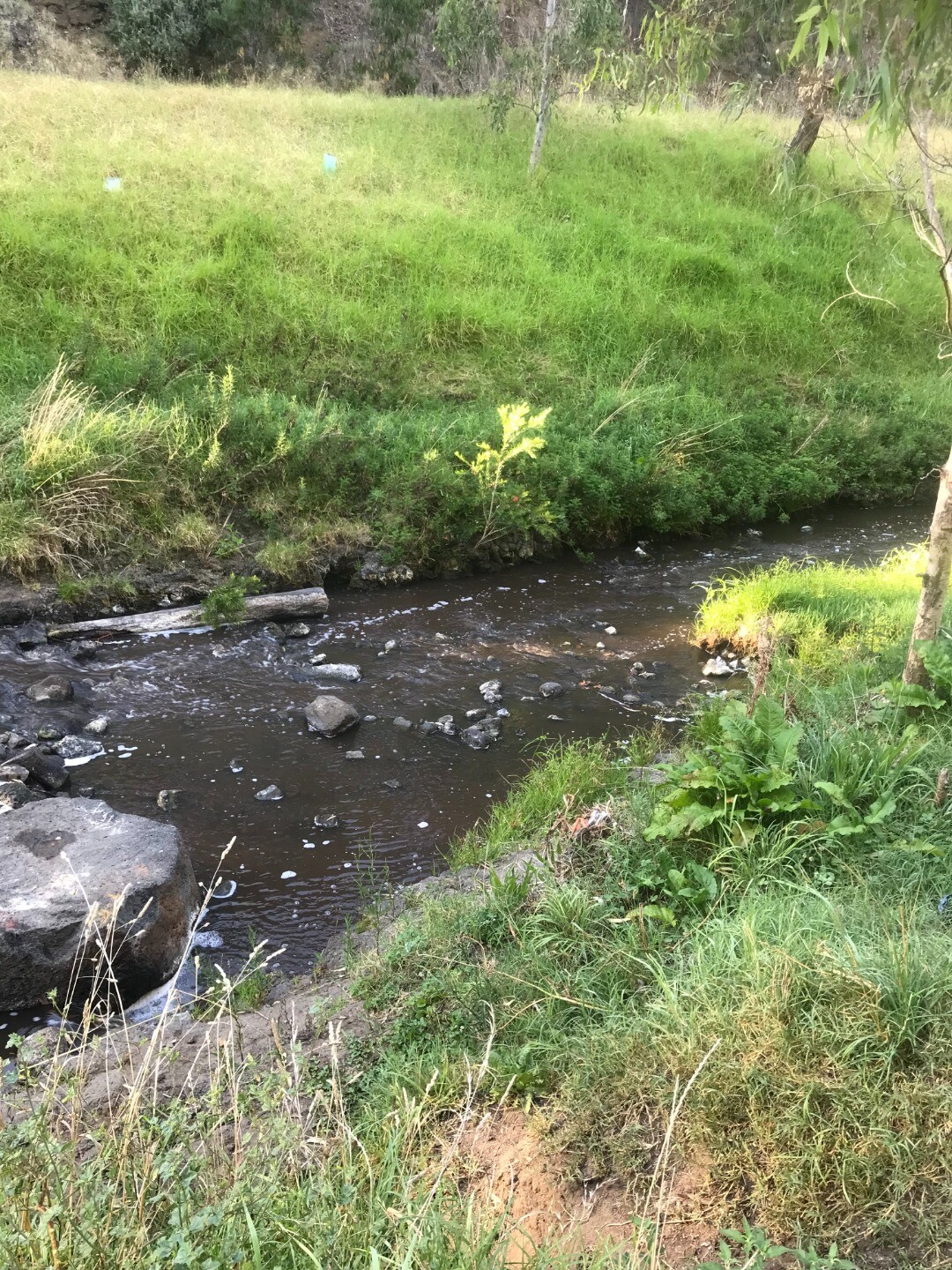
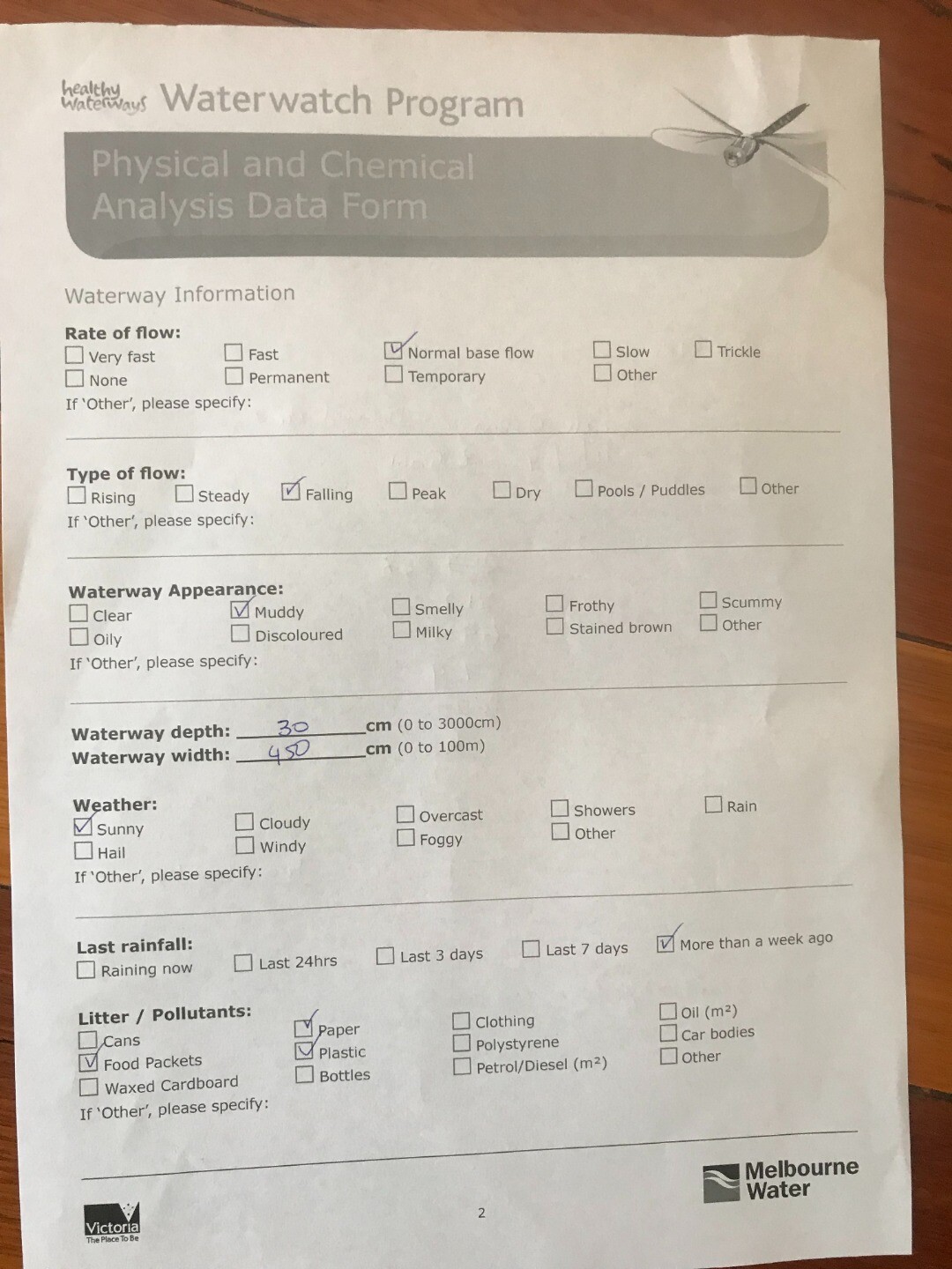
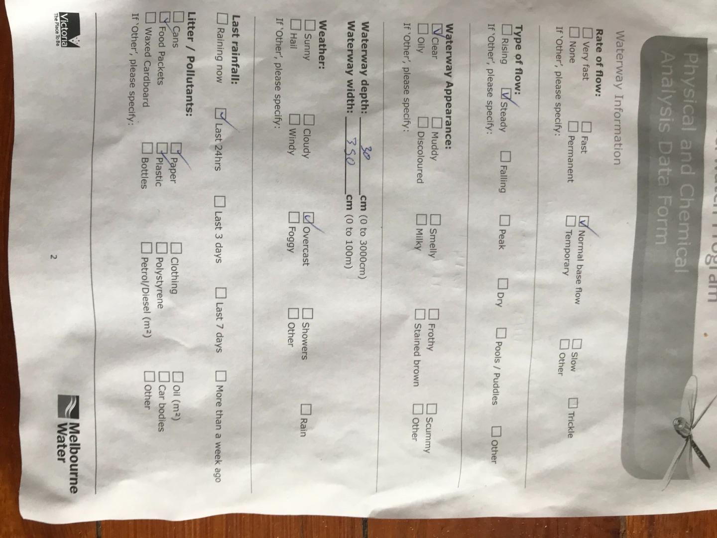
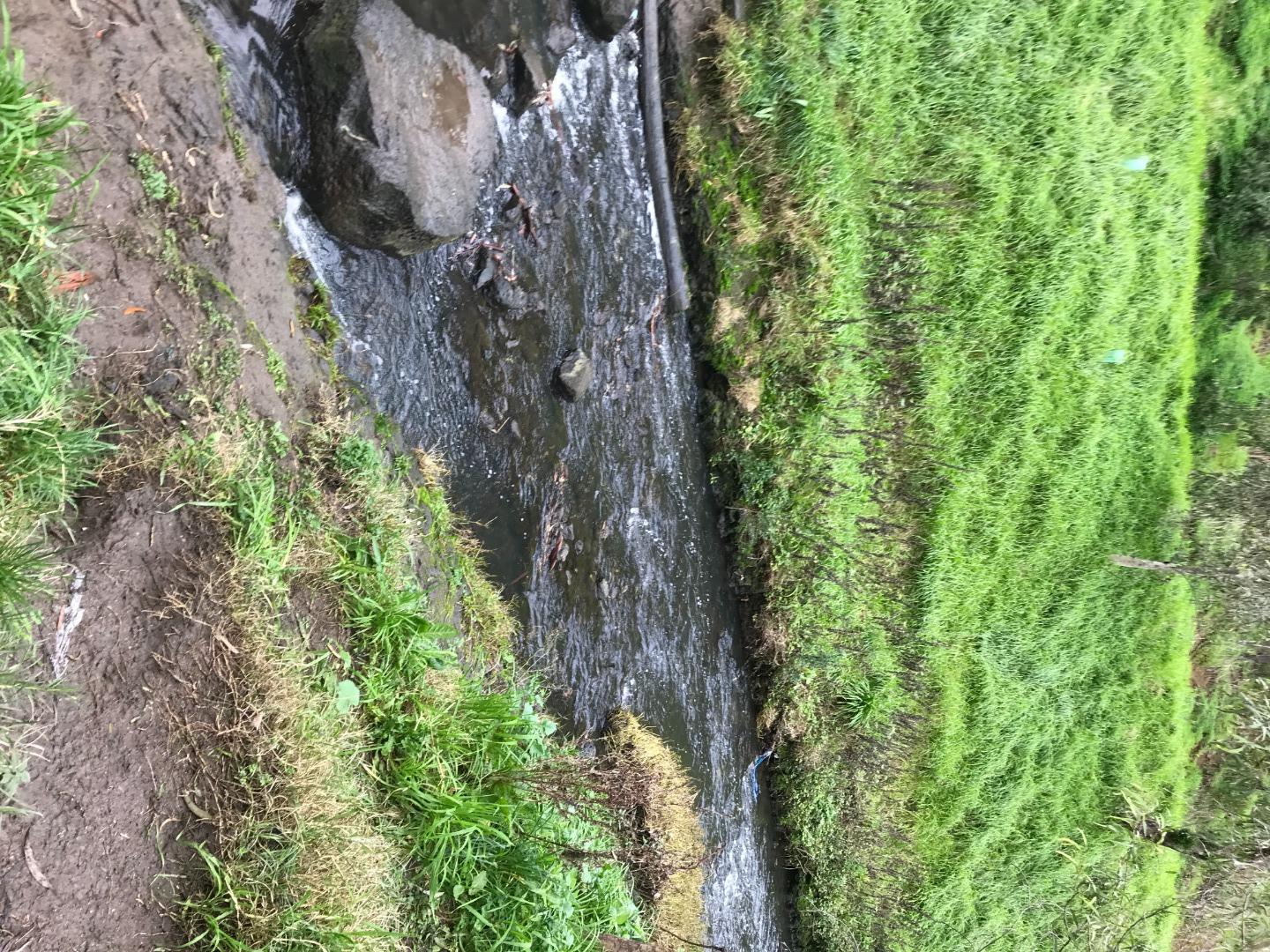
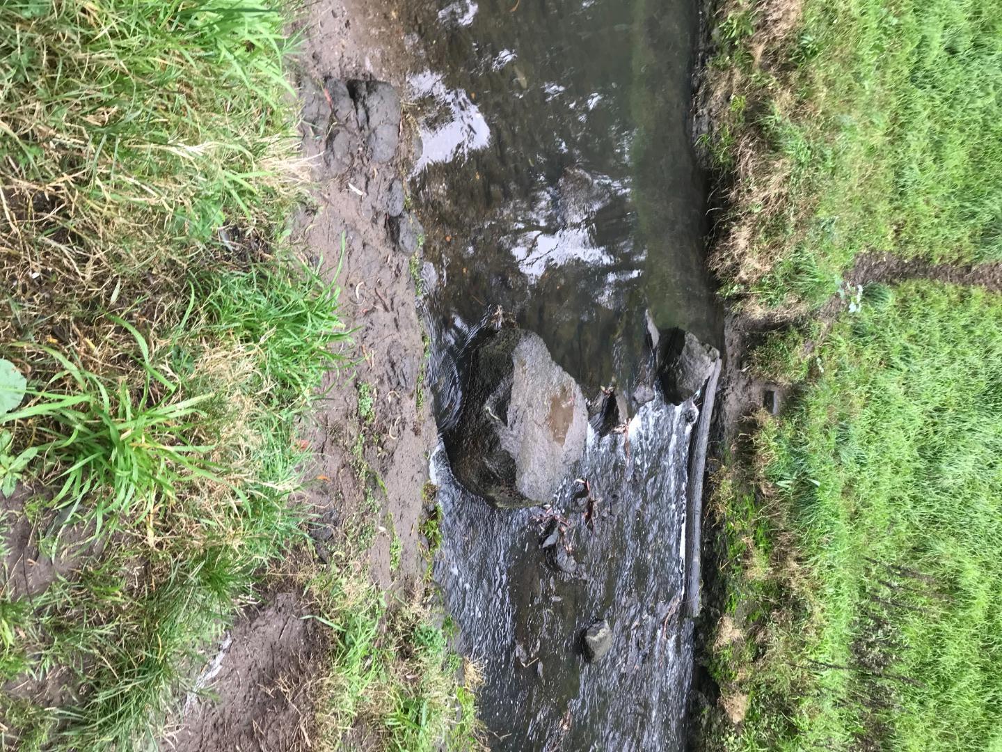
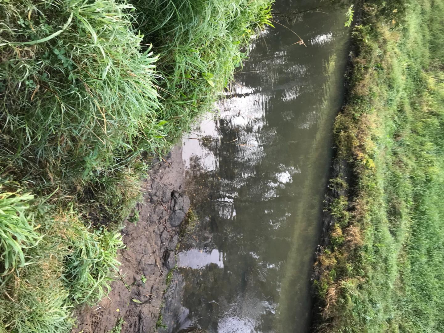
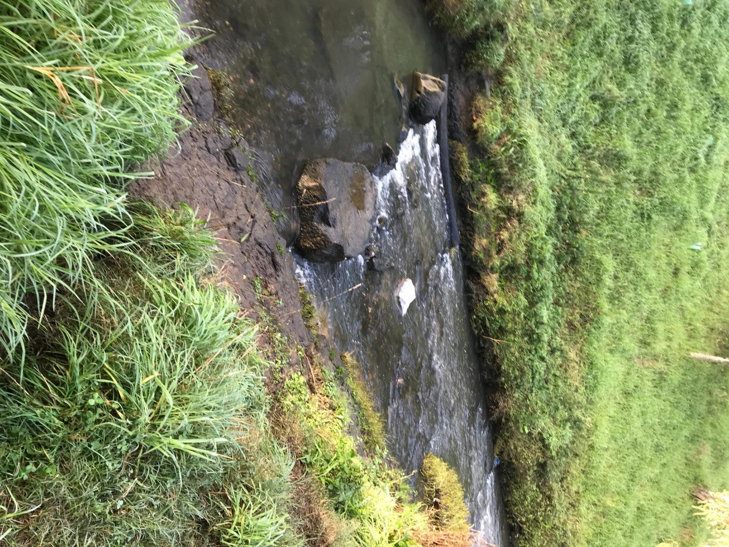
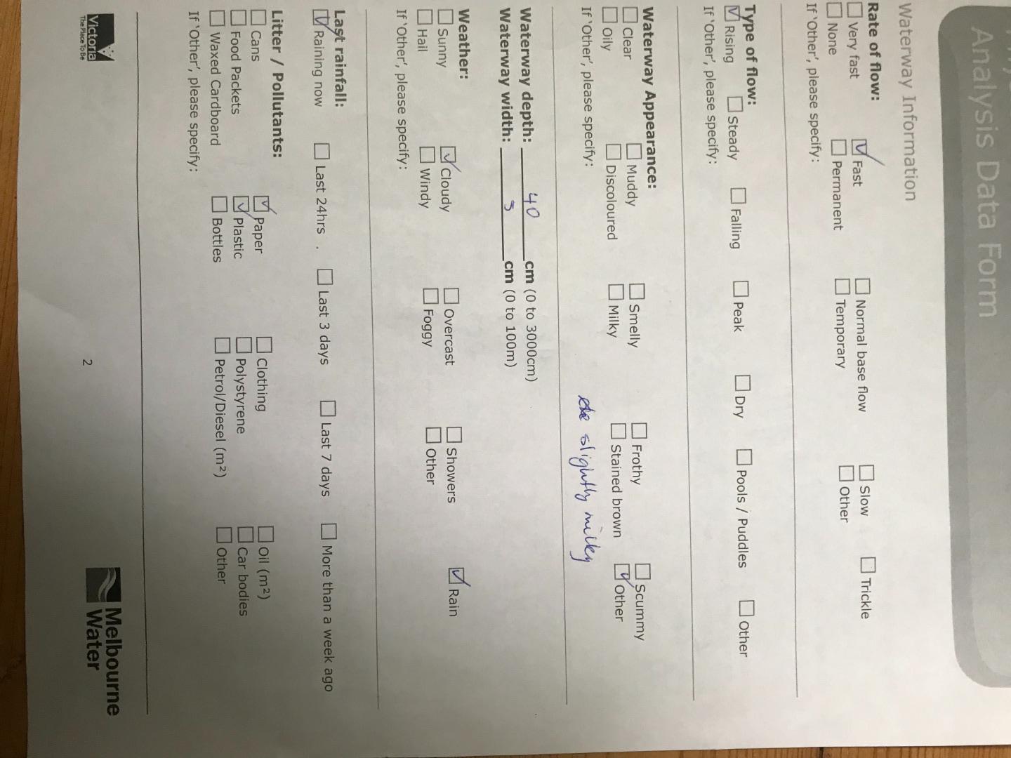
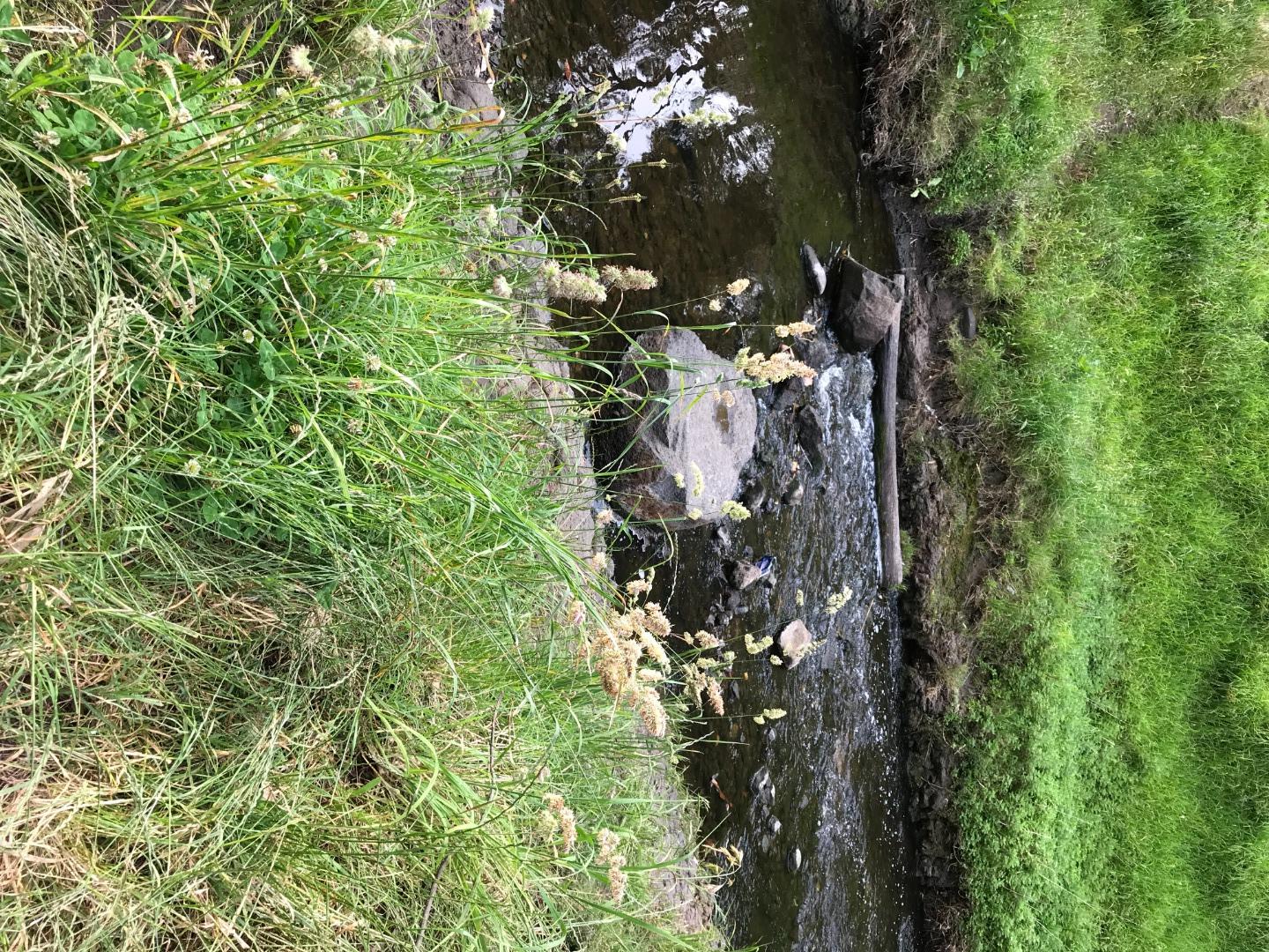
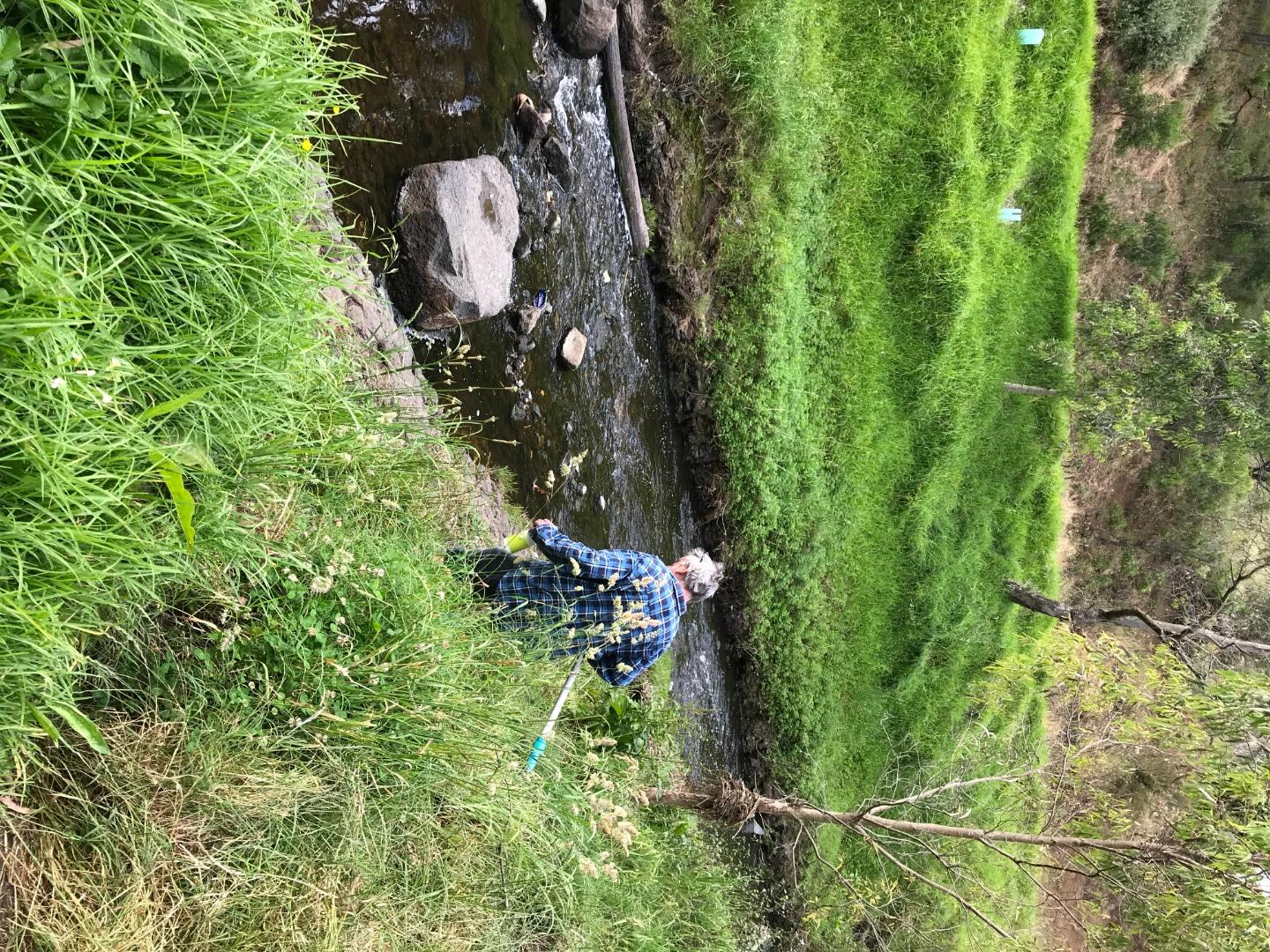
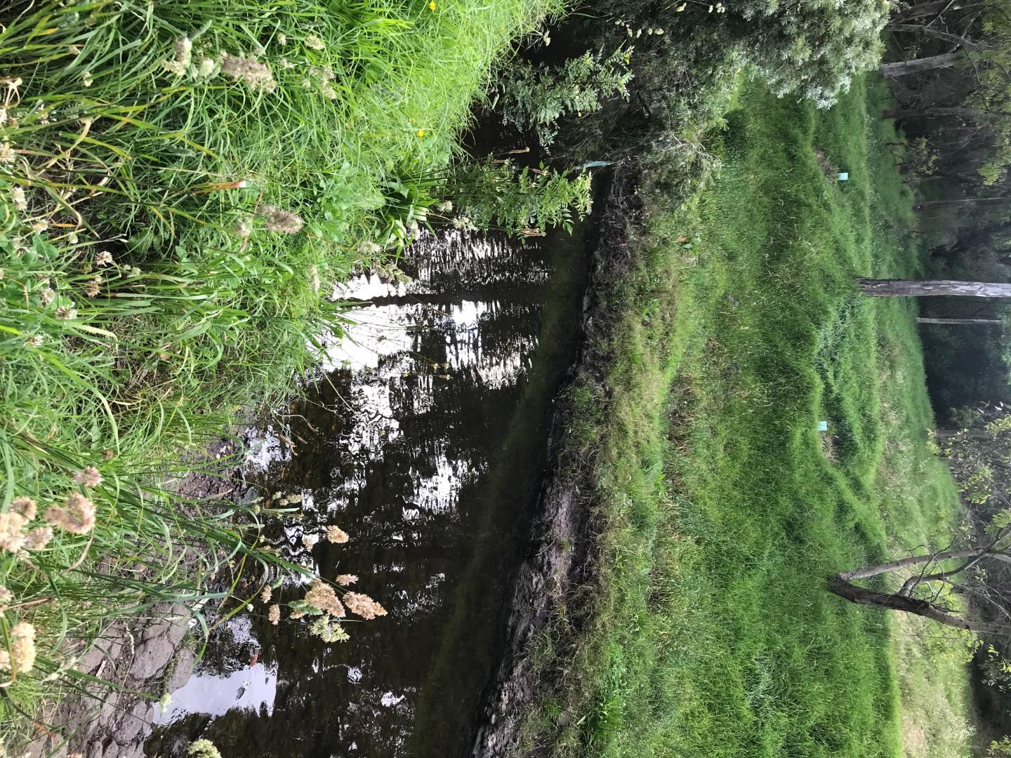
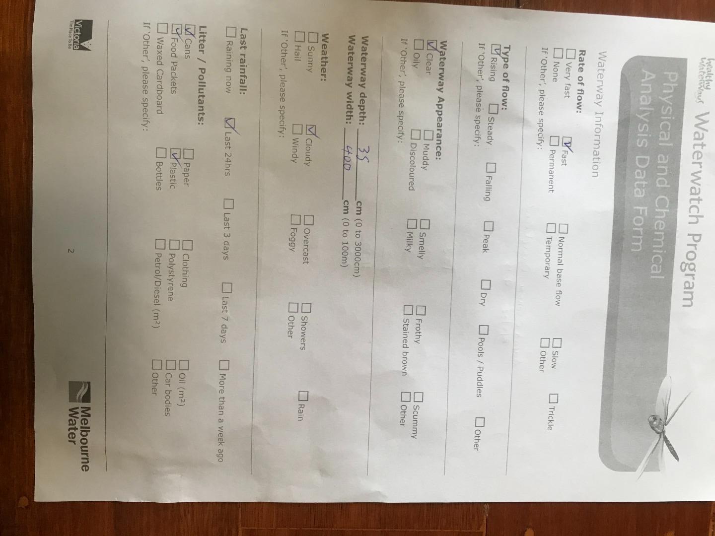
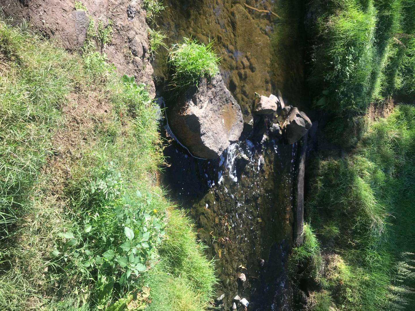
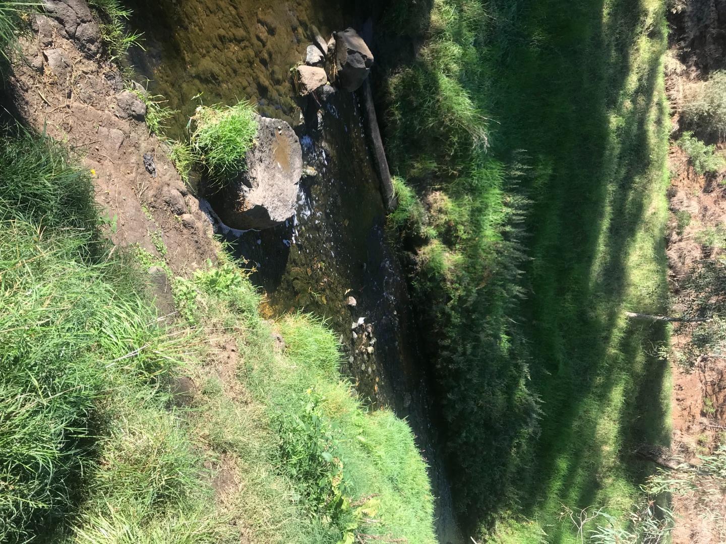
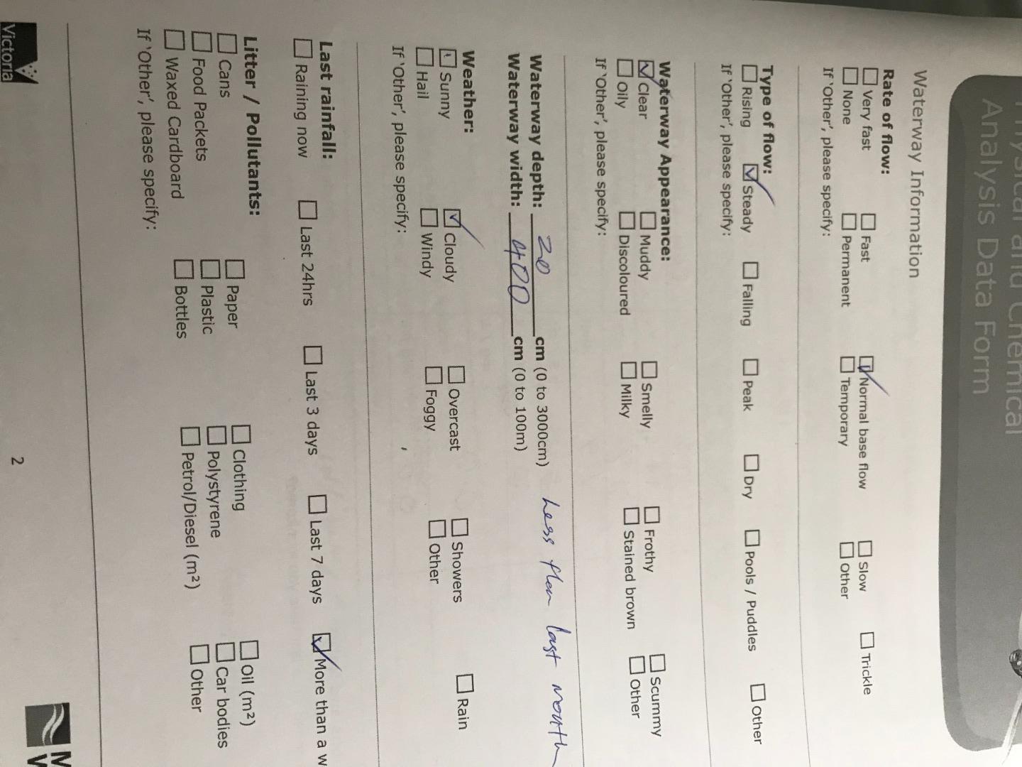
Habitat
| Date | Comment | Bank Erosion Stability | Bank Vegetation | In Stream Cover | Riffles Pools Bends | Verge Vegetation | Overall |
|---|---|---|---|---|---|---|---|
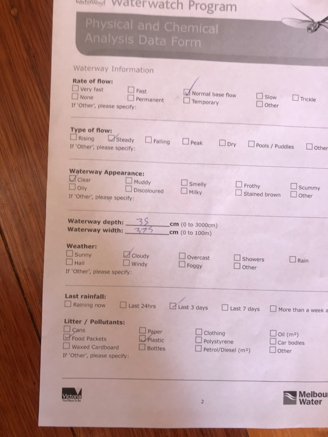
| 12-03-2023 | Good 4 | Fair 6 | Good 8 | Good 4 | Fair 6 | 28 | |
| 12-02-2023 | Fair 3 | Fair 6 | Fair 6 | Good 4 | Fair 6 | 25 | |
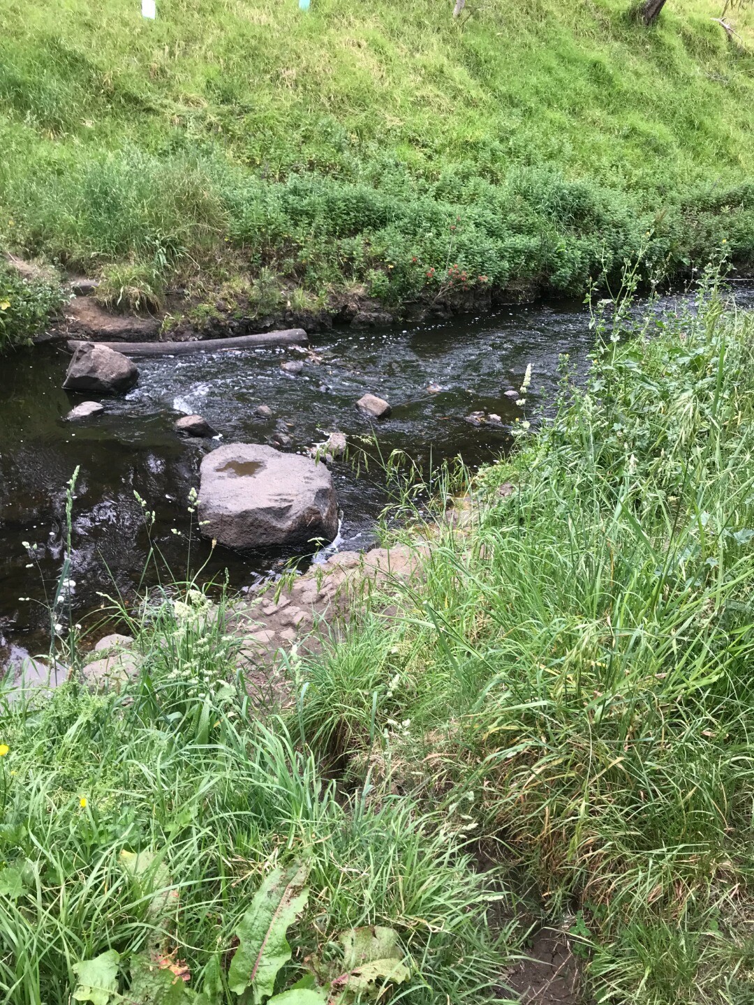
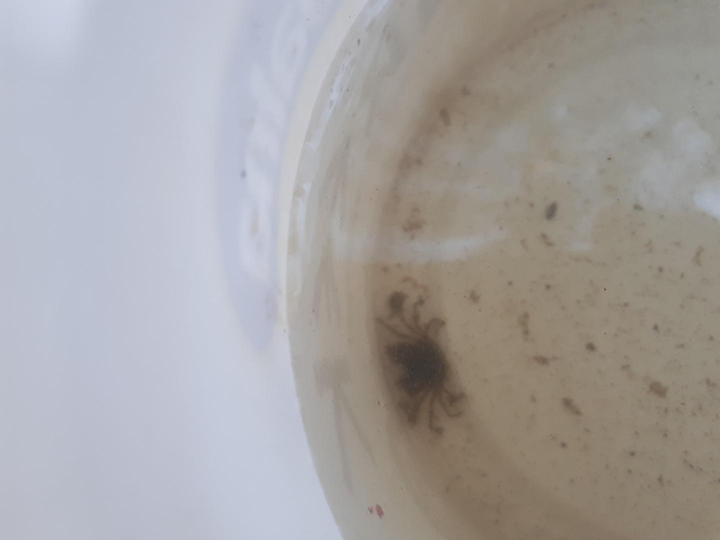
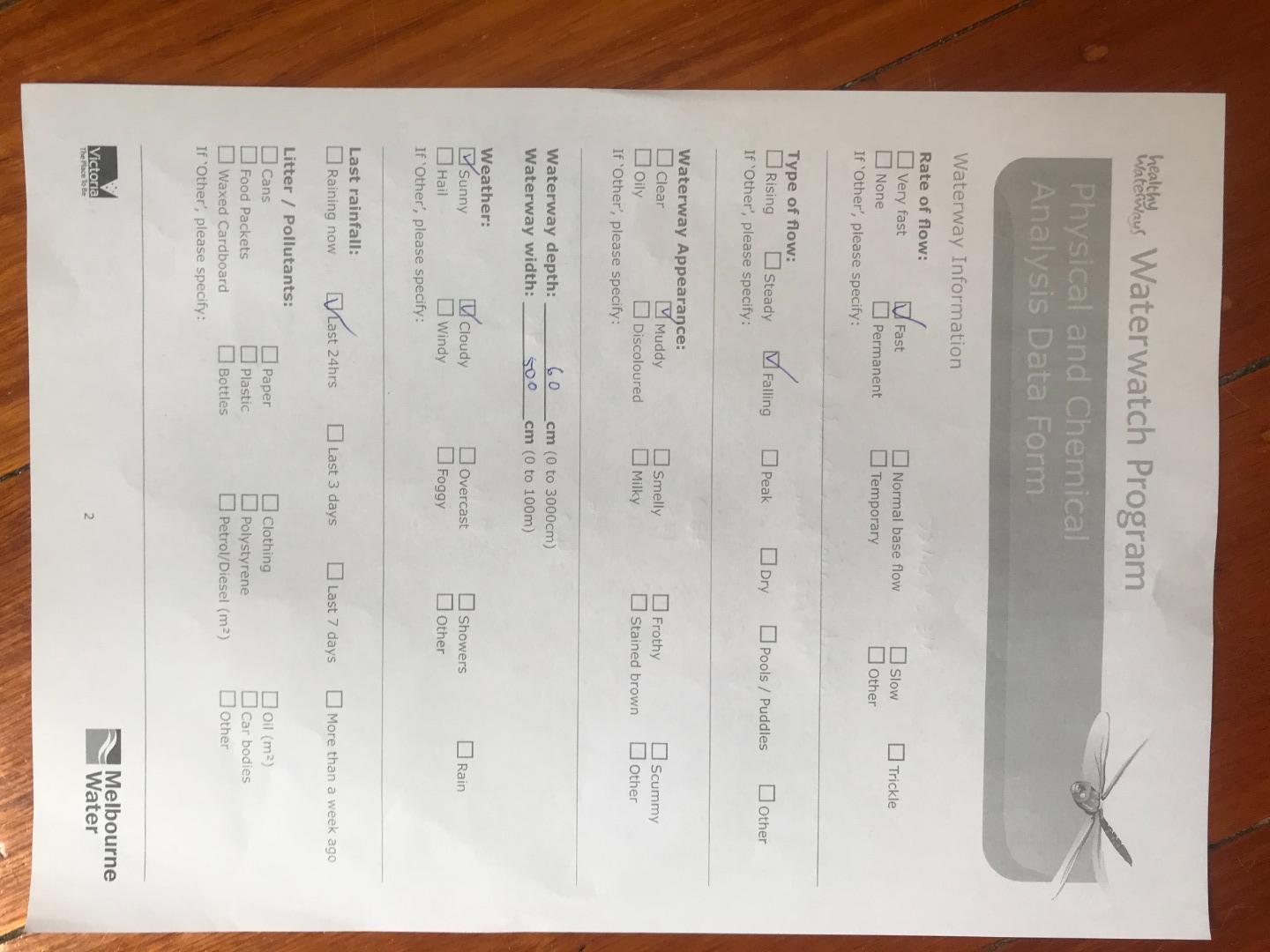
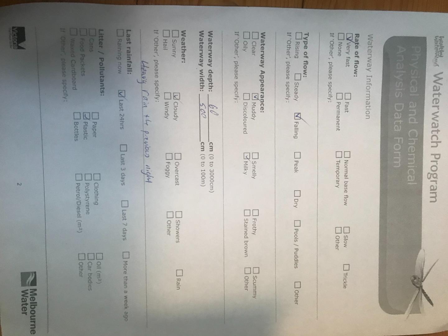
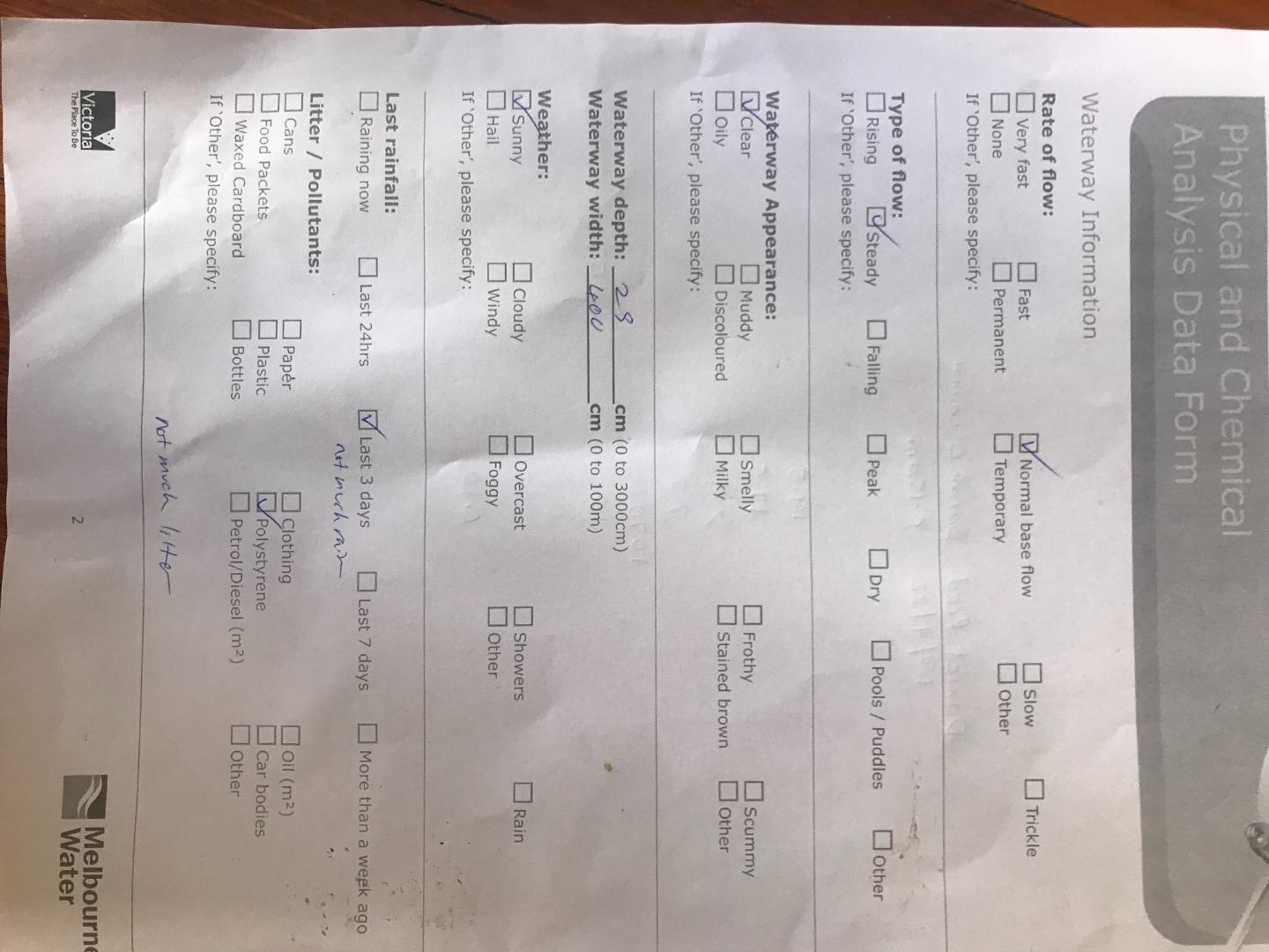
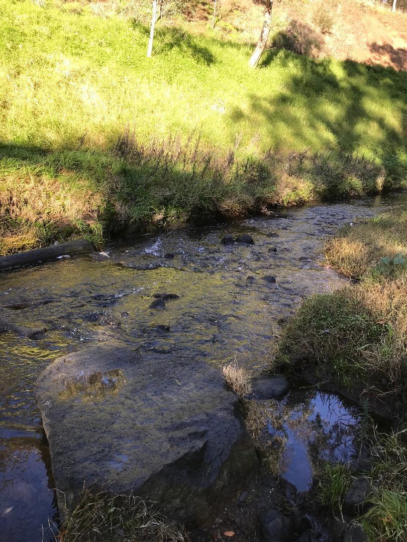
| 11-12-2022 | <p>Water level back to a normal flow, very clear can see the large rocks again.</p> | Fair 3 | Fair 6 | Good 8 | Good 4 | Fair 6 | 27 |
| 13-11-2022 | Good 4 | Fair 6 | Fair 6 | Fair 3 | Fair 6 | 25 | |
| 09-10-2022 | Good 4 | Fair 6 | Fair 6 | Fair 3 | Fair 6 | 25 | |
| 11-09-2022 | Good 4 | Fair 6 | Good 8 | Fair 3 | Fair 6 | 27 | |
| 14-08-2022 | Good 4 | Fair 6 | Fair 6 | Fair 3 | Fair 6 | 25 | |
| 10-07-2022 | Good 4 | Fair 6 | Fair 6 | Good 4 | Fair 6 | 26 | |
| 11-06-2022 | Fair 3 | Fair 6 | Fair 6 | Good 4 | Fair 6 | 25 | |
| 08-05-2022 | Good 4 | Fair 6 | Good 8 | Good 4 | Fair 6 | 28 | |
| 10-04-2022 | Good 4 | Fair 6 | Good 8 | Good 4 | Good 8 | 30 | |
| 13-03-2022 | Good 4 | Good 8 | Good 8 | Fair 3 | Fair 6 | 29 | |
| 20-02-2022 | Good 4 | Fair 6 | Fair 6 | Fair 3 | Fair 6 | 25 | |
| 11-07-2021 | Good 4 | Fair 6 | Fair 6 | Good 4 | Fair 6 | 26 |


All content, files, data and images provided by the Waterwatch Data Portal and Gallery are subject to a Creative Commons Attribution License
Content is made available to be used in any way, and should always attribute Waterwatch and www.vic.waterwatch.org.au
.png)