Waterwatch Data Portal
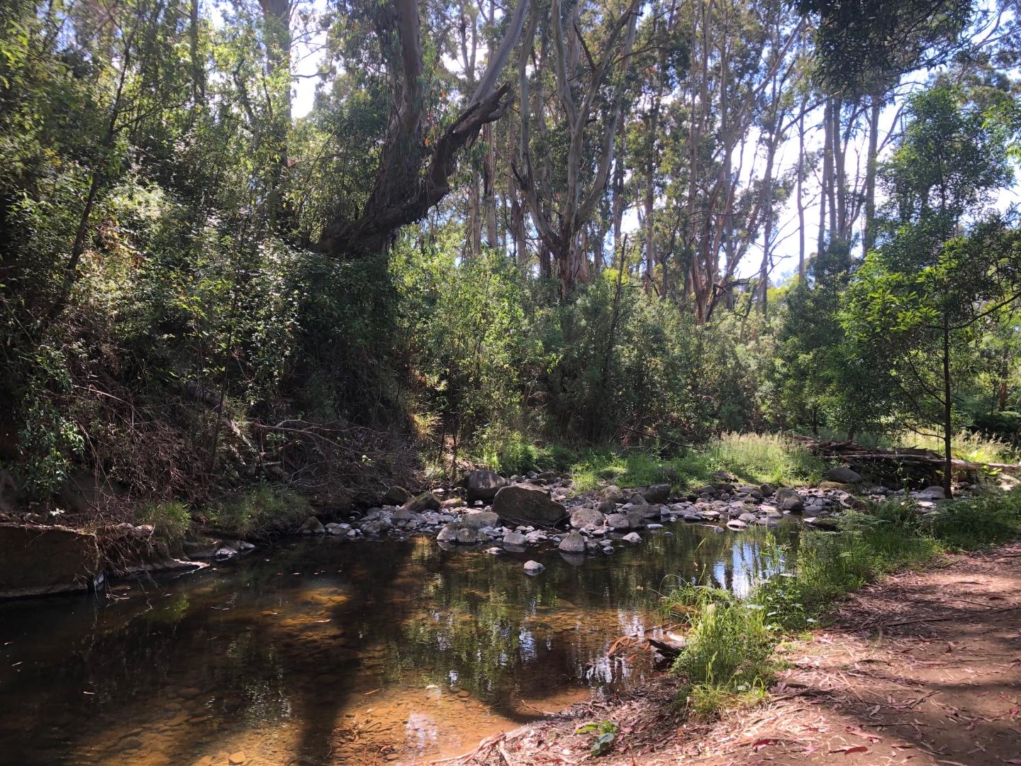
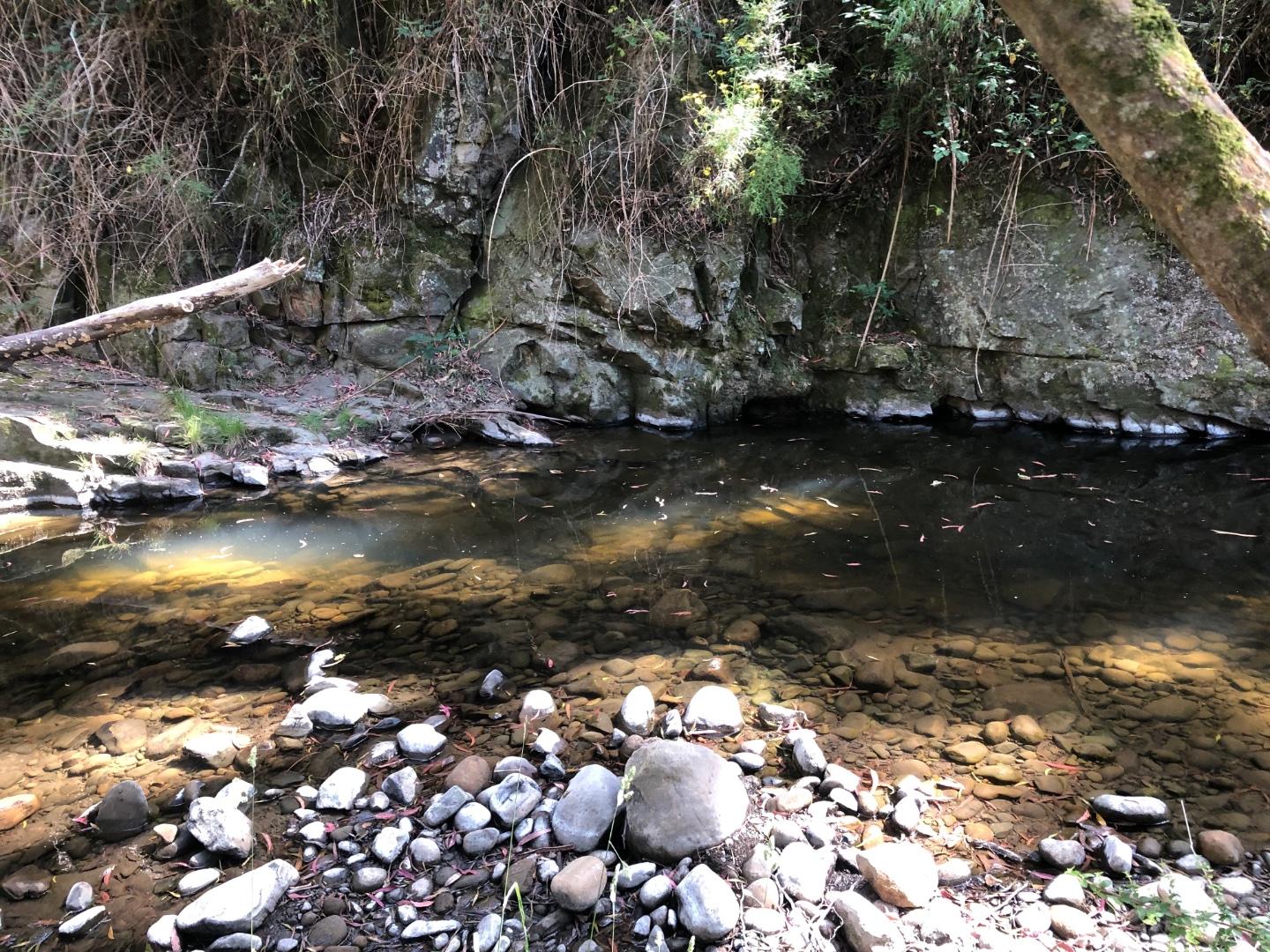
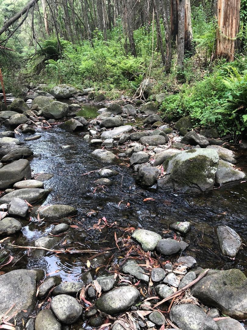
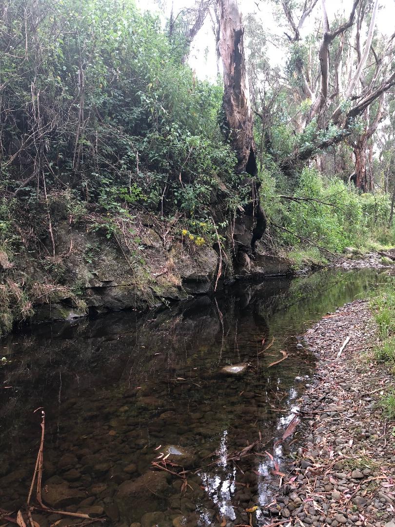
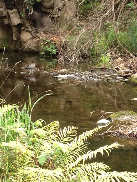
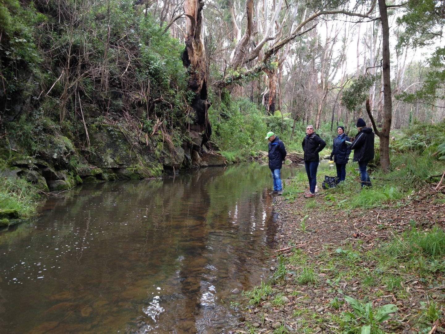
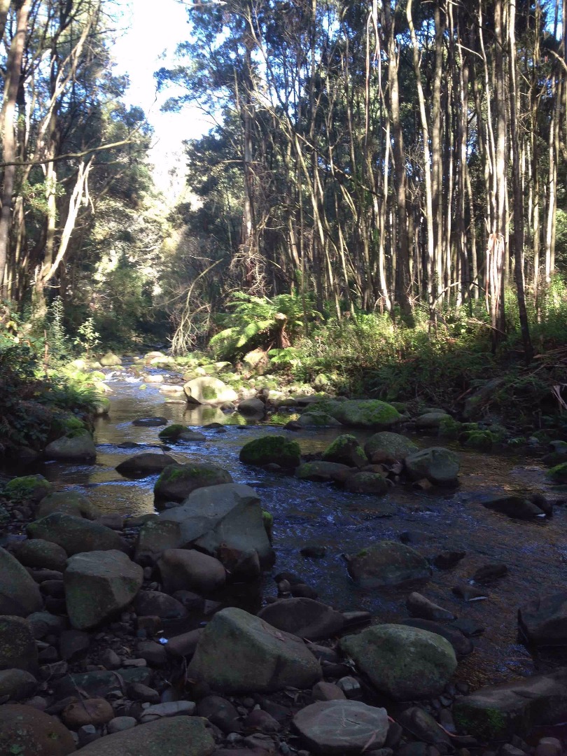
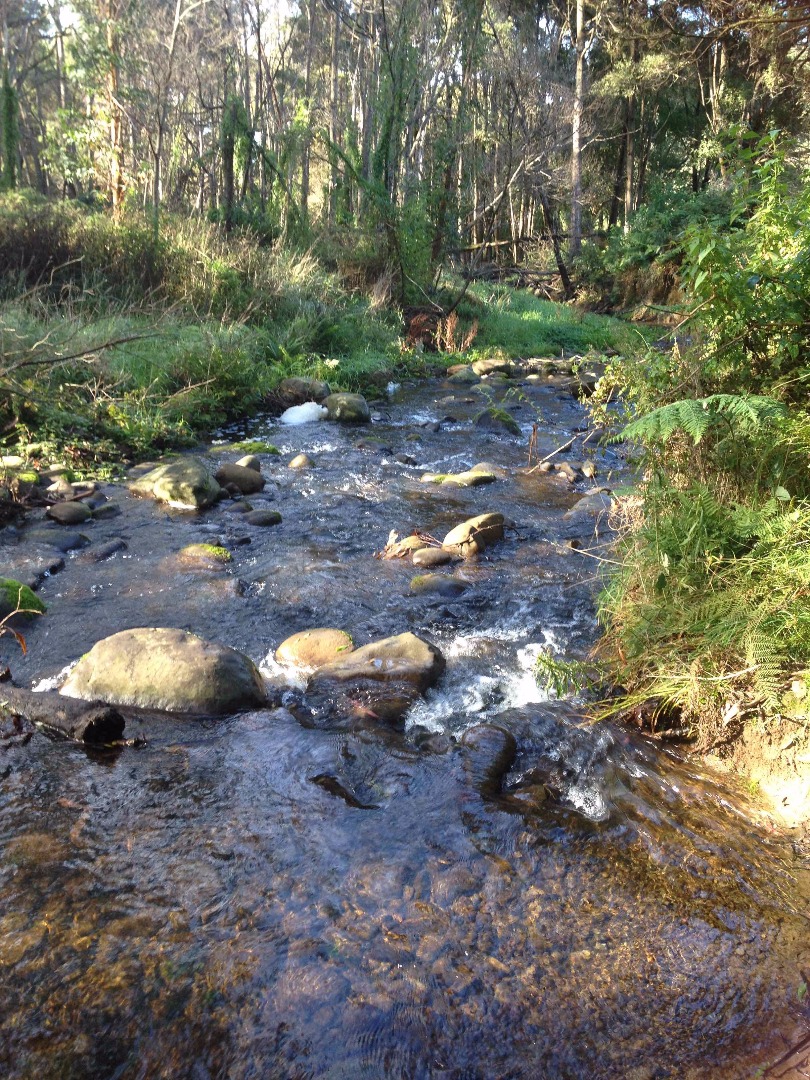
CO_WYE050 Wye River upper, above Big 4 Caravan Park
Site details
Overview
| Site code | CO_WYE050 |
|---|---|
| Site name | Wye River upper, above Big 4 Caravan Park |
| Status | Active |
| Water Authority | Corangamite |
| Basin | Otway Coast |
| Catchment | Otway Coast |
| Sub catchment | |
| Reach | 35_46 Wye River |
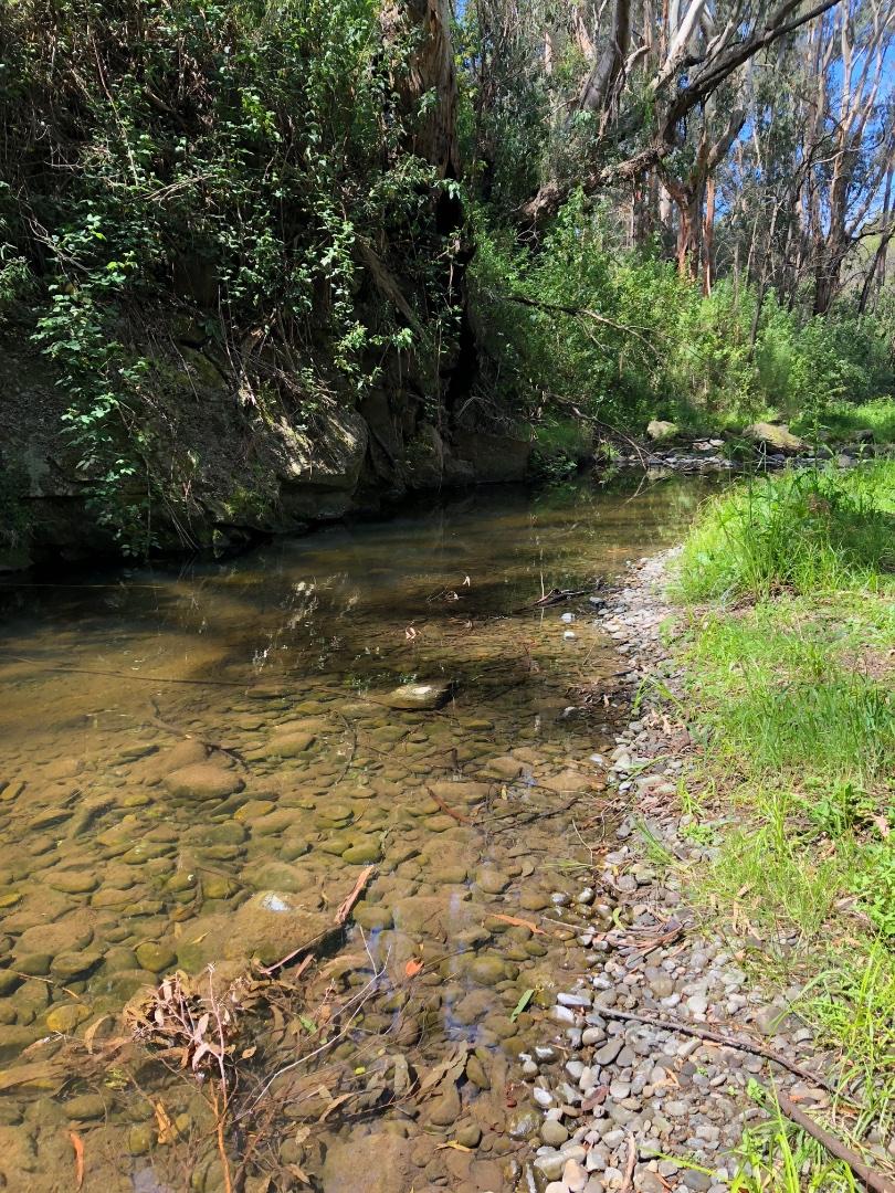
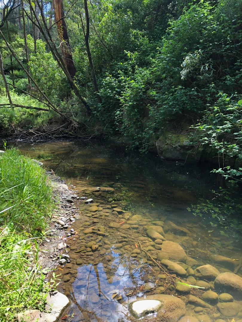
| Water type | River |
| Council | Colac Otway Shire Council |
| History | View all 116 site visits 16-11-2014 - 07-04-2024 |
| Monitoring organisations |
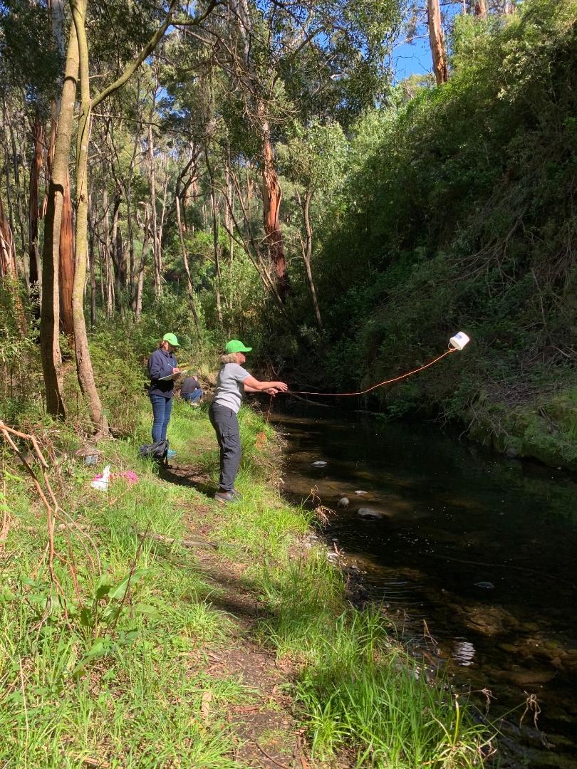
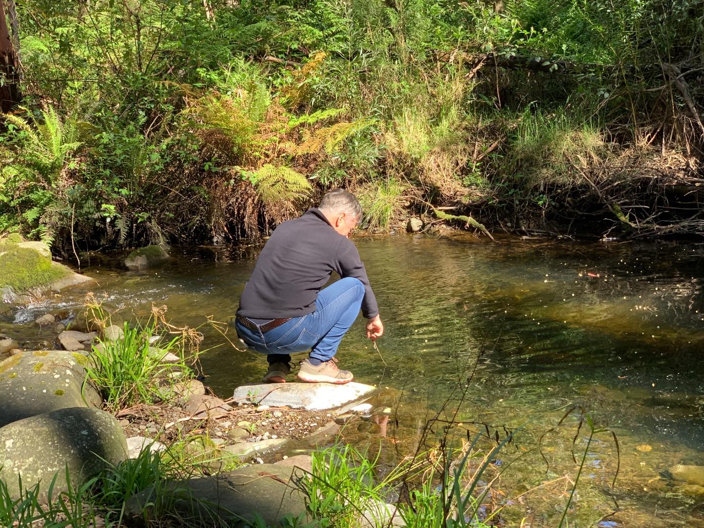
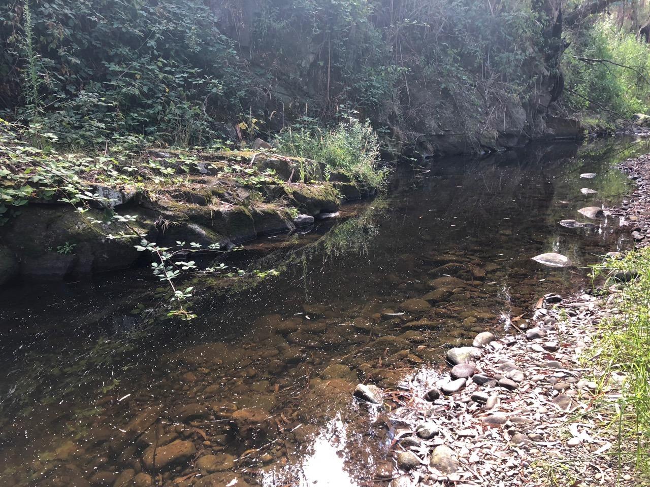
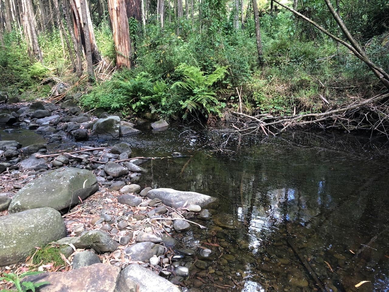
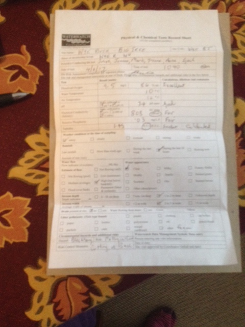
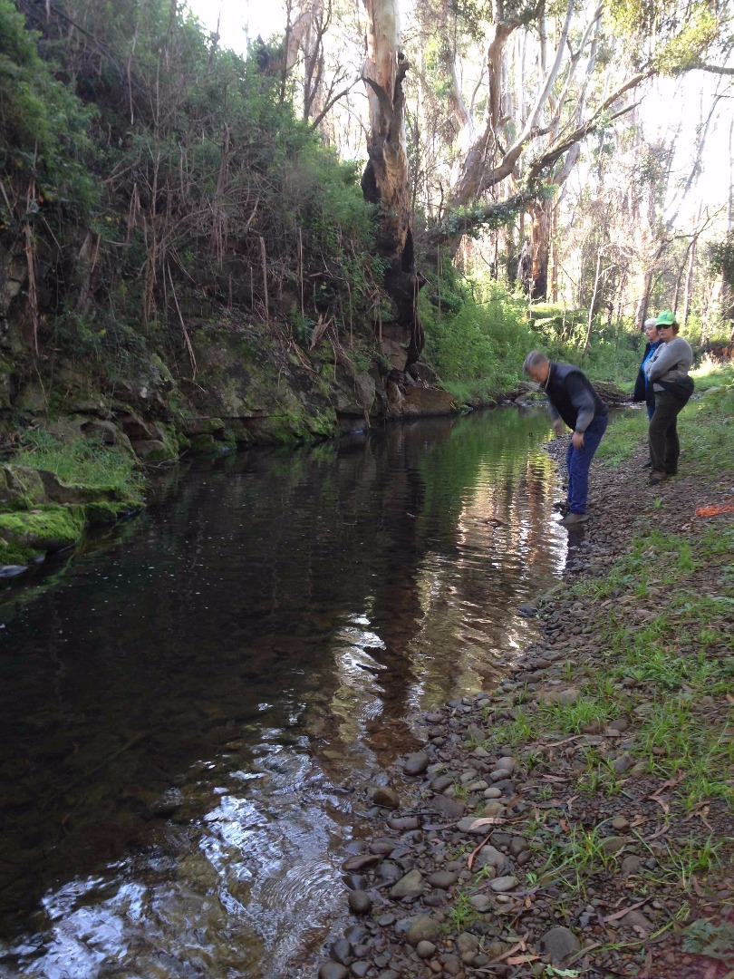
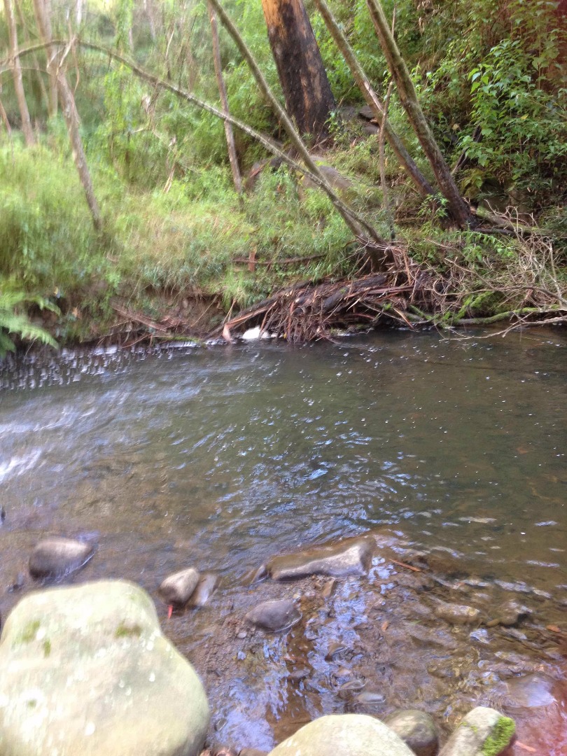
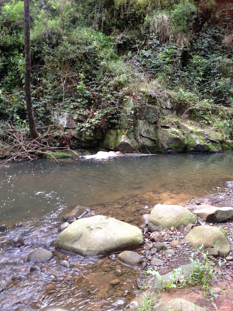
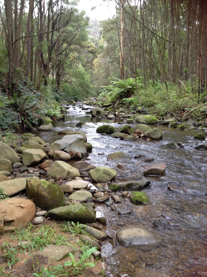
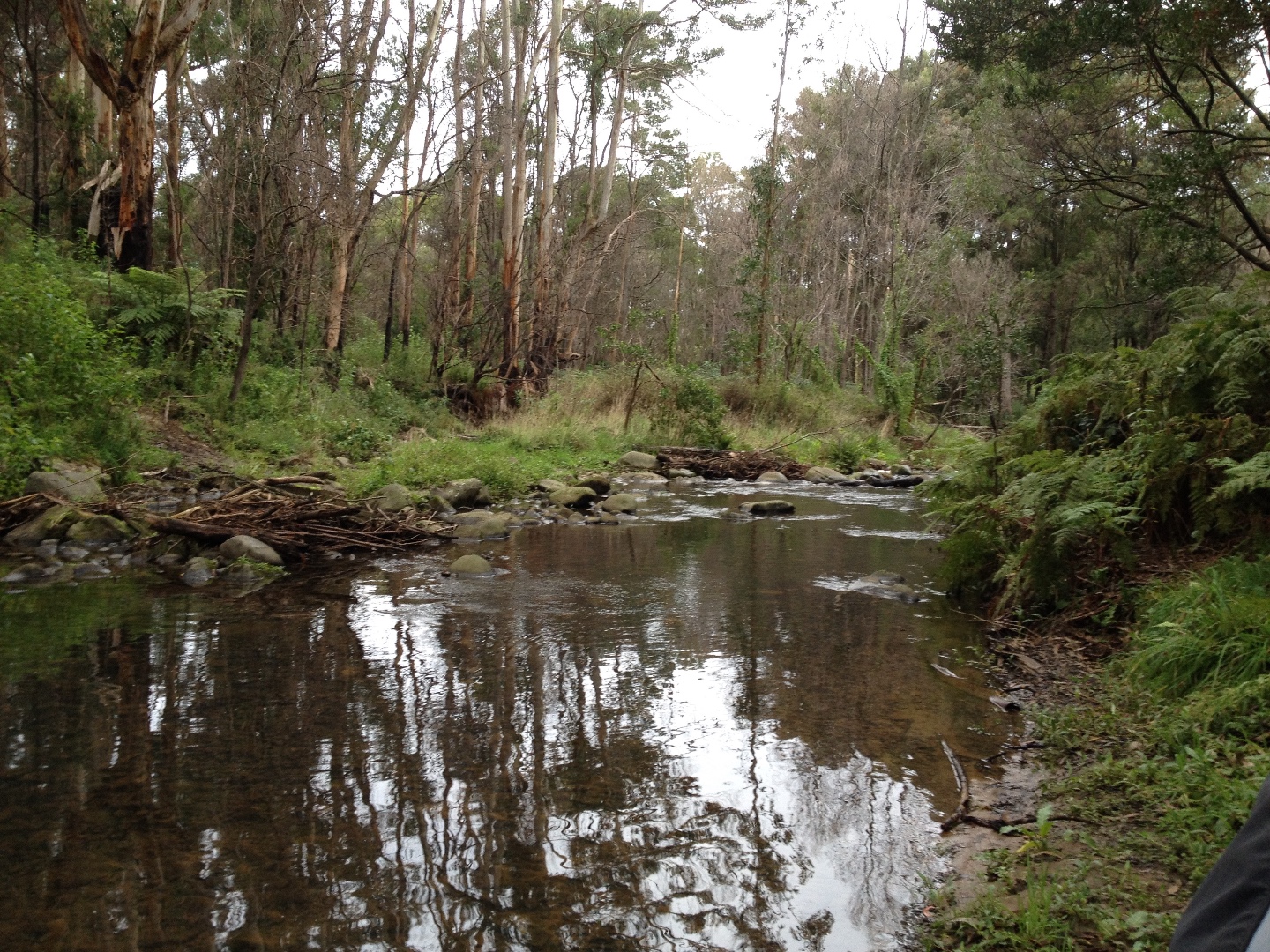
Site visits
 Loading chart
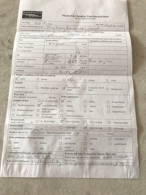
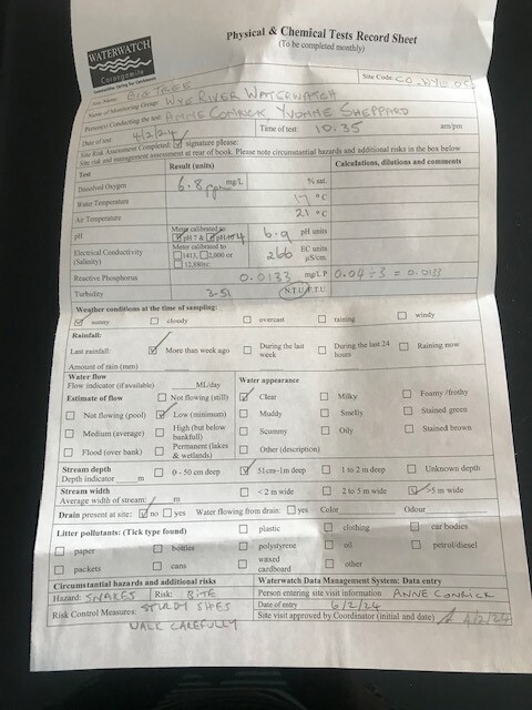
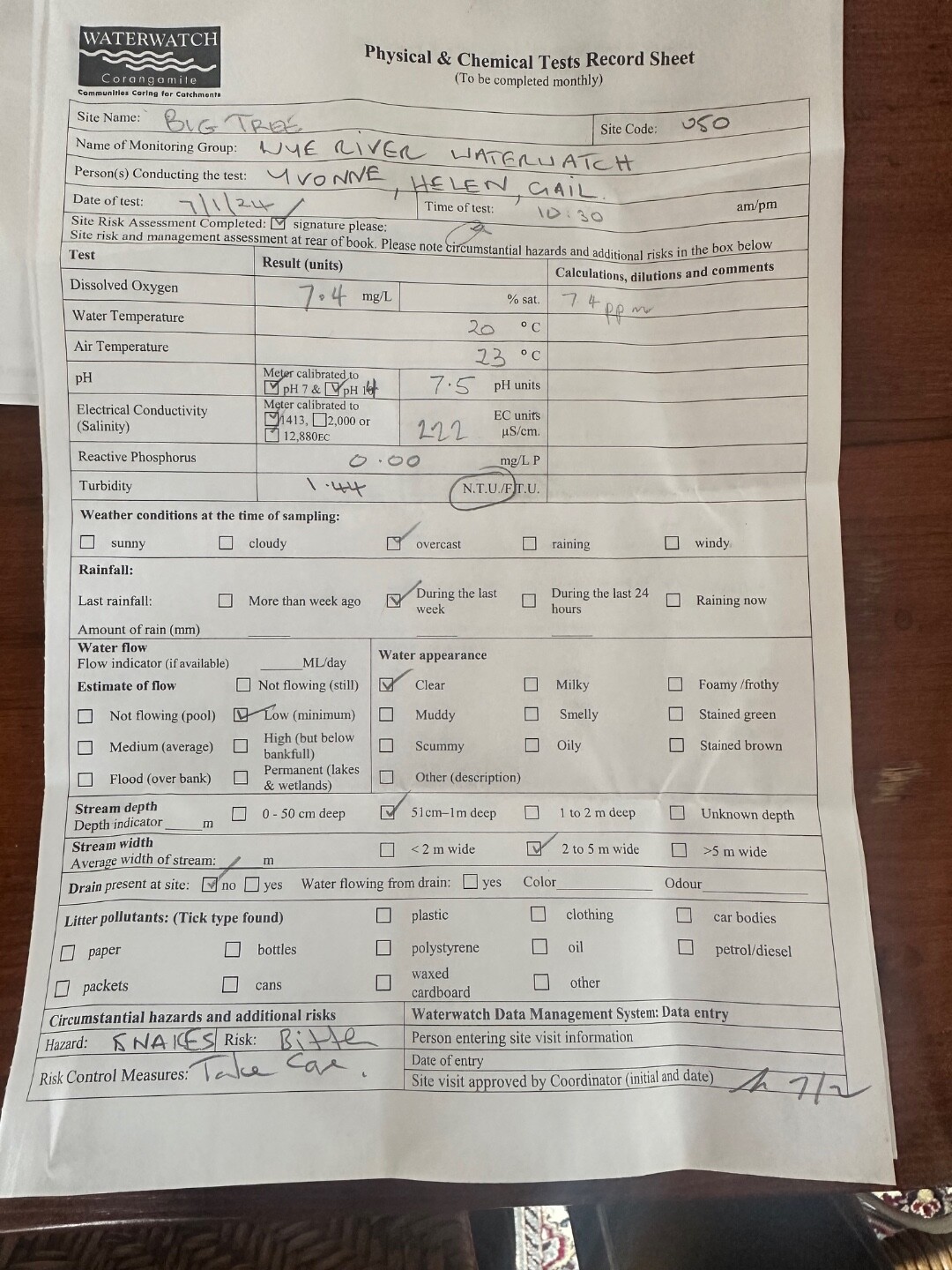
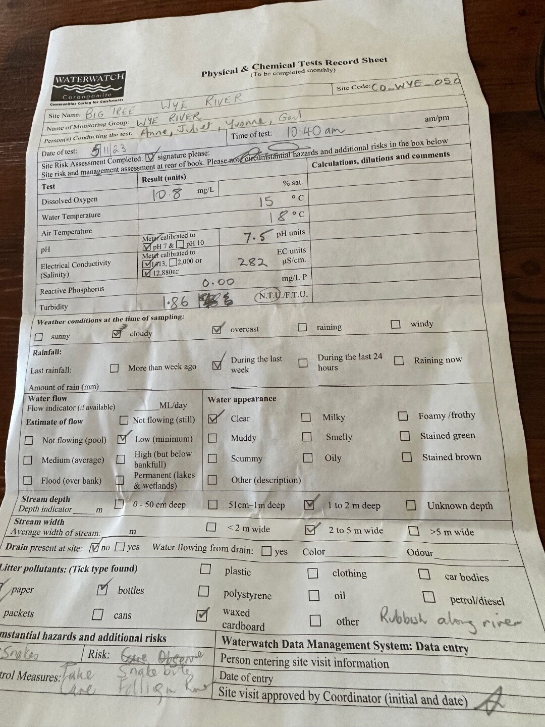
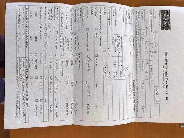
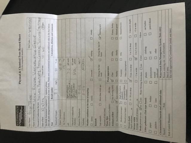
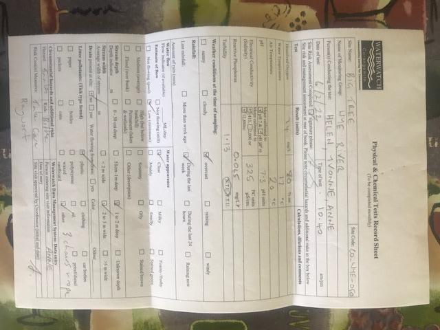
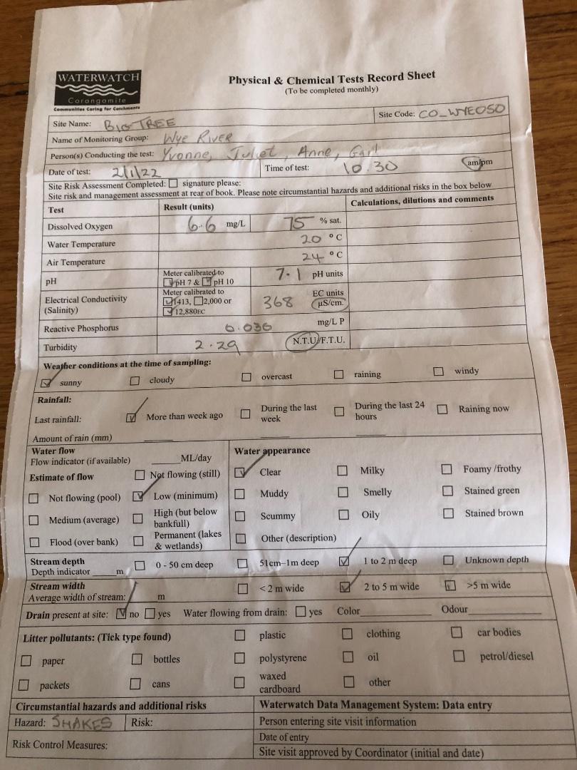
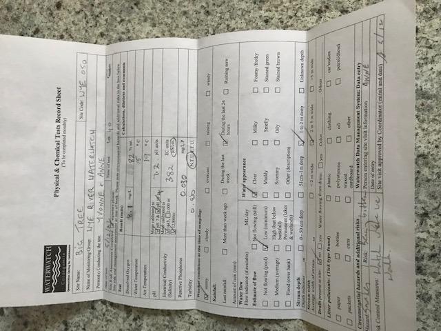
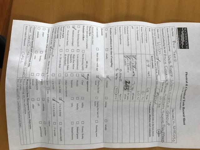
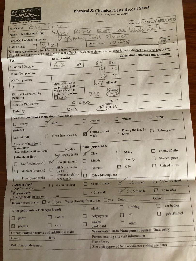
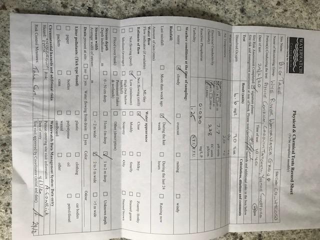
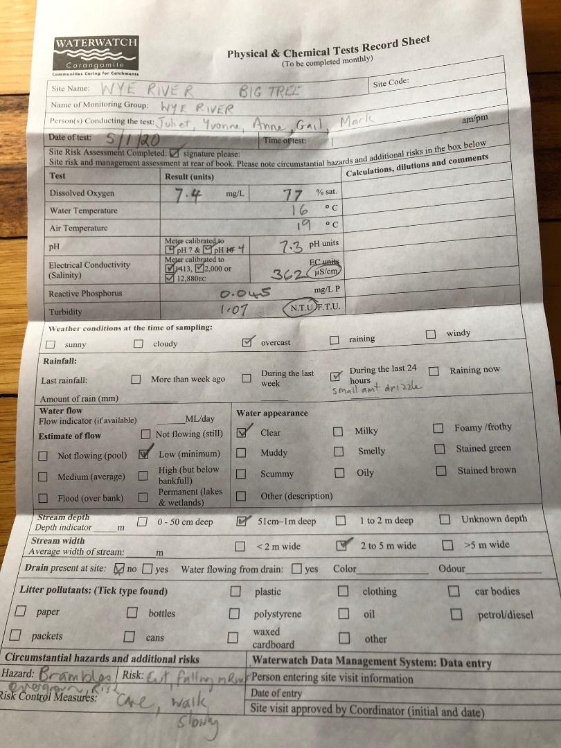
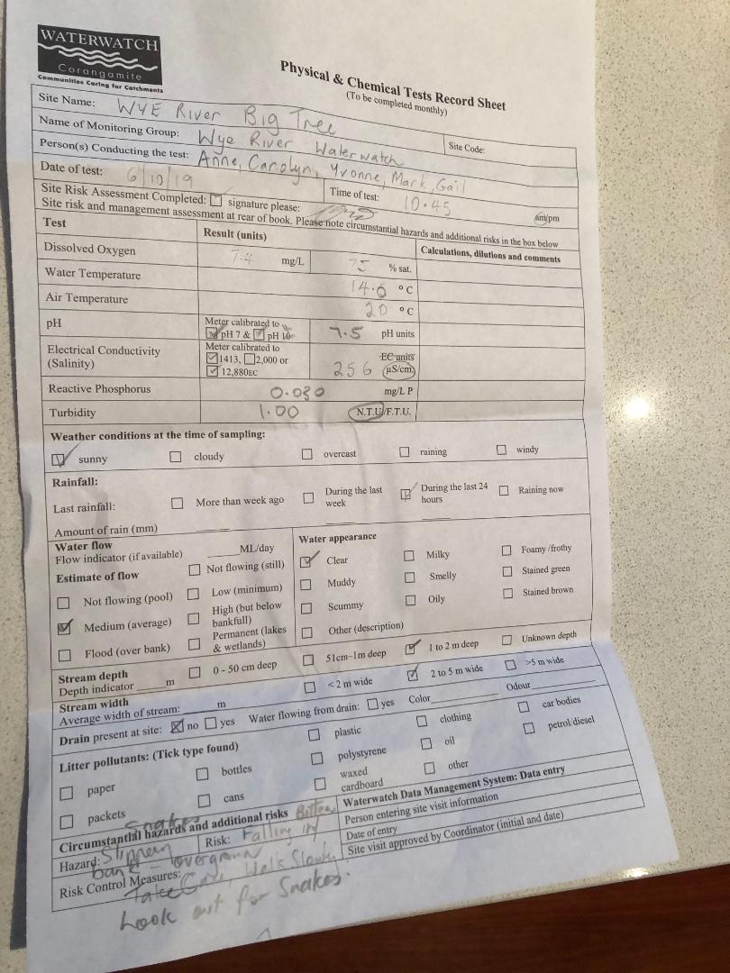
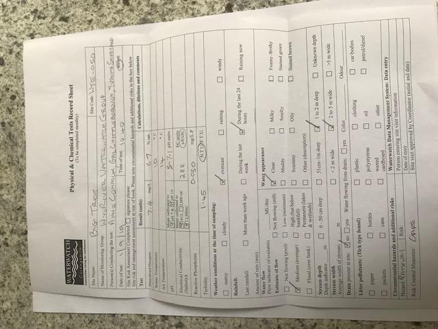
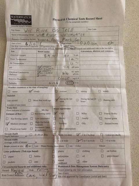
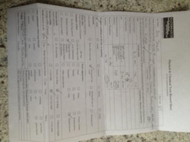
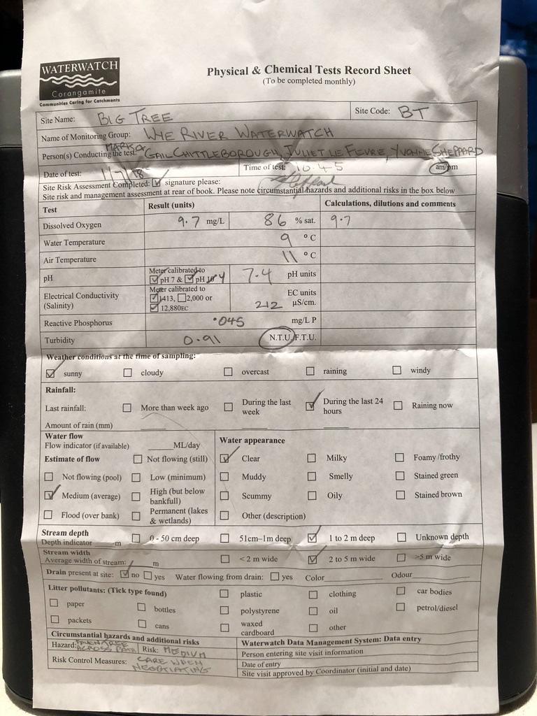
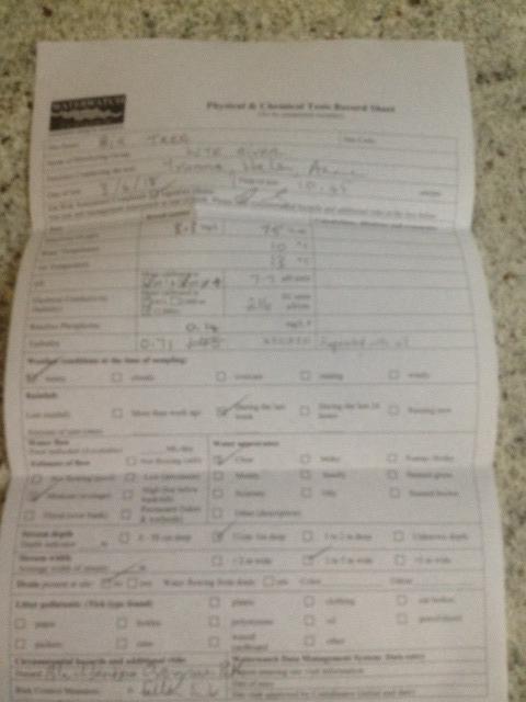
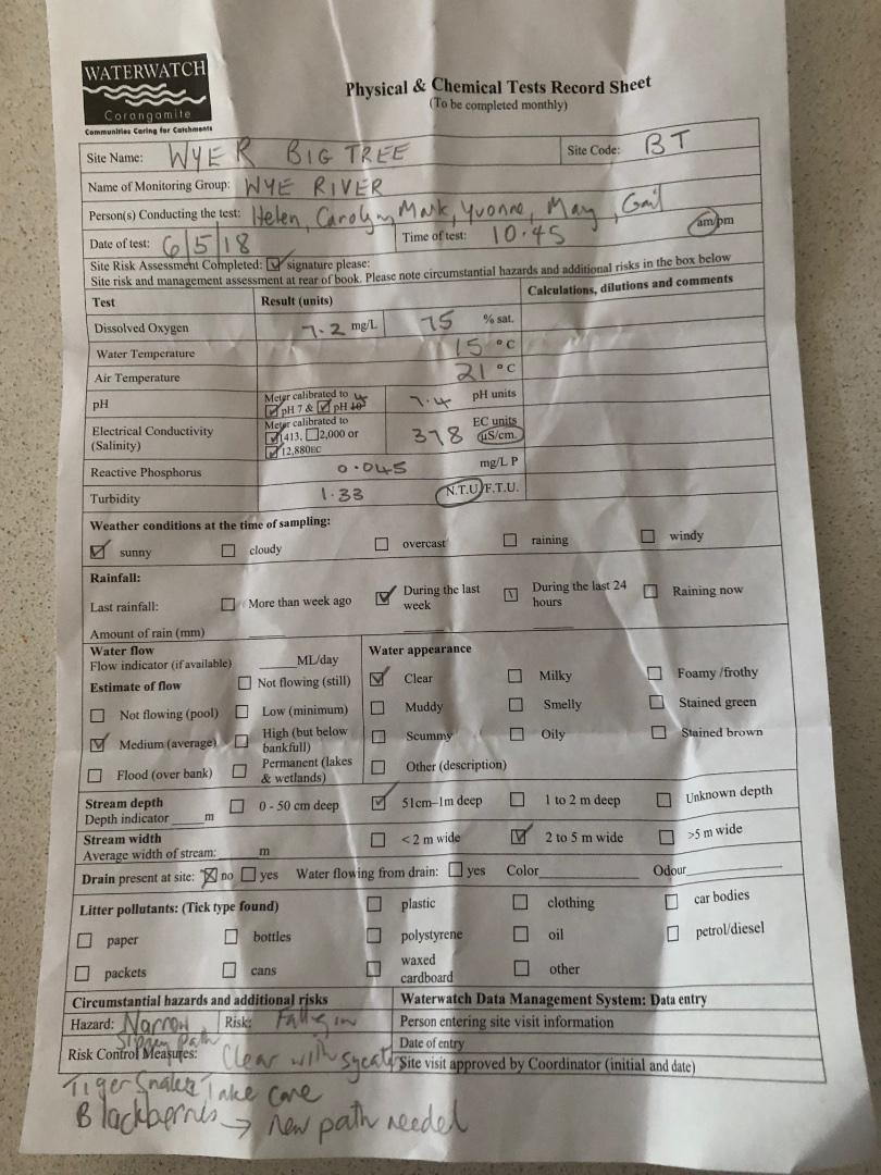
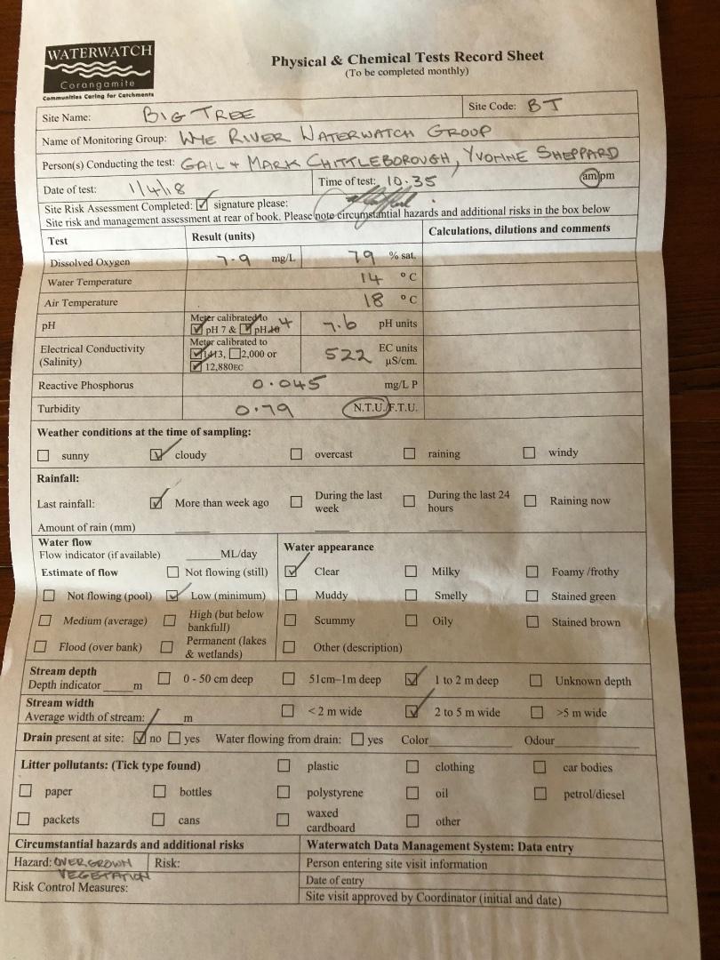
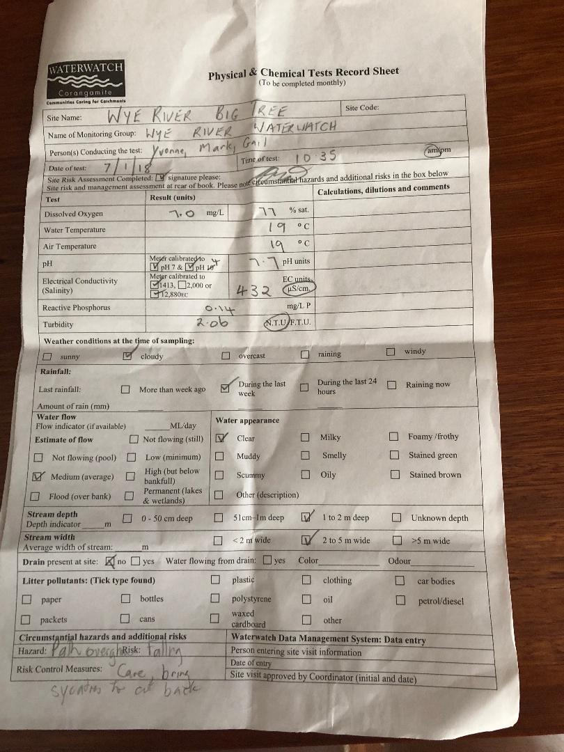
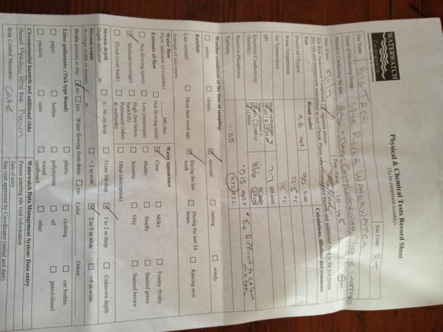
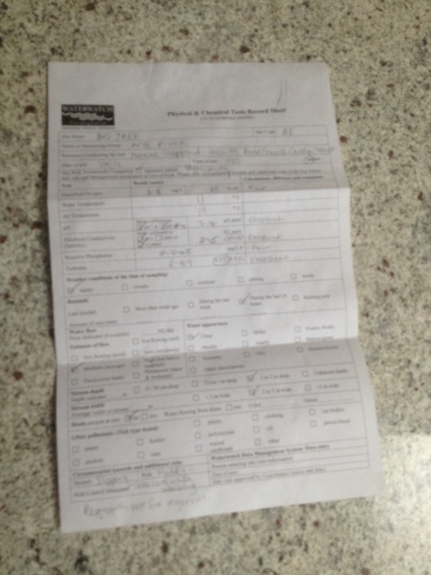
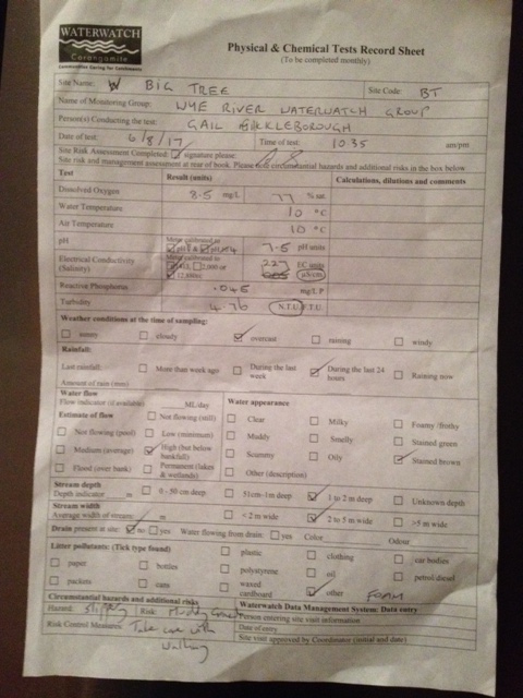
| Date | D.O. % | D.O mg/L | EC µS/cm | pH pH Units | rP mg/L P | Air ° C | Water ° C | Turb NTU |
|---|---|---|---|---|---|---|---|---|
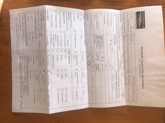
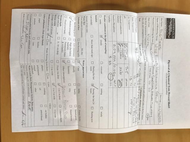
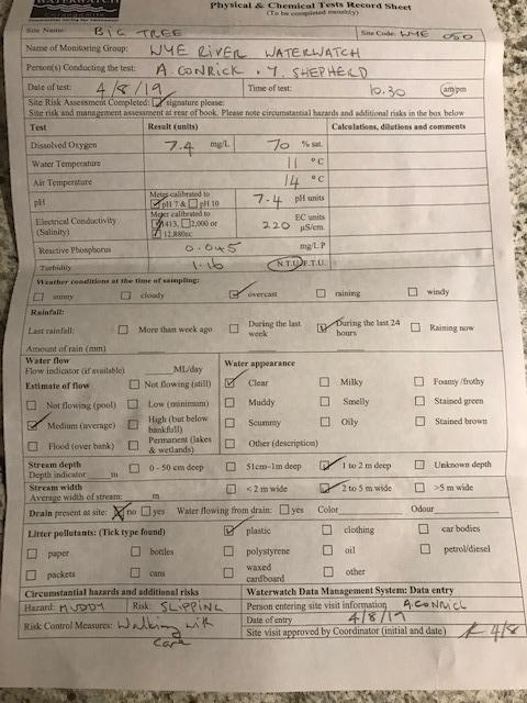
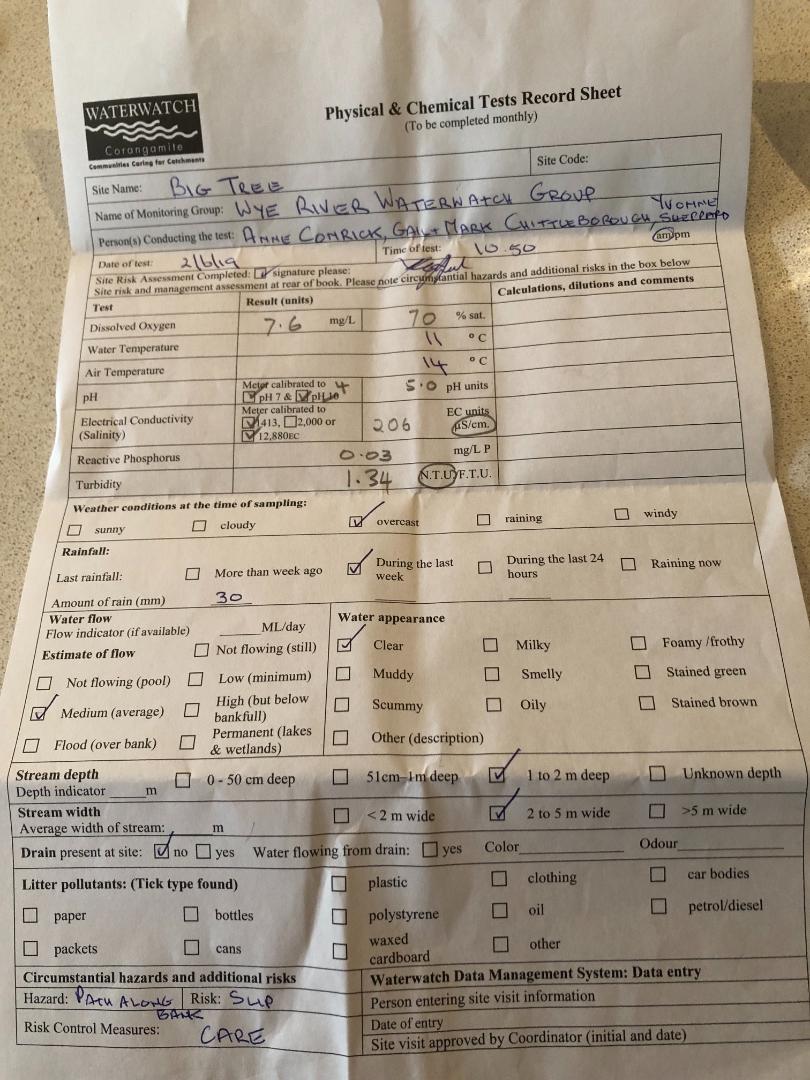
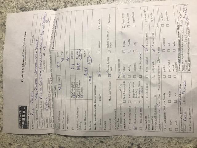
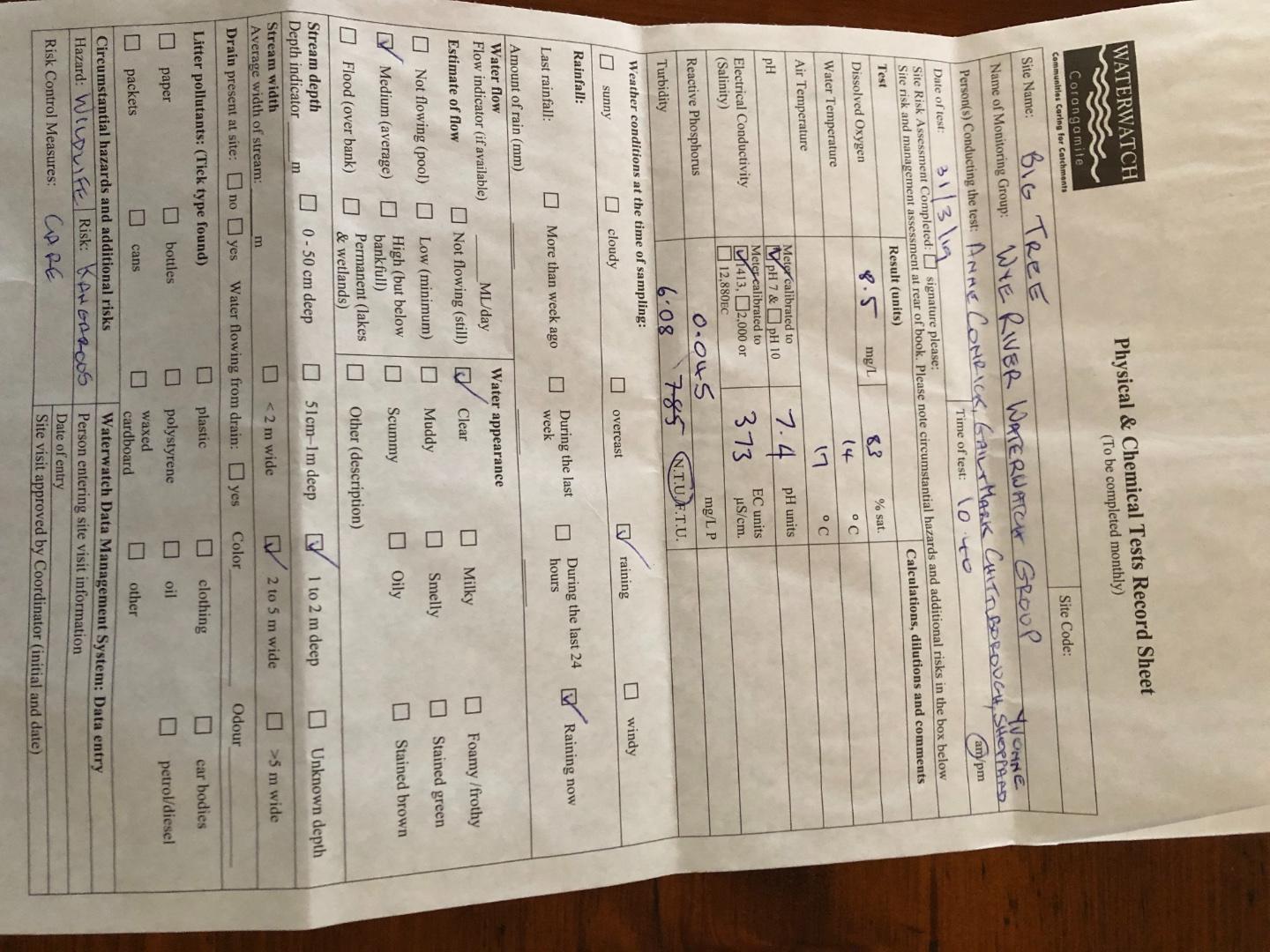
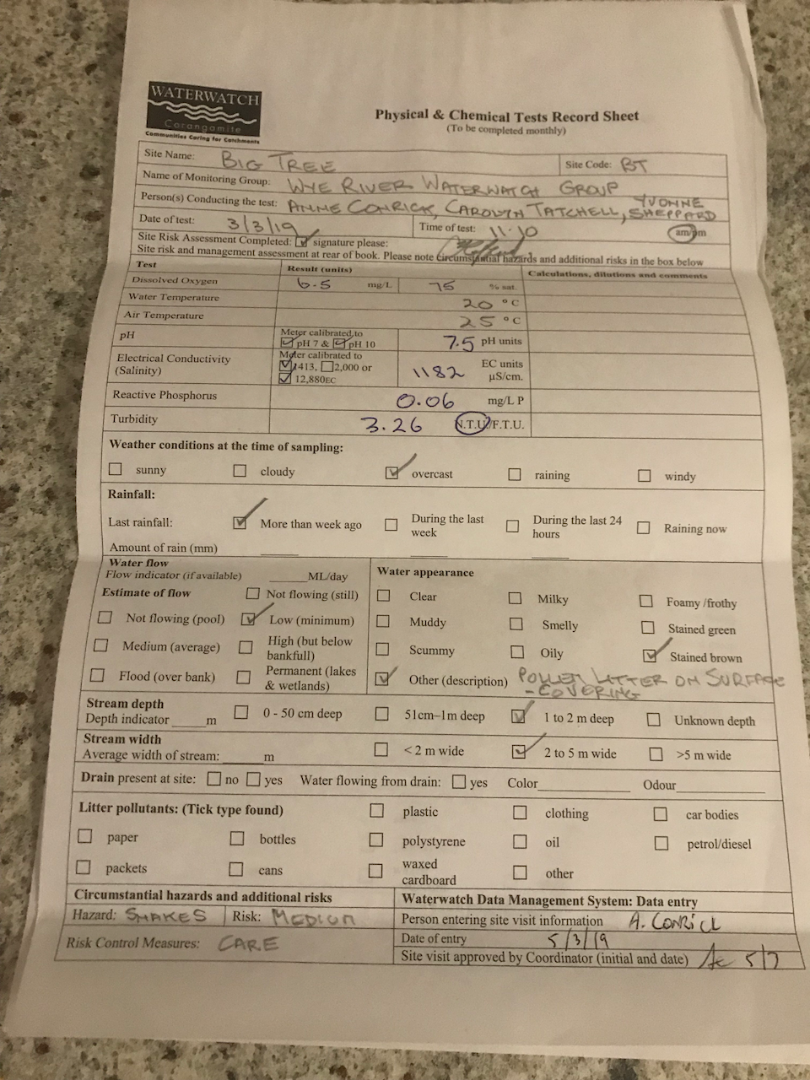
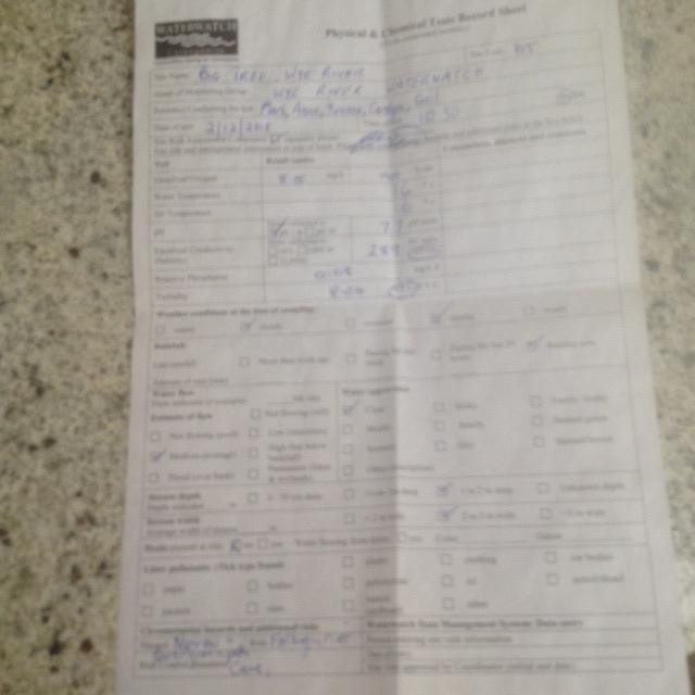
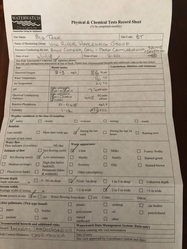
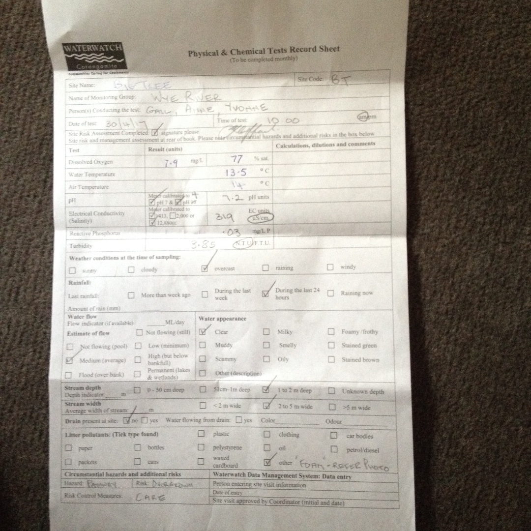
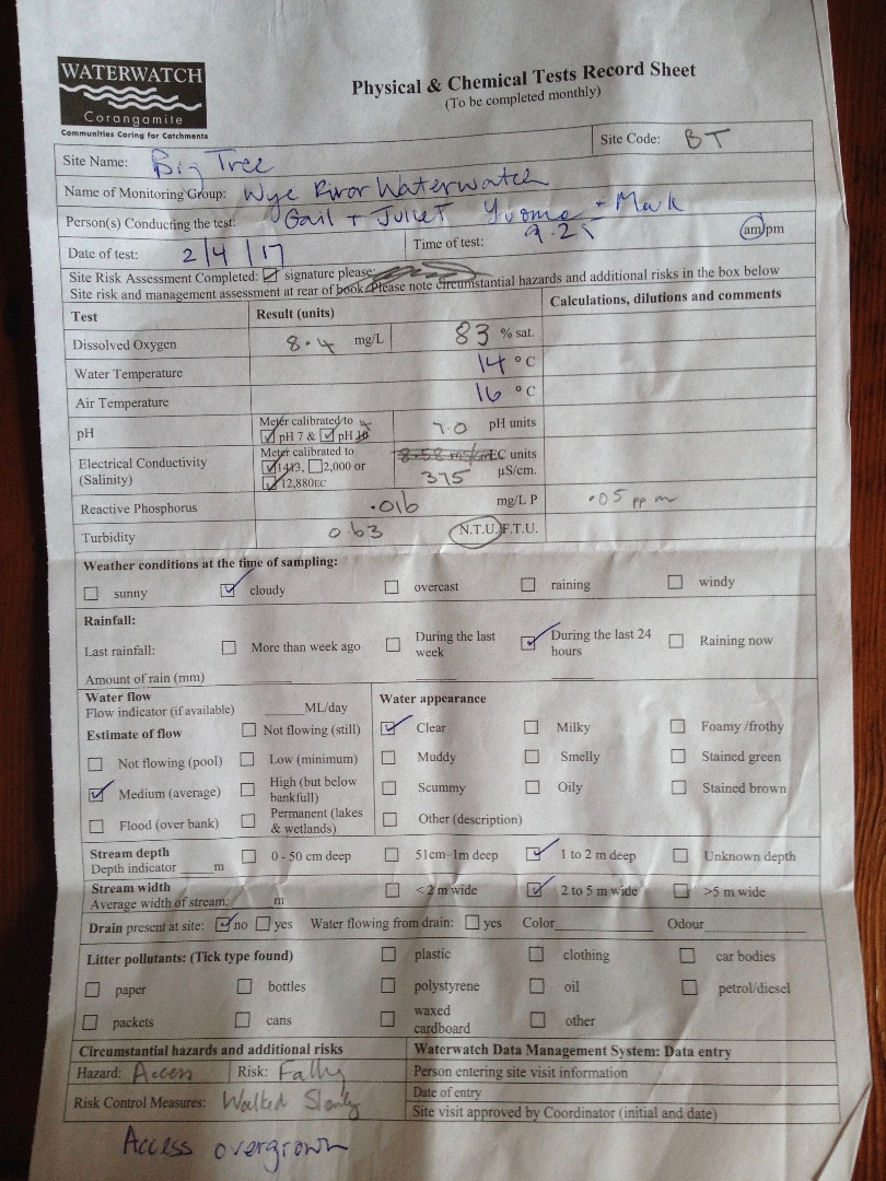
| 01-05-2022 | 79.63 | 8.2 | 263 | 7.5 | 0.045 | 18 | 14 | 1.46 |
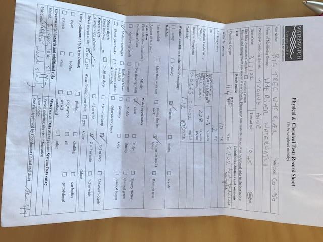
| 05-06-2022 | 91.31 | 10.3 | 226 | 7.5 | 0.03 | 13 | 10 | 5.33 |
| 03-07-2022 | 101.07 | 11.4 | 228 | 7.1 | 0.02 | 12 | 10 | 1.12 |
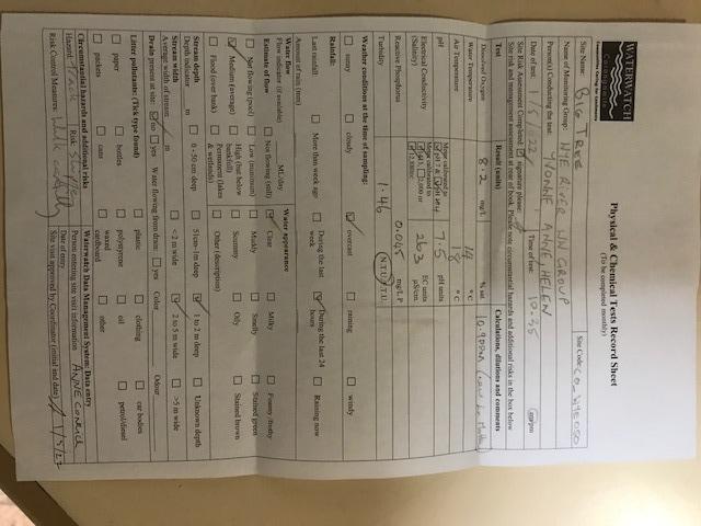
| 07-08-2022 | 73.56 | 8.2 | 254 | 7.3 | 0.003 | 13 | 10.5 | 1.79 |
| 04-09-2022 | 85.32 | 9.4 | 270 | 7 | 0.032 | 15 | 11 | 3.28 |
| 02-10-2022 | 95.3 | 10.5 | 272 | 7 | 0.02 | 18 | 11 | 2.98 |
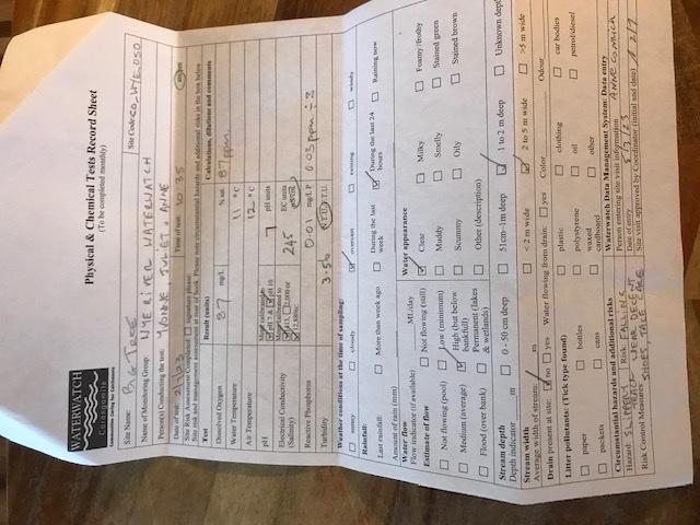
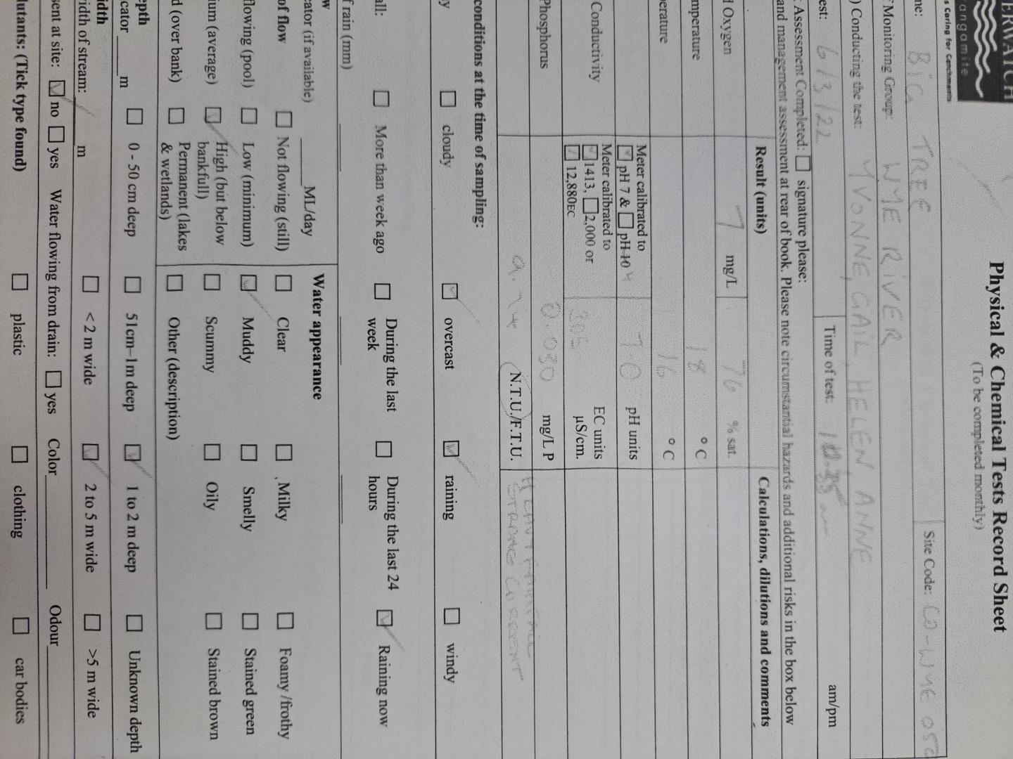
| 06-11-2022 | 91.2 | 9.6 | 309 | 7.1 | 0.027 | 18 | 13 | 3.82 |
| 04-12-2022 | 82.13 | 8.1 | 253 | 7 | 0.036 | 22 | 16 | 1.34 |
| 01-01-2023 | 85.26 | 7.9 | 386 | 7.1 | 0 | 21.5 | 19 | 3.07 |
| 13-01-2023 | 81 | 7.1 | 20.5 | |||||
| 05-02-2023 | 80.4 | 8.1 | 291 | 7.4 | 0.06 | 18 | 15 | 1.45 |
| 05-03-2023 | 86.22 | 8.5 | 385 | 7.3 | 0.07 | 21 | 16 | 1.12 |
| 02-04-2023 | 97.2 | 10 | 558 | 6.8 | 0.02 | 16 | 14 | 0.58 |
| 07-05-2023 | 337 | 7.1 | 0.06 | 13.5 | 10 | 4.66 | ||
| 04-06-2023 | 75.22 | 8.1 | 240 | 6.9 | 0.04 | 14 | 12 | 0.68 |
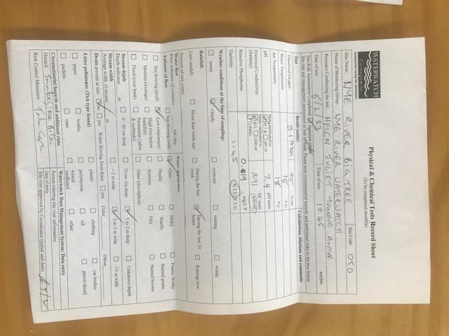
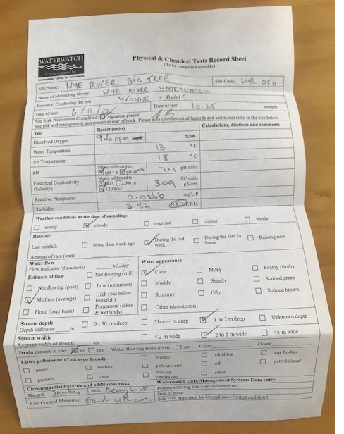
| 02-07-2023 | 78.96 | 8.7 | 245 | 7 | 0.01 | 12 | 11 | 3.56 |
| 05-08-2023 | 0 | 212 | 6.8 | 0 | 14 | 11 | 0.81 | |
| 03-09-2023 | 94.86 | 10.7 | 238 | 7.6 | 0 | 15 | 10 | 0.77 |
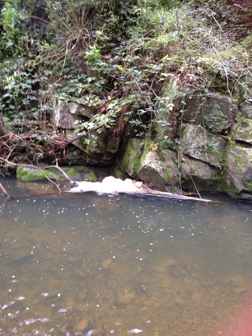
| 01-10-2023 | 88.35 | 8.9 | 317 | 7.1 | 0.1 | 17 | 15 | 1.4 |
| 05-11-2023 | 107.19 | 10.8 | 282 | 7.5 | 0 | 18 | 15 | 1.86 |
| 03-12-2023 | 90.3 | 9.1 | 216 | 7.2 | 0.016 | 20 | 15 | 7.85 |


All content, files, data and images provided by the Waterwatch Data Portal and Gallery are subject to a Creative Commons Attribution License
Content is made available to be used in any way, and should always attribute Waterwatch and www.vic.waterwatch.org.au
.png)