Waterwatch Data Portal
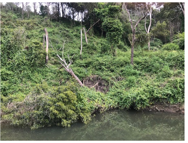
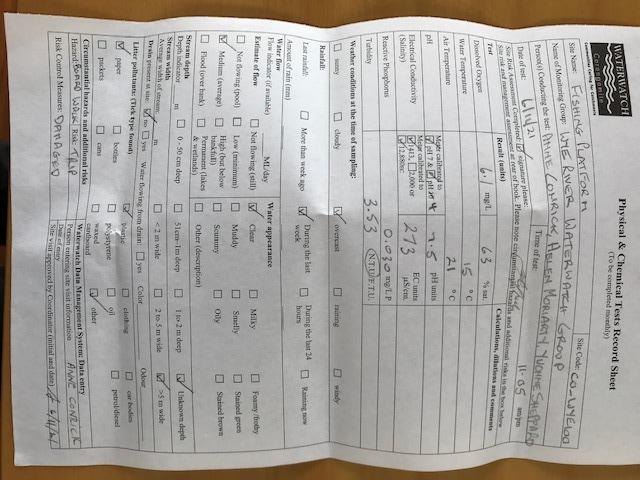
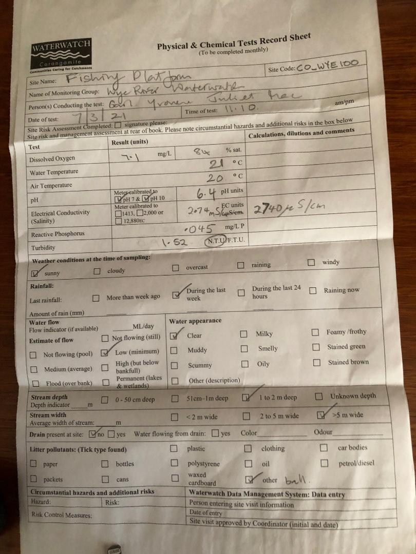
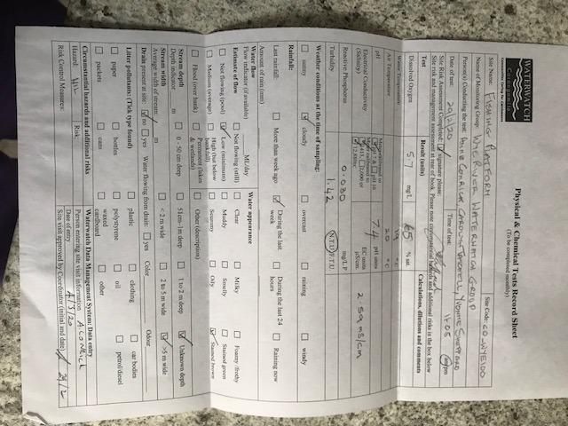
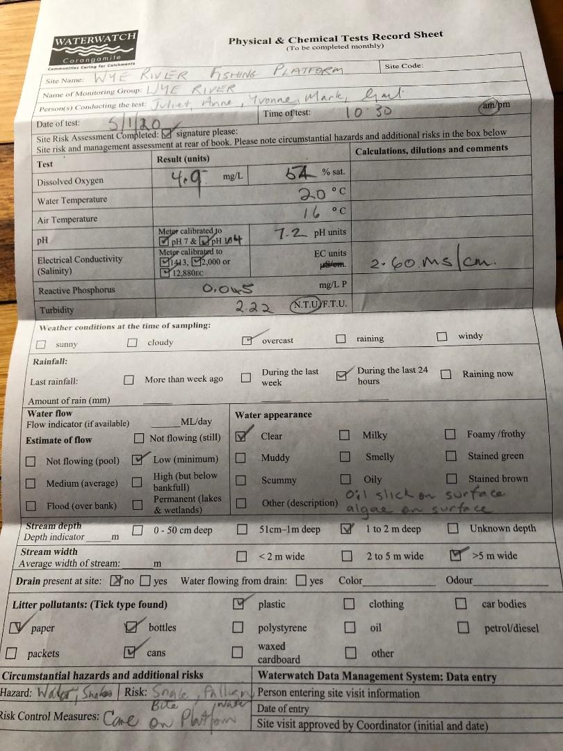
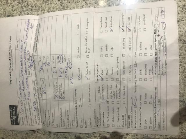
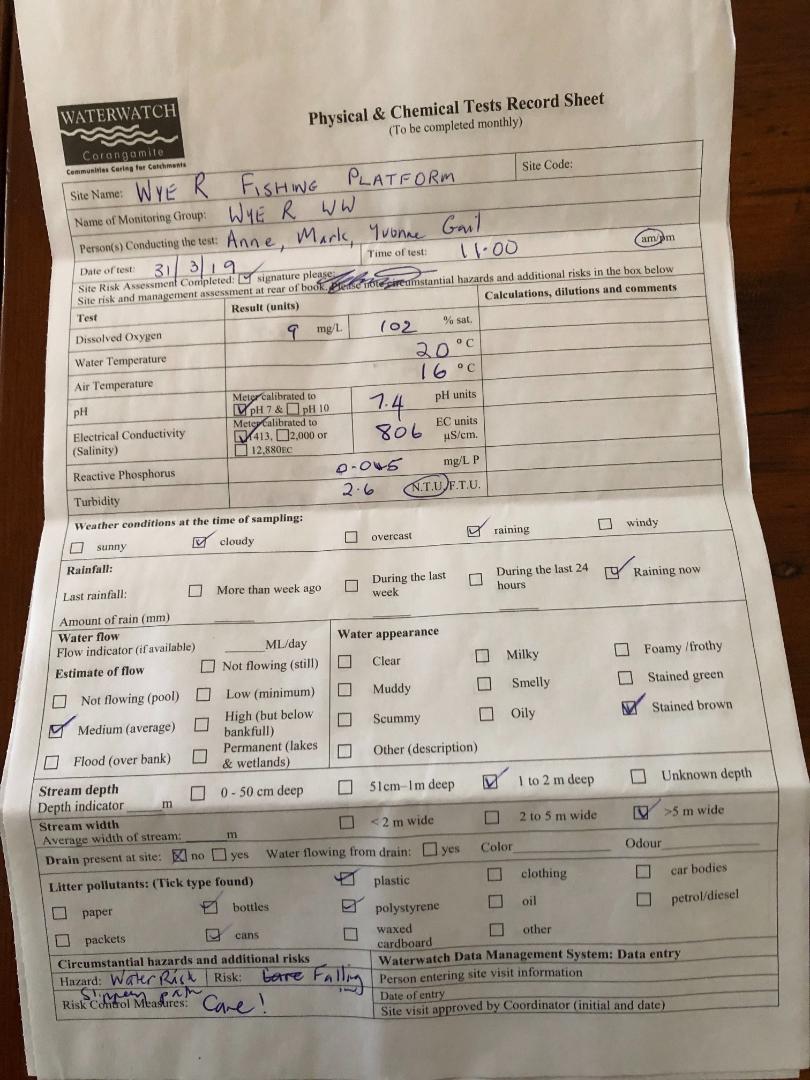
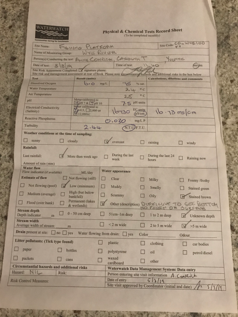
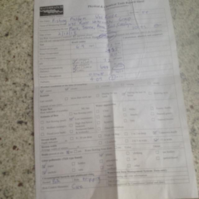
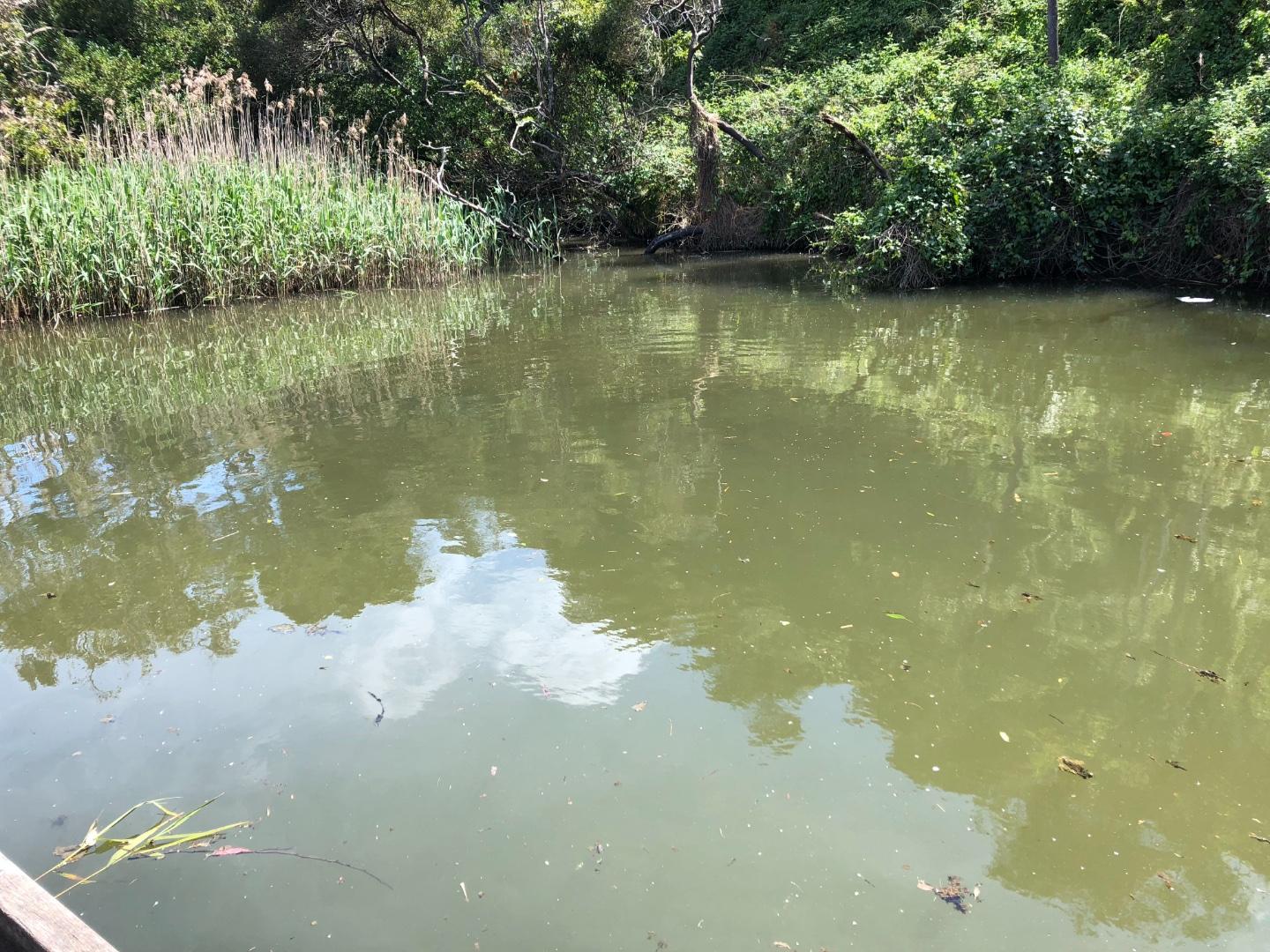
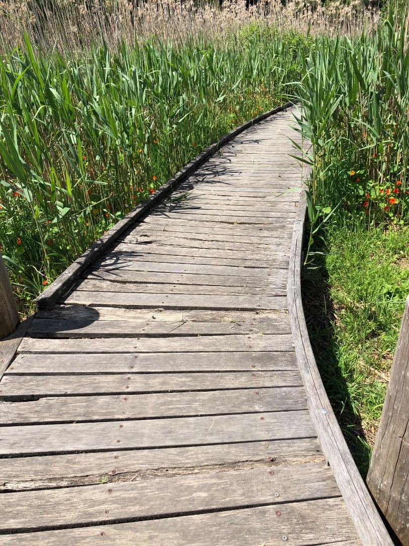
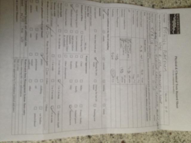
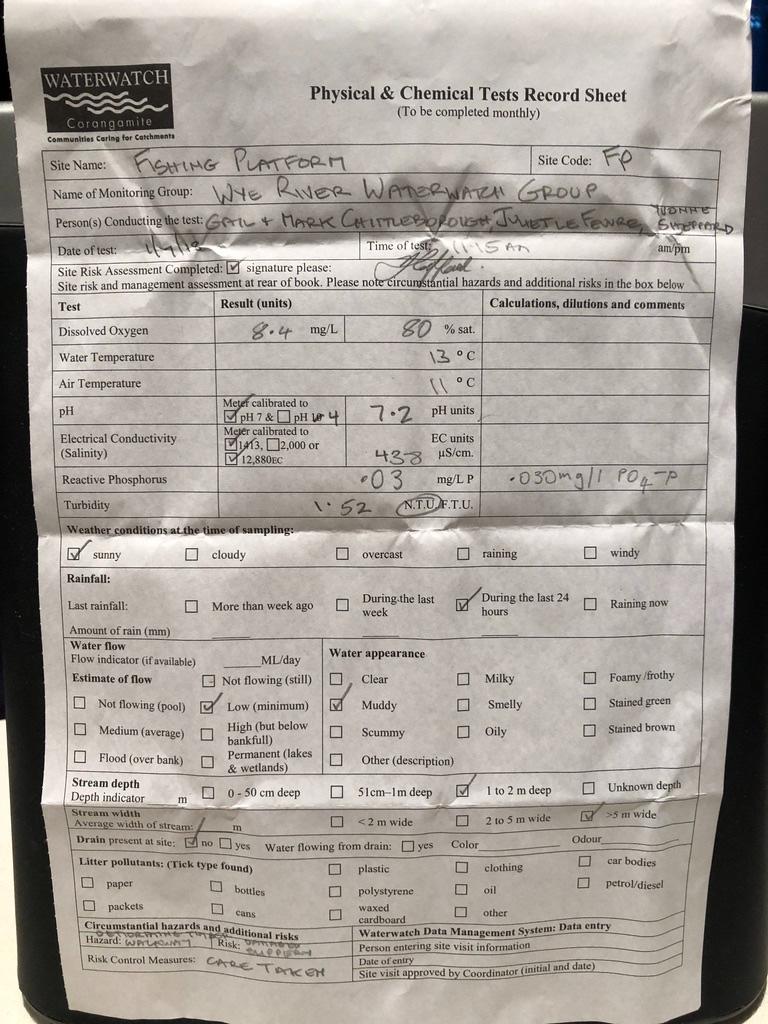
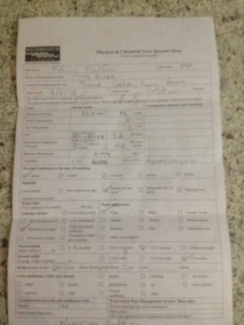
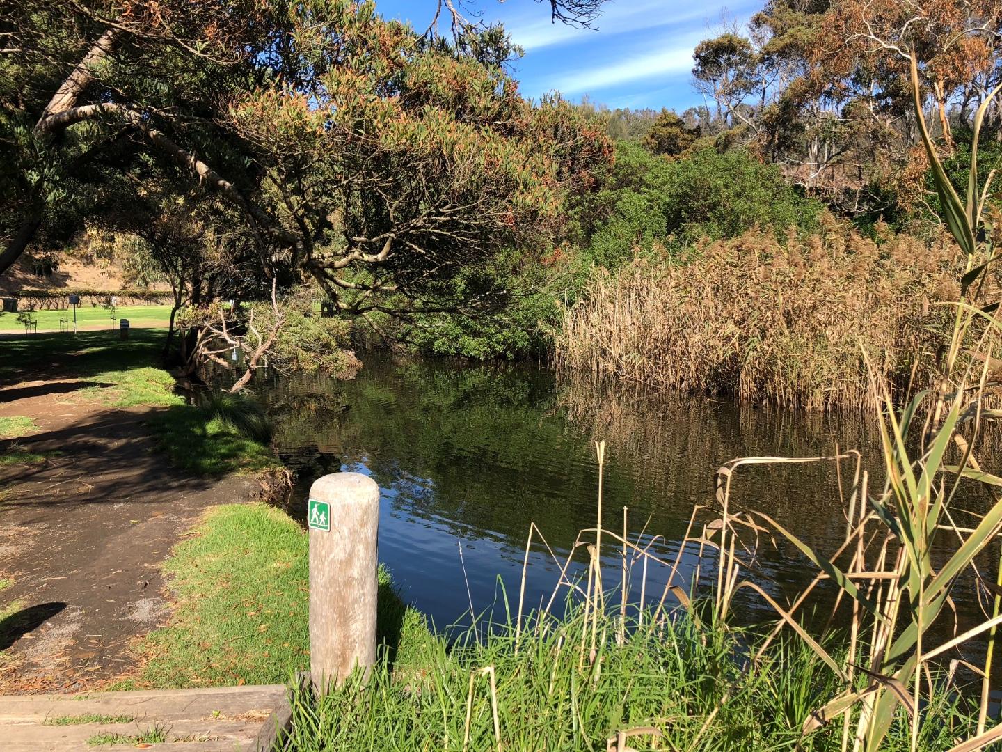
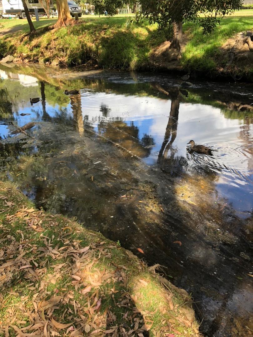
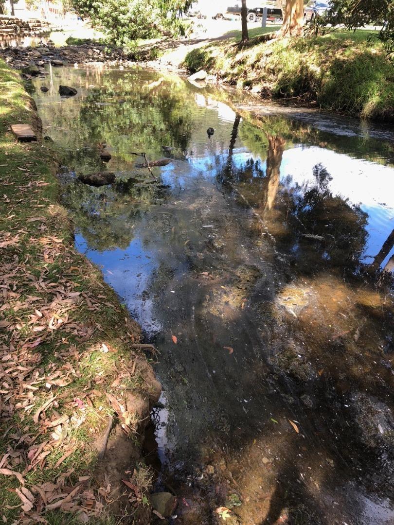
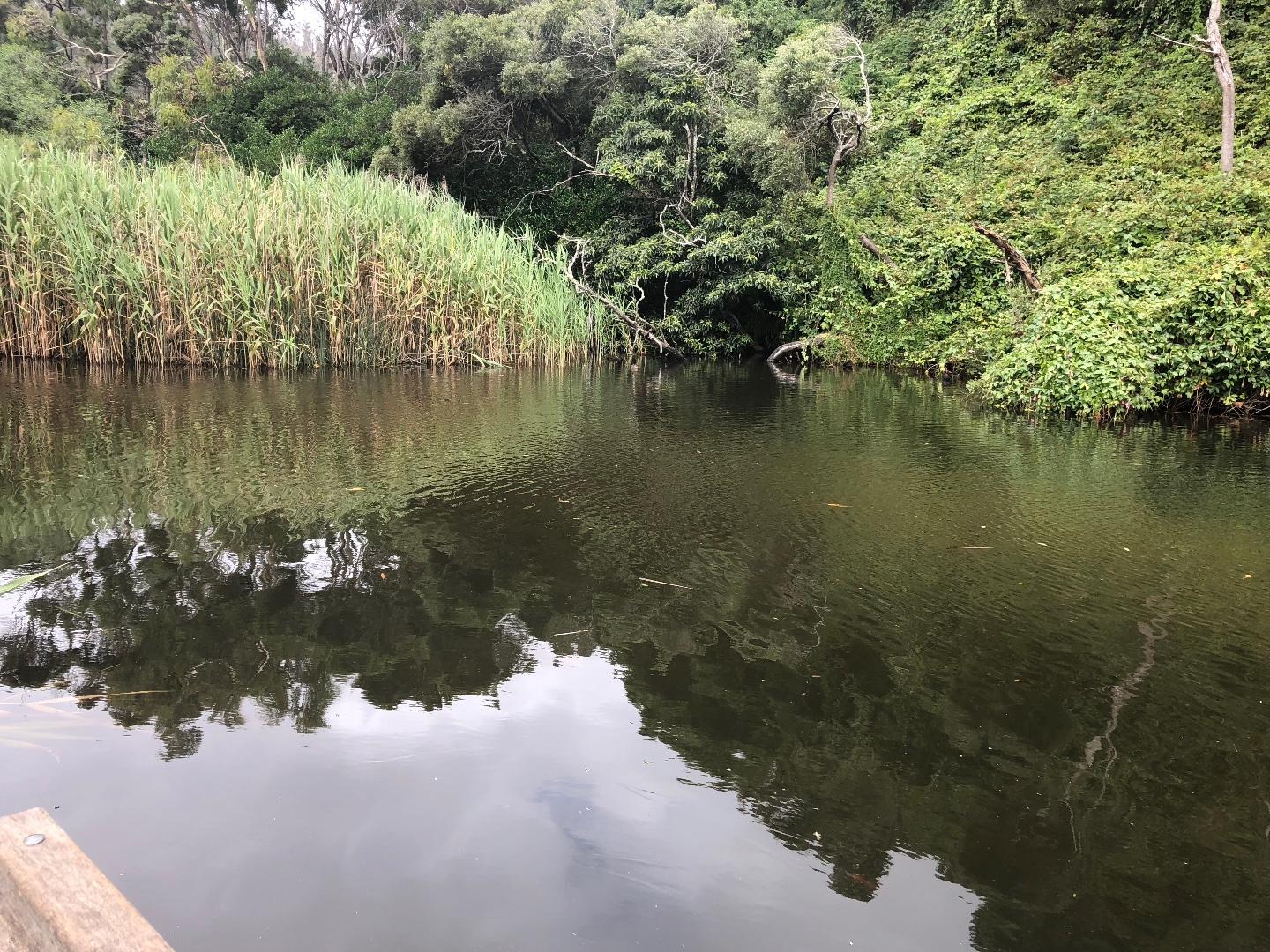
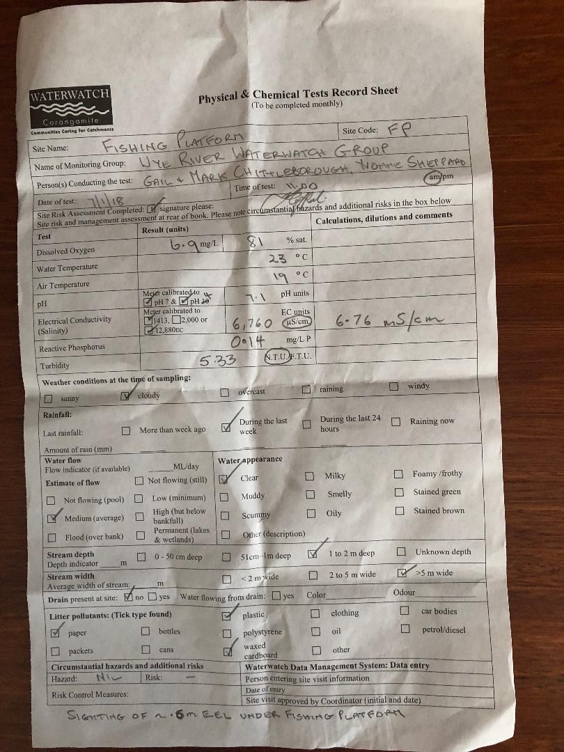
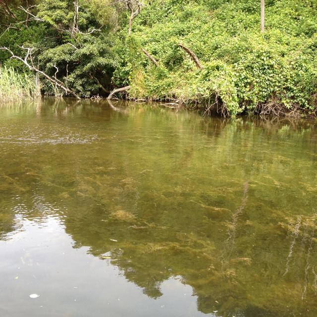
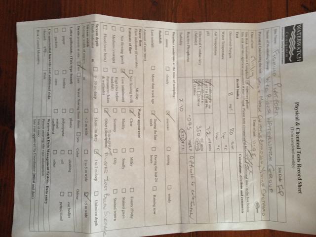
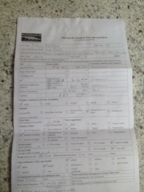
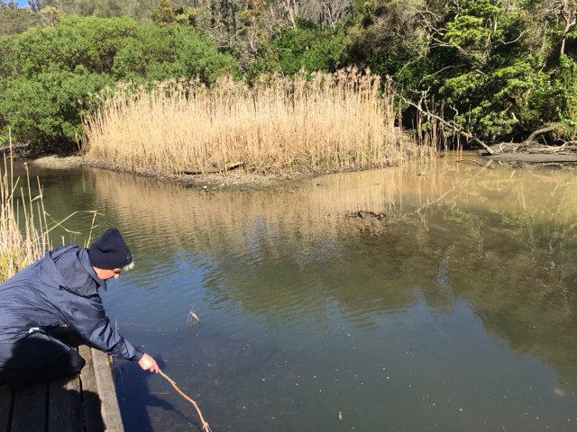
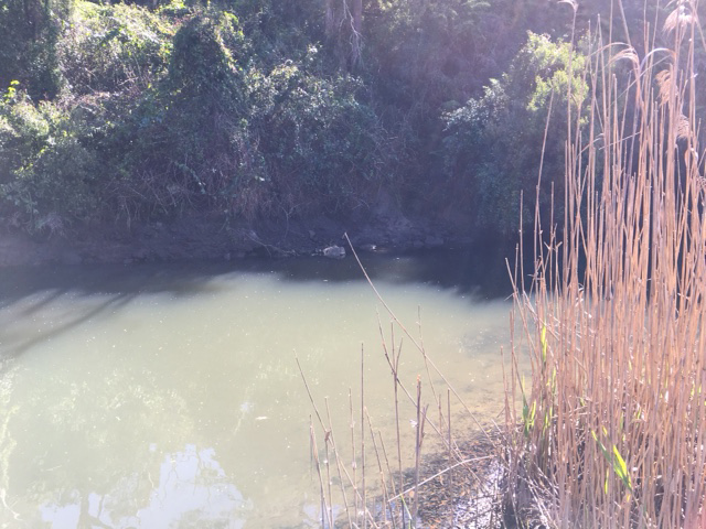
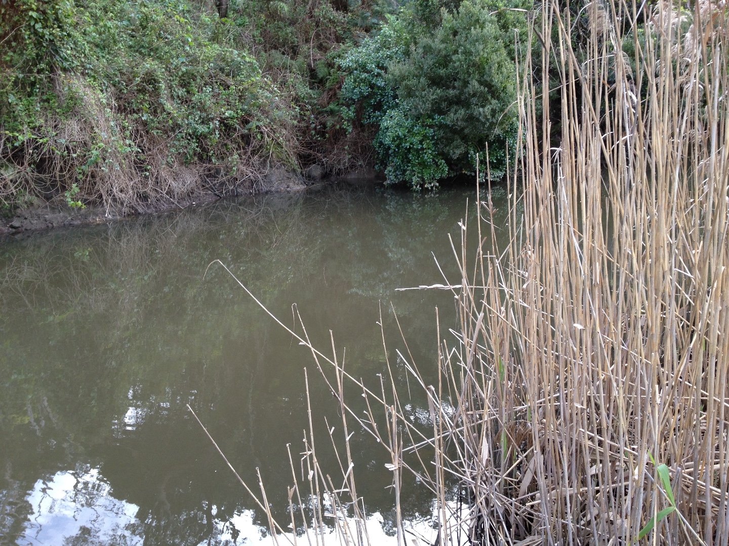
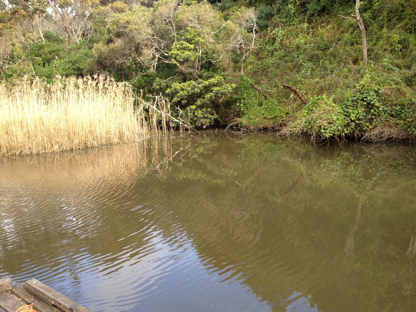
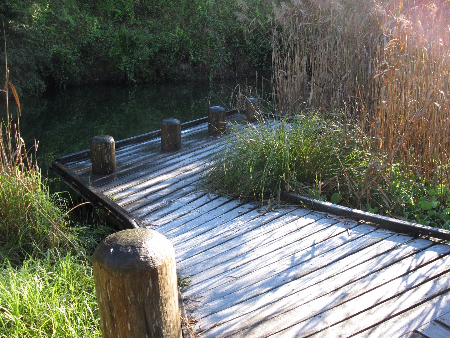
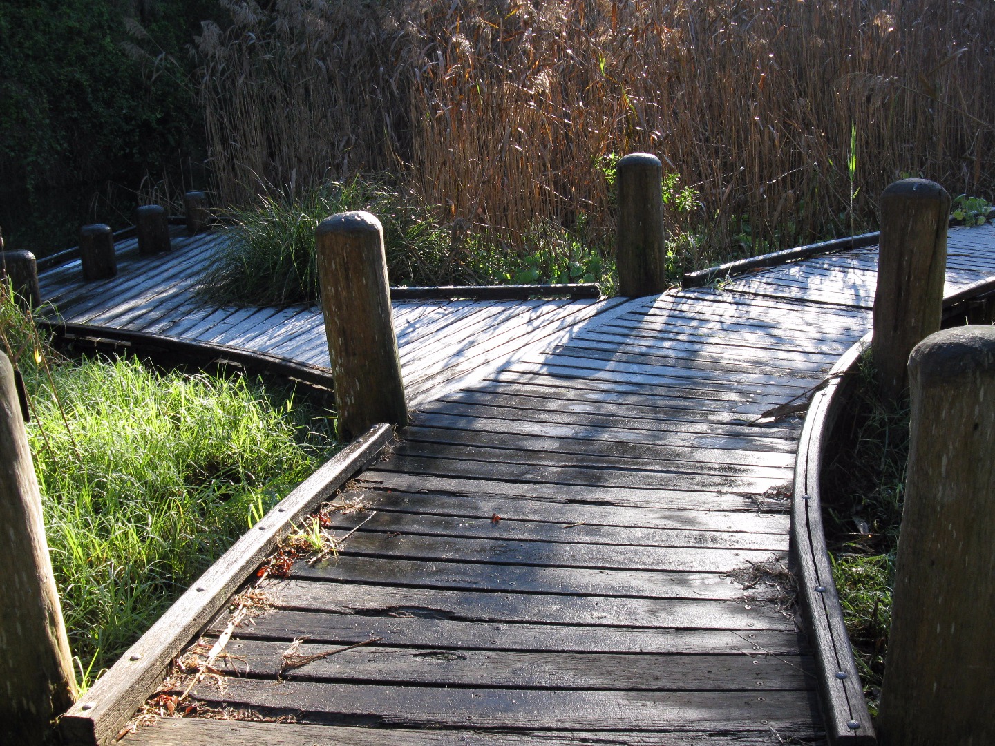
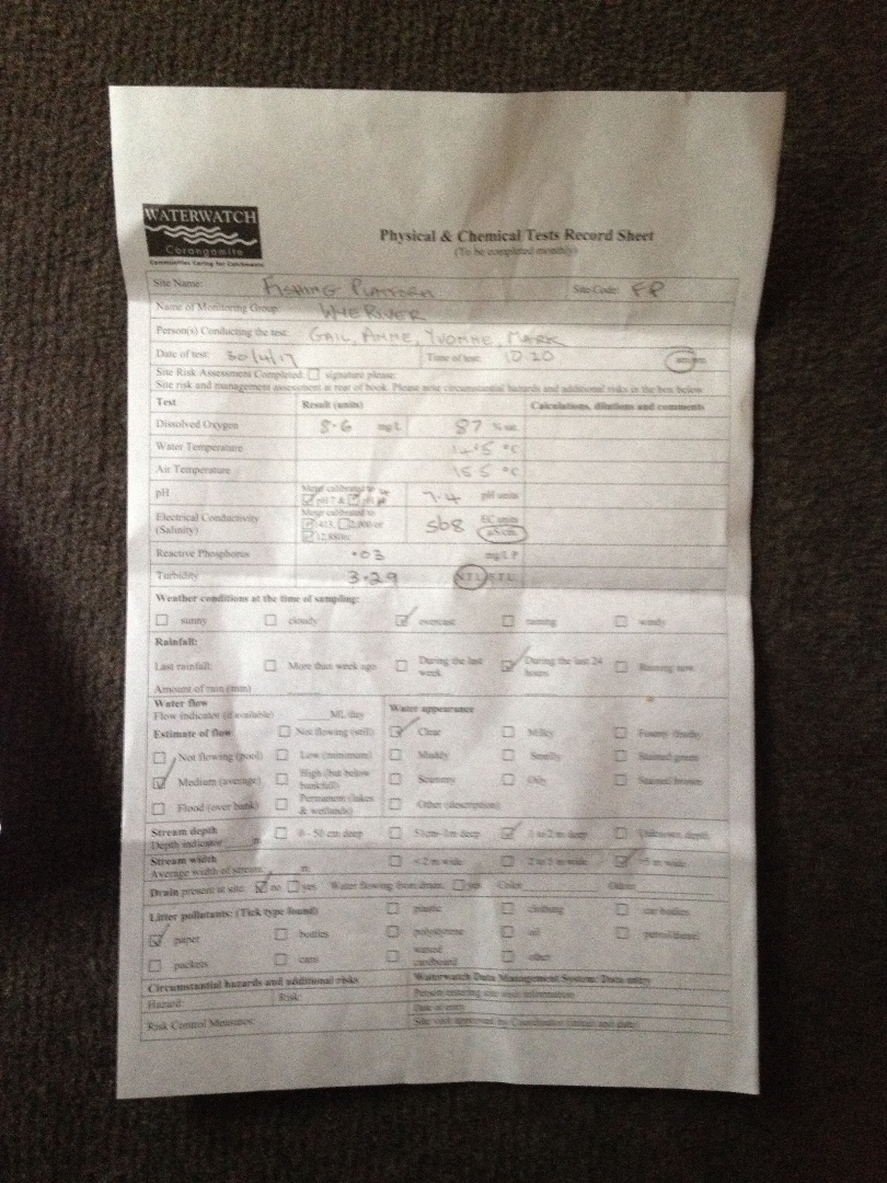
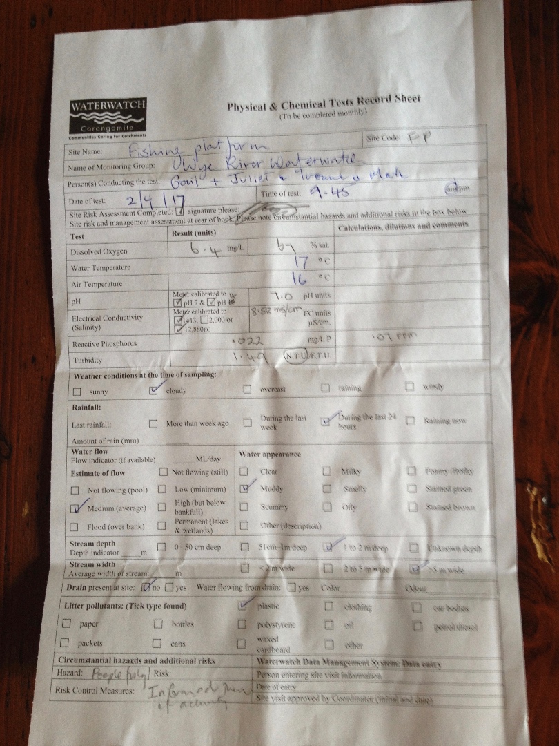
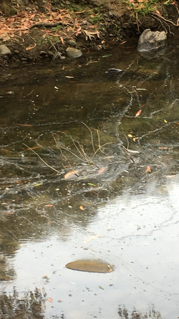
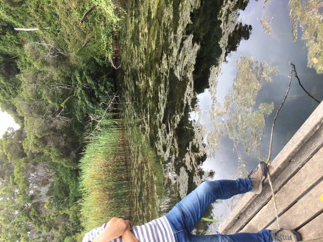
CO_WYE100 Wye River, fishing platform above playground
Site details
Overview
| Site code | CO_WYE100 |
|---|---|
| Site name | Wye River, fishing platform above playground |
| Status | Active |
| Water Authority | Corangamite |
| Basin | Otway Coast |
| Catchment | Otway Coast |
| Sub catchment | |
| Reach | 35_46 Wye River |
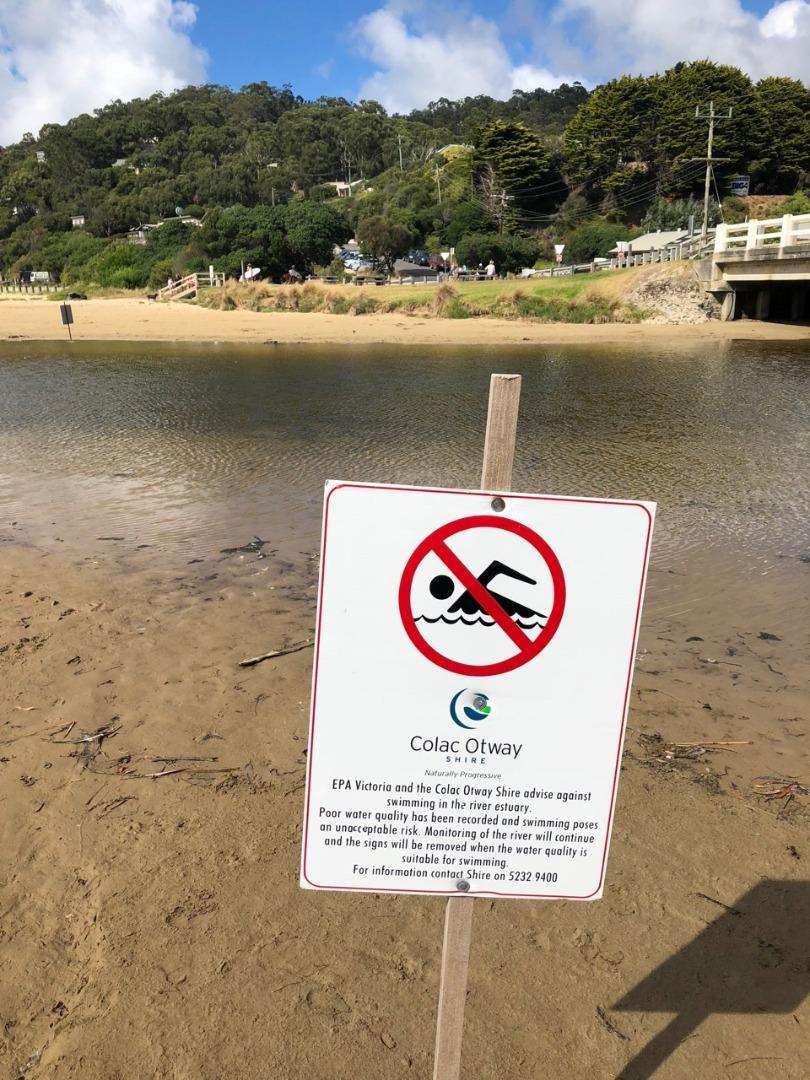
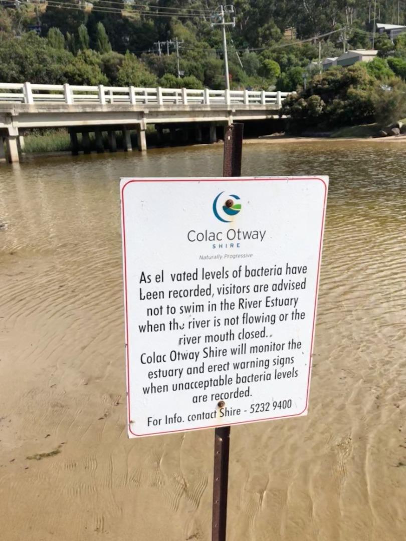
| Water type | River |
| Council | Colac Otway Shire Council |
| History | View all 112 site visits 07-09-2014 - 07-04-2024 |
| Monitoring organisations |
Site visits
 Loading chart
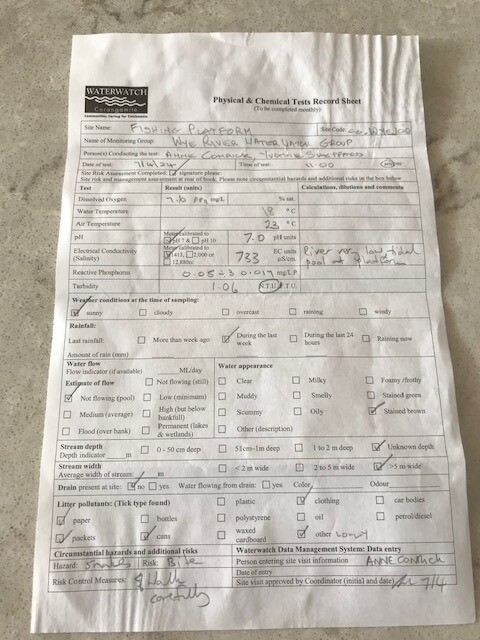
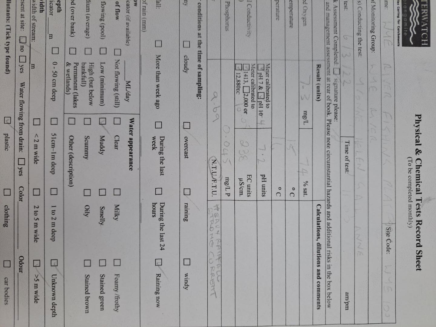
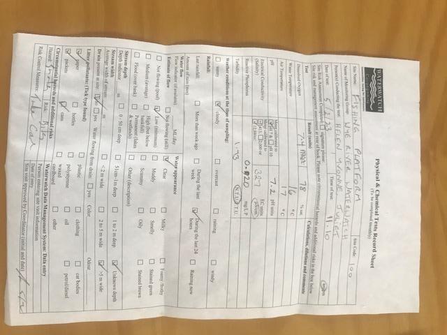
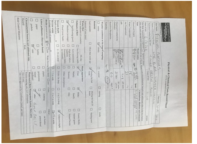
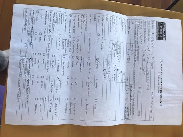
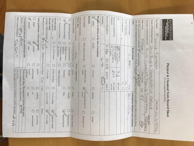
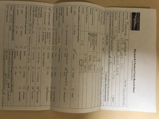
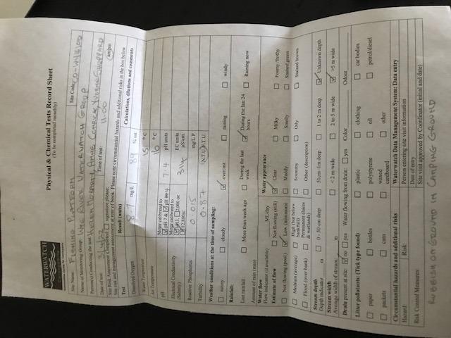
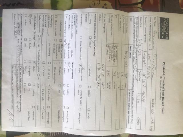
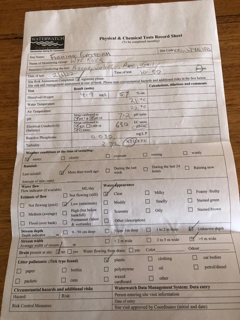
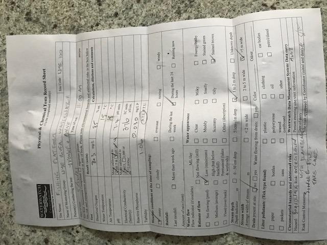
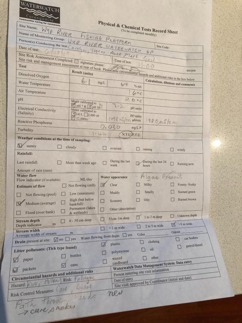
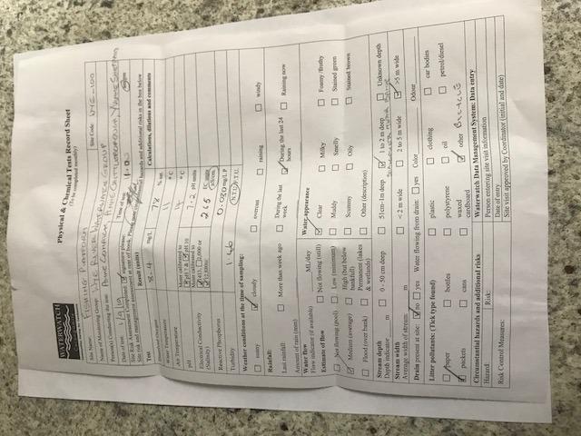
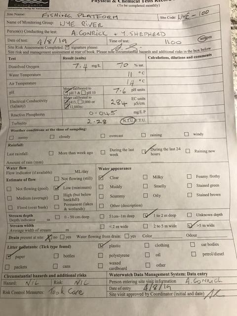
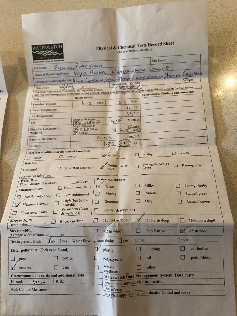
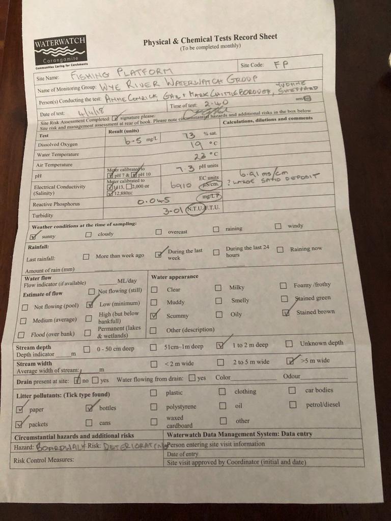
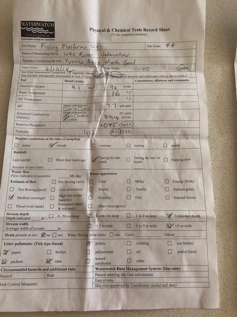
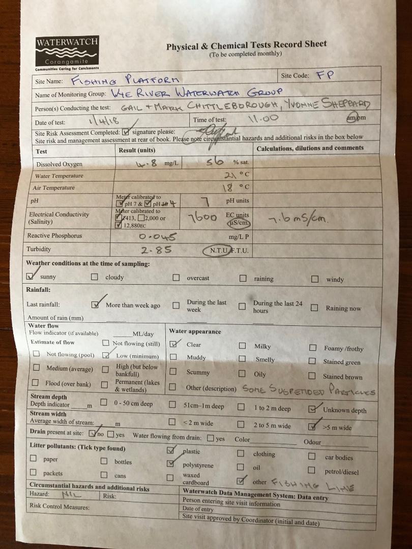
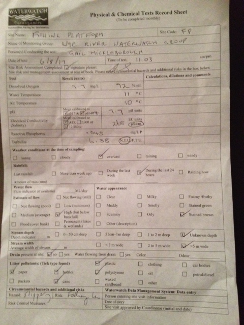
| Date | D.O. % | D.O mg/L | EC µS/cm | pH pH Units | rP mg/L P | Air ° C | Water ° C | Turb NTU |
|---|---|---|---|---|---|---|---|---|
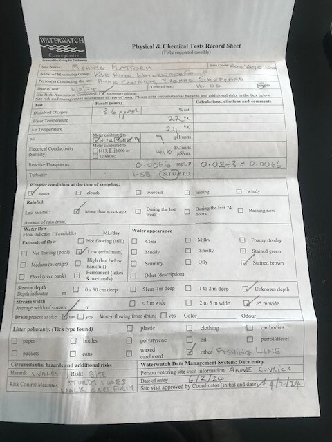
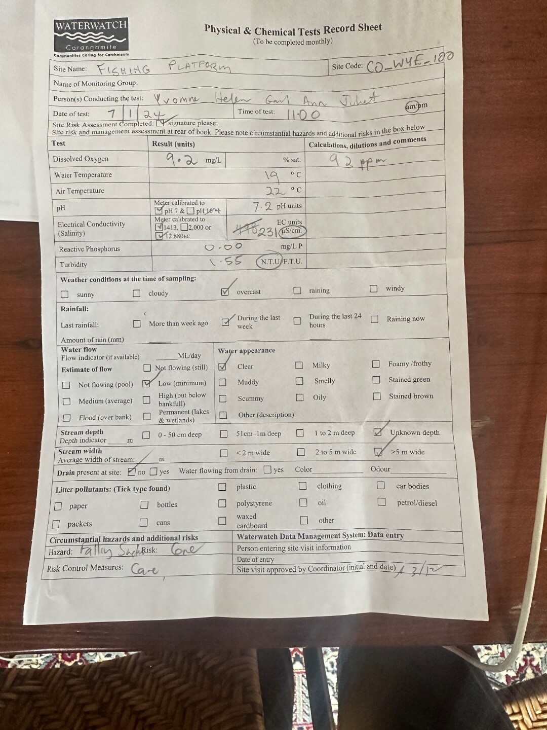
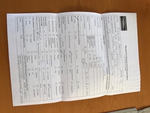
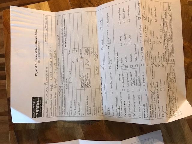
| 01-05-2022 | 101.01 | 10.4 | 306 | 7.2 | 0.03 | 18 | 14 | 1.5 |
| 05-06-2022 | 98.41 | 11.1 | 210 | 7.2 | 0.03 | 11 | 10 | 4.76 |
| 03-07-2022 | 108.16 | 12.2 | 240 | 7.2 | 0.017 | 14 | 10 | 1.51 |
| 07-08-2022 | 86.12 | 9.6 | 252 | 7.5 | 0.007 | 14 | 10.5 | 1.9 |
| 04-09-2022 | 100.32 | 10.8 | 330 | 7.4 | 0.008 | 13 | 12 | 3.6 |
| 02-10-2022 | 101.23 | 10.9 | 293 | 7.1 | 0.036 | 15 | 12 | 3.26 |
| 06-11-2022 | 93.3 | 9.4 | 270 | 7.1 | 0 | 21 | 15 | 4.19 |
| 04-12-2022 | 95.32 | 9.3 | 336 | 7.3 | 0.006 | 27 | 16.5 | 1.89 |
| 01-01-2023 | 86.35 | 8 | 418 | 6.9 | 0.007 | 23 | 19 | 2.22 |
| 05-02-2023 | 75.05 | 7.4 | 327 | 7.2 | 0.07 | 17 | 16 | 1.73 |
| 05-03-2023 | 82.96 | 7.6 | 821 | 7 | 0.02 | 22 | 19.5 | 1.22 |
| 02-04-2023 | 86.42 | 8.7 | 551 | 7.1 | 0.01 | 16 | 15 | 0.67 |
| 07-05-2023 | 94 | 10.6 | 301 | 7.2 | 0.026 | 11 | 10 | 3.91 |
| 04-06-2023 | 95.69 | 10.3 | 383 | 7.2 | 0.003 | 14 | 12 | 1.13 |
| 02-07-2023 | 72.6 | 8 | 222 | 7.4 | 0 | 12 | 11 | 3.9 |
| 03-09-2023 | 96.89 | 10.8 | 273 | 7.2 | 0.02 | 14.5 | 10.5 | 1.03 |
| 01-10-2023 | 92.4 | 9.1 | 727 | 7.1 | 0 | 16 | 16 | 2.55 |
| 05-11-2023 | 92.28 | 9.1 | 310 | 7.5 | 0.01 | 17 | 16 | 1.46 |
| 03-12-2023 | 90.23 | 8.9 | 232 | 7.3 | 0 | 20 | 16 | 8.31 |


All content, files, data and images provided by the Waterwatch Data Portal and Gallery are subject to a Creative Commons Attribution License
Content is made available to be used in any way, and should always attribute Waterwatch and www.vic.waterwatch.org.au
.png)