Waterwatch Data Portal
Site details
Overview
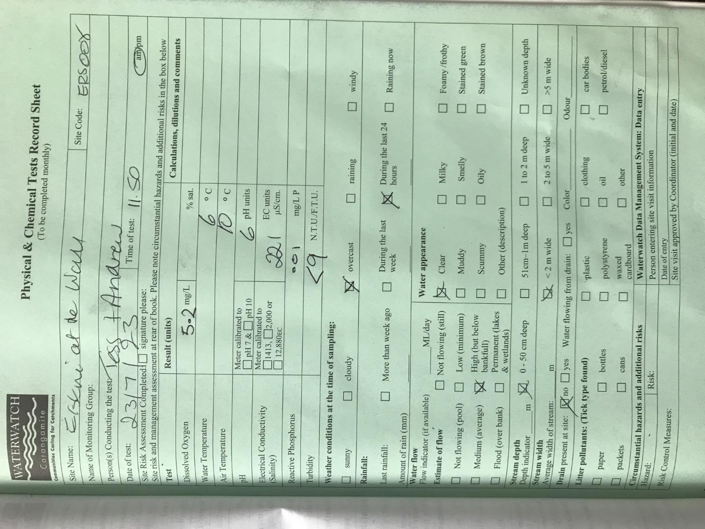
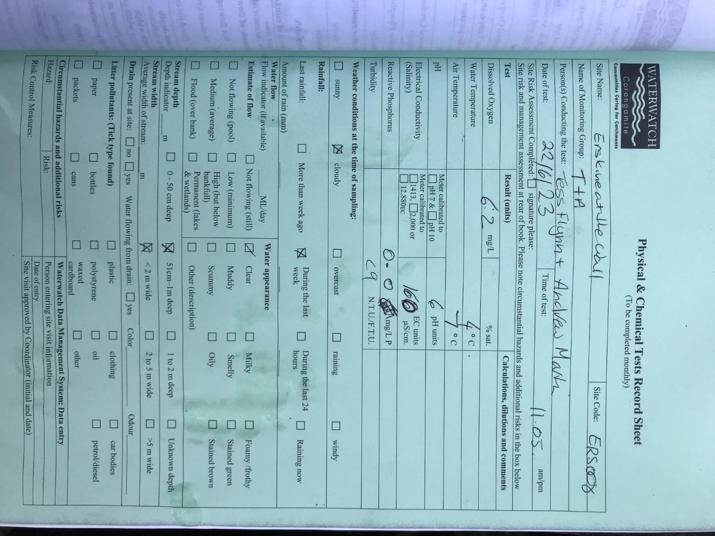
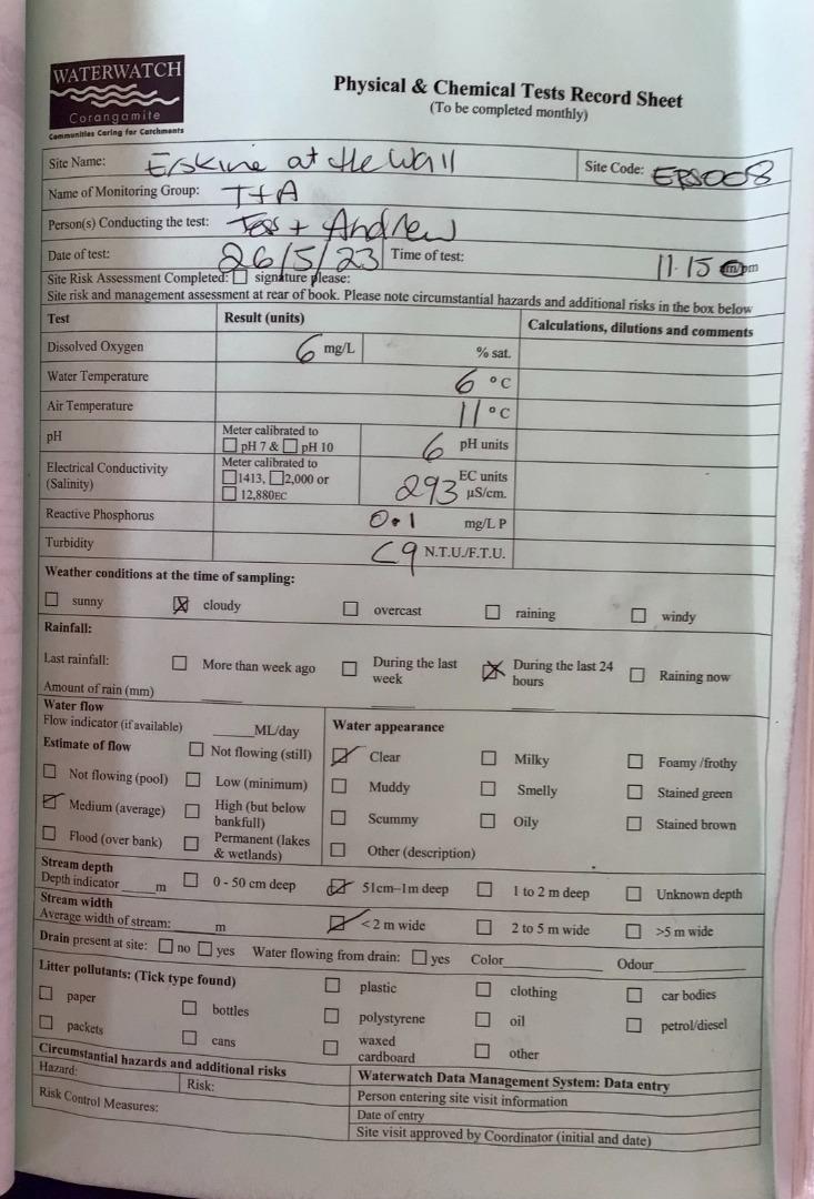
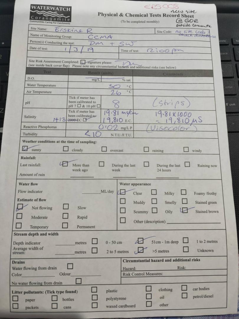
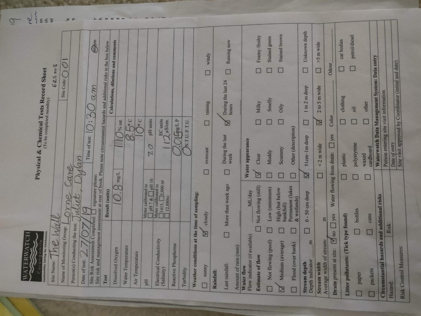
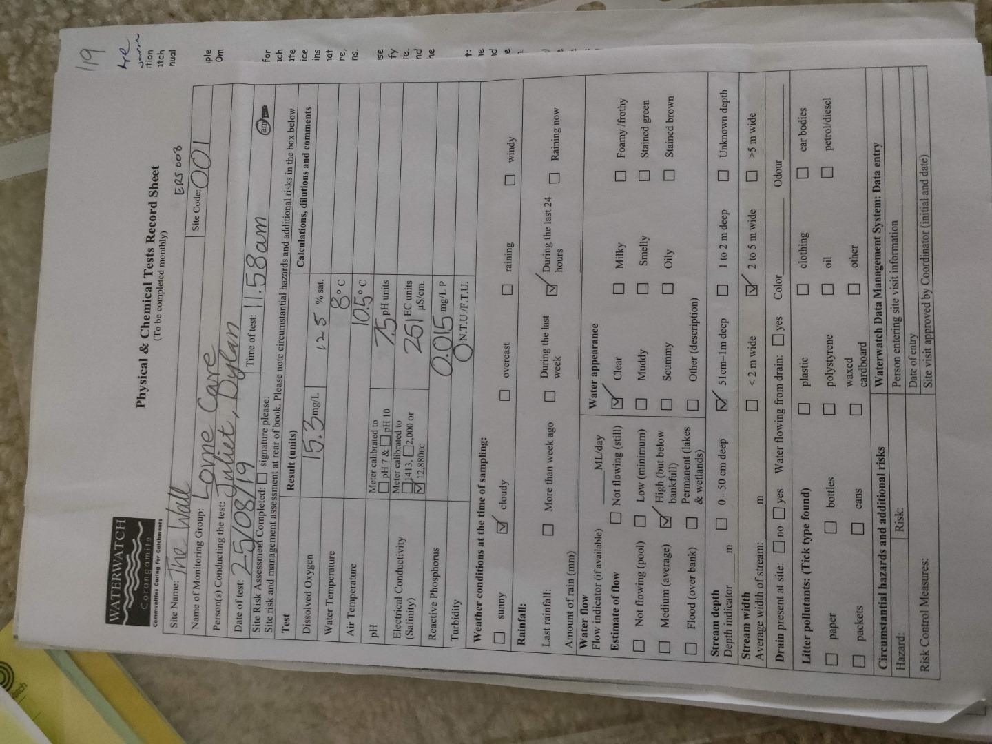
| Site code | CO_ERS008 |
|---|---|
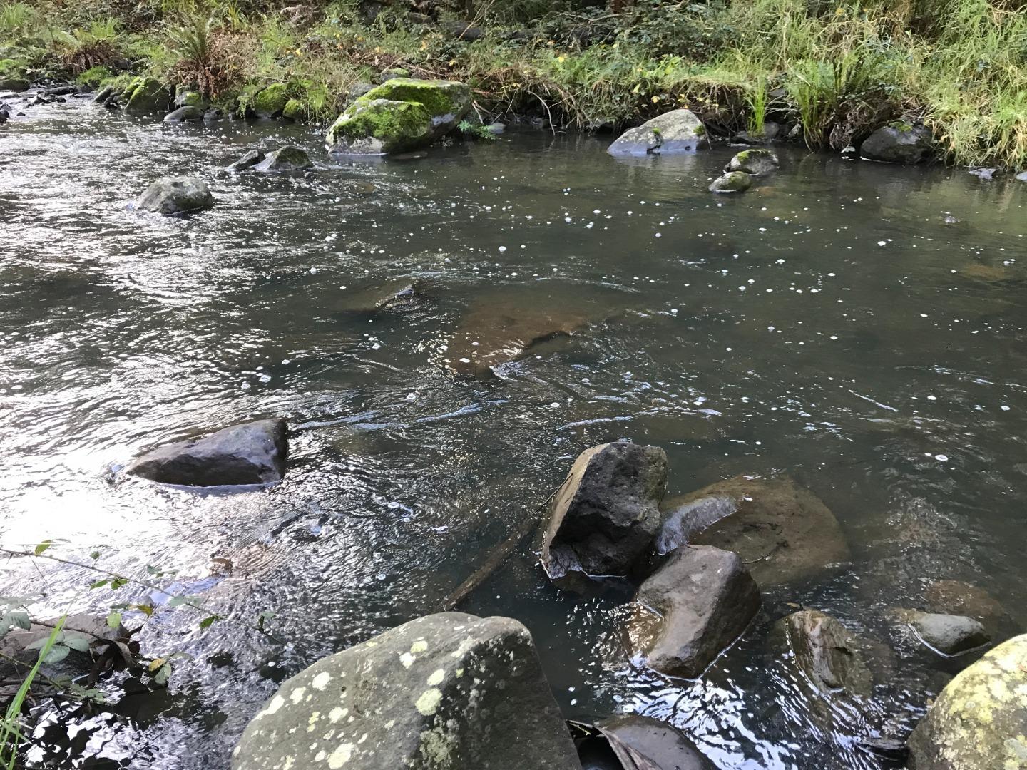
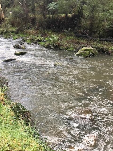
| Site name | Erskine River at The Wall |
| Status | Active |
| Water Authority | Corangamite |
| Basin | Otway Coast |
| Catchment | Otway Coast |
| Sub catchment | Erskine River |
| Reach | 35_33 Erskine River |
| Water type | River |
| Council | Surf Coast Shire Council |
| History | View all 25 site visits 01-03-2019 - 23-07-2023 |
| Monitoring organisations |
Site visits
 Loading chart
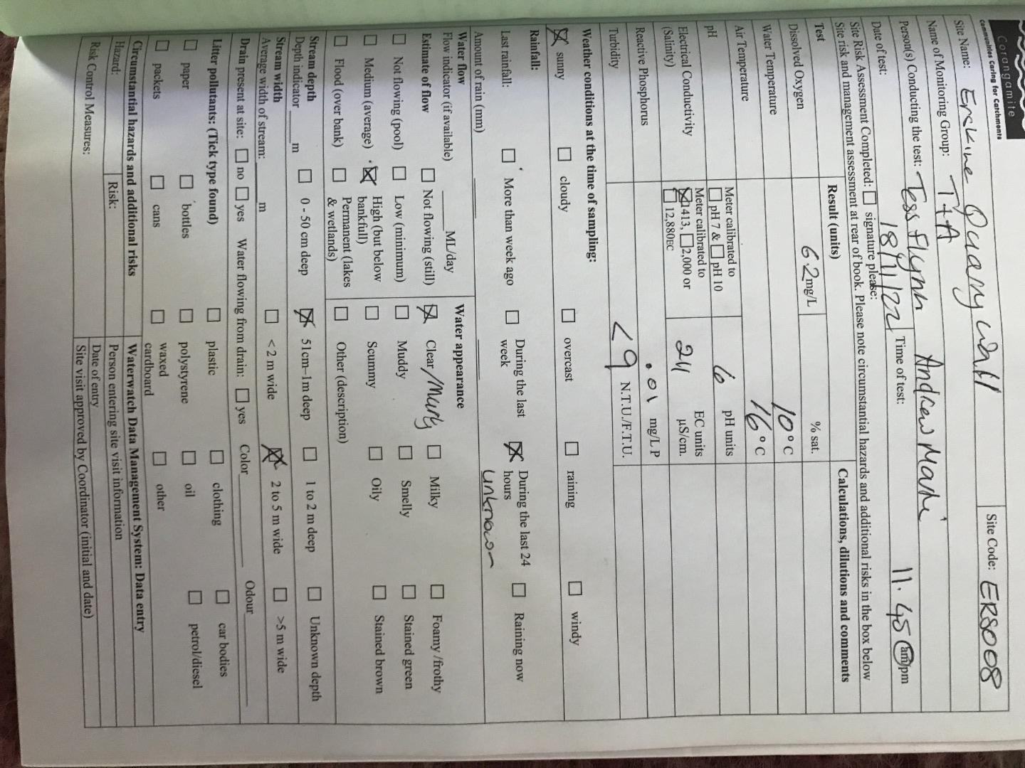
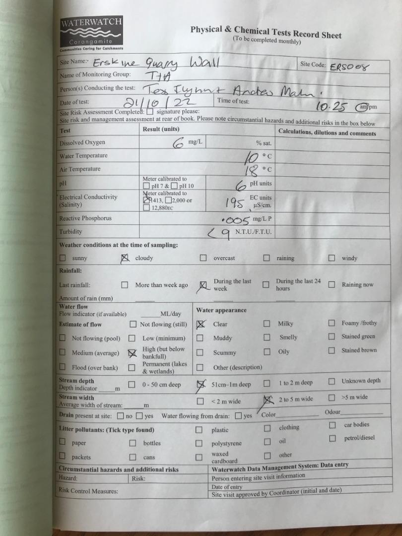
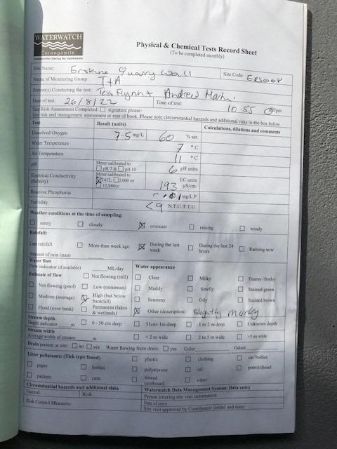
| Date | D.O. % | D.O mg/L | EC µS/cm | pH pH Units | rP mg/L P | Air ° C | Water ° C | Turb NTU |
|---|---|---|---|---|---|---|---|---|
| 09-05-2022 | 52.39 | 6.2 | 205 | 6 | 0.01 | 13 | 8 | 9 |
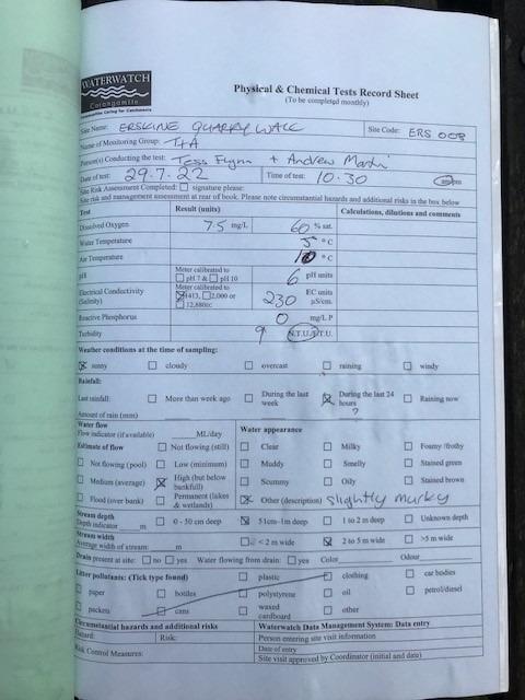
| 29-07-2022 | 58.77 | 7.5 | 230 | 6 | 0 | 10 | 5 | 9 |
| 26-08-2022 | 61.82 | 7.5 | 193 | 6 | 0.01 | 11 | 7 | 9 |
| 25-09-2022 | 59.18 | 7 | 366 | 0 | 14 | 8 | 9 | |
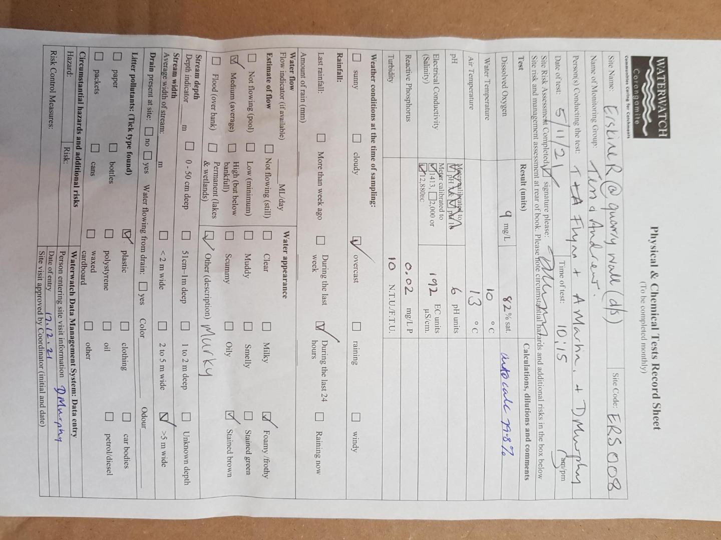
| 21-10-2022 | 53.19 | 6 | 195 | 6 | 0.005 | 18 | 10 | 9 |
| 18-11-2022 | 54.96 | 6.2 | 211 | 6 | 0.01 | 16 | 10 | 9 |
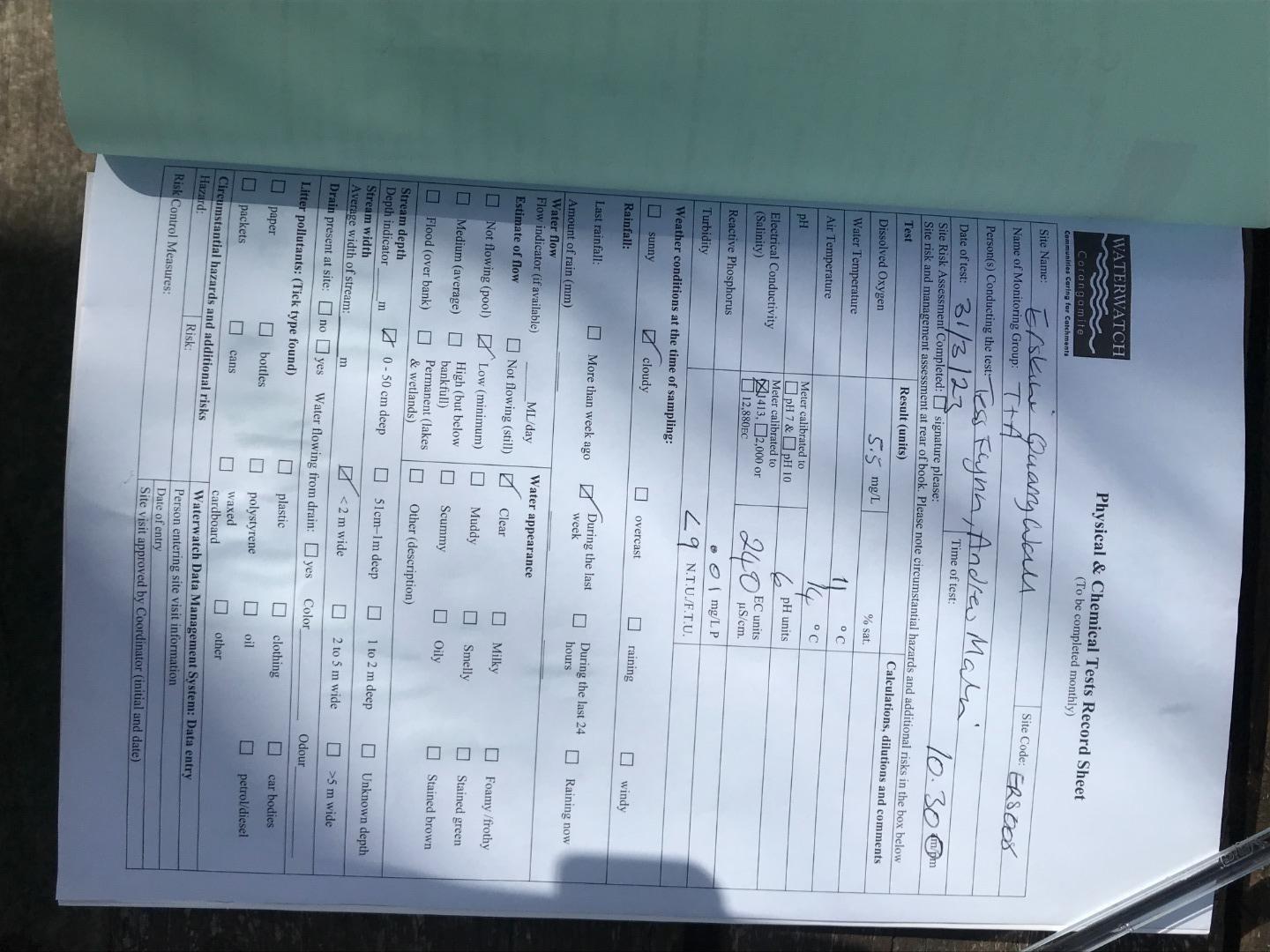
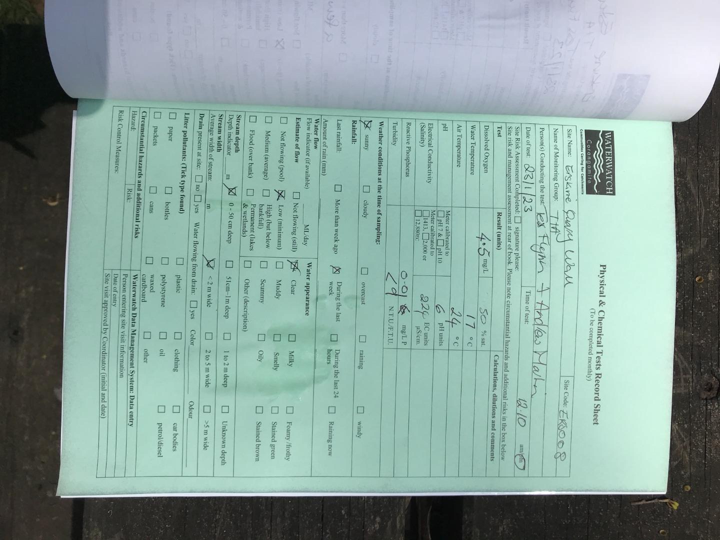
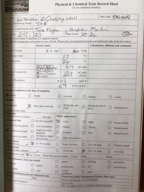
| 23-01-2023 | 46.59 | 4.5 | 224 | 6 | 0.01 | 24 | 17 | 9 |
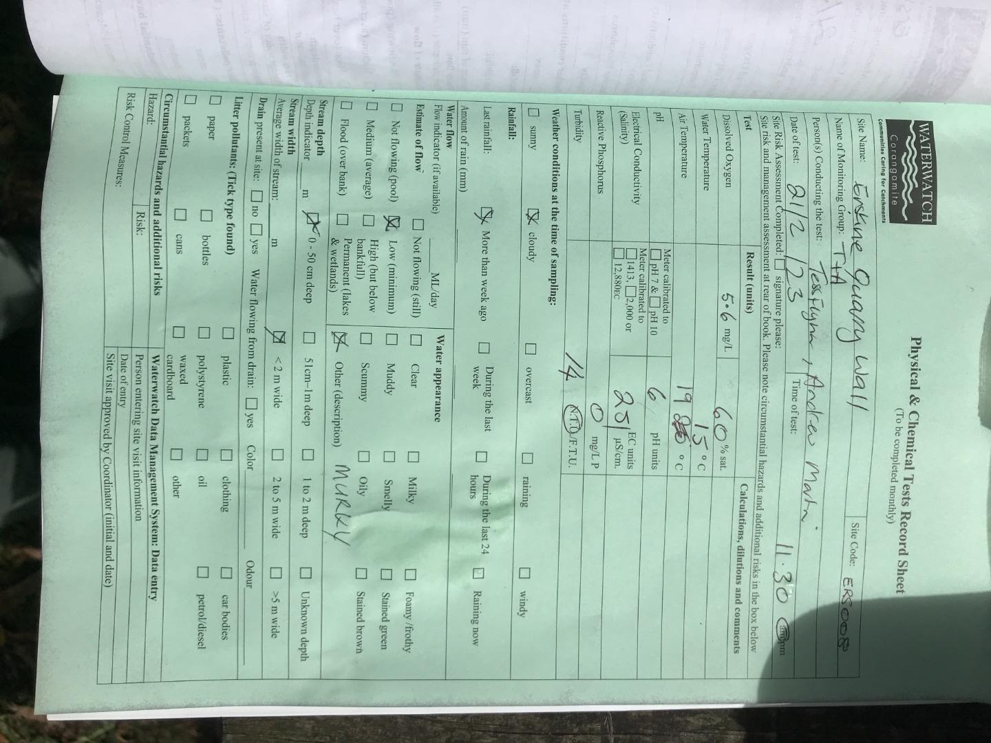
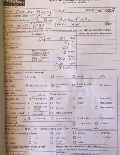
| 21-02-2023 | 55.58 | 5.6 | 251 | 6 | 0 | 19 | 15 | 14 |
| 31-03-2023 | 49.91 | 5.5 | 240 | 6 | 0.01 | 14 | 11 | 9 |
| 28-04-2023 | 54.45 | 6 | 253 | 6 | 0.01 | 13 | 11 | 9 |
| 26-05-2023 | 48.25 | 6 | 293 | 6 | 0.1 | 11 | 6 | 9 |
| 22-06-2023 | 47.32 | 6.2 | 160 | 6 | 0 | 7 | 4 | 9 |


All content, files, data and images provided by the Waterwatch Data Portal and Gallery are subject to a Creative Commons Attribution License
Content is made available to be used in any way, and should always attribute Waterwatch and www.vic.waterwatch.org.au
.png)