Waterwatch Data Portal
Site details
Overview
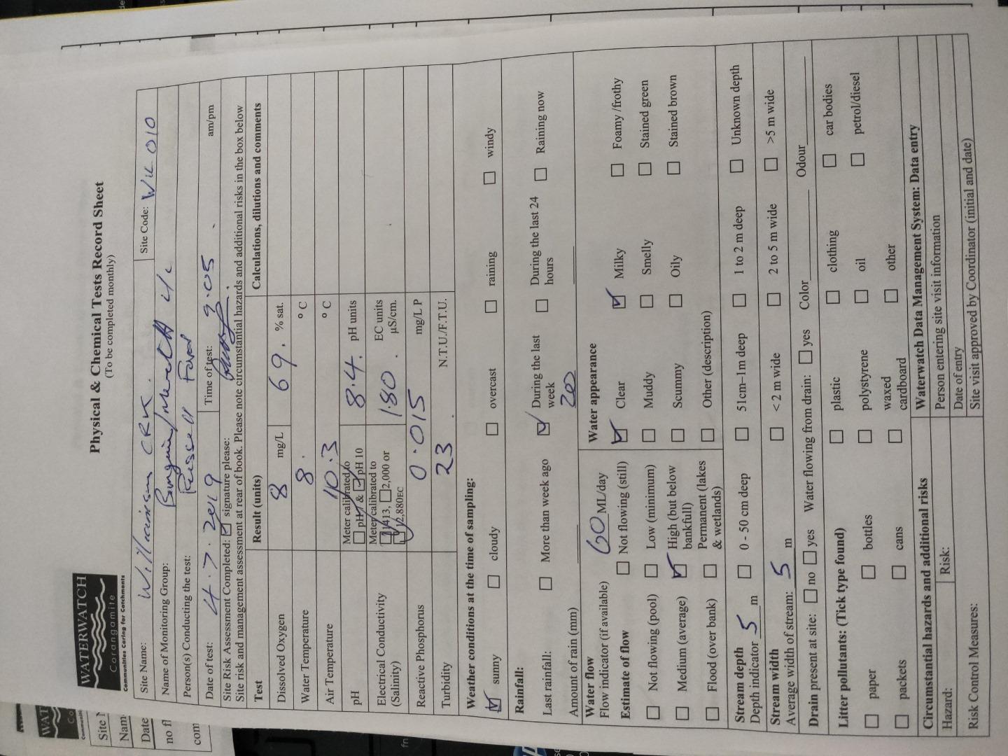
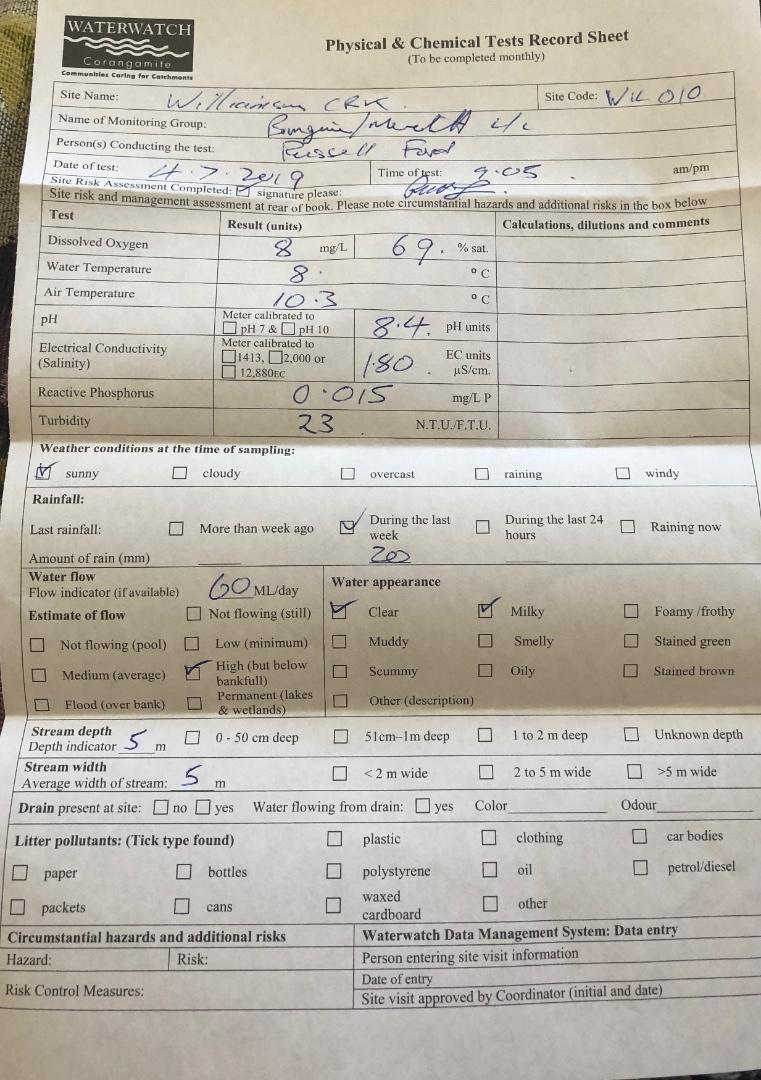
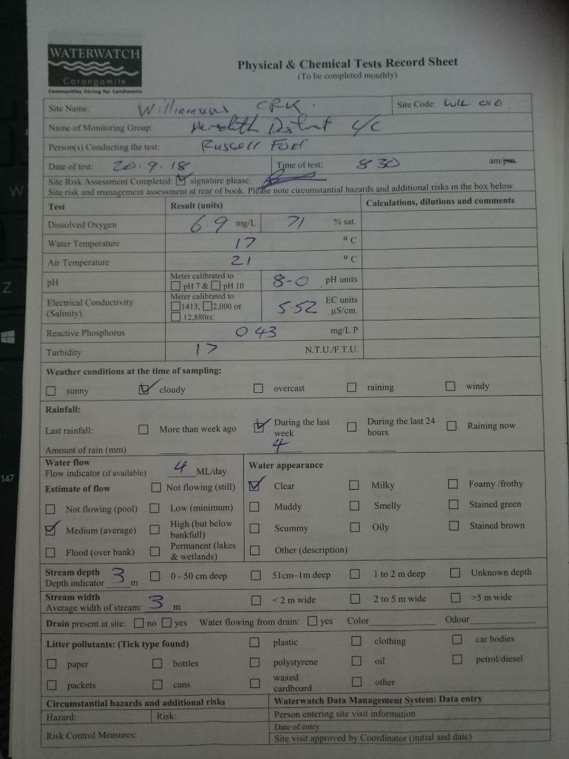
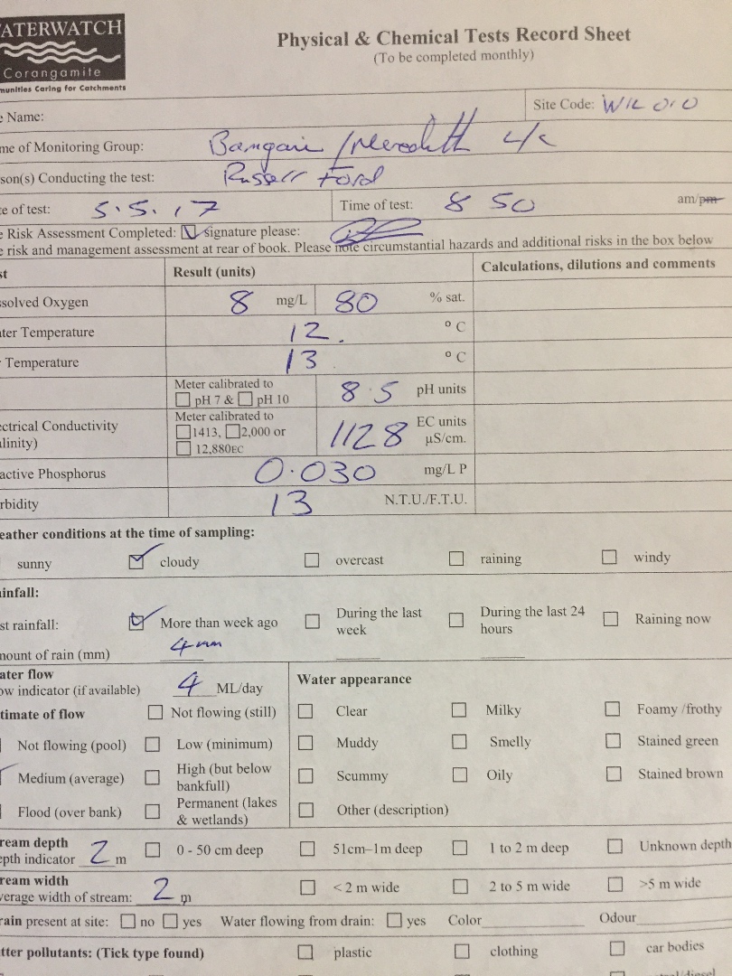
| Site code | CO_WIL010 |
|---|---|
| Site name | Williamsons Creek |
| Status | Active |
| Water Authority | Corangamite |
| Basin | Barwon River |
| Catchment | Barwon River |
| Sub catchment | Williamson Creek |
| Reach | 33_16 Williamson Creek |
| Water type | Creek |
| Council | |
| History | View all 273 site visits 10-07-1995 - 09-04-2024 |
| Monitoring organisations |
Site visits
 Loading chart
| Date | D.O. % | D.O mg/L | EC µS/cm | pH pH Units | rP mg/L P | Air ° C | Water ° C | P mg/L | Turb NTU |
|---|---|---|---|---|---|---|---|---|---|
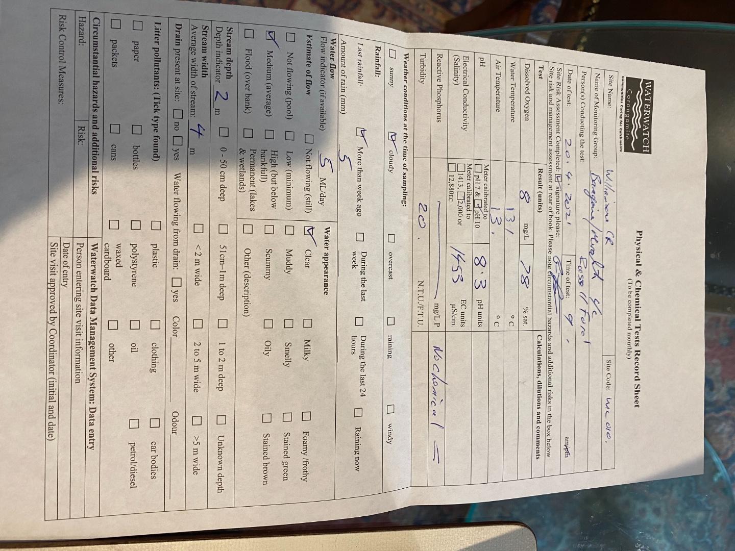
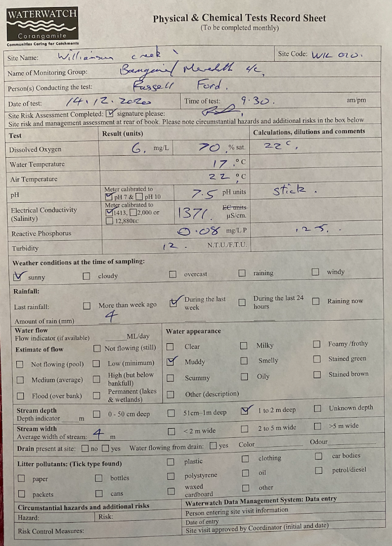
| 27-04-2022 | 71.05 | 7 | 1279 | 7.5 | 0.06 | 18.7 | 15.9 | 9 | |
| 07-02-2023 | 75.66 | 7 | 891 | 7.1 | 0.07 | 13 | 19 | 47 | |
| 07-03-2023 | 67.96 | 6.7 | 1083 | 7.2 | 0.07 | 14 | 15.9 | 14.5 | |
| 19-04-2023 | 96.77 | 9.5 | 1068 | 7.5 | 0.05 | 14.3 | 16.1 | 17 | |
| 09-06-2023 | 85.01 | 9 | 1302 | 7.9 | 0.07 | 10 | 12.6 | 45 | |
| 07-08-2023 | 92.54 | 10 | 1275 | 7.3 | 0.01 | 13.8 | 11.7 | 12.5 | |
| 14-09-2023 | 99.33 | 10 | 1203 | 7.3 | 0.02 | 21.5 | 14.9 | 9 |
Habitat
| Date | Comment | Bank Erosion Stability | Bank Vegetation | In Stream Cover | Riffles Pools Bends | Verge Vegetation | Overall |
|---|---|---|---|---|---|---|---|
| 02-06-2003 | N/A 0 |


All content, files, data and images provided by the Waterwatch Data Portal and Gallery are subject to a Creative Commons Attribution License
Content is made available to be used in any way, and should always attribute Waterwatch and www.vic.waterwatch.org.au
.png)