Waterwatch Data Portal
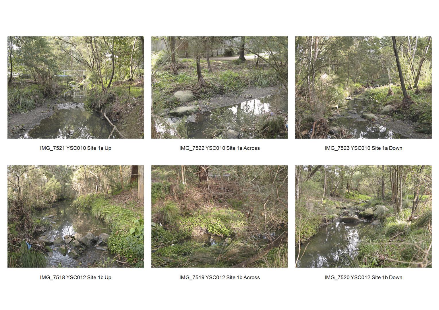
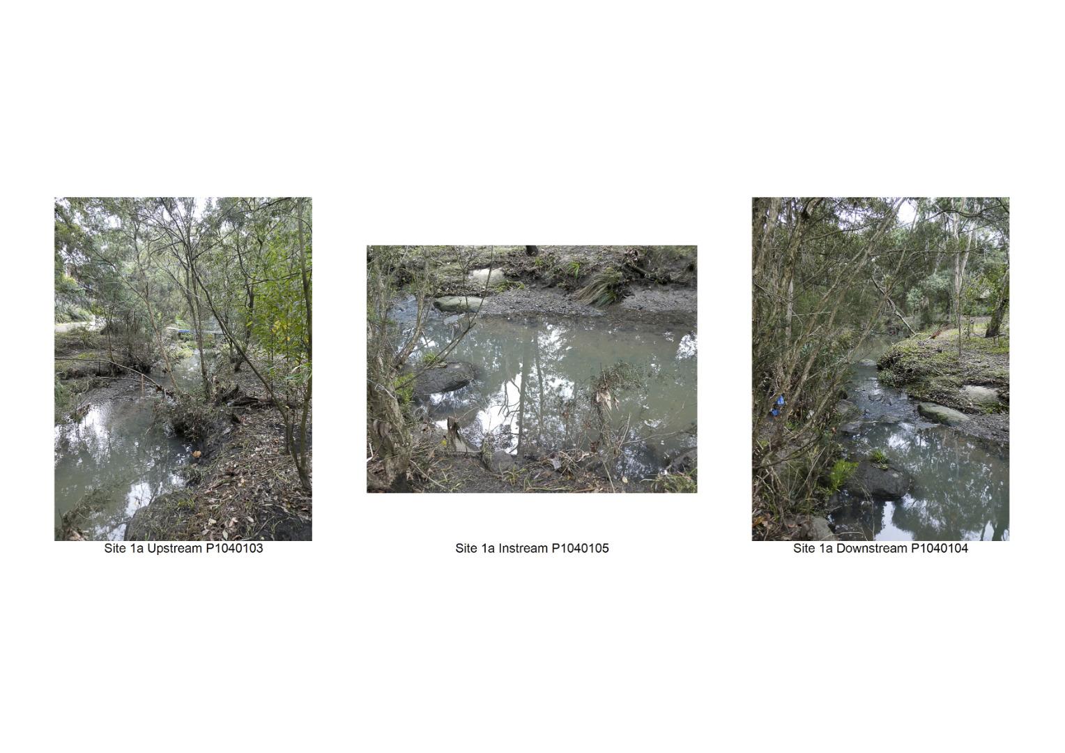
ME_YSC010 Scotchmans Creek at end of Turner Crt and Crosby Drive, Glen Waverley (Fiander arm)
Site details
Overview
| Site code | ME_YSC010 |
|---|---|
| Site name | Scotchmans Creek at end of Turner Crt and Crosby Drive, Glen Waverley (Fiander arm) |
| Status | Active |
| Water Authority | Melbourne |
| Basin | Yarra River |
| Catchment | Yarra River |
| Sub catchment | Gardiners Creek |
| Reach | |
| Water type | Creek |
| Council | Monash City Council |
| History | View all 129 site visits 23-05-2004 - 24-03-2024 |
| Monitoring organisations |
Site visits
 Loading chart
| Date | Ammon-Nit mg/L NH3-N | N mg/L NH4+ | D.O. % | D.O mg/L | EC µS/cm | FrP mg/L P | Nitrate-Nit mg/L N | pH pH Units | rP mg/L P | Air ° C | Water ° C | Turb FTU | Turb NTU |
|---|---|---|---|---|---|---|---|---|---|---|---|---|---|
| 24-04-2022 | 0 | 79.83 | 8.4 | 440 | 7.1 | 0.016 | 12 | 13 | 9 | ||||
| 22-05-2022 | 0.04 | 600 | 7.3 | 10.5 | 11 | 7 | |||||||
| 19-06-2022 | 0.04 | 82.64 | 9.1 | 460 | 7.4 | 0 | 10 | 11 | 10 | ||||
| 24-07-2022 | 0 | 320 | 7.5 | 14 | 12.5 | 35 | |||||||
| 21-08-2022 | 91.09 | 9.8 | 540 | 7.6 | 0.026 | 9.5 | 12 | 22 | |||||
| 19-03-2023 | 0 | 420 | 16.5 | 16.5 | 6 | ||||||||
| 20-08-2023 | 0 | 83.62 | 9.1 | 540 | 13 | 11.5 | 21 | ||||||
| 24-09-2023 | 0.07 | 62.79 | 6.6 | 750 | 7.3 | 0.026 | 17 | 13 | 10 | ||||
| 29-10-2023 | 0 | 770 | 7.3 | 15.5 | 16.5 | 9 | |||||||
| 26-11-2023 | 0.01 | 82.81 | 8 | 140 | 7.4 | 0.029 | 16.5 | 17 | 24 | ||||
| 21-01-2024 | 0 | 600 | 7.6 | 18 | 17.5 | 9 | |||||||
| 18-02-2024 | 0 | 72.81 | 7.1 | 510 | 7 | 0.013 | 18.5 | 16.5 | 6 |
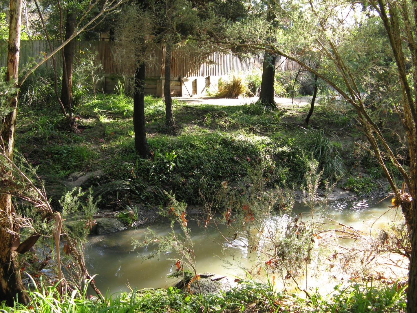
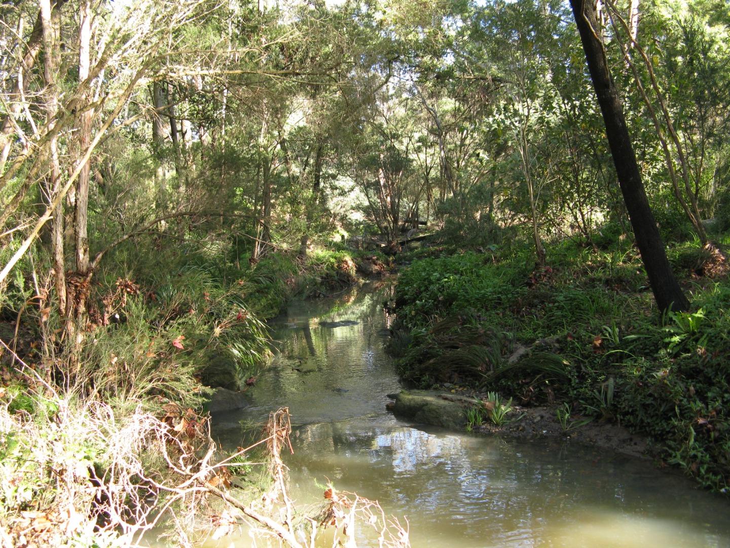
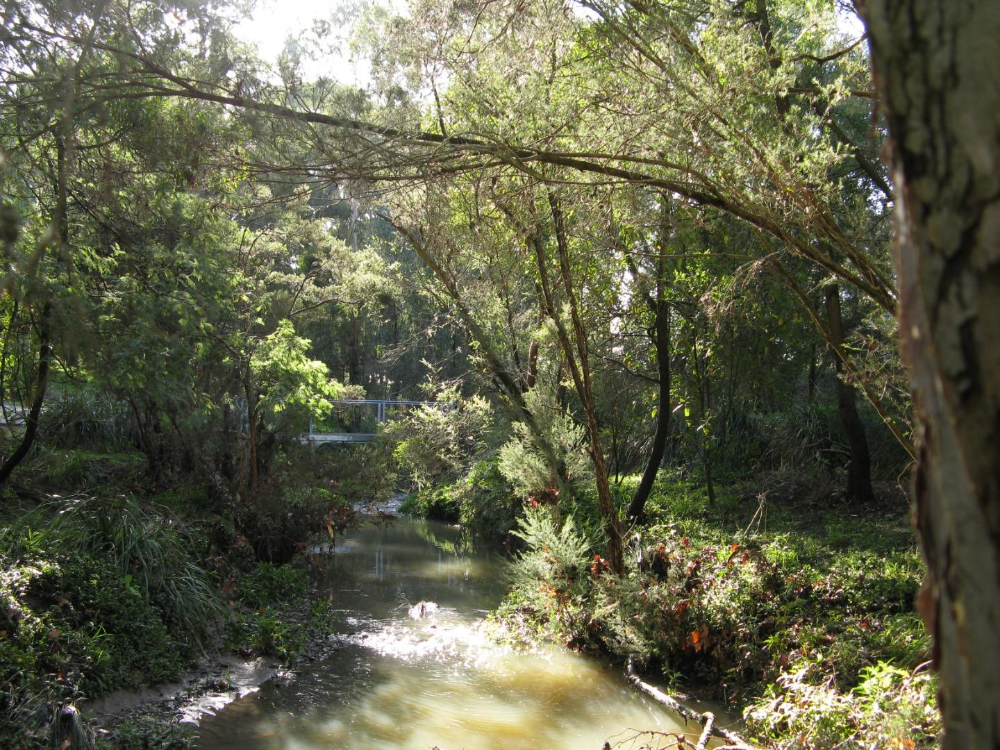
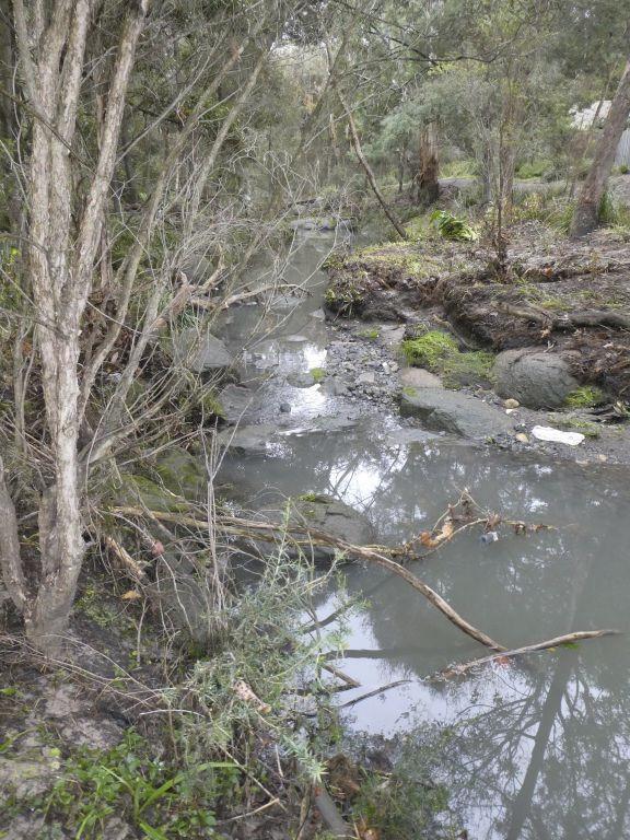
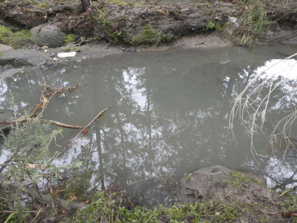
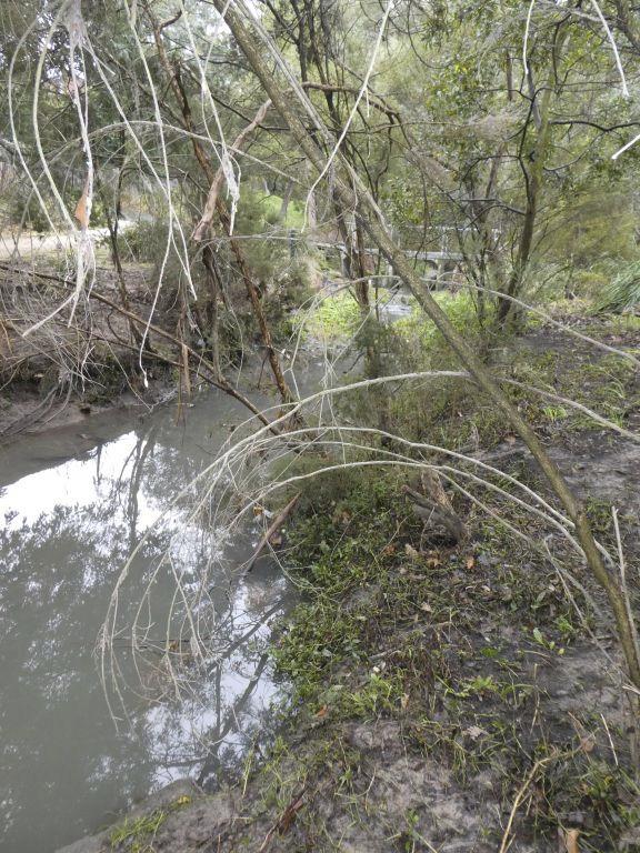
Habitat
| Date | Comment | Bank Erosion Stability | Bank Vegetation | In Stream Cover | Riffles Pools Bends | Verge Vegetation | Overall |
|---|---|---|---|---|---|---|---|
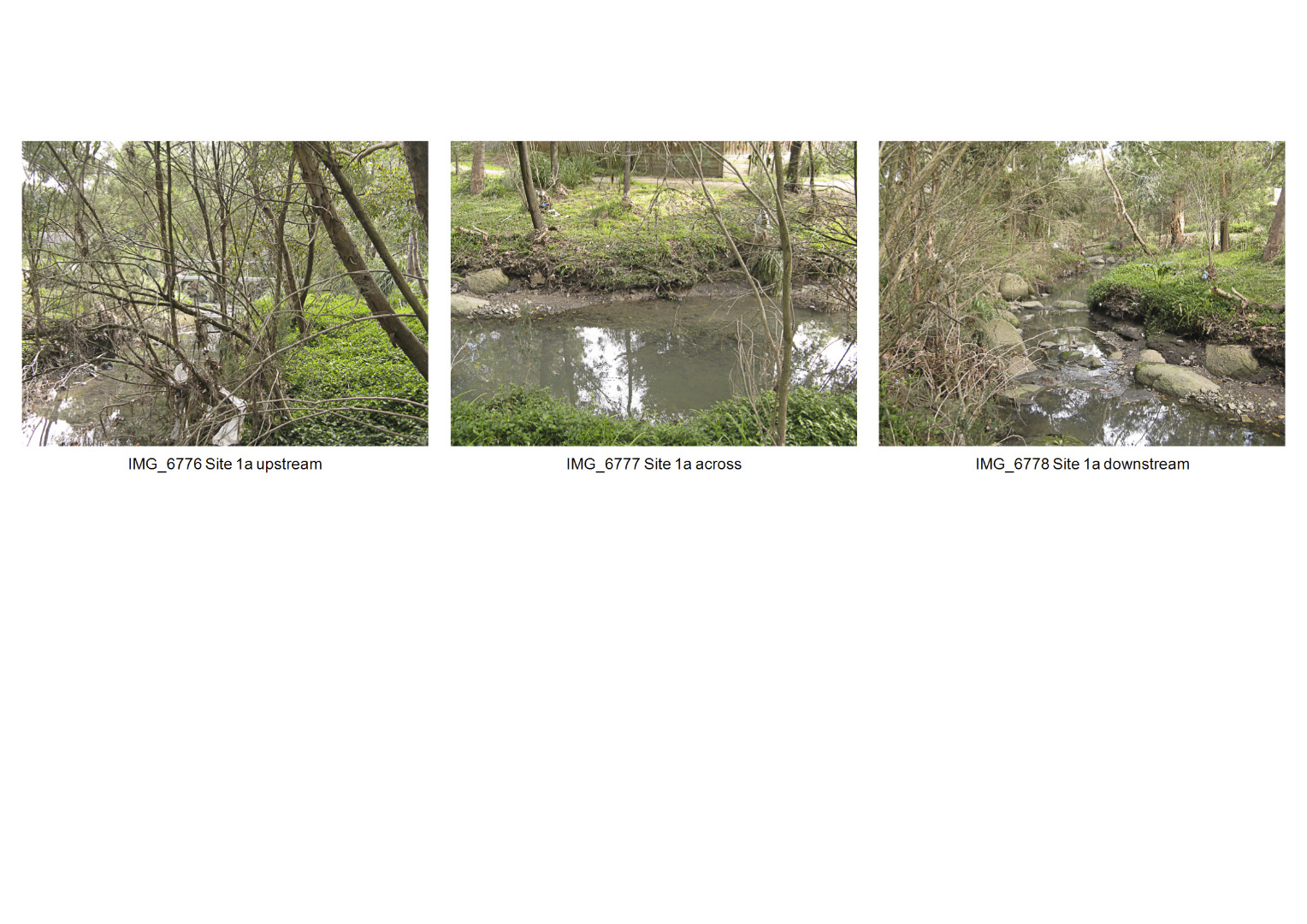
| 18-06-2023 | <p>Ivy covers the west bank at the upstream end of the site. Narrow verge coverage of native trees and bushes, flanked by paths and mown grass.</p> | Fair 3 | Fair 6 | Poor 4 | Fair 3 | Poor 4 | 20 |
| 19-06-2022 | Fair 3 | Fair 6 | Fair 6 | Good 4 | Poor 4 | 23 | |
| 27-06-2021 | <p>Overstorey predominantly native (revegetated) provides extensive cover and shading across channel but understorey is very weedy. Frequent large clumps of instream vegetation. Sand and gravel substrate with introduced large boulders creating riffles and controlling erosion. Banks largely protected but some erosion on northern bank. High flow event within last week increased depth to ~0.5m which has flushed leaf litter from low banks.</p> | Fair 3 | Fair 6 | Fair 6 | Fair 3 | Poor 4 | 22 |
| 23-06-2019 | <p>Very little in-stream vegetation, and continued deposition of sand and gravel along the site-area stream bed. Erosion appears more extensive than last year. </p> | Fair 3 | Fair 6 | Fair 6 | Fair 3 | Poor 4 | 22 |
| 24-06-2018 | <p>Erosion along North bank has increased, vegetation cover along N bank and verge affected by deposits of sand/gravel. Verge vegetation still very weedy.</p> | Poor 2 | Fair 6 | Fair 6 | Fair 3 | Poor 4 | 21 |
| 23-07-2017 | <p>23 July 2017: There is still very little in-stream vegetation. Verge vegetation very weedy (Tradescantia etc). Spot erosion still apparent.</p> | Fair 3 | Fair 6 | Fair 6 | Fair 3 | Fair 6 | 24 |
| 19-06-2016 | In stream vegetation has been largely removed by dredging - slowly returning. Verge vegetation very weedy (Tradescantia etc). Spot erosion still apparent. | Fair 3 | Fair 6 | Fair 6 | Good 4 | Fair 6 | Fair 25 |
| 21-06-2015 | 21 June 2015: Little change from 2014. The bridge approaches have been concreted to avoid washouts of the previous crushed granite surface. | Fair 3 | Fair 6 | Good 8 | Fair 3 | Fair 6 | Fair 26 |
| 24-08-2014 | Exotic weeds are rampant on the west bank / verge. In-stream vegetation is patchy but reasonably good. | Good 4 | Fair 6 | Fair 6 | Good 4 | Fair 6 | Fair 26 |
| 21-07-2013 | Banks have been cleared of some weeds, exposing some local erosion. Sandy sediment is accumulating in the stream bed. | Fair 3 | Fair 6 | Fair 6 | Fair 3 | Fair 6 | Fair 24 |
| 26-08-2012 | 26 Aug 2012: Bank erosion has increased. Weeds have increased (tradescantia). In stream sediment (probably eroded from crushed rock pathways) is inhibiting in stream vegetation in some places | Fair 3 | Good 8 | Fair 6 | Good 4 | Fair 6 | Fair 27 |
| 21-08-2011 | in stream cover was rated as a 5 | Good 4 | Good 8 | Poor 4 | Good 4 | Good 8 | Fair 28 |
| 24-03-2011 | Migrated from old Melbourne data | Fair 3 | Excellent 10 | Fair 6 | Good 4 | Good 8 | Poor 31 |

All content, files, data and images provided by the Waterwatch Data Portal and Gallery are subject to a Creative Commons Attribution License
Content is made available to be used in any way, and should always attribute Waterwatch and www.vic.waterwatch.org.au
.png)