Waterwatch Data Portal
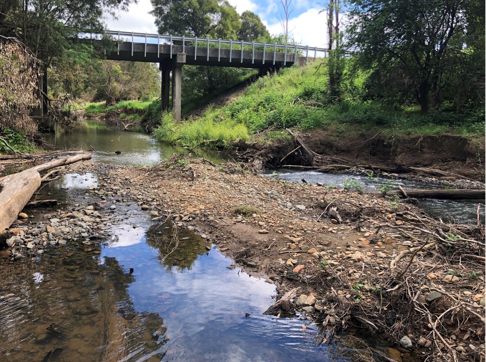
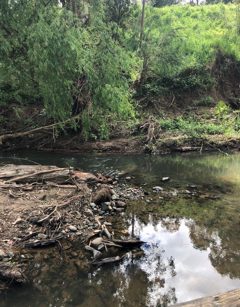
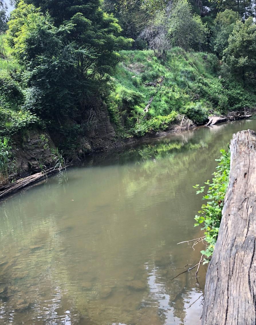
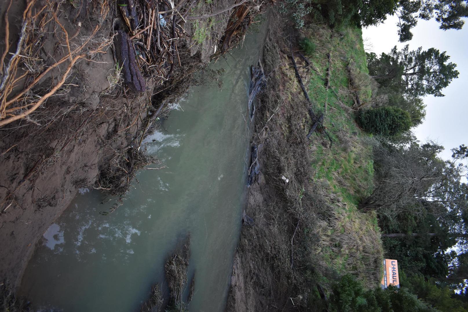
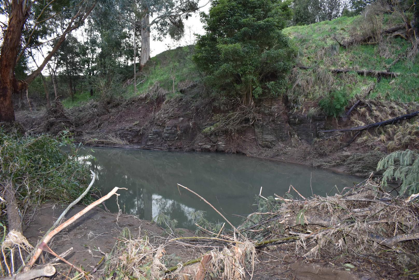
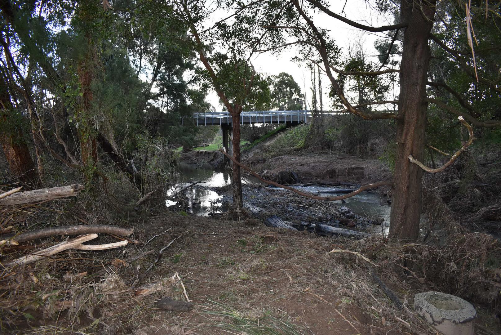
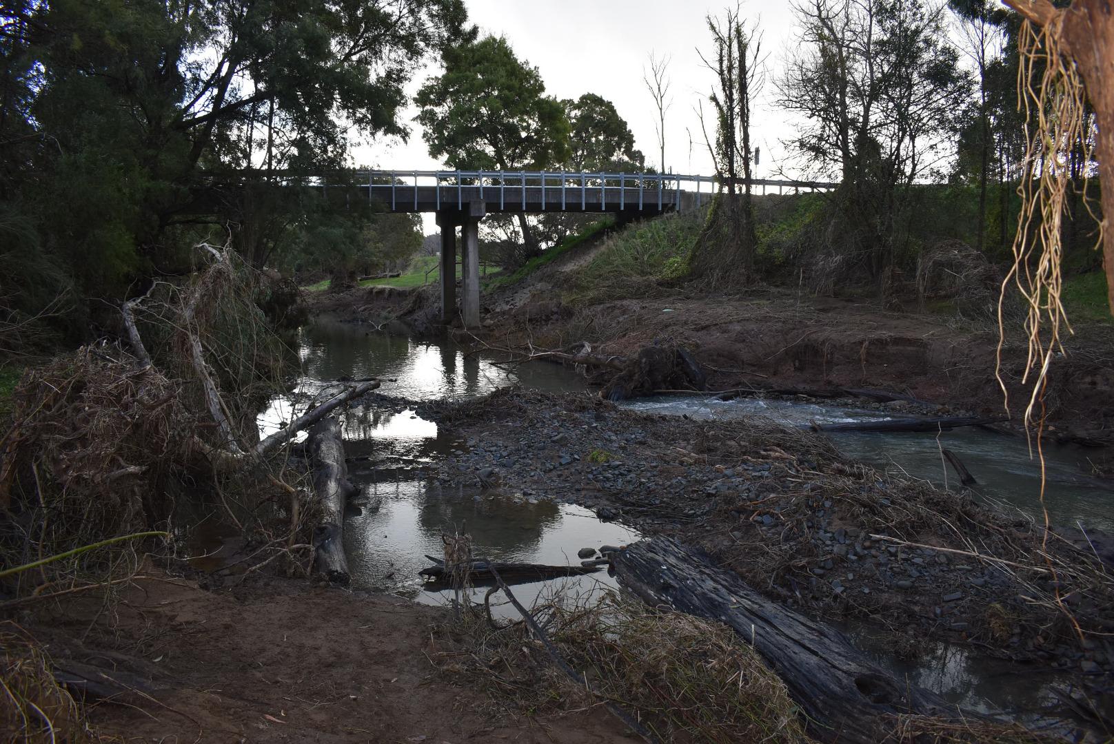
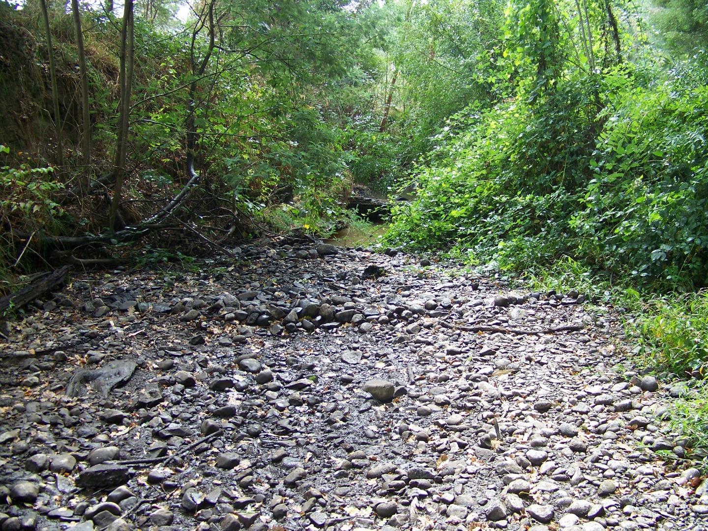
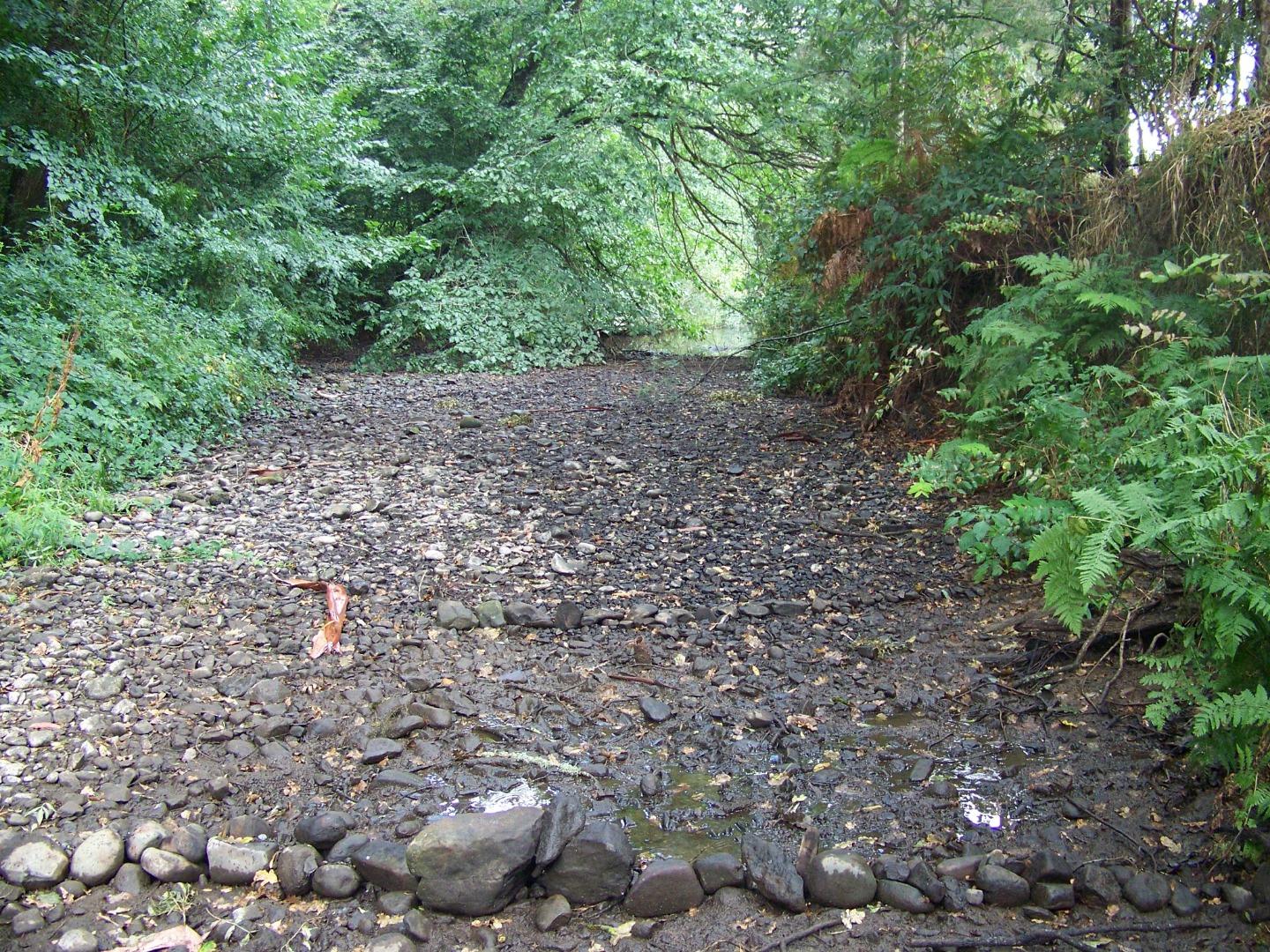
WG_MID060 Middle Creek at Martin Walker Reserve Yinnar South
Site details
Overview
| Site code | WG_MID060 |
|---|---|
| Site name | Middle Creek at Martin Walker Reserve Yinnar South |
| Status | Active |
| Water Authority | West Gippsland |
| Basin | Latrobe River |
| Catchment | Latrobe River |
| Sub catchment | Middle Creek |
| Reach | 26_21 Middle Creek |
| Water type | Other |
| Council | Latrobe City Council |
| History | View all 210 site visits 05-10-2007 - 02-04-2024 |
| Monitoring organisations |
Site visits
 Loading chart
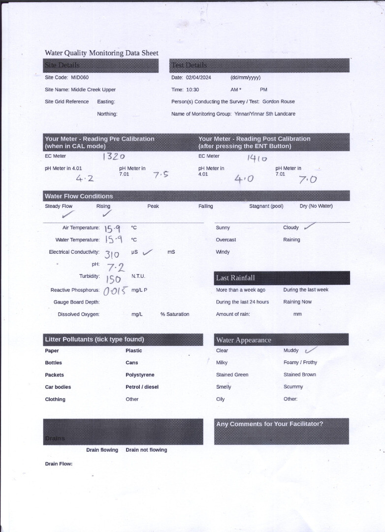
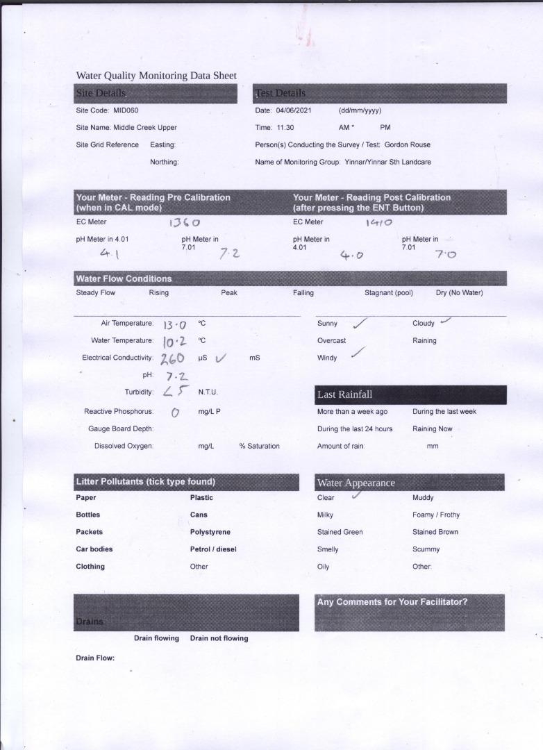
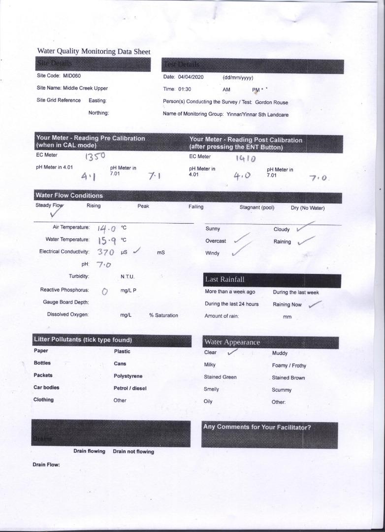
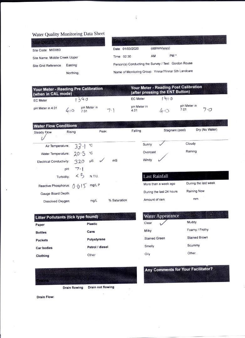
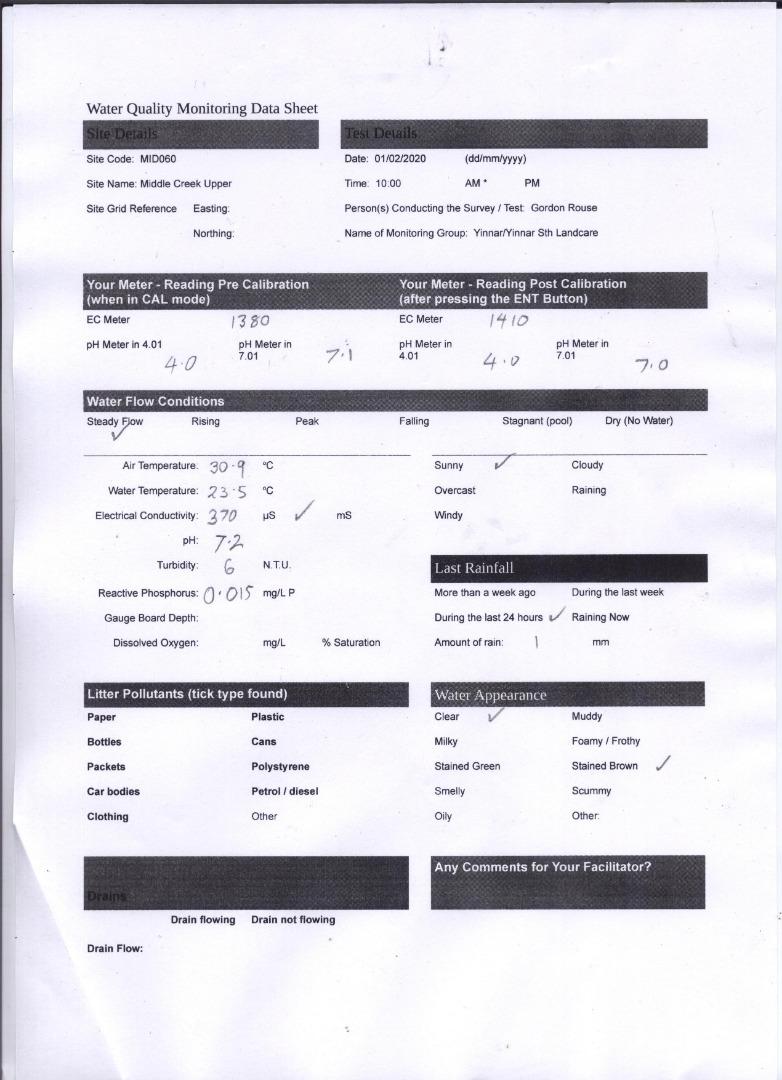
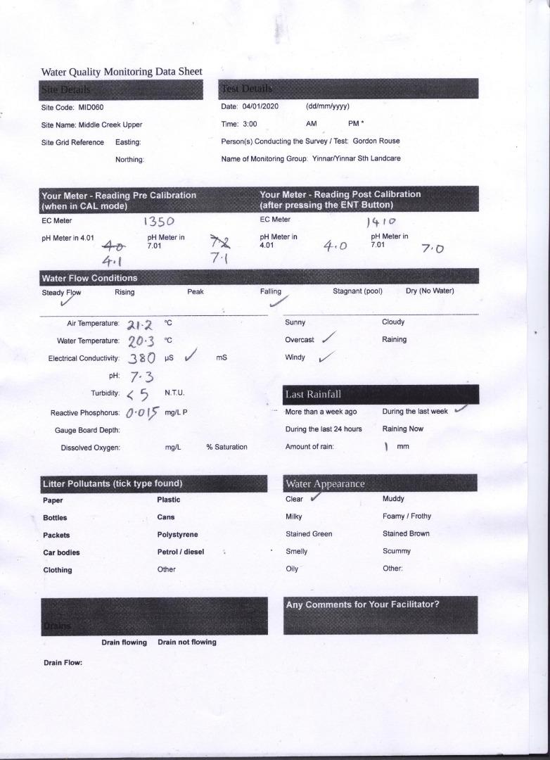
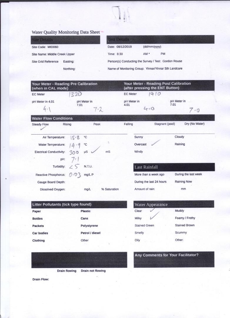
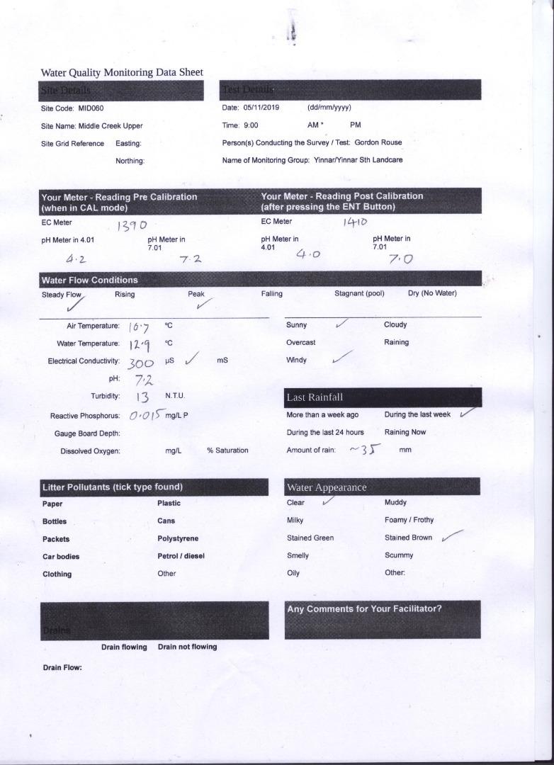
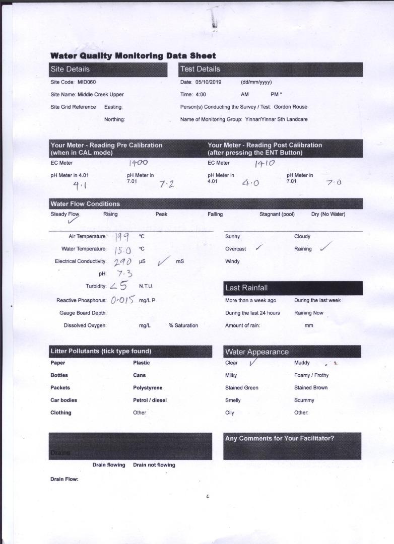
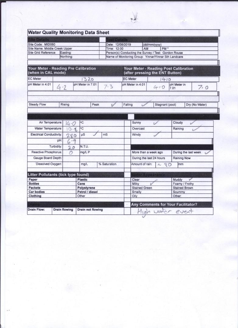
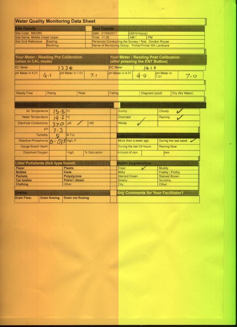
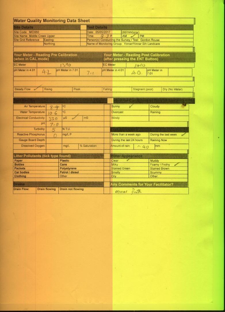
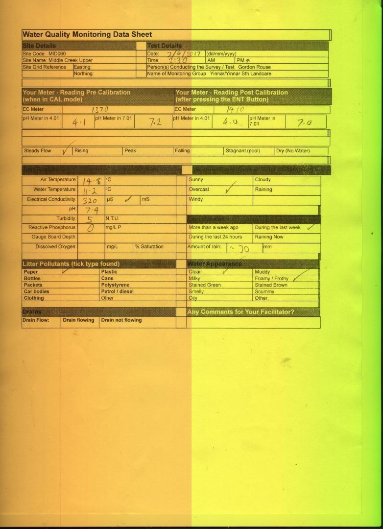
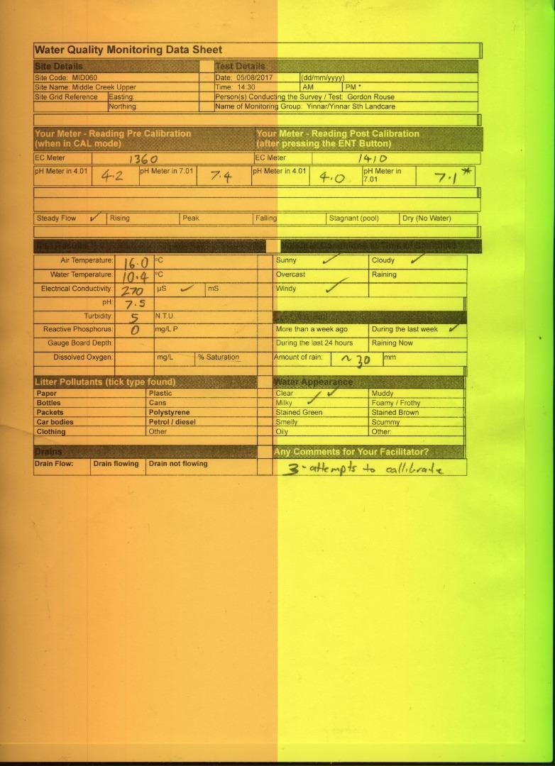
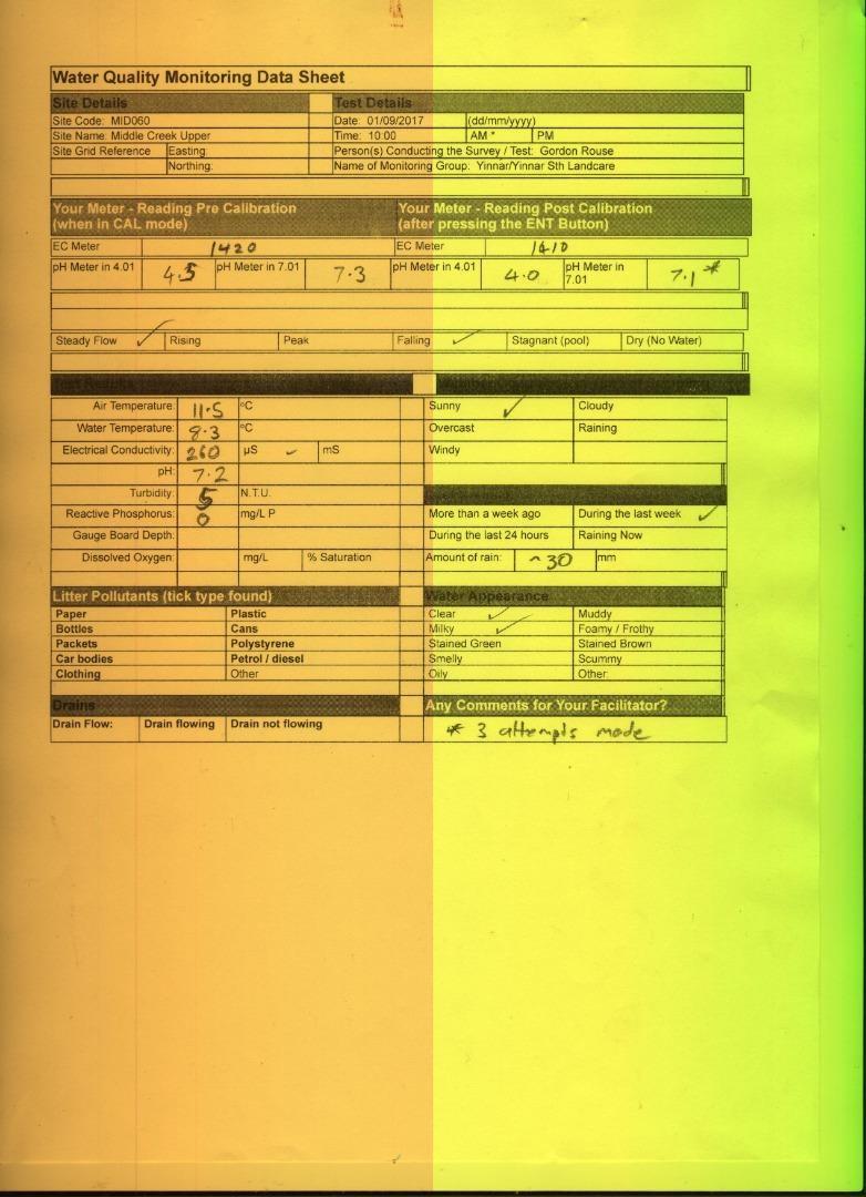
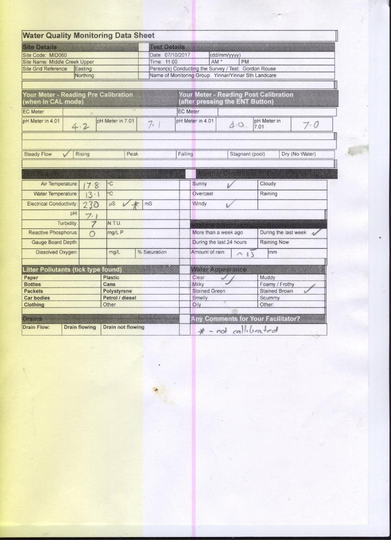
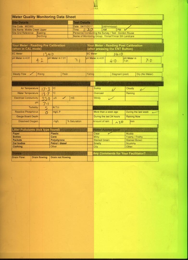
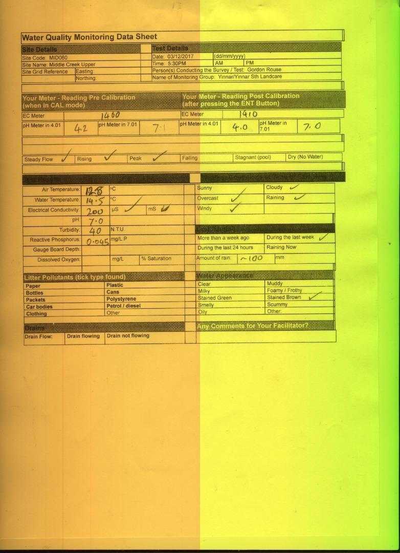
| Date | EC µS/cm | pH pH Units | rP mg/L P | Air ° C | Water ° C | Turb NTU |
|---|---|---|---|---|---|---|
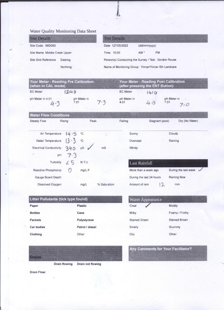
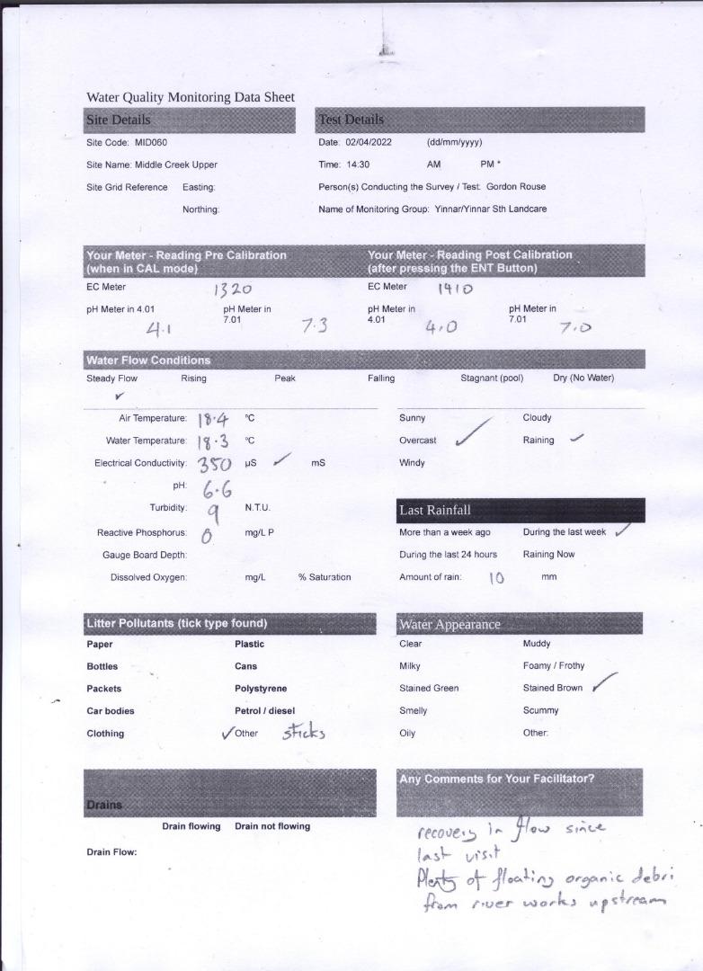
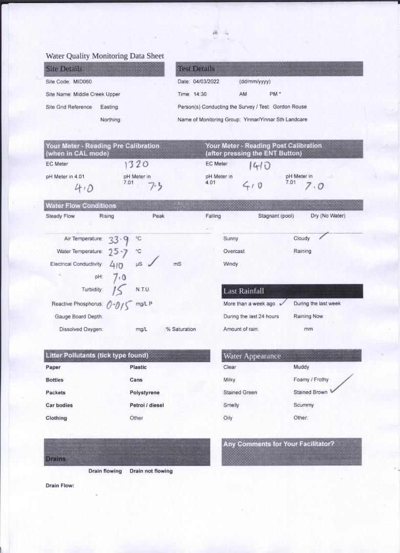
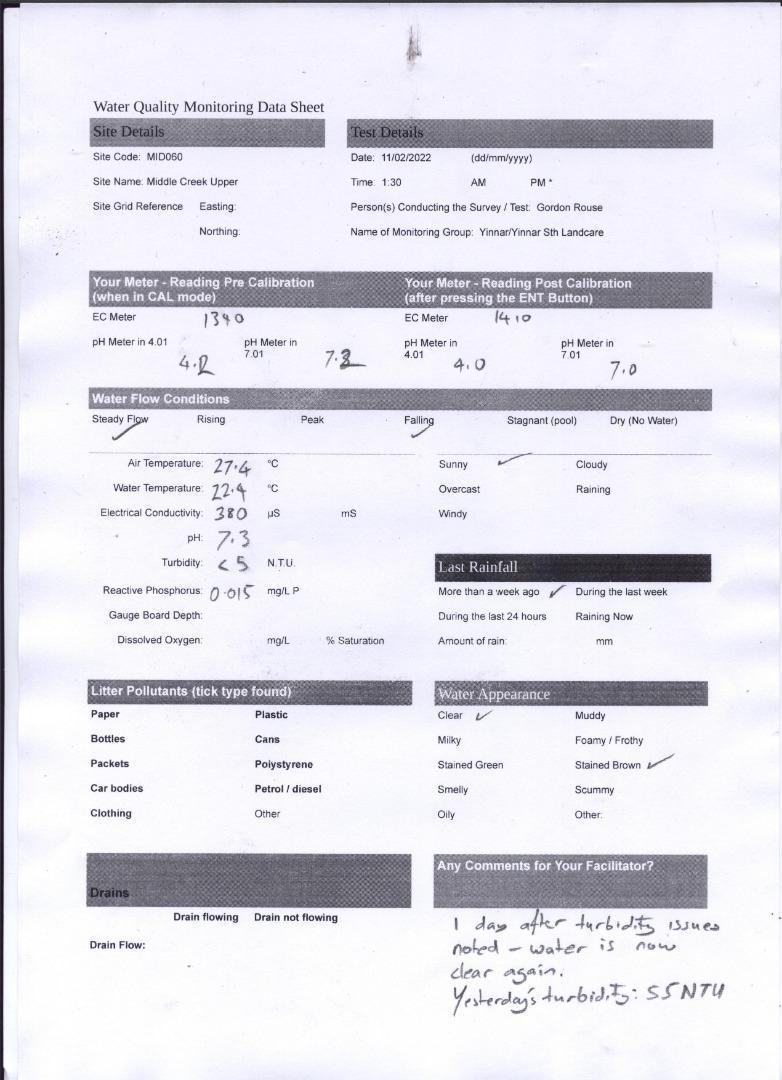
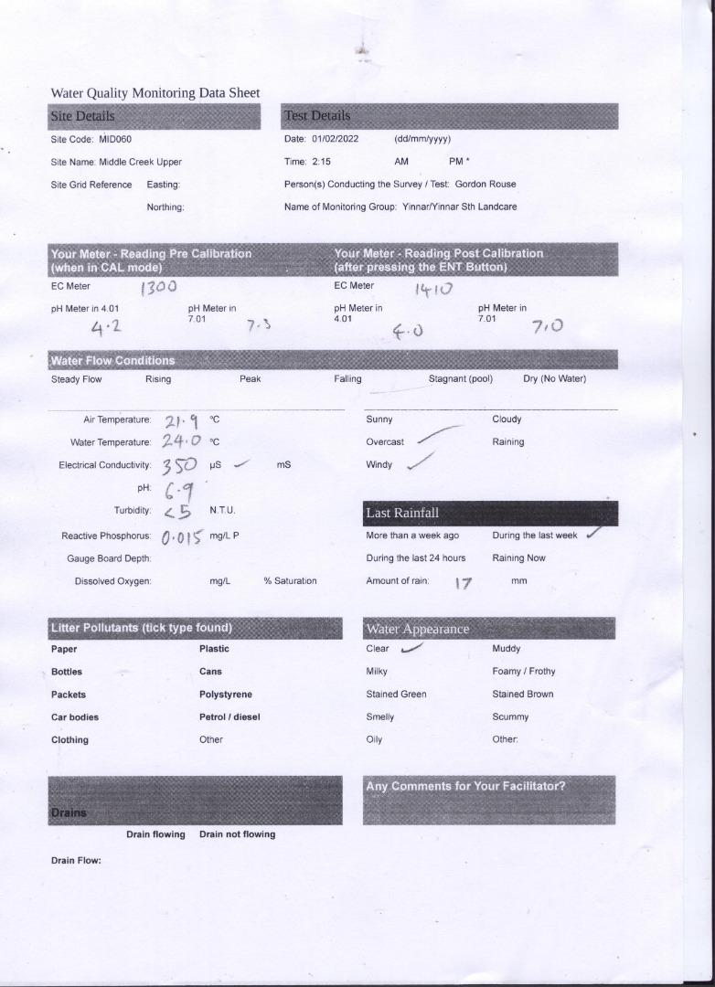
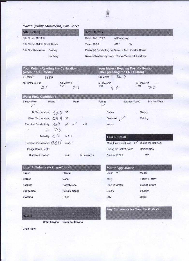
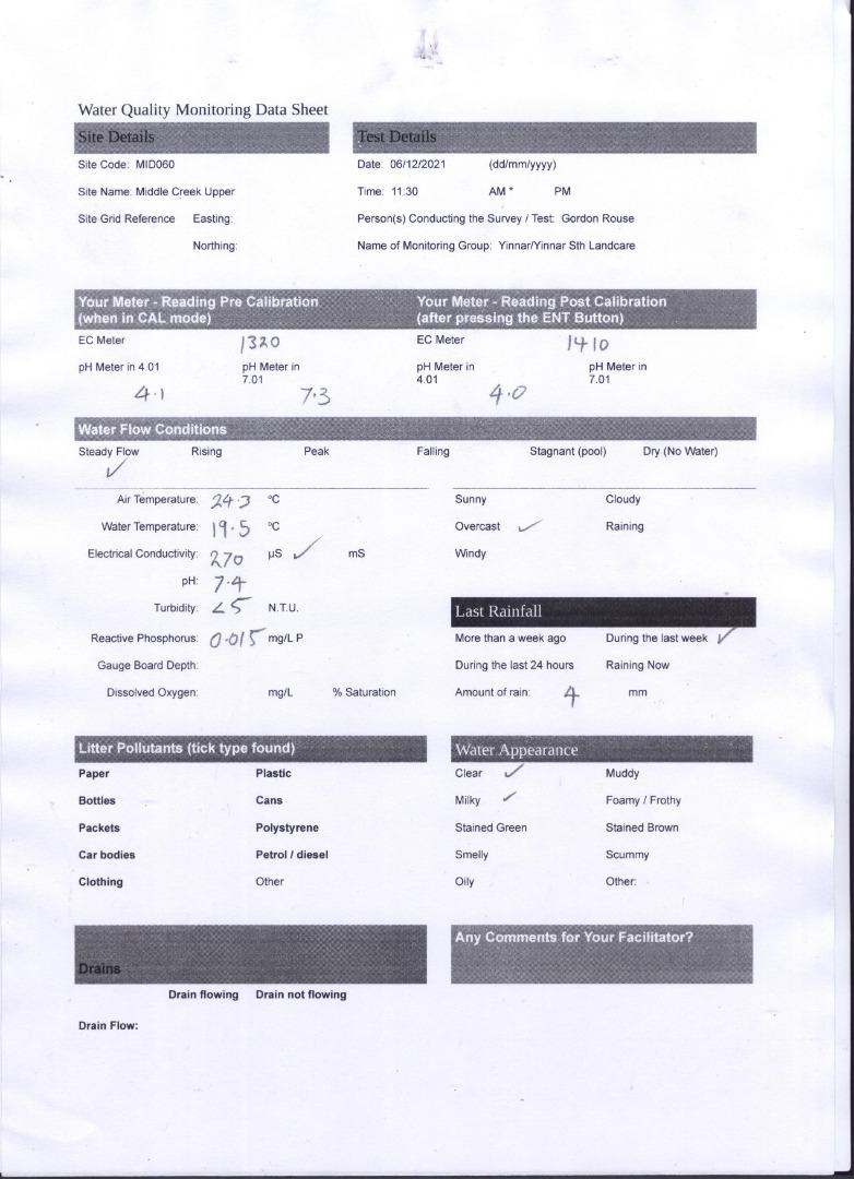
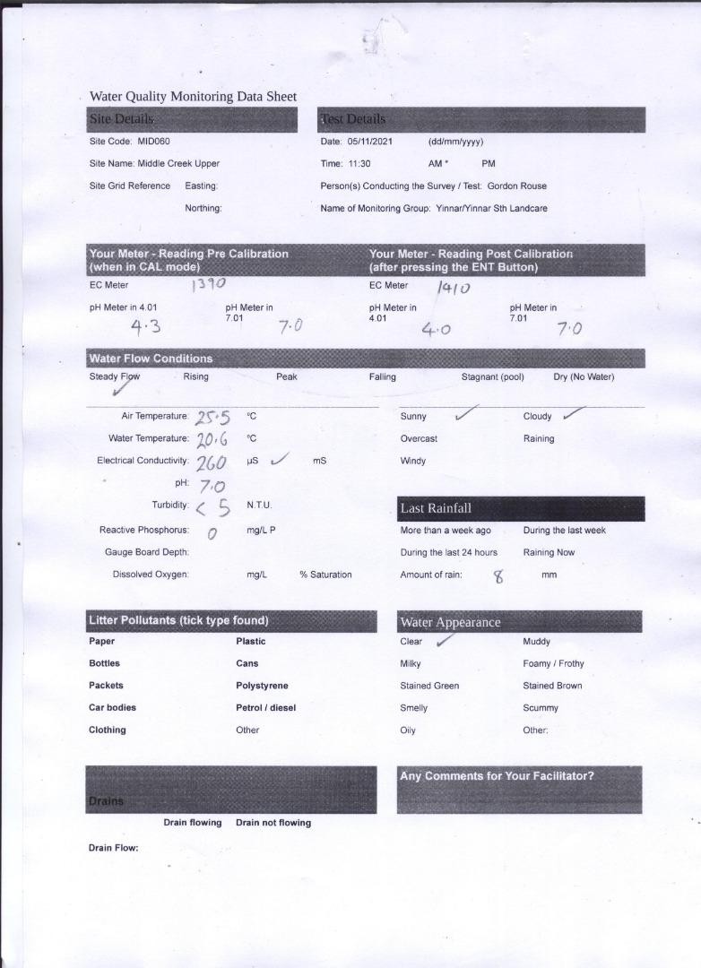
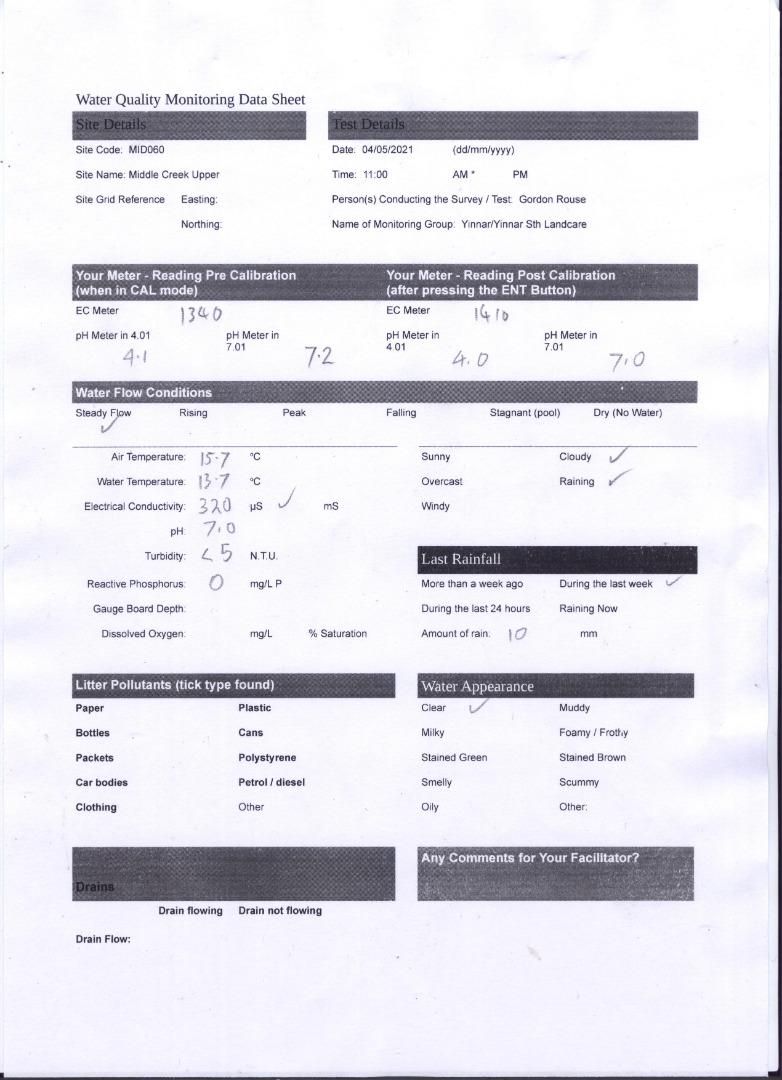
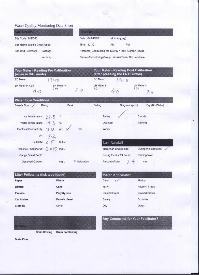
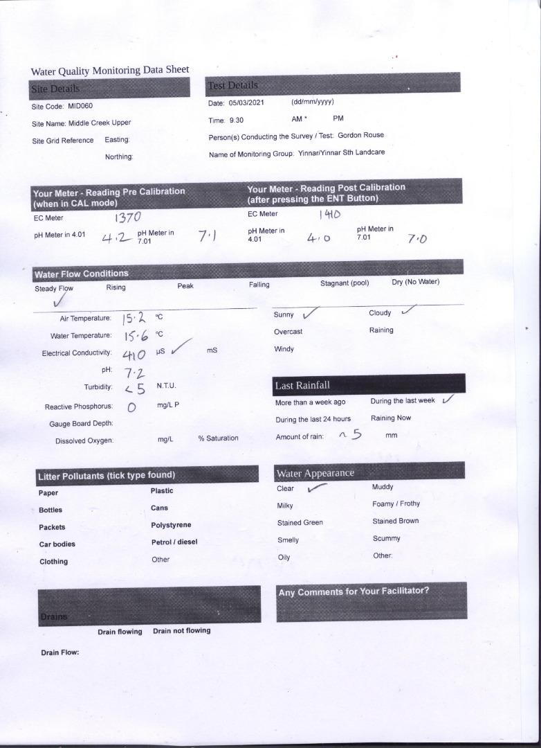
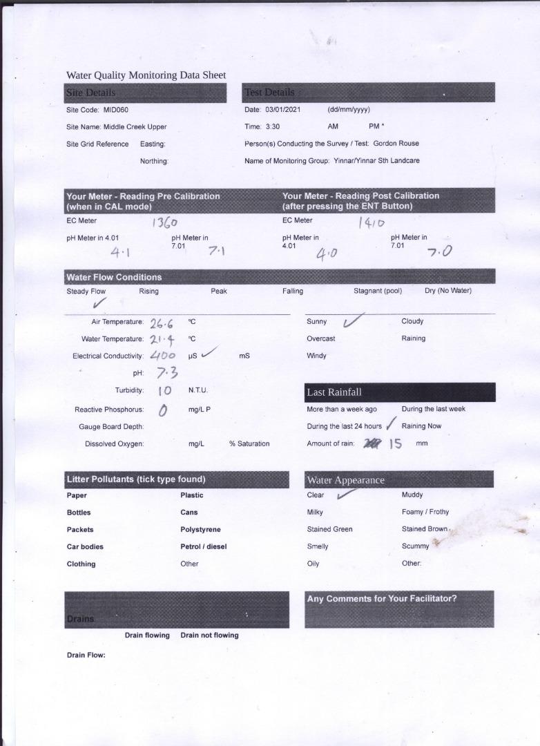
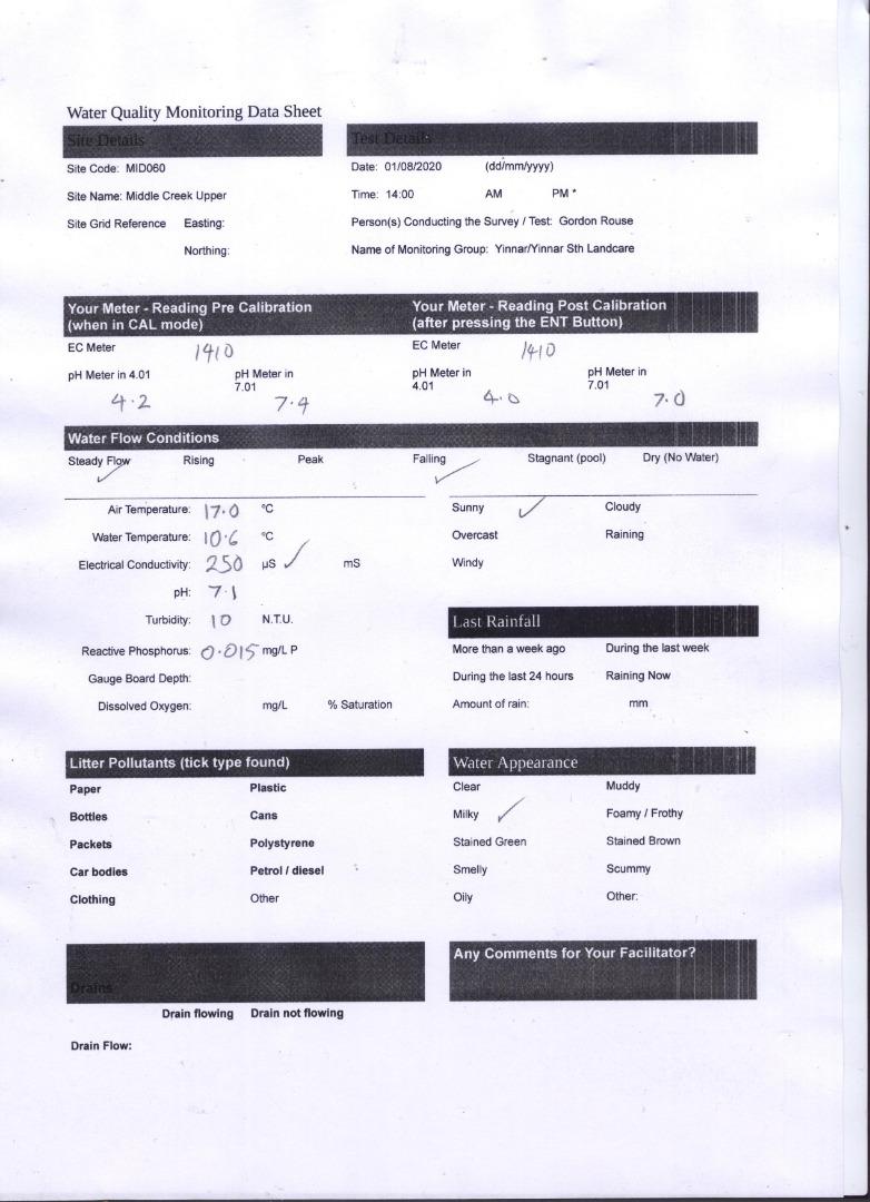
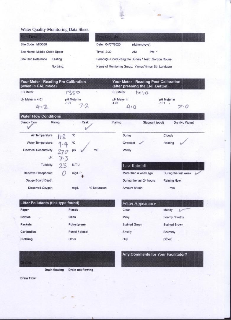
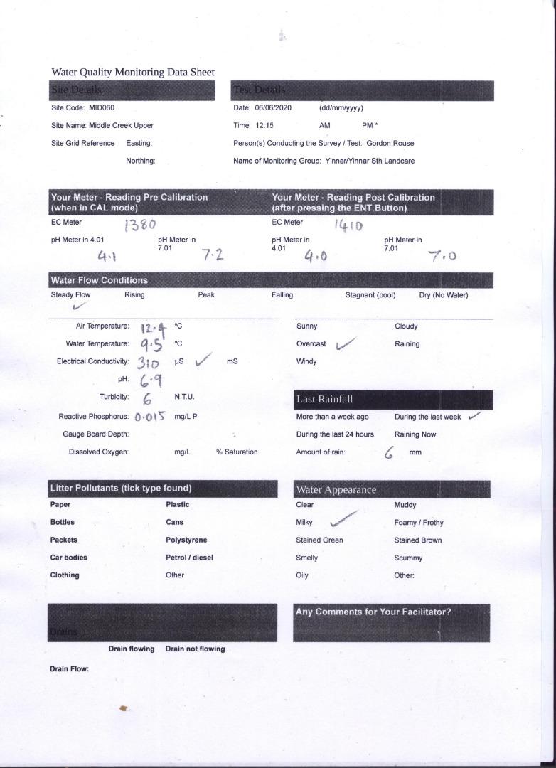
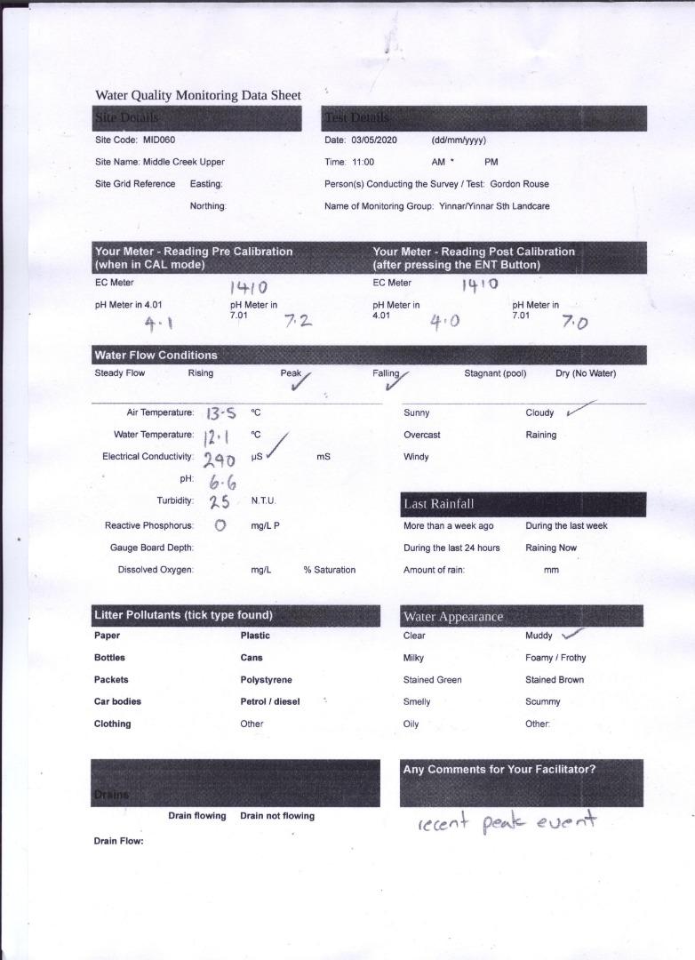
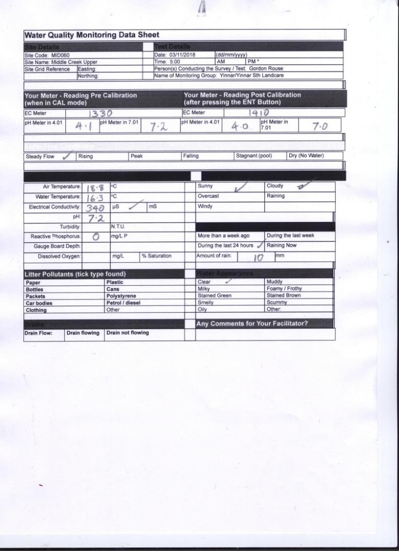
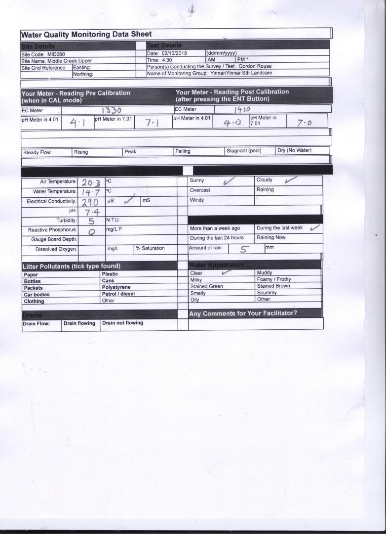
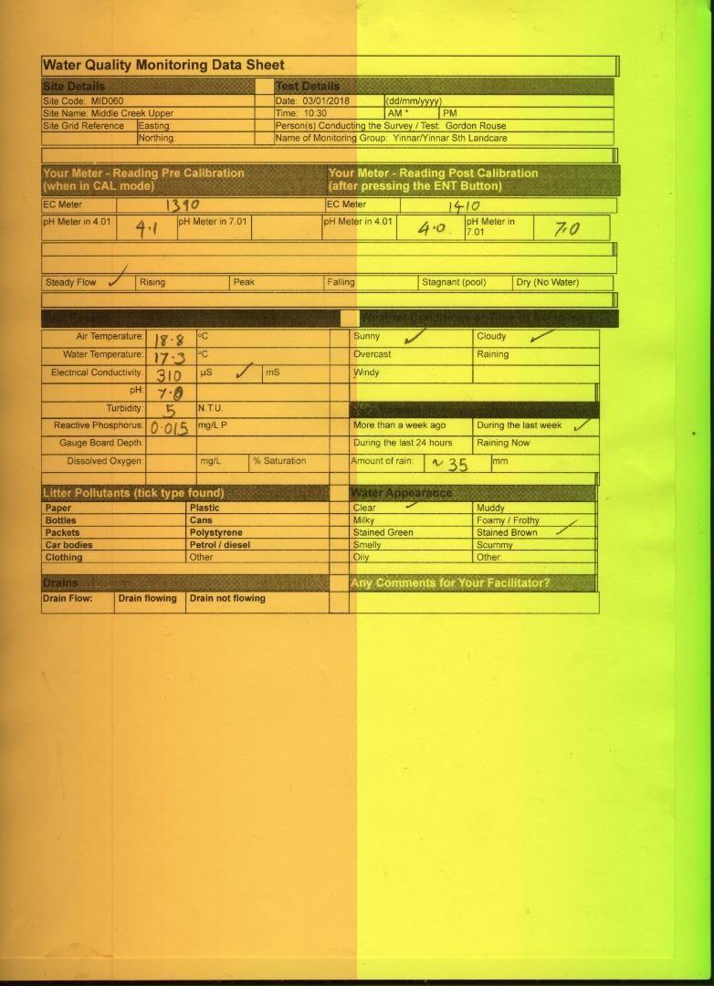
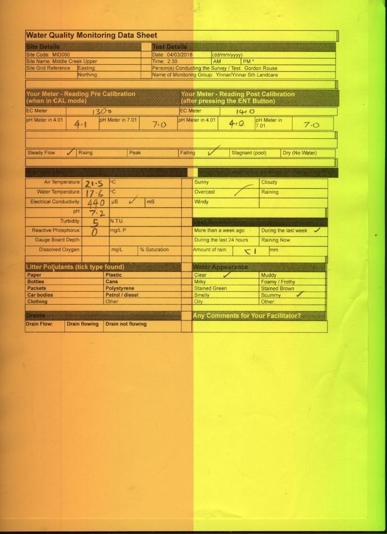
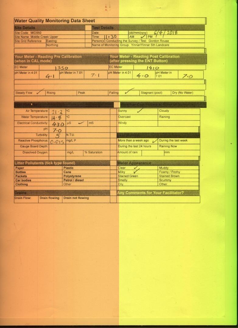
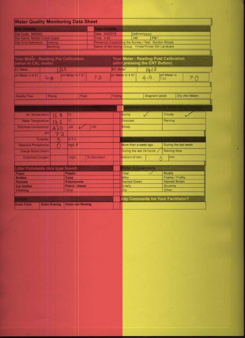
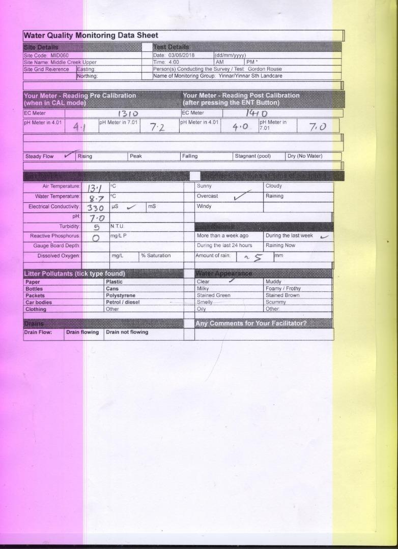
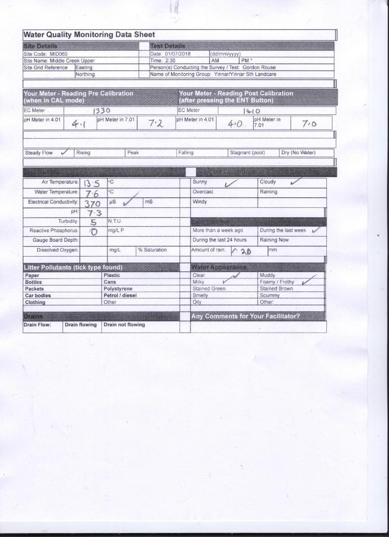
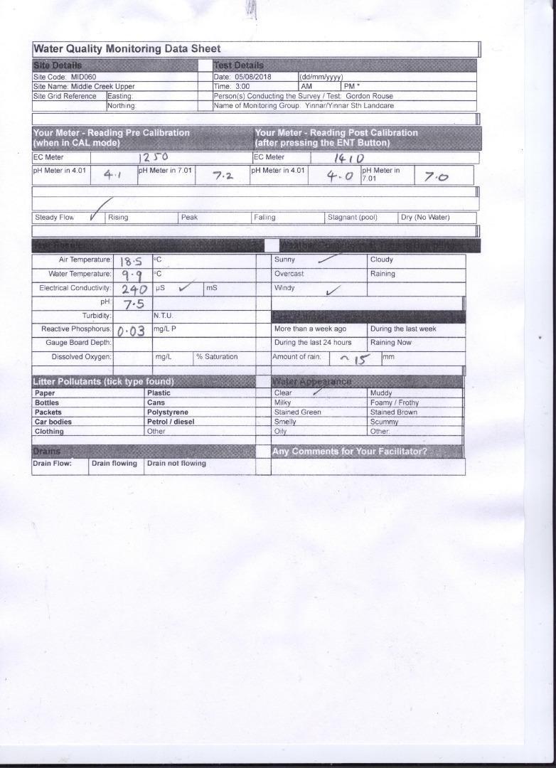
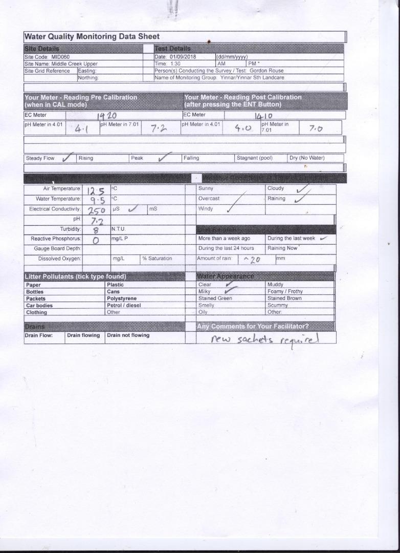
| 12-05-2022 | 340 | 7.3 | 0 | 14.5 | 13.3 | 5 |
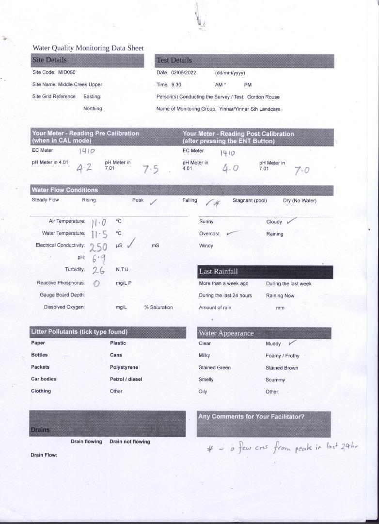
| 02-06-2022 | 250 | 6.9 | 0 | 11 | 11.5 | 26 |
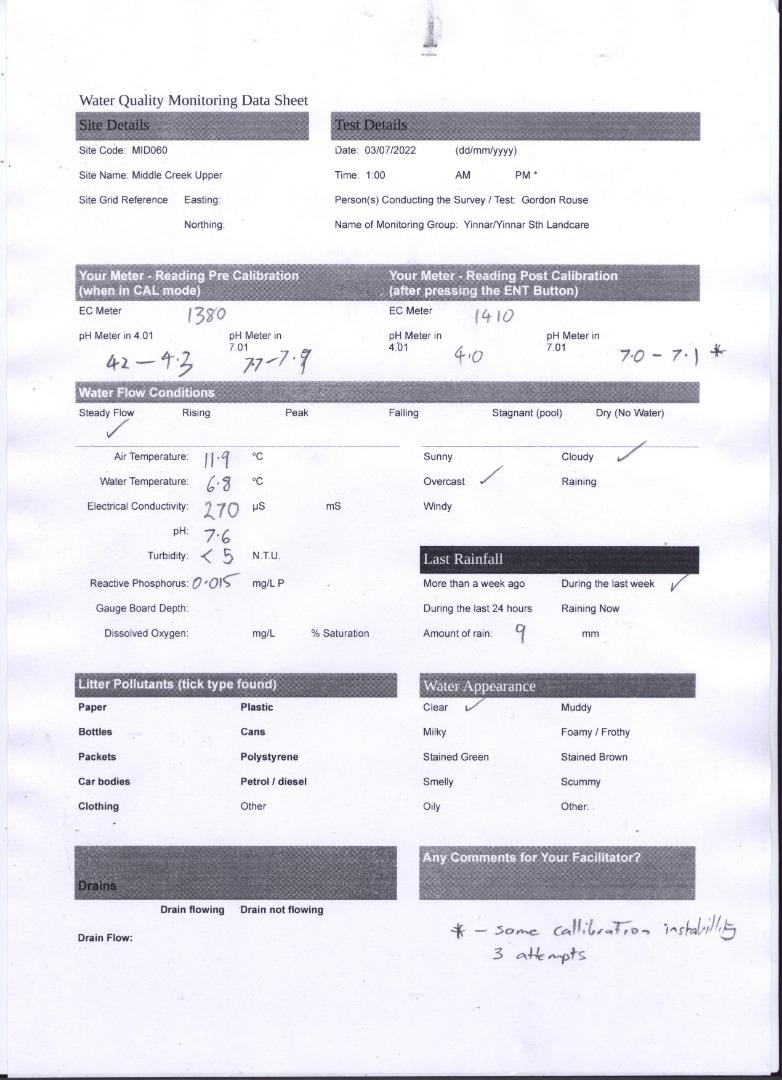
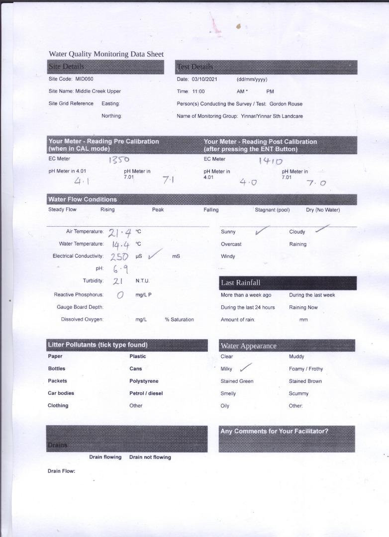
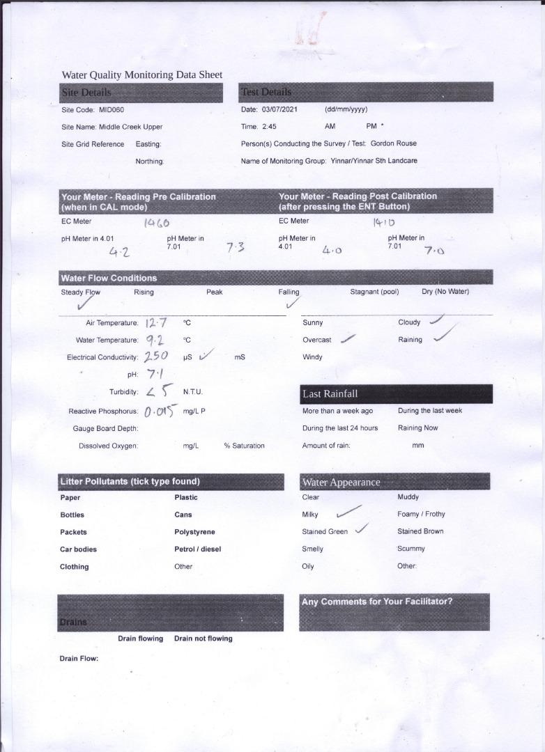
| 03-07-2022 | 270 | 7.6 | 0.015 | 11.9 | 6.8 | 5 |
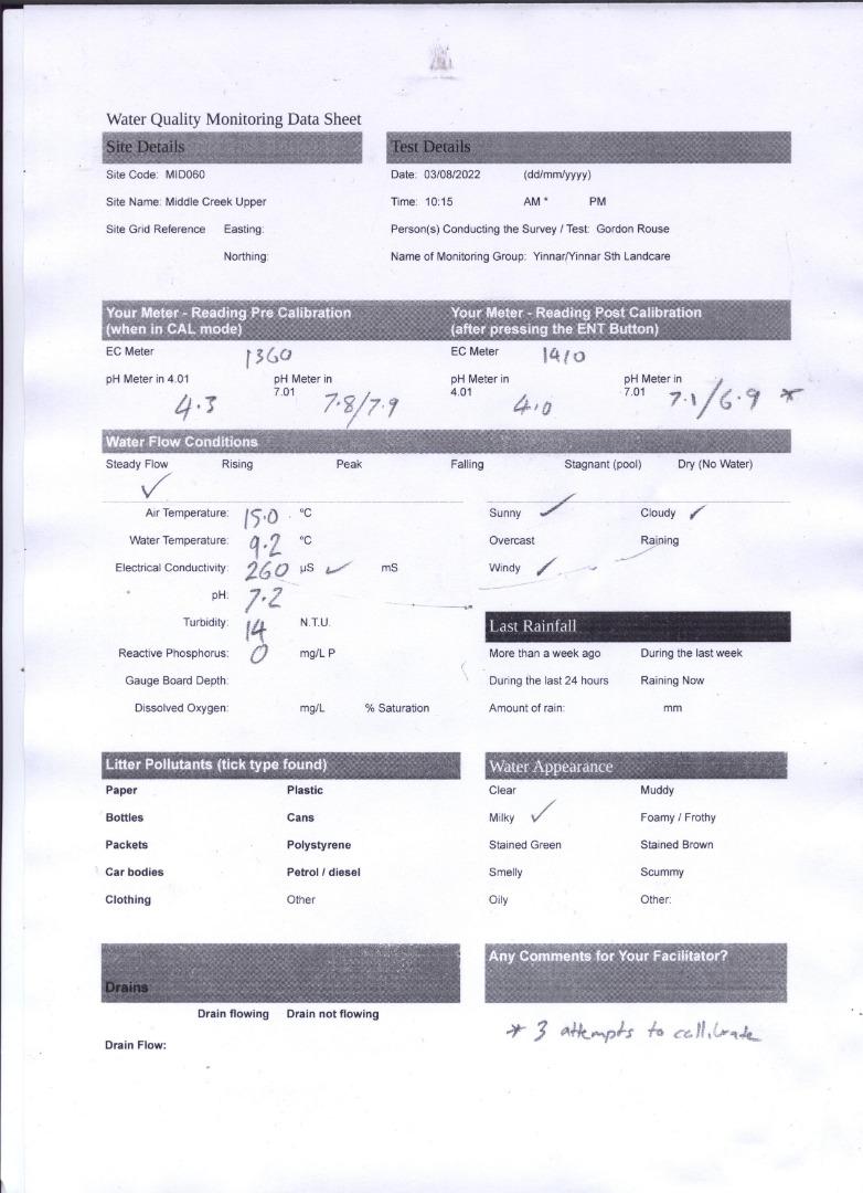
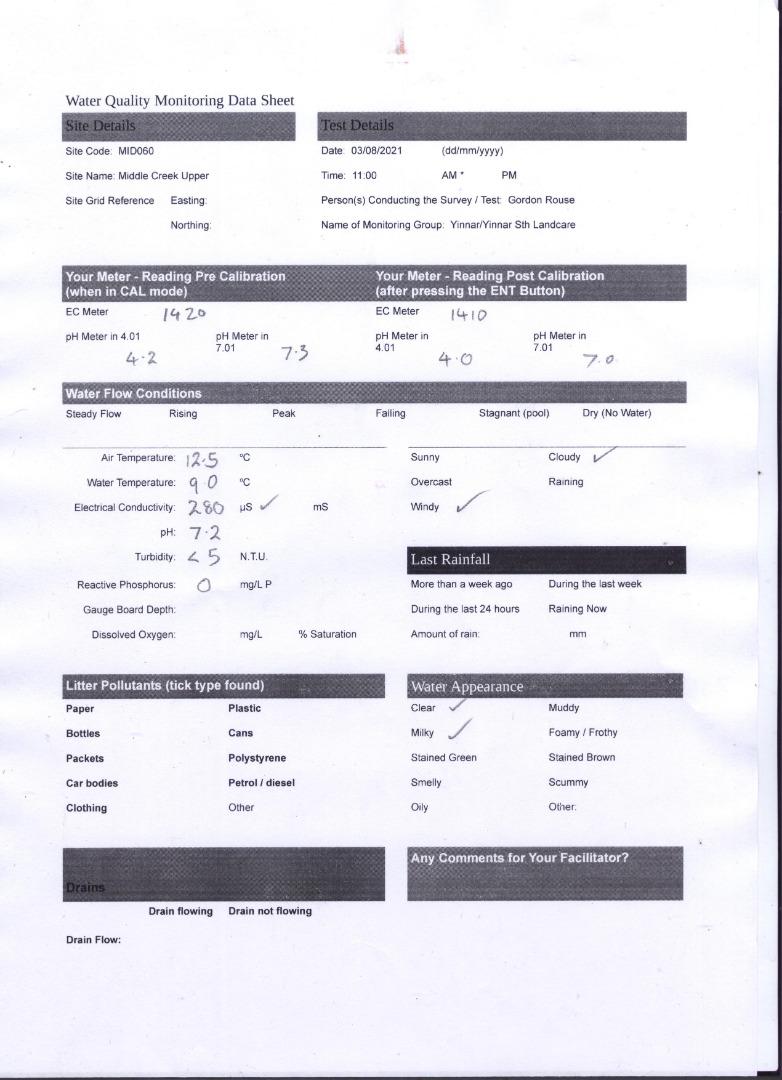
| 03-08-2022 | 260 | 7.2 | 0 | 15 | 9.2 | 14 |
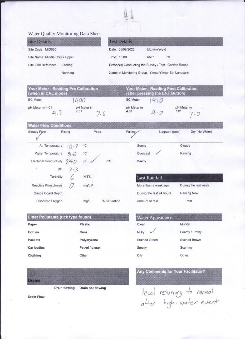
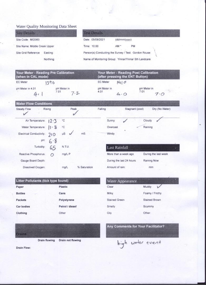
| 05-09-2022 | 240 | 7.3 | 0 | 10.7 | 8.6 | 6 |
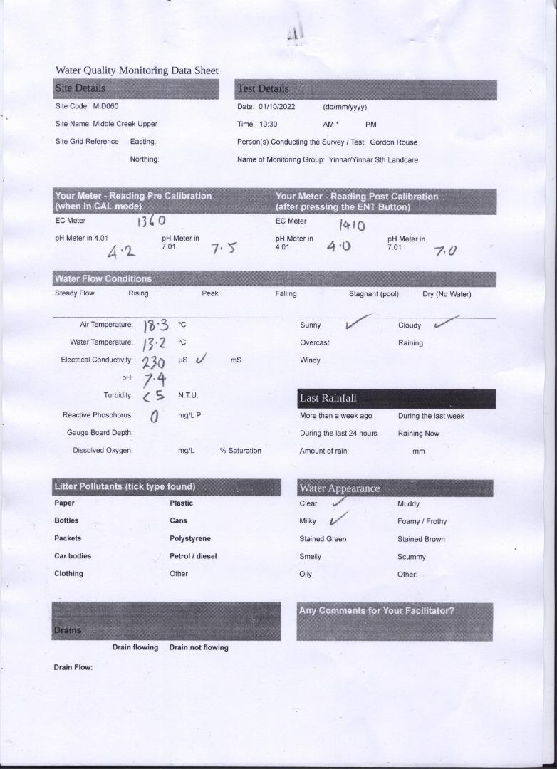
| 01-10-2022 | 230 | 7.4 | 0 | 18.3 | 13.2 | 5 |
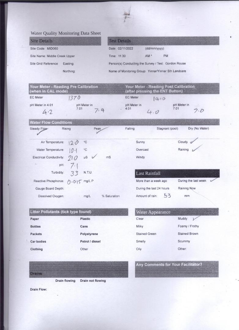
| 02-11-2022 | 210 | 7.1 | 0.015 | 12 | 10.1 | 33 |
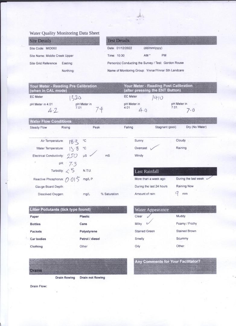
| 01-12-2022 | 250 | 7.3 | 0.015 | 18.3 | 13.8 | 5 |
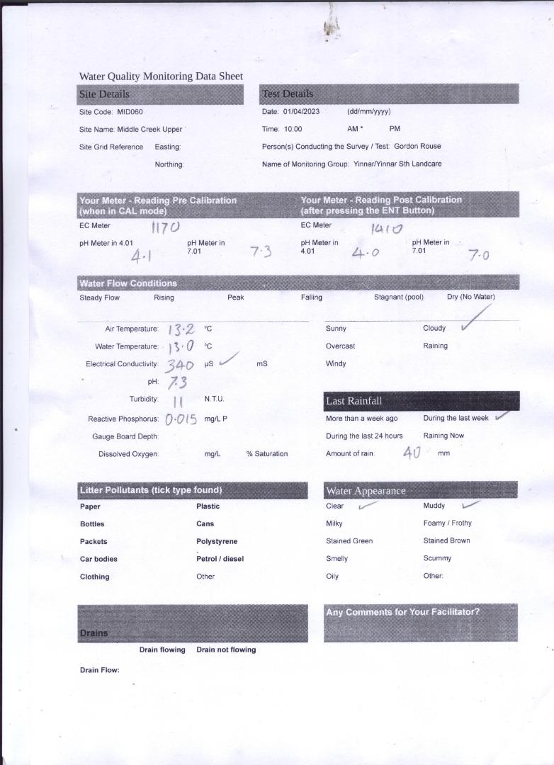
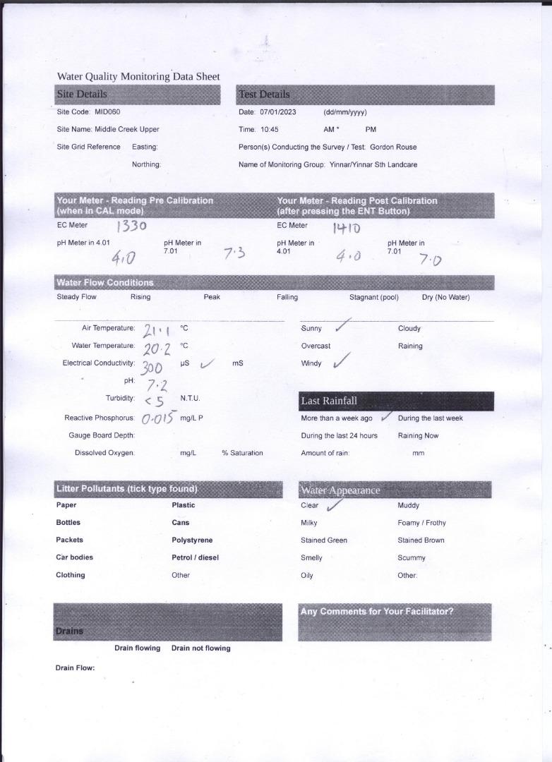
| 07-01-2023 | 300 | 7.2 | 0.015 | 21.1 | 20.2 | 5 |
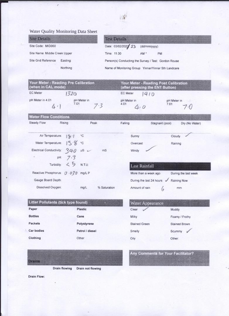
| 03-02-2023 | 340 | 7.3 | 0.03 | 18.1 | 15.8 | 5 |
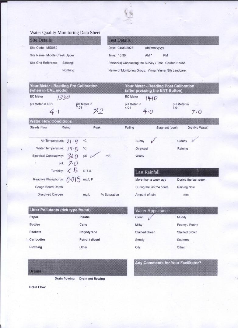
| 04-03-2023 | 360 | 7 | 0.015 | 21.9 | 19.5 | 5 |
| 01-04-2023 | 340 | 7.3 | 0.015 | 13.2 | 13 | 11 |
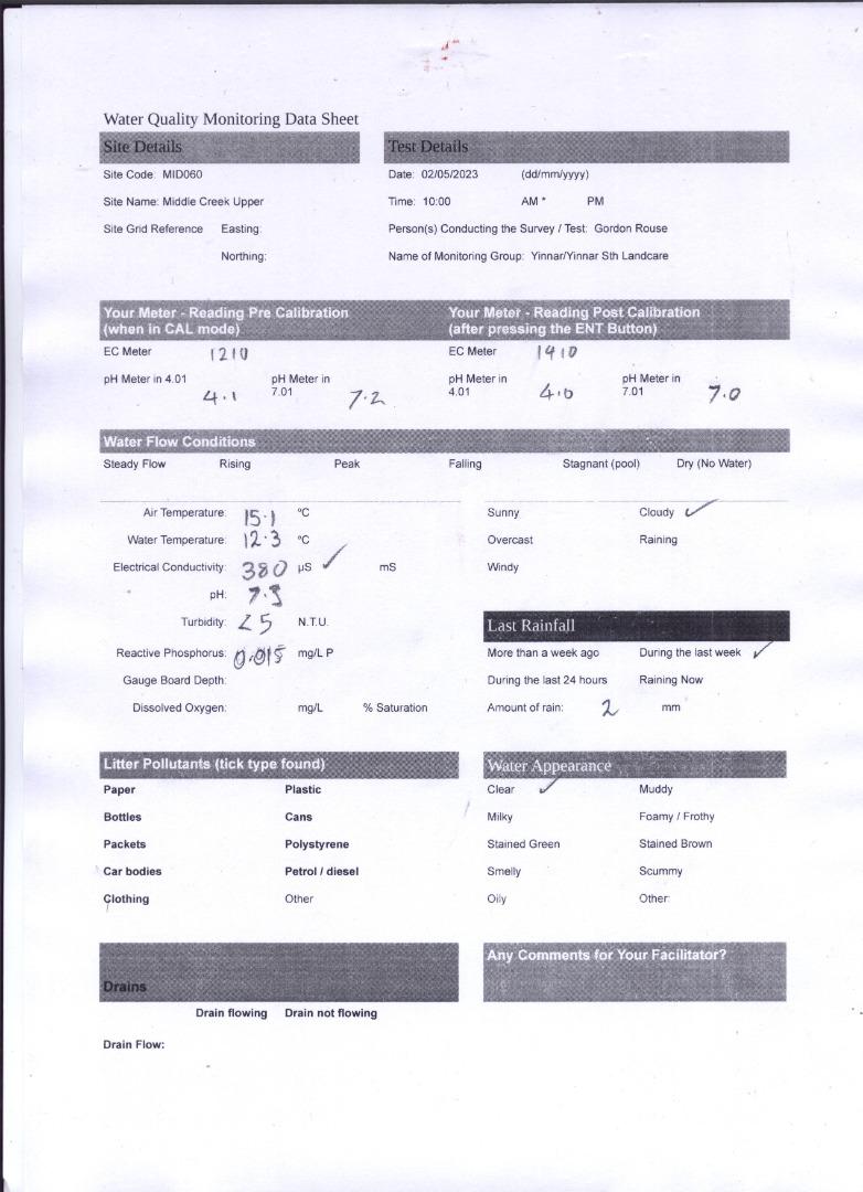
| 02-05-2023 | 380 | 7.3 | 0.015 | 15.1 | 12.3 | 5 |
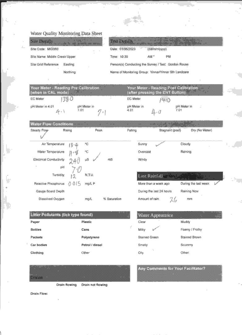
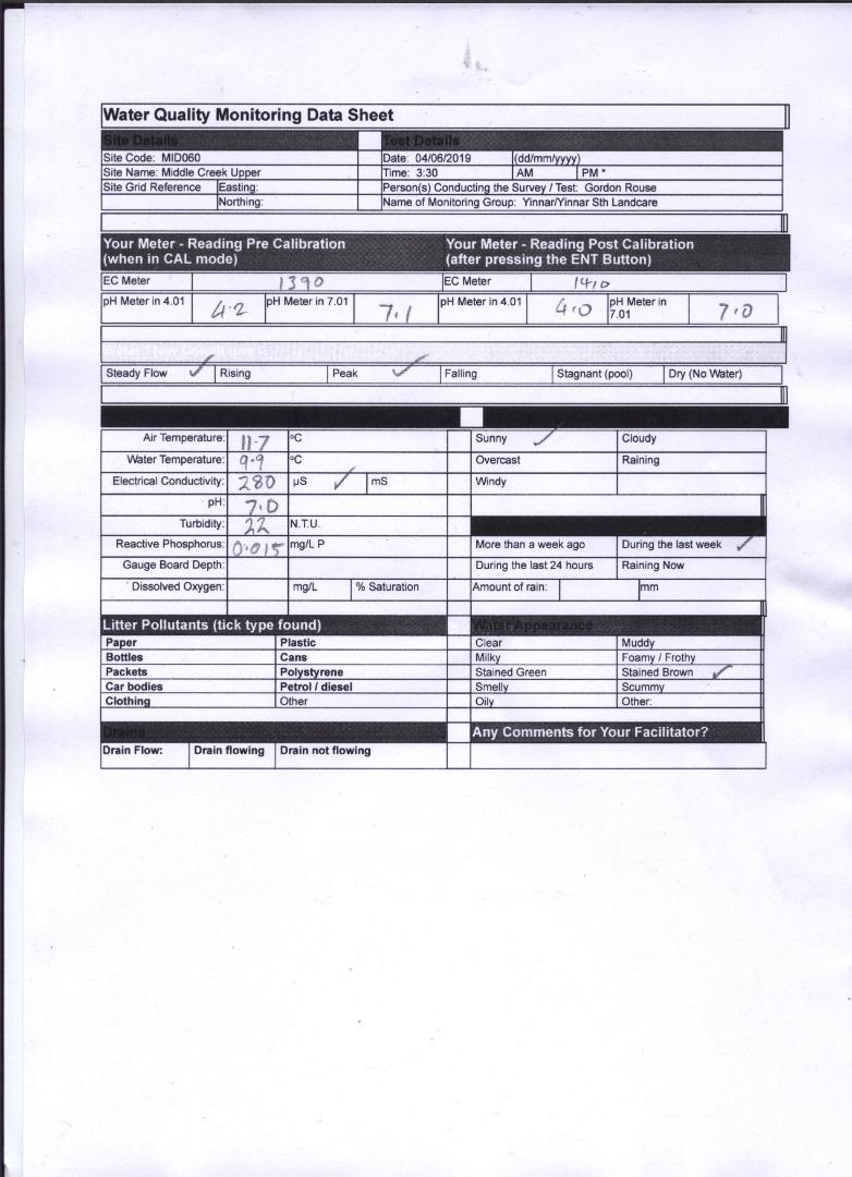
| 01-06-2023 | 240 | 7 | 0.015 | 13.4 | 11.8 | 12 |
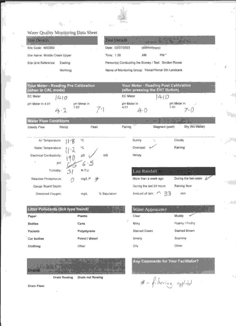
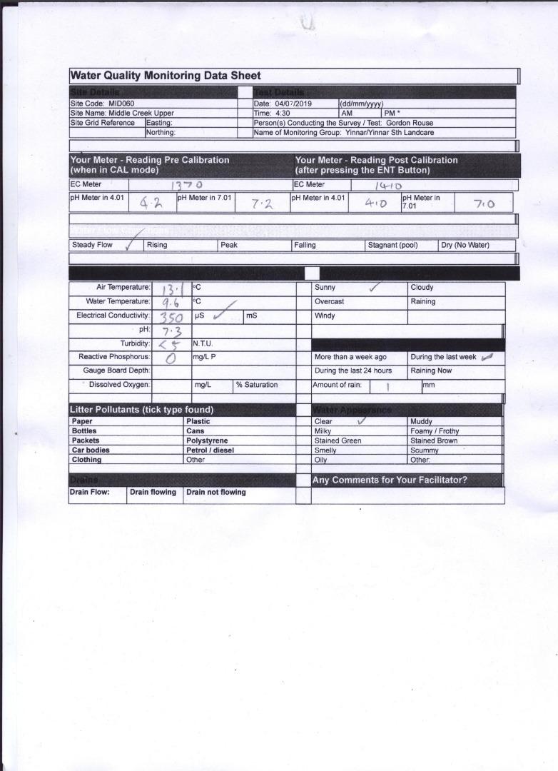
| 02-07-2023 | 190 | 6.5 | 0 | 11.8 | 11.2 | 31 |
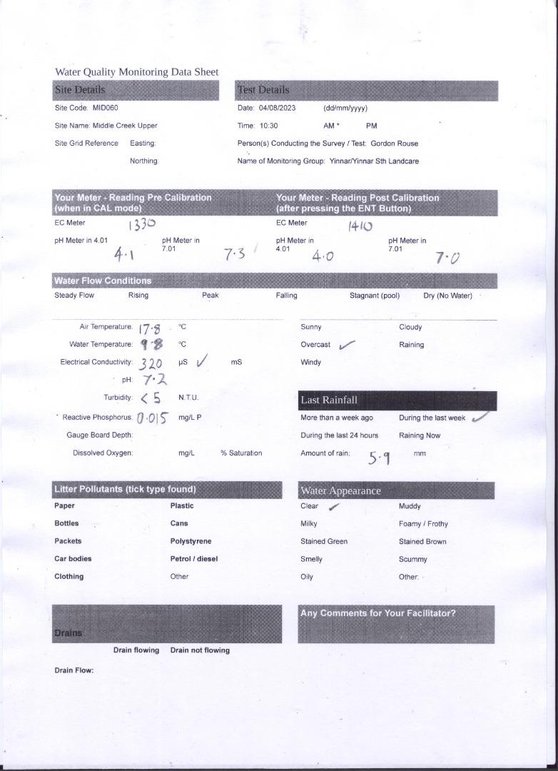
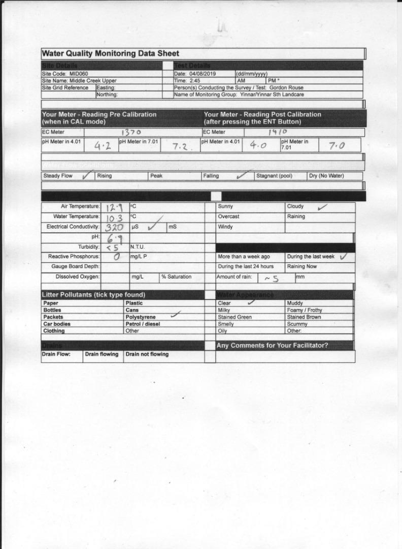
| 04-08-2023 | 320 | 7.2 | 0.015 | 17.8 | 9.8 | 5 |
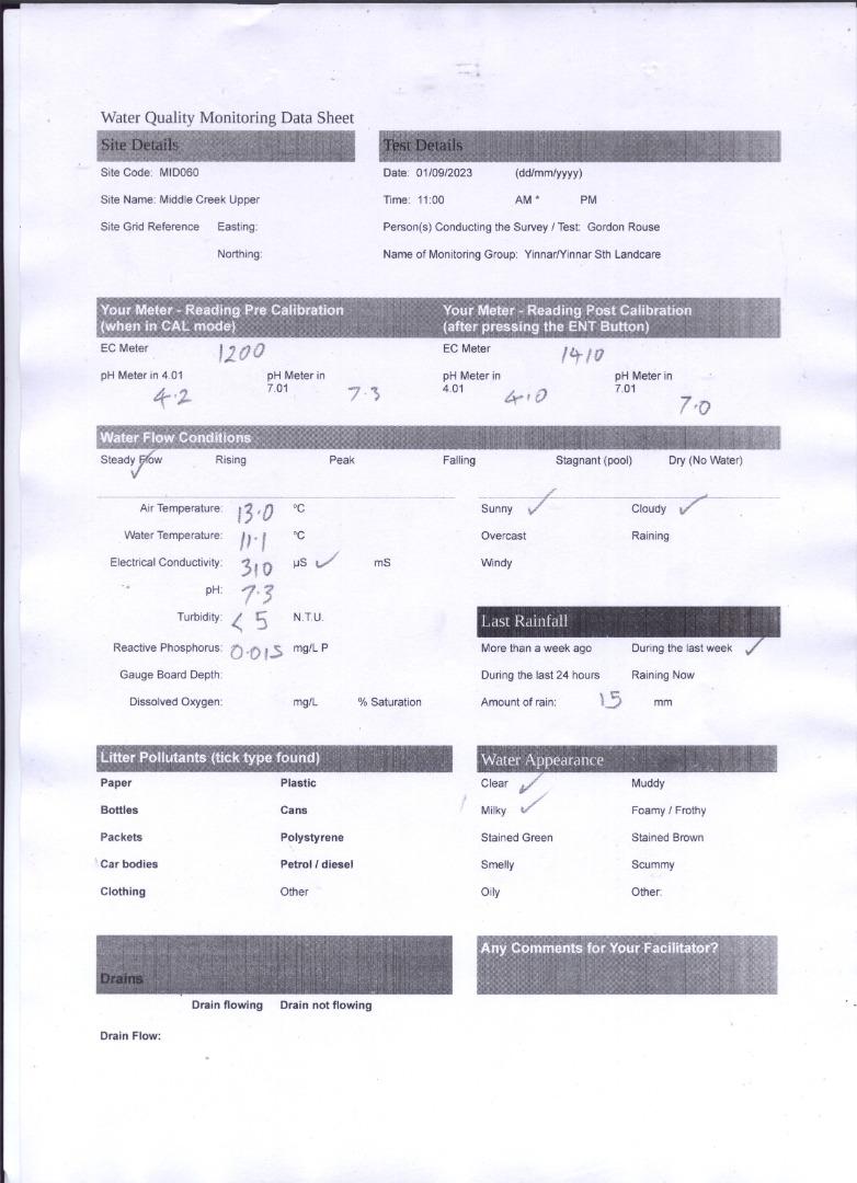
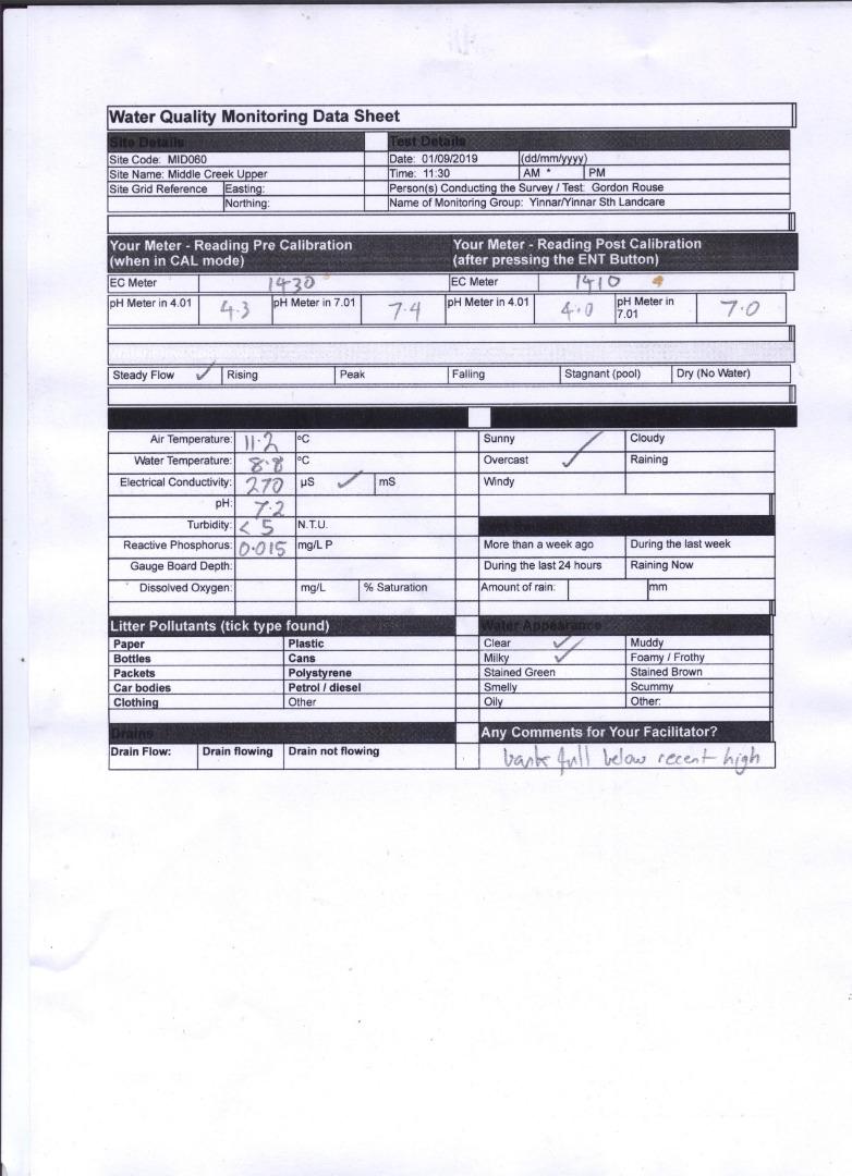
| 01-09-2023 | 310 | 7.3 | 0.015 | 13 | 11.1 | 5 |
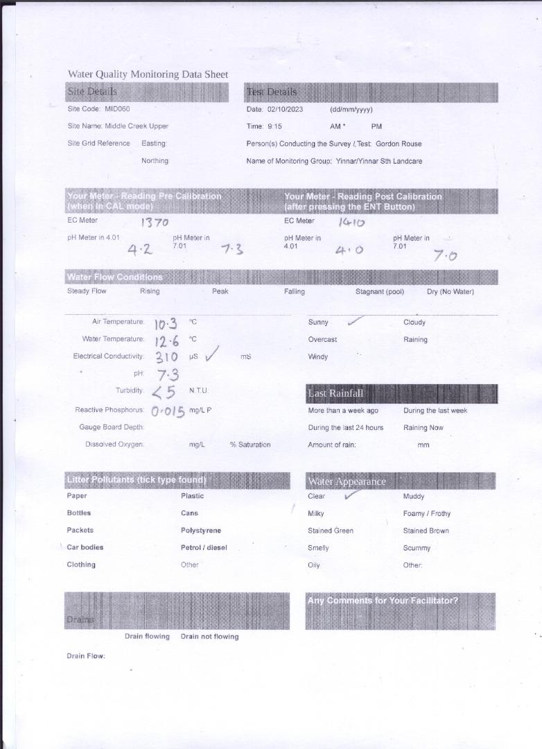
| 02-10-2023 | 310 | 7.3 | 0.015 | 10.3 | 12.6 | 5 |
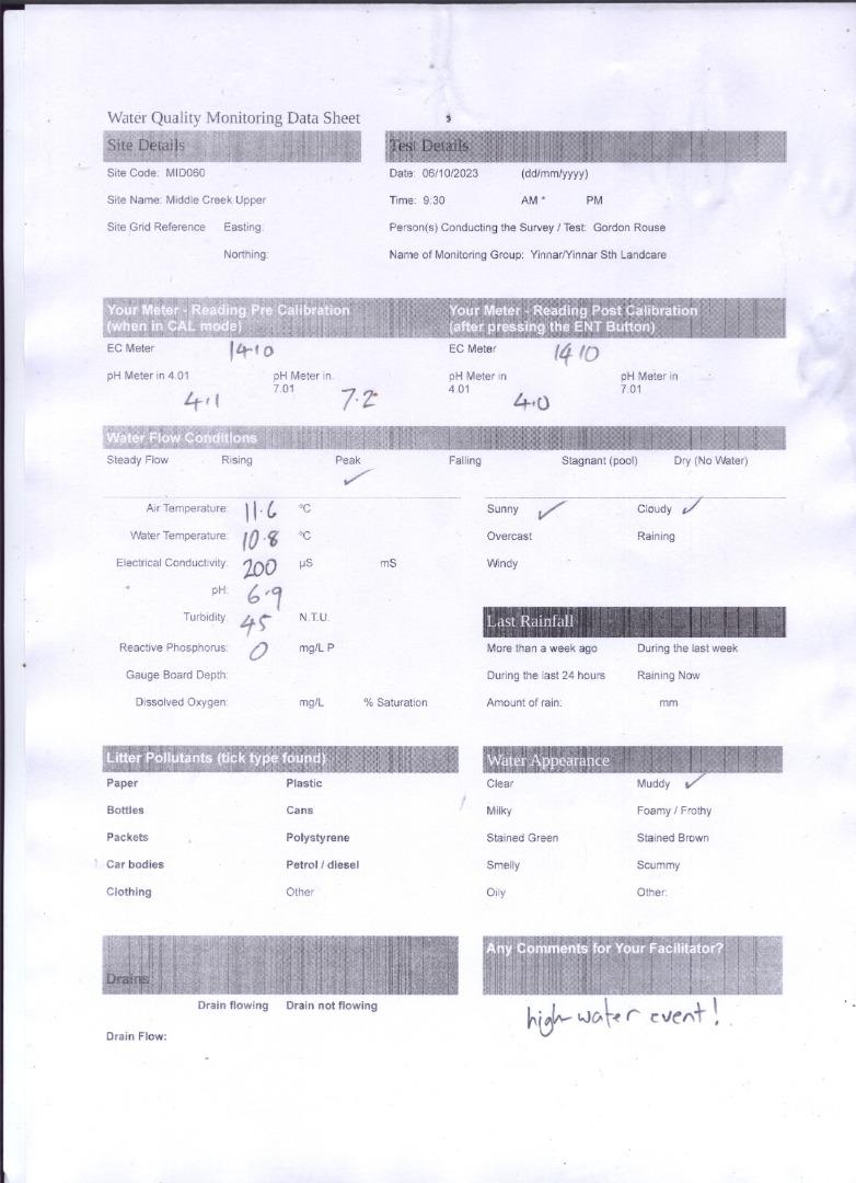
| 06-10-2023 | 200 | 6.9 | 0 | 11.6 | 10.8 | 45 |
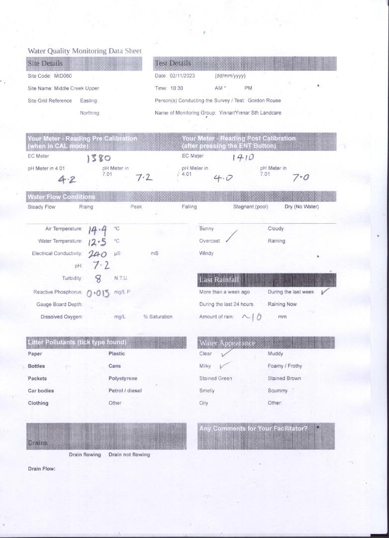
| 02-11-2023 | 240 | 7.2 | 0.015 | 14.4 | 12.5 | 8 |
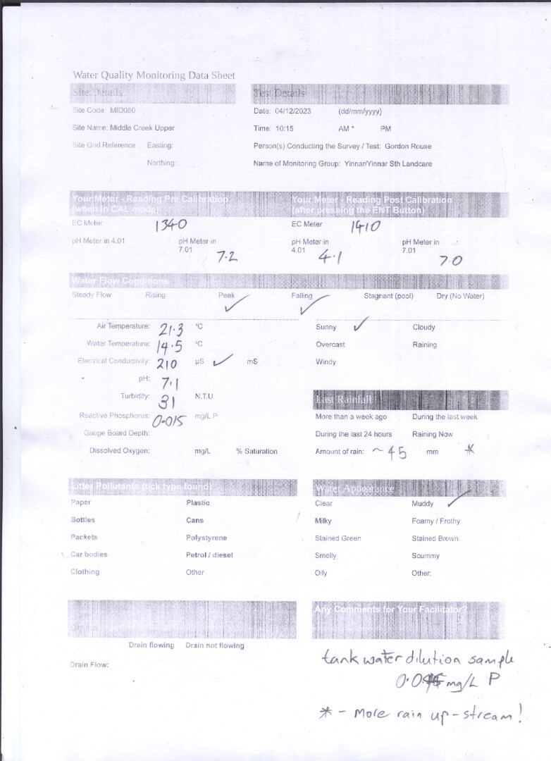
| 04-12-2023 | 210 | 7.1 | 0.015 | 21.3 | 14.5 | 31 |
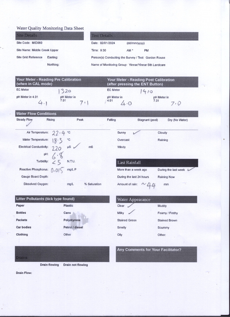
| 02-01-2024 | 220 | 6.8 | 0.015 | 22.4 | 18.3 | 5 |
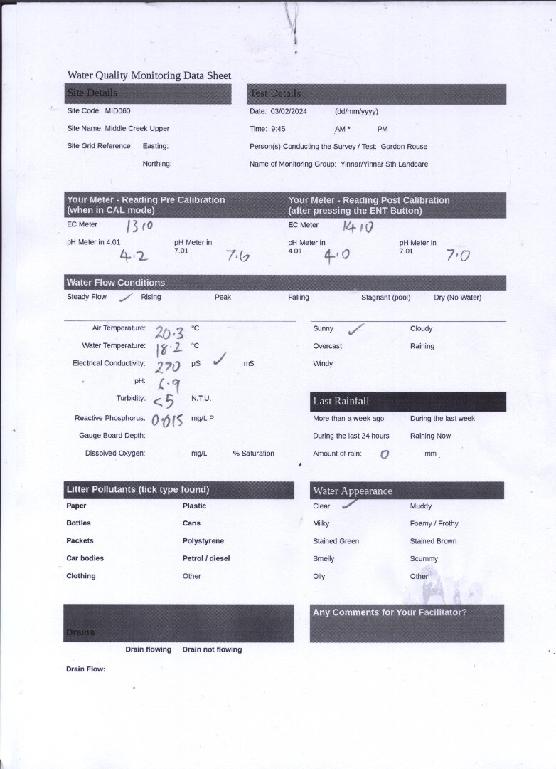
| 03-02-2024 | 270 | 6.9 | 0.015 | 20.3 | 18.2 | 5 |
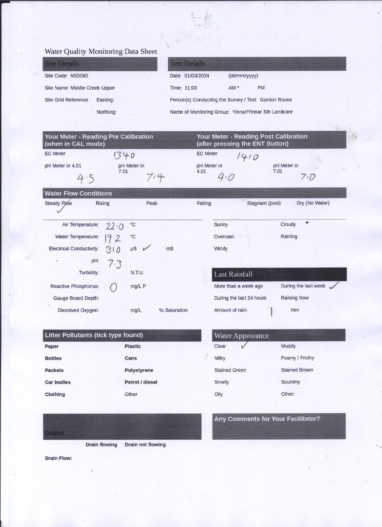
| 01-03-2024 | 310 | 7.3 | 0 | 22 | 19.2 | 5 |
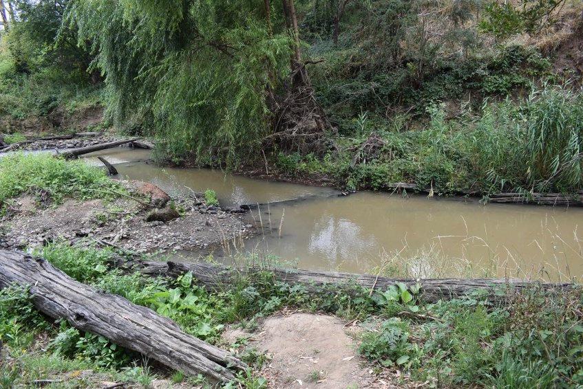
| 02-04-2024 | 310 | 7.2 | 0.015 | 15.9 | 15.9 | 150 |
Habitat
| Date | Comment | Bank Erosion Stability | Bank Vegetation | In Stream Cover | Riffles Pools Bends | Verge Vegetation | Overall |
|---|---|---|---|---|---|---|---|
| 03-07-2021 | Poor 2 | VeryPoor 2 | N/A | N/A | N/A | 4 | |
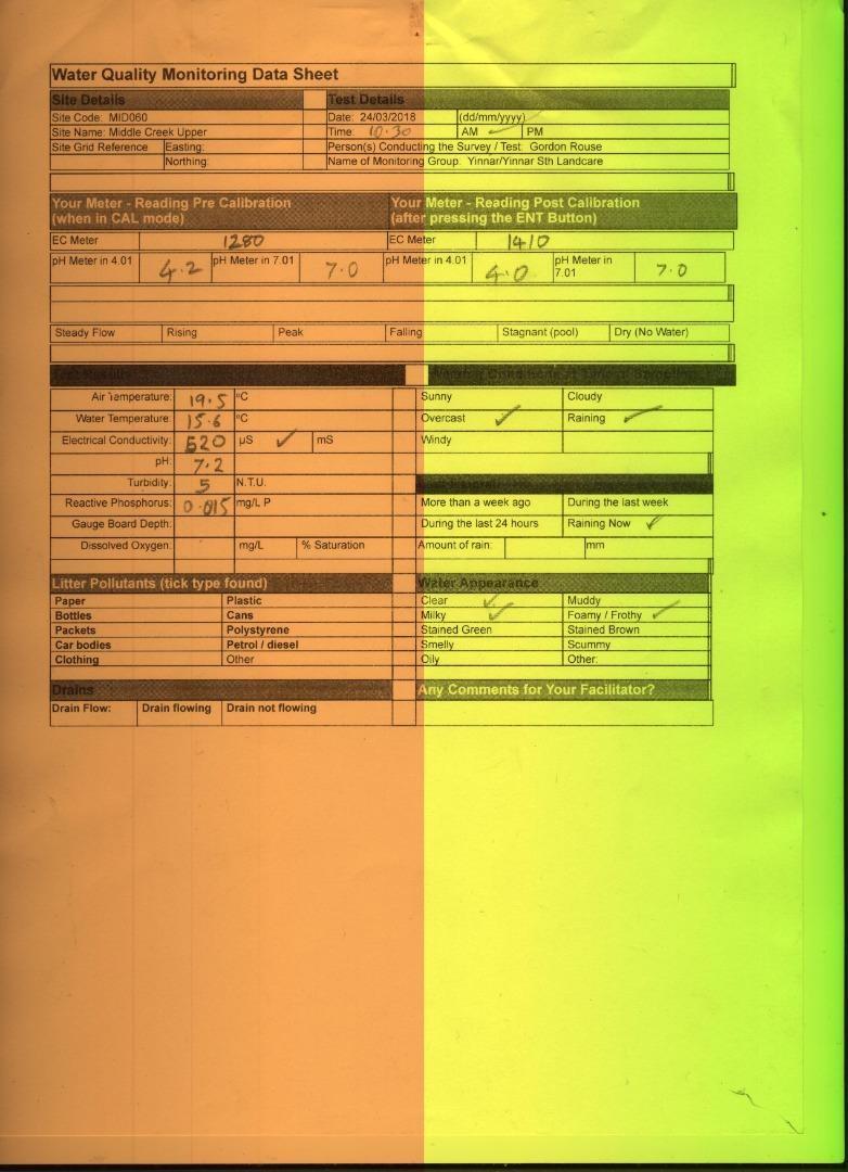
| 24-03-2018 | Good 4 | Good 8 | Good 8 | Good 4 | Fair 6 | 30 | |
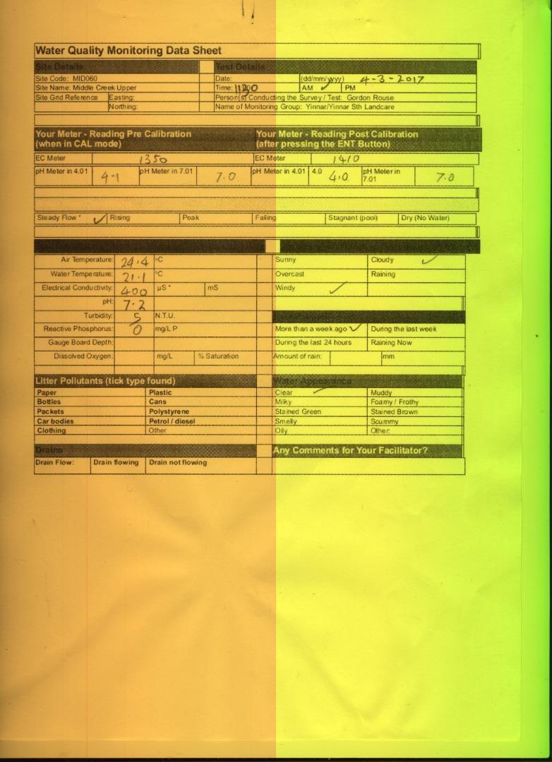
| 04-03-2017 | Good 4 | Good 8 | Good 8 | Good 4 | Fair 6 | 30 |


All content, files, data and images provided by the Waterwatch Data Portal and Gallery are subject to a Creative Commons Attribution License
Content is made available to be used in any way, and should always attribute Waterwatch and www.vic.waterwatch.org.au
.png)