Waterwatch Data Portal
Site details
Overview
| Site code | MA_CBO500 |
|---|---|
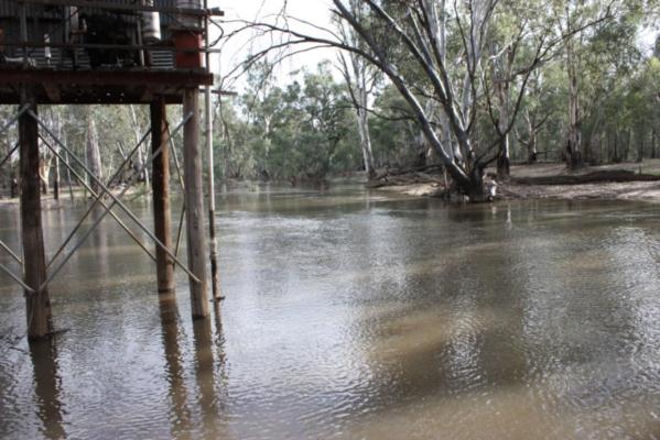
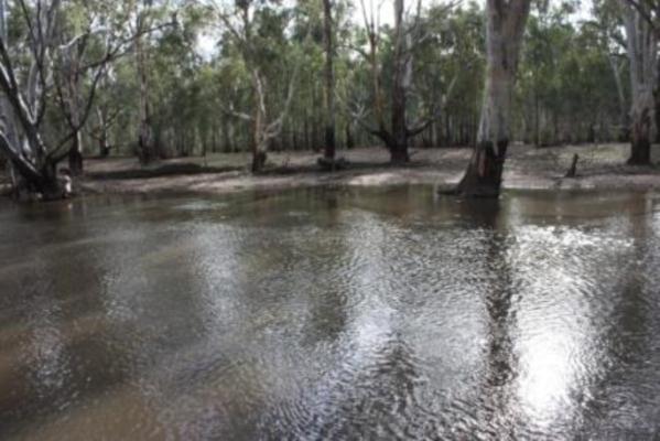
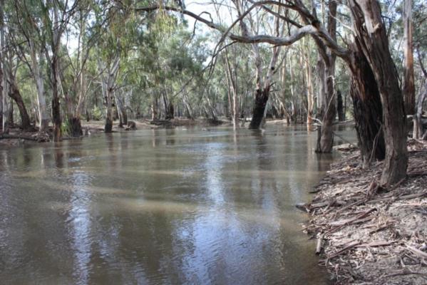
| Site name | Bonyaricall Creek |
| Status | Active |
| Water Authority | Mallee |
| Basin | Mallee |
| Catchment | Mallee |
| Sub catchment | |
| Reach | 14_6 Murray River |
| Water type | Creek |
| Council | |
| History | View all 81 site visits 31-08-2008 - 14-11-2015 |
| Monitoring organisations |
 Loading chart
Habitat
| Date | Comment | Bank Erosion Stability | Bank Vegetation | In Stream Cover | Riffles Pools Bends | Verge Vegetation | Overall |
|---|---|---|---|---|---|---|---|
| 14-11-2015 | Excellent 5 | Excellent 10 | Excellent 10 | Excellent 5 | Good 8 | Excellent 38 | |
| 09-10-2015 | Excellent 5 | Excellent 10 | Good 8 | Excellent 5 | Excellent 10 | Excellent 38 | |
| 11-09-2015 | Good 4 | Excellent 10 | Excellent 10 | Excellent 5 | Excellent 10 | Excellent 39 | |
| 29-08-2015 | Good 4 | Excellent 10 | Excellent 10 | Excellent 5 | Excellent 10 | Excellent 39 | |
| 31-07-2015 | Good 4 | Excellent 10 | Excellent 10 | Excellent 5 | Excellent 10 | Excellent 39 | |
| 27-06-2015 | Good 4 | Excellent 10 | Excellent 10 | Excellent 5 | Excellent 10 | Excellent 39 | |
| 11-06-2015 | Good 4 | Excellent 10 | Excellent 10 | Excellent 5 | Excellent 10 | Excellent 39 | |
| 22-05-2015 | Good 4 | Excellent 10 | Excellent 10 | Excellent 5 | Excellent 10 | Excellent 39 | |
| 01-05-2015 | Good 4 | Excellent 10 | Excellent 10 | Excellent 5 | Excellent 10 | Excellent 39 | |
| 21-03-2015 | Good 4 | Excellent 10 | Excellent 10 | Excellent 5 | Excellent 10 | Excellent 39 | |
| 02-03-2015 | Good 4 | Excellent 10 | Excellent 10 | Excellent 5 | Excellent 10 | Excellent 39 | |
| 27-11-2014 | Excellent 5 | Excellent 10 | Good 8 | Excellent 5 | Excellent 10 | Excellent 38 | |
| 09-11-2014 | Excellent 5 | Excellent 10 | Excellent 10 | Excellent 5 | Good 8 | Excellent 38 | |
| 03-10-2014 | Excellent 5 | Excellent 10 | Excellent 10 | Excellent 5 | Good 8 | Excellent 38 | |
| 04-09-2014 | Excellent 5 | Excellent 10 | Excellent 10 | Excellent 5 | Good 8 | Excellent 38 | |
| 05-08-2014 | Excellent 5 | Excellent 10 | Excellent 10 | Excellent 5 | Good 8 | Excellent 38 | |
| 22-07-2014 | Excellent 5 | Excellent 10 | Excellent 10 | Excellent 5 | Good 8 | Excellent 38 | |
| 03-06-2014 | Excellent 5 | Excellent 10 | Excellent 10 | Excellent 5 | Good 8 | Excellent 38 | |
| 15-03-2014 | Excellent 5 | Excellent 10 | Good 8 | Excellent 5 | Good 8 | Excellent 36 | |
| 04-02-2014 | Excellent 5 | Excellent 10 | Good 8 | Excellent 5 | Good 8 | Excellent 36 | |
| 29-11-2013 | Excellent 5 | Excellent 10 | Good 8 | Excellent 5 | Excellent 10 | Excellent 38 | |
| 18-05-2013 | Excellent 5 | Excellent 10 | Excellent 10 | Excellent 5 | Good 8 | Excellent 38 | |
| 07-02-2013 | Excellent 5 | Excellent 10 | Excellent 10 | Excellent 5 | Good 8 | Excellent 38 | |
| 19-01-2013 | Excellent 5 | Excellent 10 | Excellent 10 | Excellent 5 | Good 8 | Excellent 38 | |
| 10-12-2012 | Excellent 5 | Excellent 10 | Excellent 10 | Excellent 5 | Good 8 | Excellent 38 | |
| 10-11-2012 | Excellent 5 | Excellent 10 | Excellent 10 | Excellent 5 | Good 8 | Excellent 38 | |
| 15-10-2012 | Excellent 5 | Excellent 10 | Excellent 10 | Excellent 5 | Good 8 | Excellent 38 | |
| 31-08-2012 | Excellent 5 | Excellent 10 | Excellent 10 | Excellent 5 | Good 8 | Excellent 38 | |
| 04-08-2012 | Good 4 | Excellent 10 | Excellent 10 | Excellent 5 | Excellent 10 | Excellent 39 | |
| 28-05-2012 | Good 4 | Excellent 10 | Excellent 10 | Excellent 5 | Good 8 | Excellent 37 | |
| 01-05-2012 | Good 4 | Excellent 10 | Excellent 10 | Excellent 5 | Good 8 | Excellent 37 | |
| 23-03-2012 | Excellent 5 | Excellent 10 | Excellent 10 | Excellent 5 | Good 8 | Excellent 38 | |
| 15-03-2012 | Good 4 | Excellent 10 | Excellent 10 | Excellent 5 | Good 8 | Excellent 37 | |
| 08-01-2012 | Good 4 | Excellent 10 | Excellent 10 | Excellent 5 | Good 8 | Excellent 37 |


All content, files, data and images provided by the Waterwatch Data Portal and Gallery are subject to a Creative Commons Attribution License
Content is made available to be used in any way, and should always attribute Waterwatch and www.vic.waterwatch.org.au
.png)