Waterwatch Data Portal
Site details
Overview
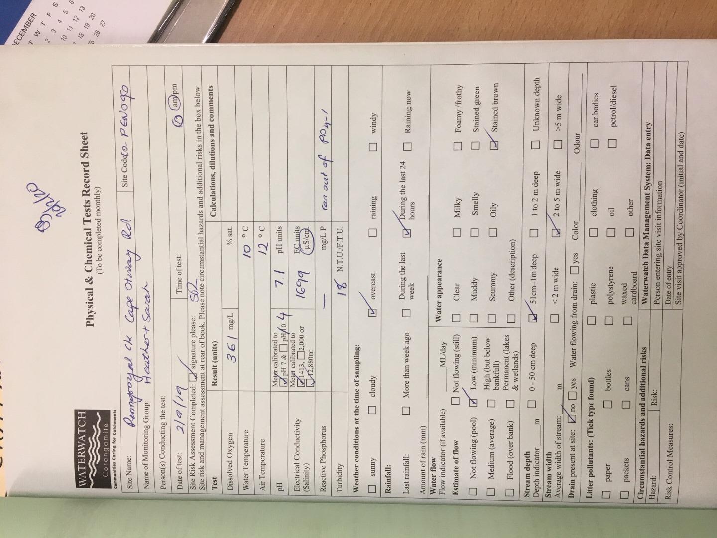
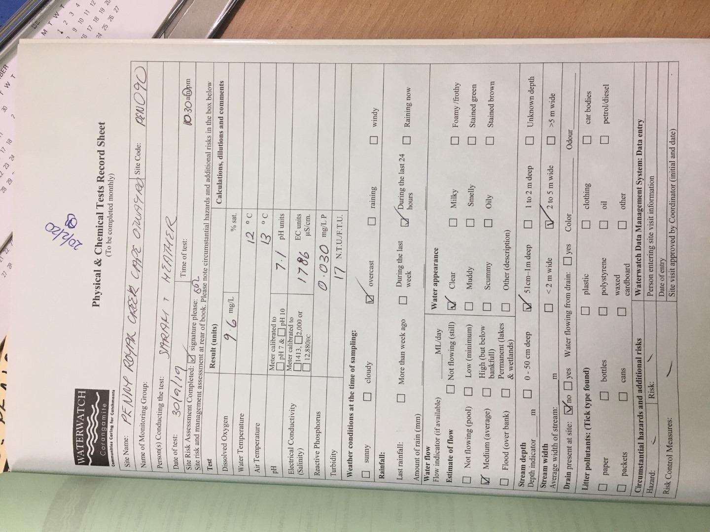
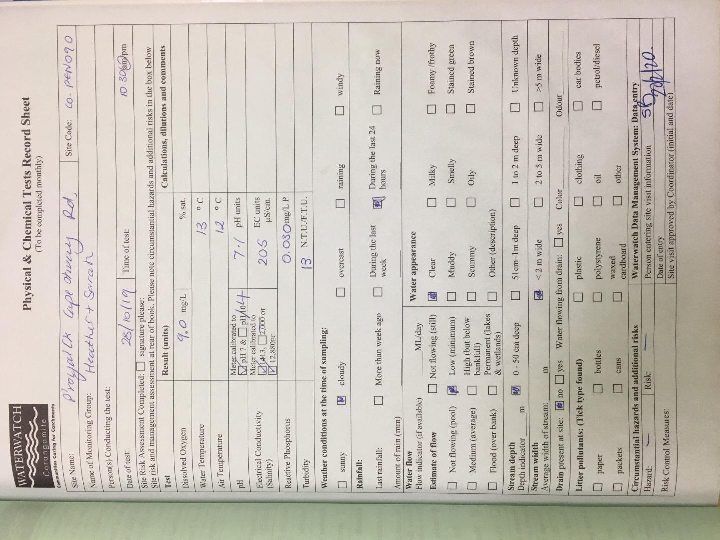
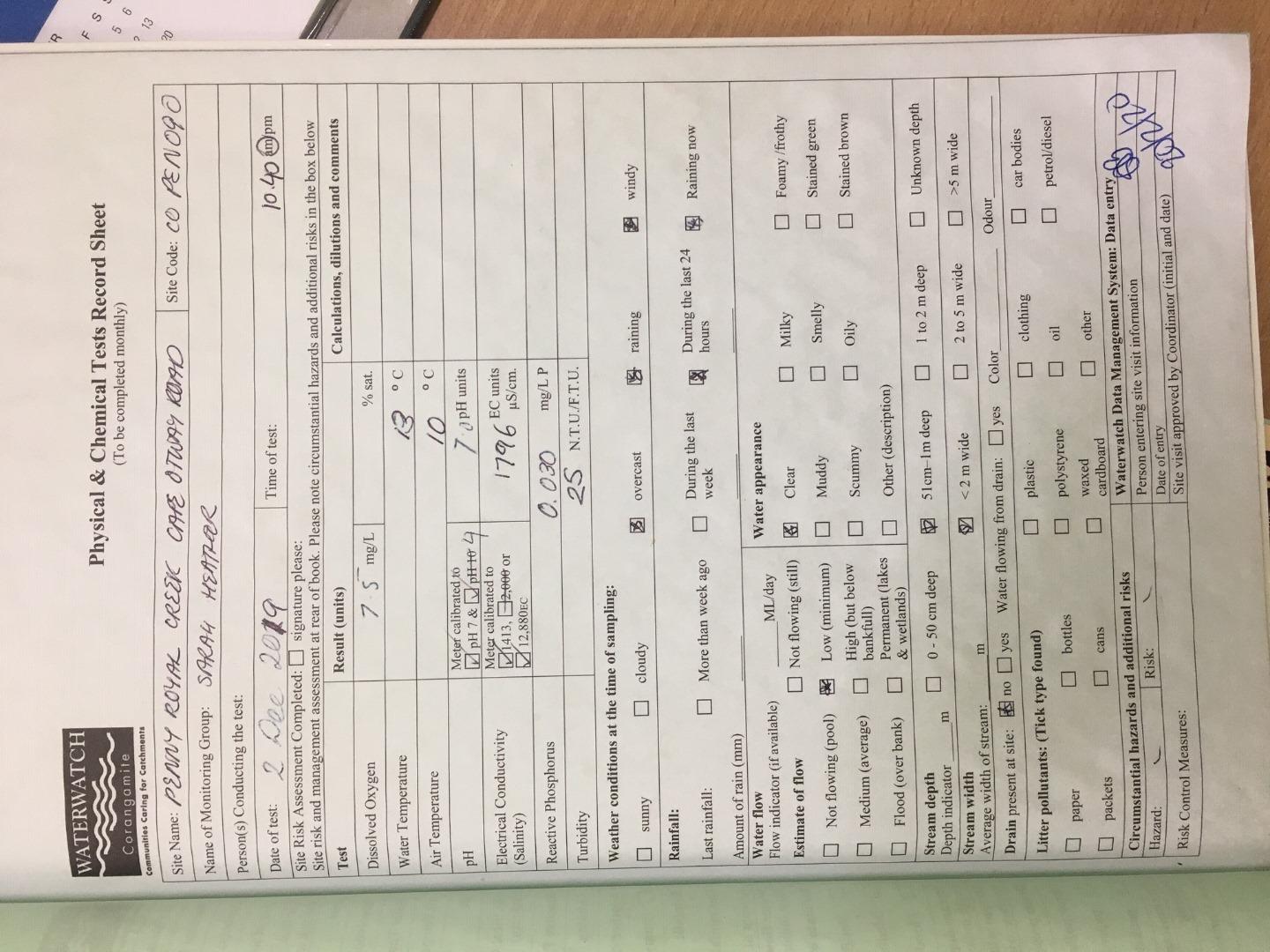
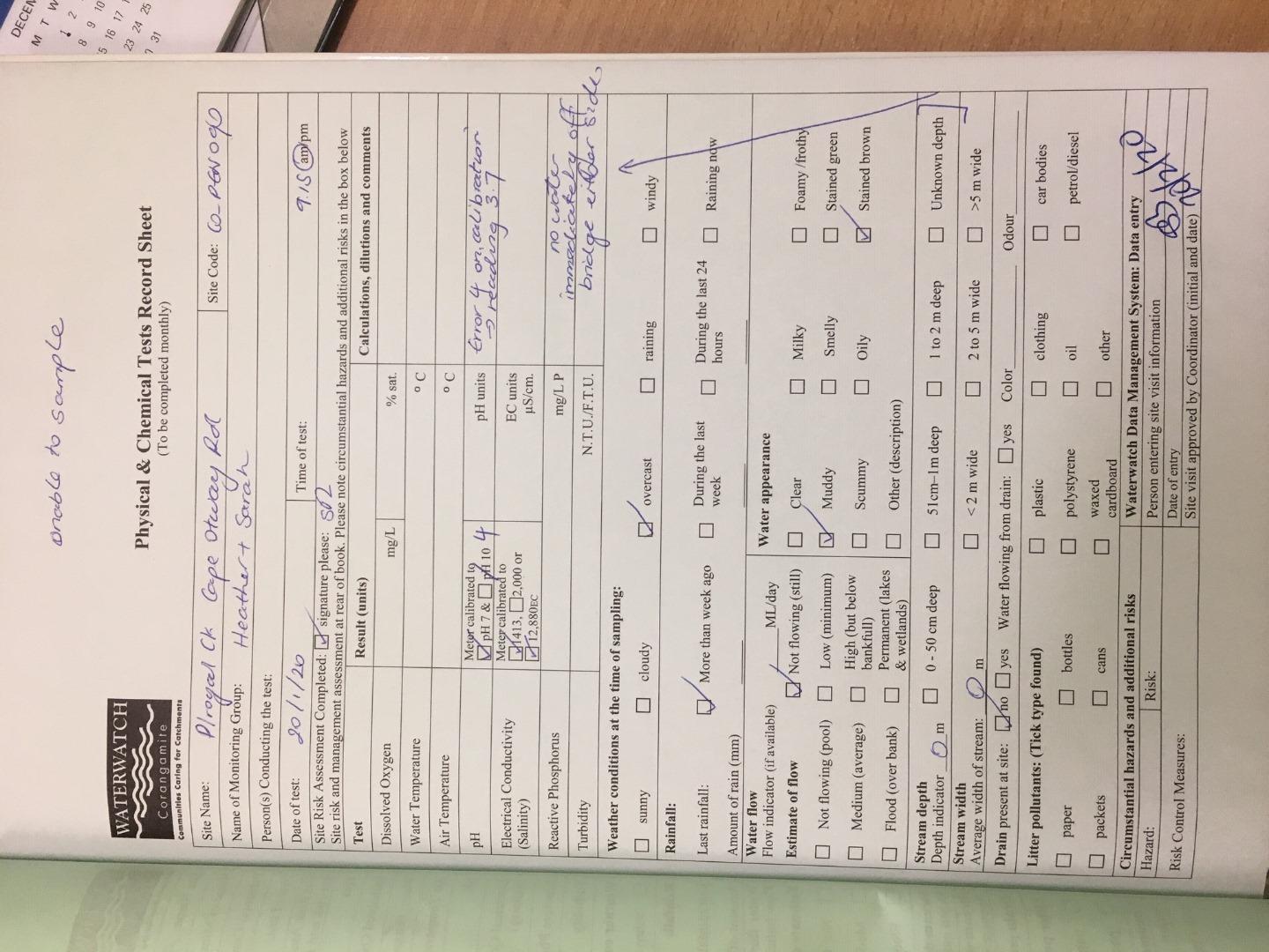
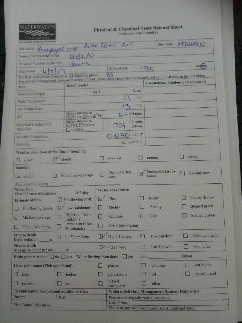
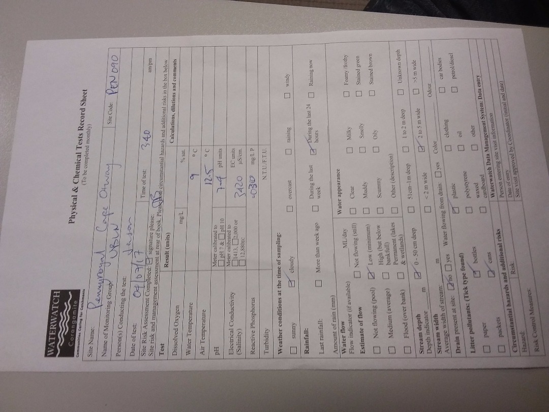
| Site code | CO_PEN090 |
|---|---|
| Site name | Pennyroyal Creek - Cape Otway Rd |
| Status | Inactive |
| Water Authority | Corangamite |
| Basin | Barwon River |
| Catchment | Barwon River |
| Sub catchment | |
| Reach | 33_23 Penny Royal Creek |
| Water type | Other |
| Council | |
| History | View all 117 site visits 05-12-2005 - 22-04-2020 |
| Monitoring organisations |
|
 Loading chart
Habitat
| Date | Comment | Bank Erosion Stability | Bank Vegetation | In Stream Cover | Riffles Pools Bends | Verge Vegetation | Overall |
|---|---|---|---|---|---|---|---|
| 02-02-2020 | <p>Platypus eDNA site</p> <p>Burrowing Habitat Score: 3</p> <p>Site Equivocal </p> | Good 4 | Fair 6 | Poor 4 | Fair 3 | Fair 6 | 23 |
| 04-07-2011 | Poor 2 | Poor 4 | Poor 4 | Poor 2 | VeryPoor 2 | Poor 14 | |
| 08-06-2010 | willows, bare ground, cypress, pasture grasses. | Good 4 | Good 8 | Good 8 | Good 4 | Excellent 10 | Poor 34 |
| 01-07-2009 | blackberries, cypress, poplars, willows, gorse | Good 4 | Excellent 10 | Good 8 | Good 4 | Excellent 10 | Poor 36 |
| 04-06-2008 | poplars, cyprus, pasture grasses, gorse | Good 4 | Excellent 10 | Good 8 | Excellent 5 | Excellent 10 | Degraded 37 |
| 04-07-2007 | no native veg, introduced grasses, man made channel | Fair 3 | Good 8 | Good 8 | Good 4 | Good 8 | Poor 31 |

All content, files, data and images provided by the Waterwatch Data Portal and Gallery are subject to a Creative Commons Attribution License
Content is made available to be used in any way, and should always attribute Waterwatch and www.vic.waterwatch.org.au
.png)